The city prepared for changes.
Basic information
Project Title
Full project title
Category
Project Description
The subject of the following work focuses on the issue of shaping urban in flood-prone areas. The main challenge for the city of future is to find a balance between a compact city – one in which daily travel distances are as short as possible – and a green city with maximum land retention capacity. This project describes the functional zoning method based on flood risk. It is looking for solutions for the co-evolution of built environment and nature.
Project Region
EU Programme or fund
Description of the project
Summary
The subject of the following work focuses on the issue of shaping urban in flood-prone areas on the example of Tczew. The relationship between cities and climate change, urban substance resilience to its effects have been described.
The aim of the study is to create a design concept based on the analysis of the problem. The theoretical part is mostly focused on issues related to water and the threats it poses. It discusses floods caused by sudden weather phenomena and river floods. The study points out their causes and solutions to deal with this problem. The project part is an attempt to apply conclusions drawn from the analysis of the problem contained in the topic.
The described method is based on the zoning of space, resulting from the desire of the urban structure to coexist with water. The approach involves analysis of flood conditions in a specific location, returning floodplains to the rivers without giving up their use and adapting buildings to the threat.
The Assumption of the resilient city should be fulfilled in the project. The buildings have been arranged in accordance with zoning rules due to flood risk. According to buildings at risk of flooding, solutions have been applied to make them resistant to the effects of water. Small-scale retention in the interiors of the quarters and the buffer park on the riverbank are the key elements of the whole concept.
The authors believe that the main challenge for the city of future is to find a balance between a compact city – one in which daily travel distances are as short as possible – and a green city with maximum land retention capacity.
The functional zoning method based on flood risk analysis is simple to apply and requires only generally available planning materials. This is solution for the co-evolution of built environment and nature.
Key objectives for sustainability
This study took climate change and its predicted effects as its starting point. The subject is vast and impossible to analyse in detail in a single work.
The subject of the following work focuses on the issue of shaping urban in flood-prone areas on the example of Tczew. The relationship between cities and climate change, urban substance resilience to its effects have been described. The work focuses primarily on the issues related to water and the threats it poses. It deals with both floods caused by sudden weather phenomena and river floods. It indicates their causes and selected solutions that help to deal with this problem.
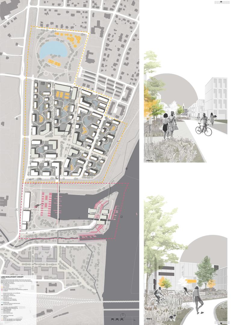
The main purpose of the project was to allow the city and the river to coexist without the need for advanced technological solutions. The response to these needs was a recreational buffer zone at the edge of the water. The buildings are located outside the zone at risk of flooding and those that are exceptionally located within it have been appropriately protected.
Climate change requires designers to take a new, holistic approach. The project presented here involves:
- improving the urban microclimate through green areas and water,
- reducing uncontrolled suburbanisation through the conversion of degraded areas,
- protecting cities from flooding through sustainable rainwater management systems,
- increasing retention and careful planning of development in river valleys.
We believe that these actions taken today will make it possible to meet the needs of future generations.
Key objectives for aesthetics and quality
The idea behind the project is to create a piece of resilient city that blends harmoniously with the existing built environment.
The strategy is implemented on the basis of three main initial assumptions. These issues are:
- composition: layout that takes advantage of the strengths of the location and is integrated into the existing structure, based on the main north-south axis
- zoning: multifunctional flood resilient development, distributed according to flood risk zoning principles
- retention: key element which protects the structure against flooding on several levels, influencing the character of the district.
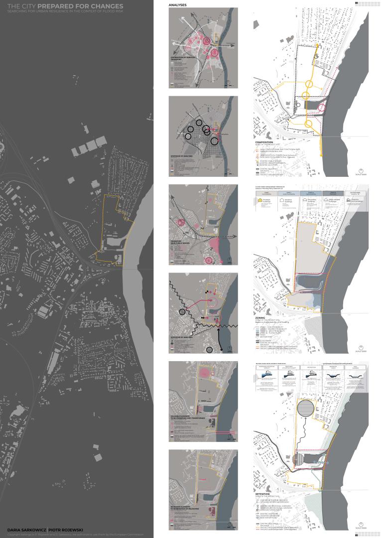
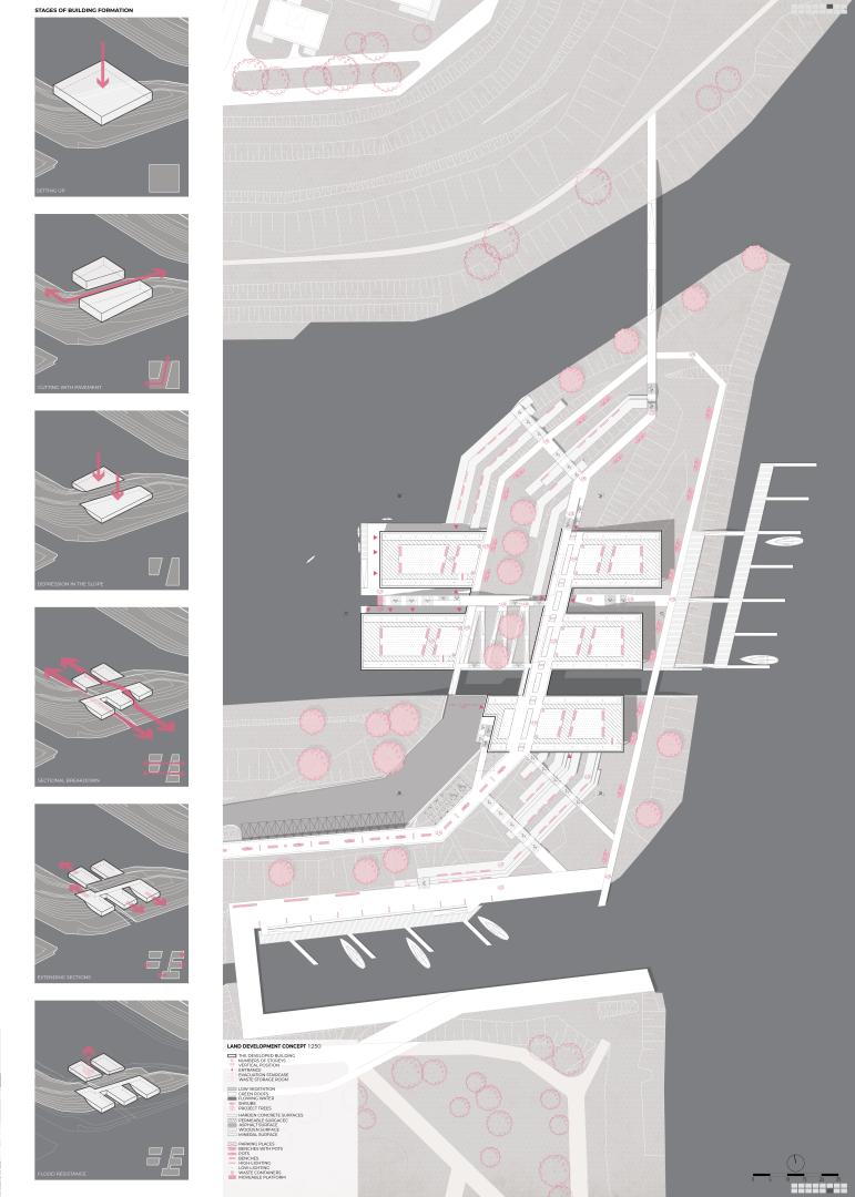
Composition
The composition of the layout is based on the main axis in the north-south direction, a walking route along the Vistula bank, and two transverse axes resulting from the access to public transport. The main axis running through the whole establishment connects the existing Vistula boulevard, passes through the post-shipyard areas and connects with the dominant feature in the form of the church tower. The old layout of public spaces together with the new elements creates a coherent network.
Zoning
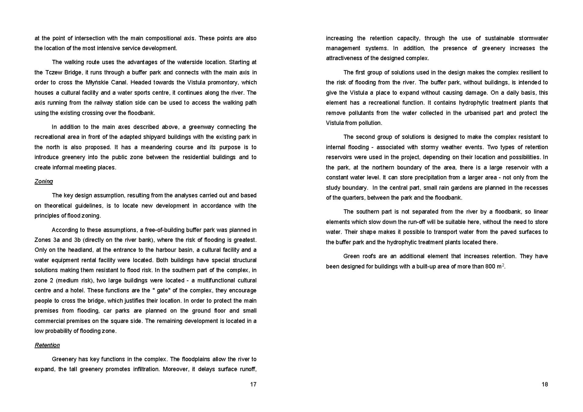
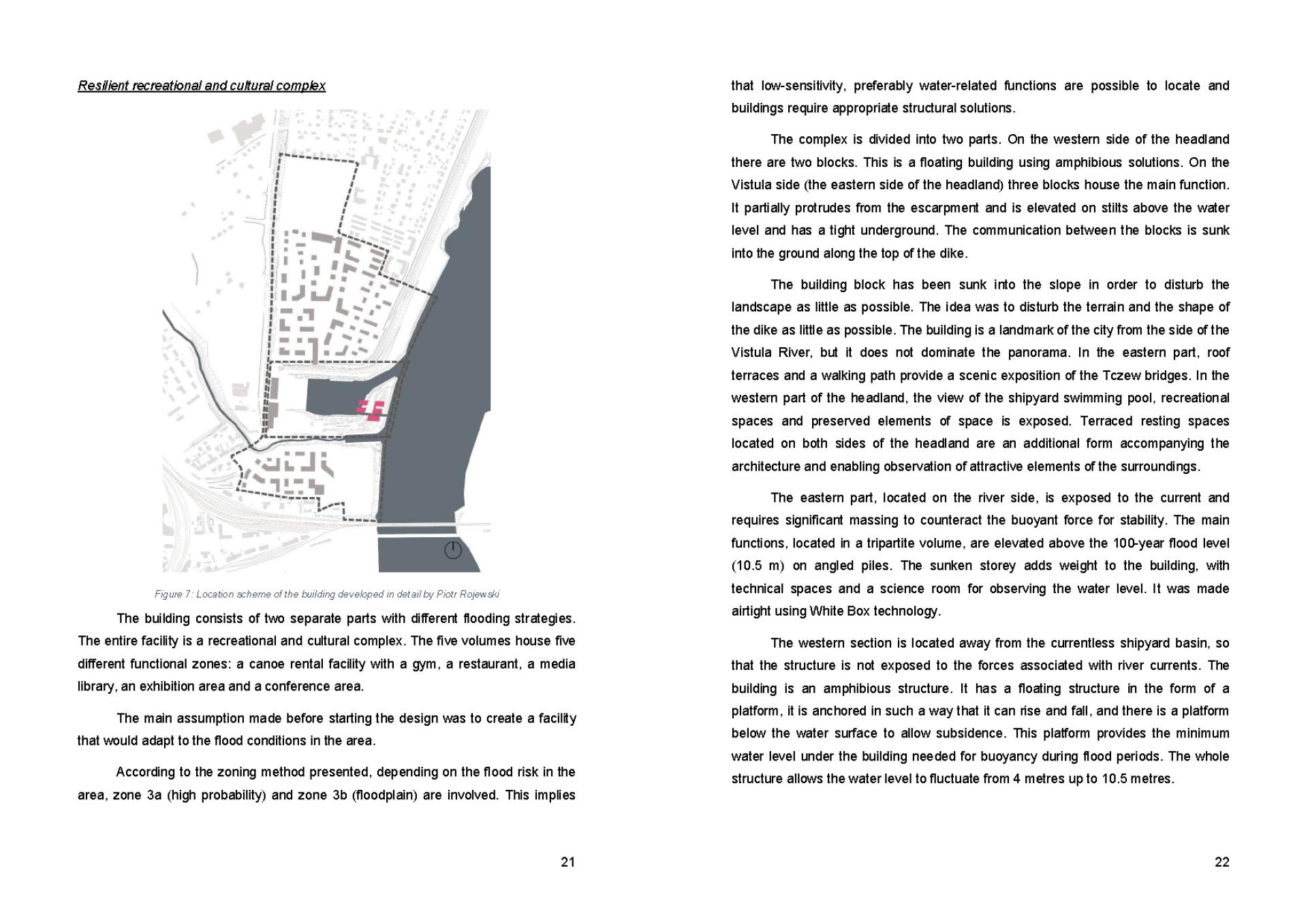
The key design assumption, resulting from the analyses carried out and based on theoretical guidelines, is to locate new development in accordance with the principles of flood zoning. According to these assumptions, a free-of-building buffer park was planned in zones where the risk of flooding is greatest. Only on the headland, at the entrance to the harbour basin, a cultural facility and a water equipment rental facility were located.
Retention
Greenery has key functions in the complex. The floodplains allow the river to expand, the tall greenery promotes infiltration. Moreover, it delays surface runoff, increasing the retention capacity, through the use of sustainable stormwater management systems.
Key objectives for inclusion
The project involves residents in project implementation and includes an educational layer on climate change.
1.Physical accessibility
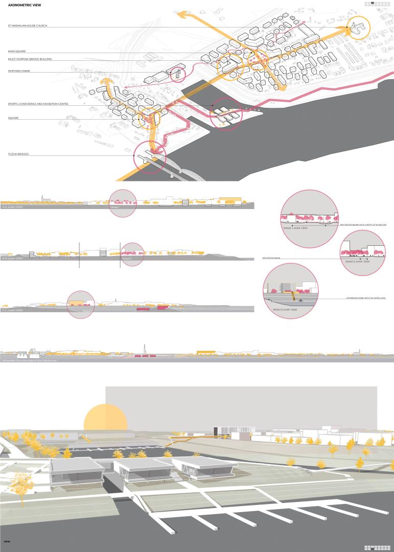
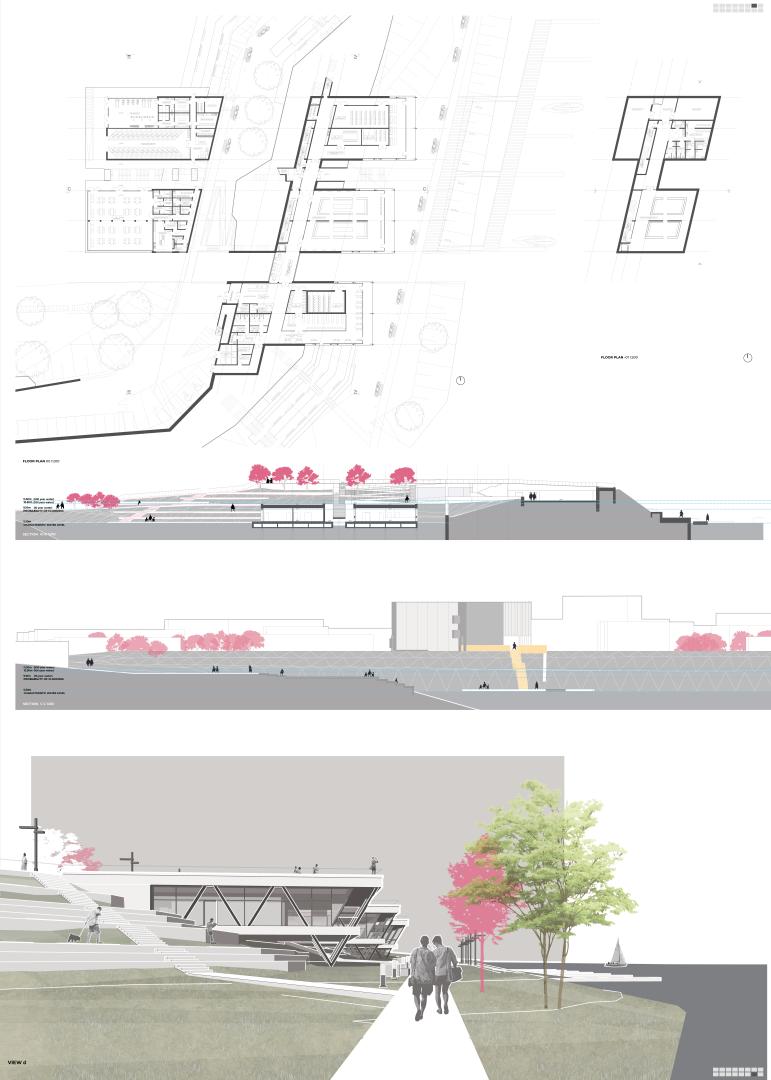
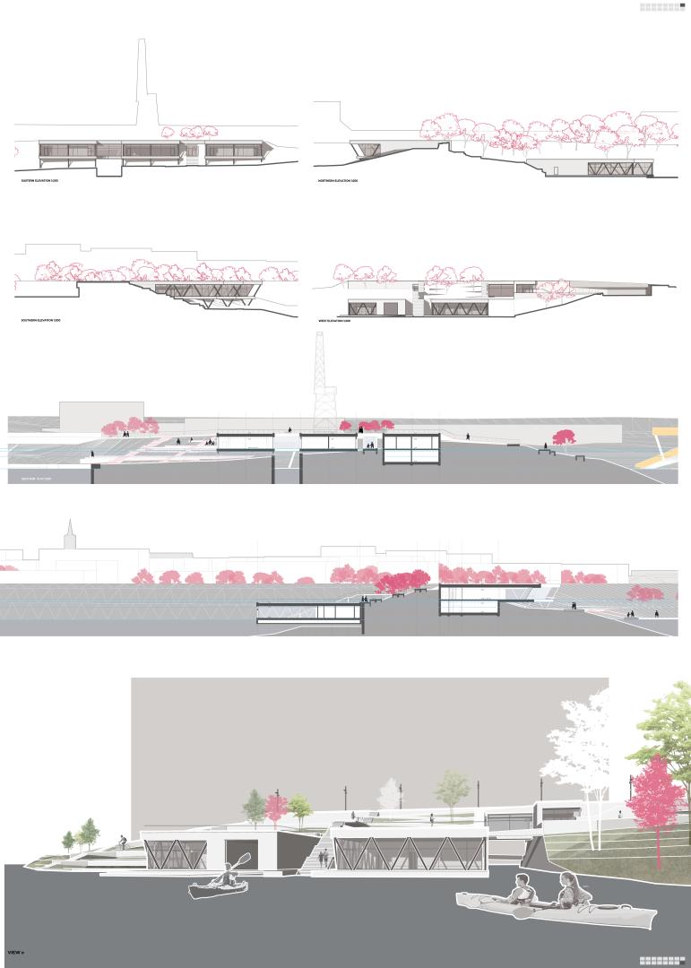
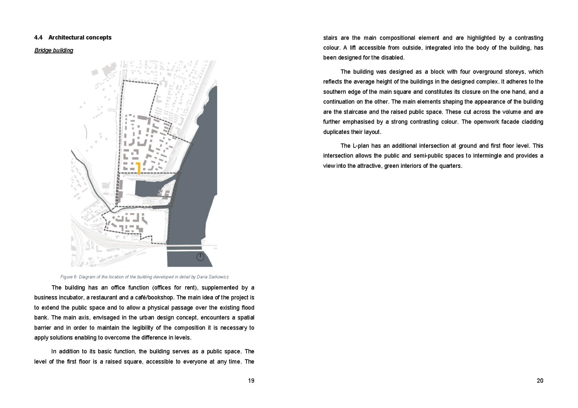
This project is located in a degraded area with a significant difference in terrain. The main axis runs through the floodbanks, so a bridge building was designed to allow access to the higher level.
The building has an office function (offices for rent), supplemented by a business incubator, a restaurant and a café/bookshop. The main idea of the project is to extend the public space and to allow a physical passage over the existing flood bank. The main axis, envisaged in the urban design concept, encounters a spatial barrier and in order to maintain the legibility of the composition it is necessary to apply solutions enabling to overcome the difference in levels.
In addition to its basic function, the building serves as a public space. The level of the first floor is a raised square, accessible to everyone at any time. The stairs are the main compositional element and are highlighted by a contrasting colour. A lift accessible from outside, integrated into the body of the building, has been designed for the disabled.
Solutions to ensure total accessibility are provided at every problematic point in the project, including floating buildings.
2. Education
Educational activities, including workshops on climate change and its potential impacts, are part of the project development plan. Potential solutions shall be discussed using the project as an example.
3. Consultations
Consultations with the city's residents shall be a part of the project development. We would like to get their opinion on the adopted solutions and work out a common vision which will respond to as many needs as possible.
Innovative character
This project contains design steps based on the functional zoning method:
1. Flood risk analysis.
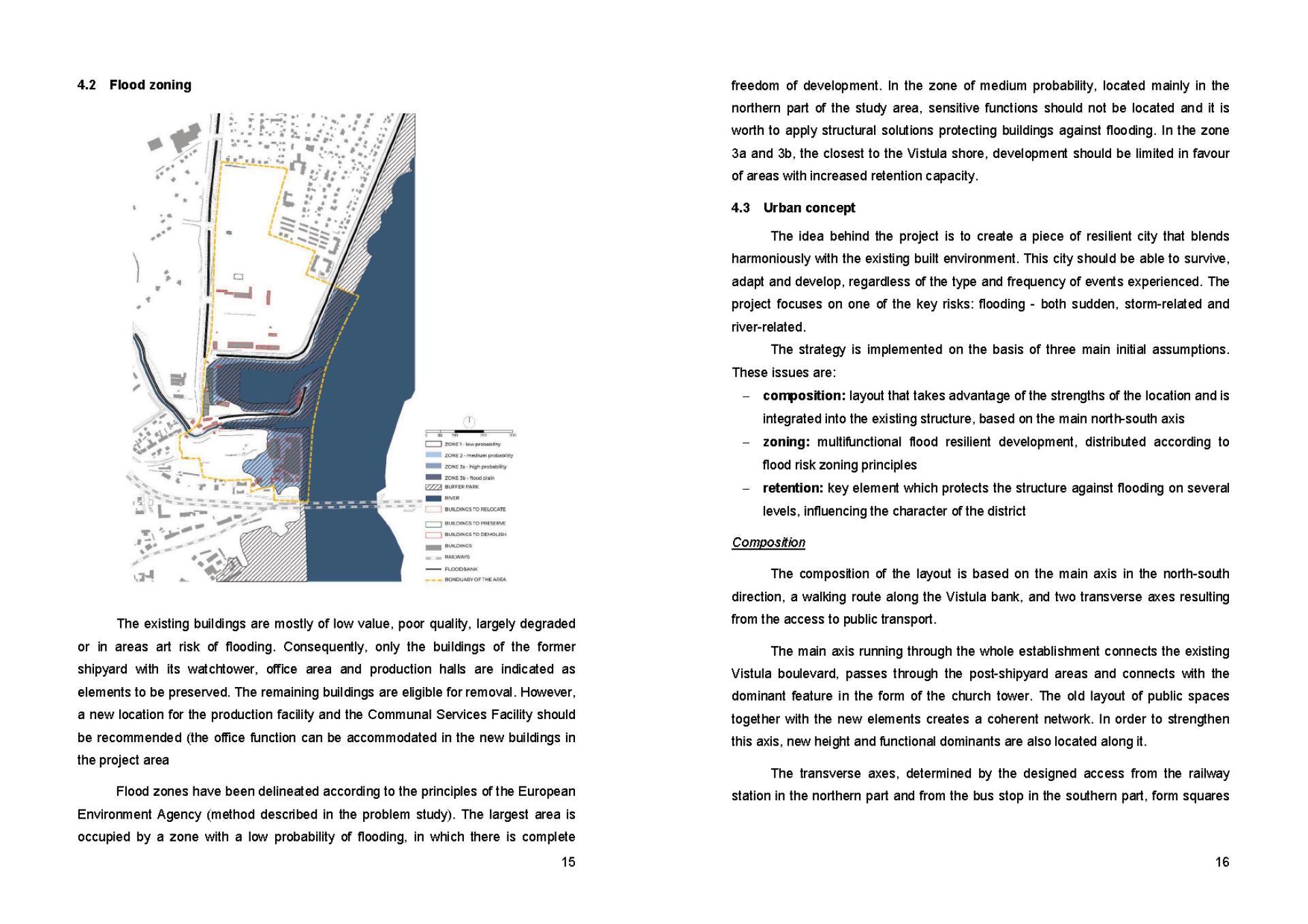
The risk of external flooding from proximity to water surfaces are relatively easy to predict. Flood hazard and risk maps should be consulted before designing areas in the proximity of water. However, a more difficult issue is flooding caused by heavy rainfall and an increase in impermeable surfaces. This phenomenon is relatively new and difficult to analyse. We can be sure of its increasing incidence and the consequent need for resilience solutions in all projects.
2. Selection of the main flood protection strategy.
The strategies undertaken to protect against flooding can be divided into four main categories:
- separating people from the water (use of floodbanks)
- keeping people away from the water (prohibition of floodplain development)
- coexistence with water
- preventive measures throughout the catchment area
3. Sustainable use of rainwater management principles
Five main principles of sustainable water management can be mentioned:
- Distribute water in the landscape
- Let the water flow through the landscape
- Make the project look and function well
- The solution should not be too expensive
- Stay conscious
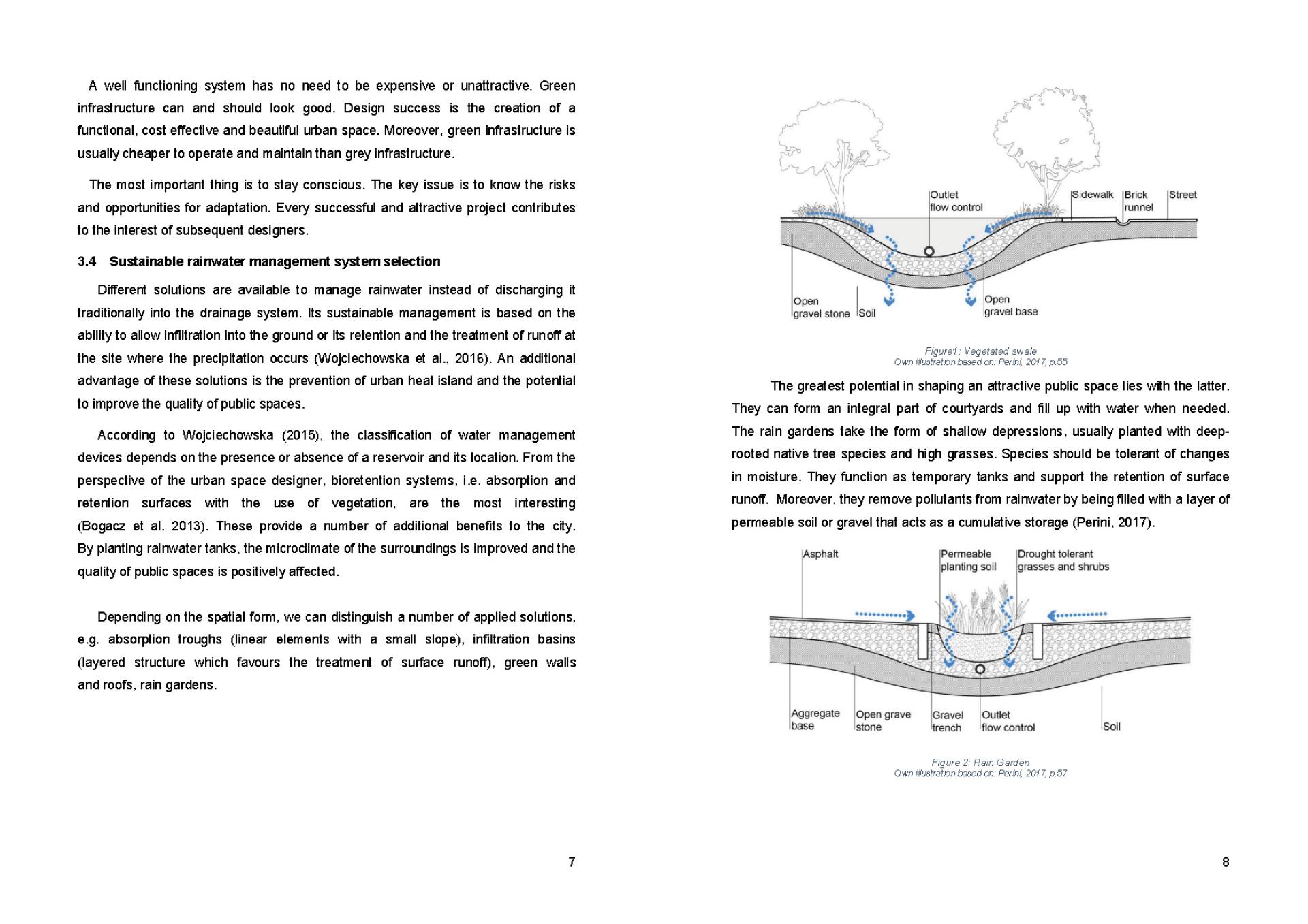
4. Sustainable rainwater management system selection
Different solutions are available to manage rainwater instead of discharging it traditionally into the drainage system. Its sustainable management is based on the ability to allow infiltration into the ground or its retention and the treatment of runoff at the site where the precipitation occurs.
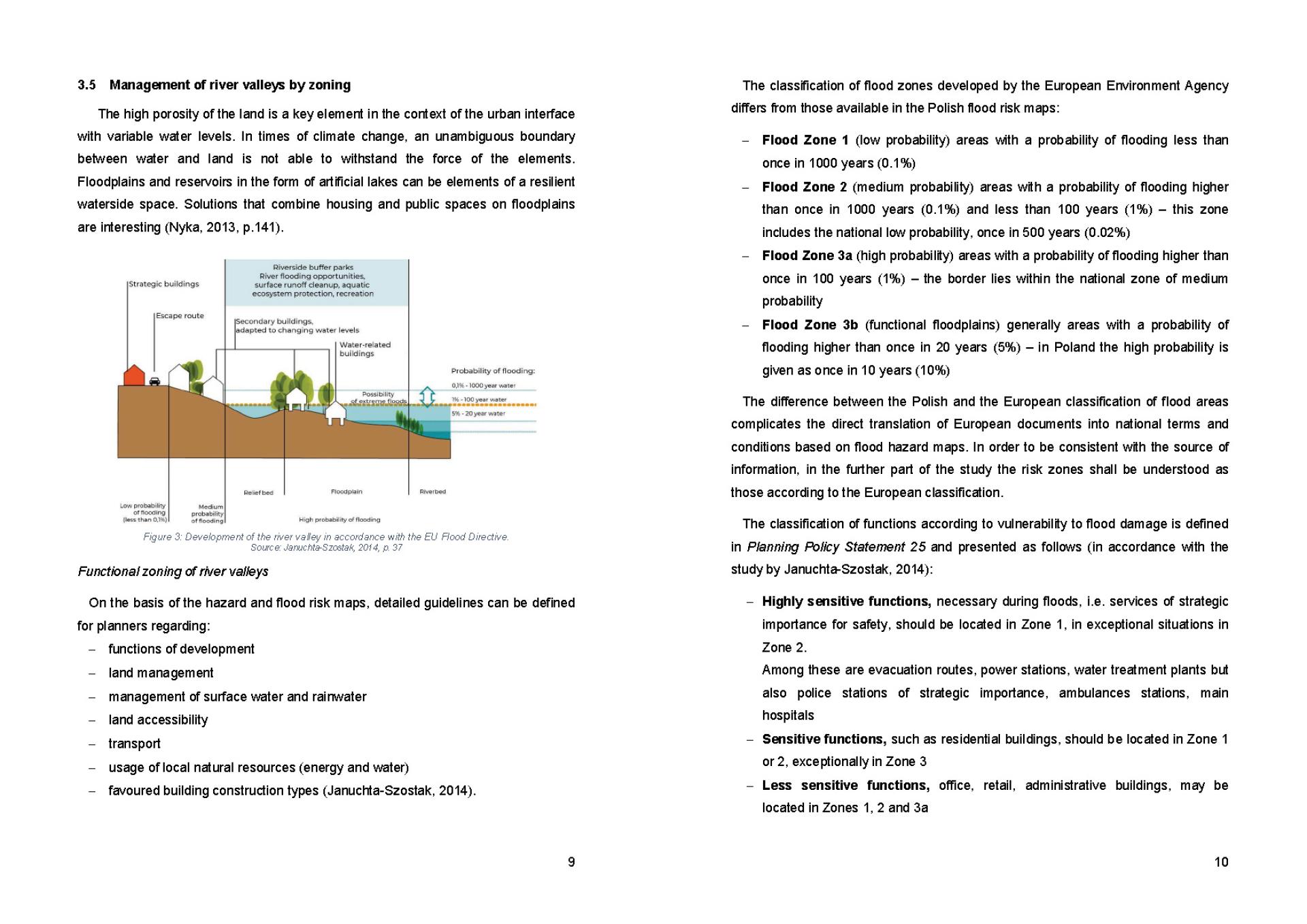
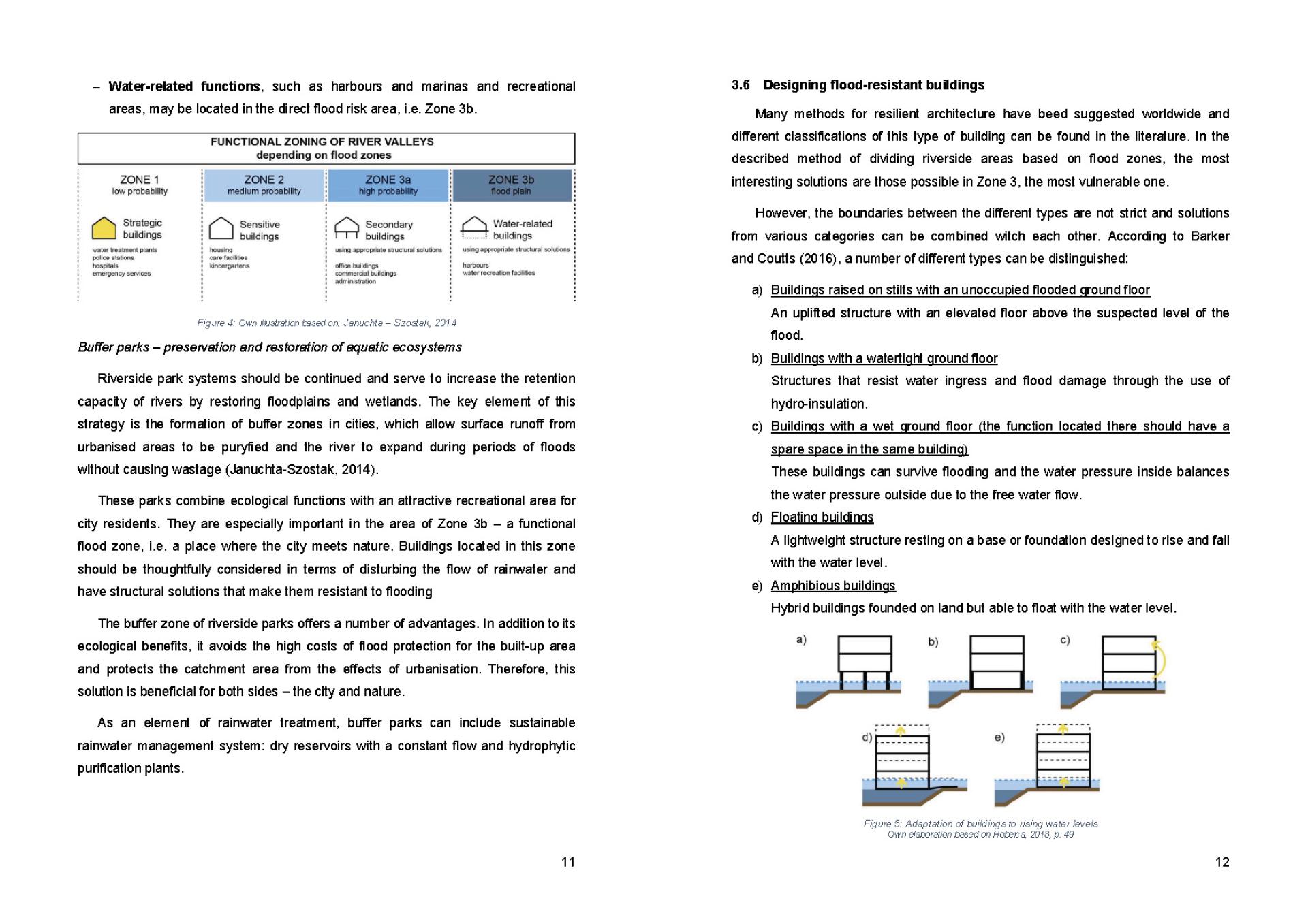
5. Management of river valleys by zoning
The classification of functions according to vulnerability to flood damage is defined in Planning Policy Statement 25 and presented as follows: strategic buildings, sensitive buildings, secondary buildings, water-related buildings. An additional element are buffer parks.
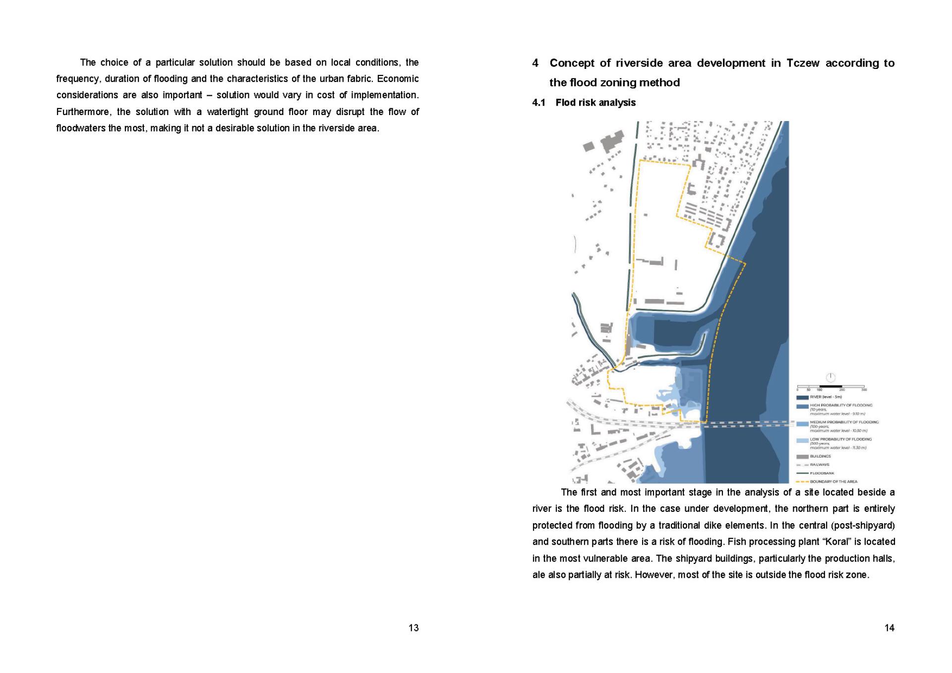
6.Designing flood-resistant buildings