Living landscape South Moravia
Basic information
Project Title
Full project title
Category
Project Description
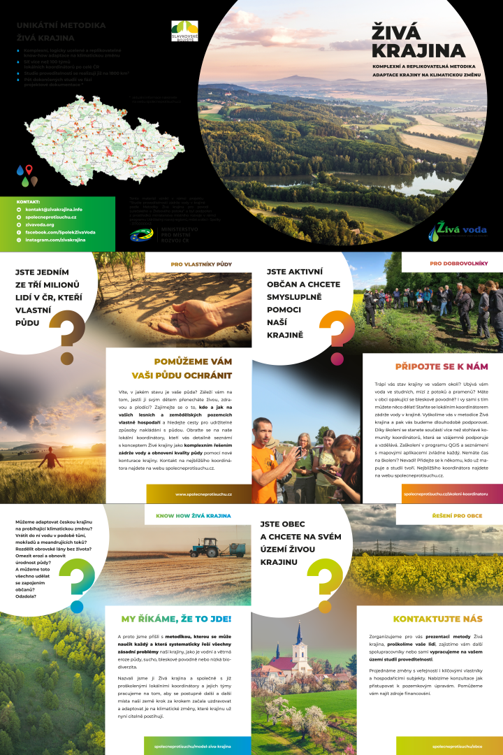
A living landscape stands for water, ground, nature and people in synergy with each other. We are not waiting for solutions from above, everyone can get involved. Working together, we restore our landscape. Our goal is to have a landscape adaptation plan on how to retain water into it, to break up the huge lifeless farm monocultures, to increase soil fertility and to reduce ground erosion.
Geographical Scope
Project Region
Urban or rural issues
Physical or other transformations
EU Programme or fund
Which funds
Description of the project
Summary
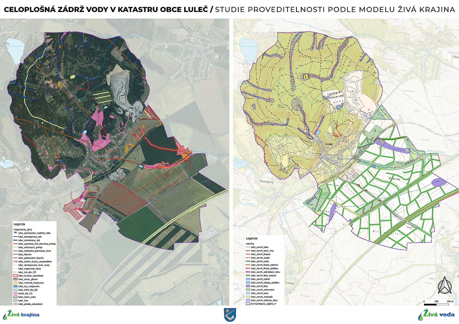
We have elaborated feasibility studies to address the overall water retention in the landscape, anti-erosion measures, increasing climate resilience and biodiversity of the landscape in the Lulečský and Žlebový brook basin (23 km² in total). We are using the Living Landscape methodology, which is a know-how that our organization Živá voda has developed based on long-term experience with landscape problems and in response to the advancing climate change.
The Living Landscapes know-how is innovatively conceived in such a way that interested volunteers from the general public can be drawn into the game.So far, over 140 volunteers have been trained through intensive training followed by online education and team practice.
The Living Landscapes methodology is versatile and can be used repeatedly with minimal costs. Finished projects build on each other and gradually assemble like a puzzle into a coherent treatment of larger areas.
Our experience has verified that the process of creating the study helps to create new local communities in communities, where citizens strengthen their cooperation and competence to solve other problems based on the common experience of mapping and making proposals for the feasibility study. It also creates opportunities for cooperation and sharing experiences with communities in neighbouring.
Key objectives for sustainability
The Living Landscape methodology approaches the area as a synergistic whole and offers solutions for both farmland and open countryside. It works conceptually always in the catchment area of a given stream so that water is retained over the entire catchment area through a series of sustainable, nature-based measures.
We propose to break up the huge monoculture fields into smaller units, contoured by belts of trees and shrubs, to provide shade and shelter for animals, and to return the straightened river courses to more natural channels and meanders that allow for the controlled flow of water in the floodplains. We support the transition from conventional agriculture to a more sustainable way of production. Methodics contours the given landscape into smaller units, thus helping to increase biodiversity and the overall permeability of the landscape.
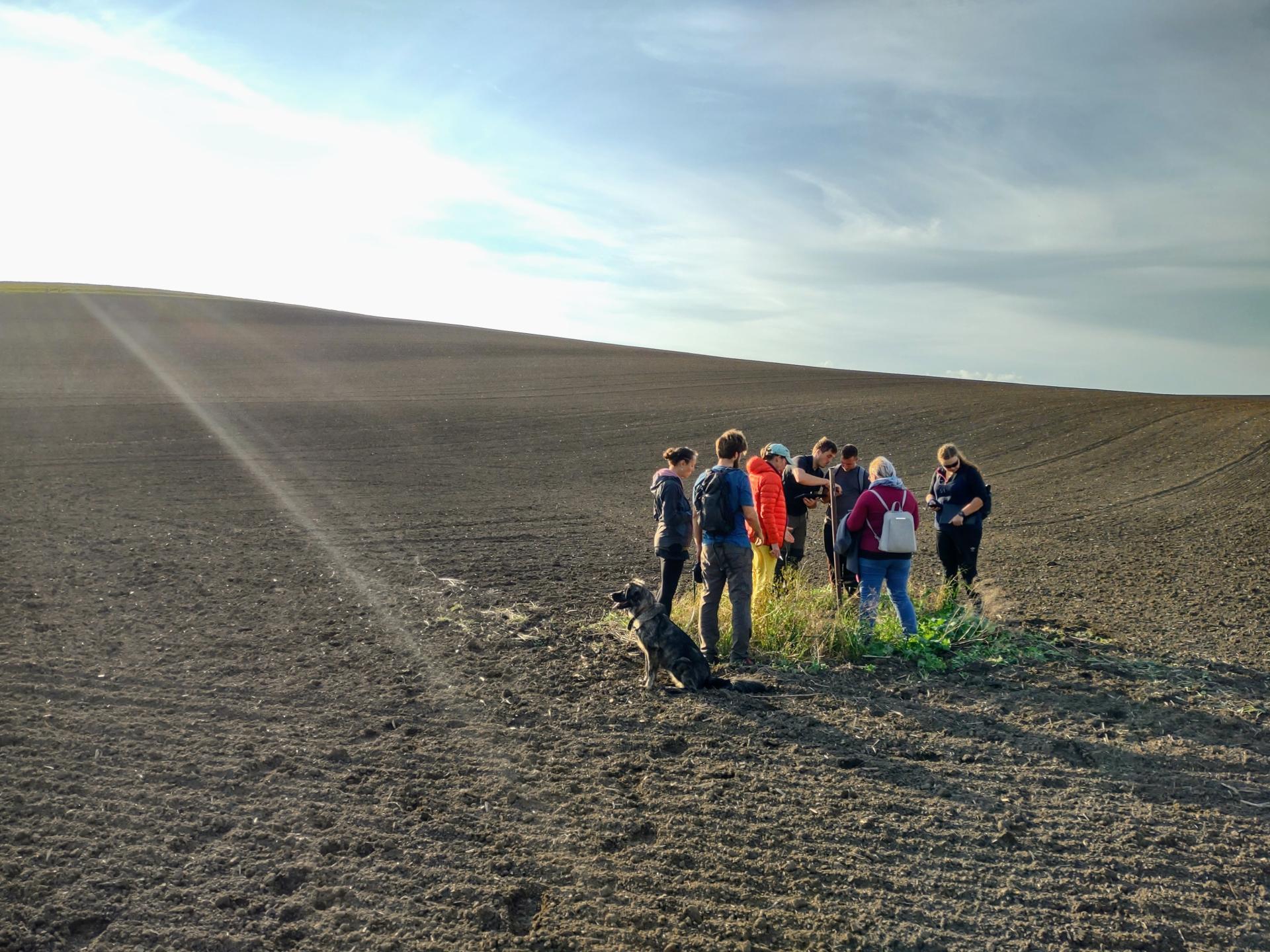
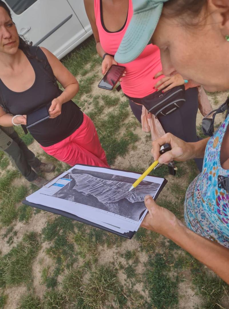
Volunteer members of the mapping team have been trained in the use of mobile mapping applications, understanding of basic geographic and geological phenomena and map background.Qgis software was used. The local volunteers gained detailed know-how on how to design a set of water retention and erosion control measures (pools, wetlands, valley grassed areas, boundary strips, swales, planting of greenery, etc.) and improve the resilience of the landscape to climate change in terrain familiar to them.
We have focused on direct involvement of local citizens who, after training and practice, are able to independently replicate the solutions in other areas in the region. Collaboration between experts and trained local public has already been successfully tested in the ongoing national Together Against Drought project (www.spolecneprotisuchu.cz).
The completed feasibility studies for the sites serve as the basis for the project documentation after discussion and approval by the stakeholders concerned, and thus allow for a disproportionately faster and less demanding process from preparation to project implementation.
Key objectives for aesthetics and quality
Our proposed contoured landscape aims to revitalize and regenerate the area for better business and healthier living for residents, to develop strategic planning based on functional regions, and to foster collaboration between actors in the area.
If the proposed measures resulting from the Living Landscape methodology are implemented, it will create a healthy, aesthetically and recreationally attractive, biodiverse and climatically stable environment for the residents, in which the ecological functions of the landscape and its overall ecological stability are not disturbed.
At the same time, the risk of a reduction in the quality of life of rural residents due to climate change will be reduced. The project will stabilise the water regime of the rural agricultural landscape. It emphasises the protection and improvement of the quality of the soil so that it is able to withstand various forms of erosion and degradation. It creates conditions for the implementation of various innovative agricultural approaches such as agroforestry, organic food cultivation, contour farming, no till systems, etc.
By subdividing giant farmland units, we also want to ensure the freedom to roam of the countryside, which is the general public's right to access certain public or privately owned land, lakes, and rivers for recreation and exercise, as is anchored in our legal system.
The project is designed to use the specific landscape findings from the study to engage landowners to address problems on their properties - such as water and wind erosion and arable land washout. Thanks to field mapping, the study provides much more accurate documentation of the actual condition of the land than is offered by state agricultural databases, including unique mapping of drainage systems in the area. This forensic evidence helps motivate owners to address the issue.
Key objectives for inclusion
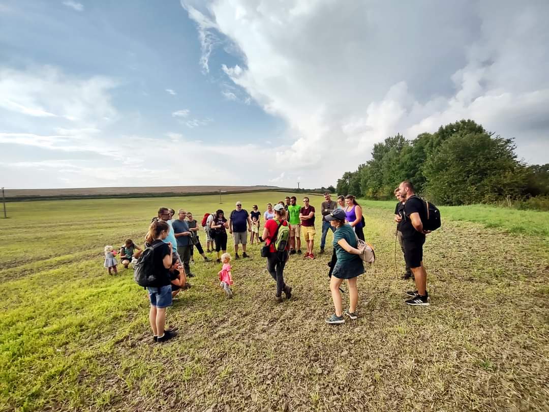
We have managed this project by involving a large group of volunteers in a process of accurate mapping in the field, studying archival material and then proposing the necessary measures in the landscape, thus ensuring the participation of the local community, which goes far beyond the usual framework of similar projects.
Our project is participatory and gives citizens the tools to be equal and active partners in local government decision-making processes.
It works with publicly available and technologies and methodologies that are completely free or not expensive. We have trained candidates for the position of local coordinators at only the cost of room and board. We make use of the globally available freeware QGIS and mapping applications, use of available mapping materials, government methodologies).
Thanks to the acquired know-how, the project pFeasibility study of the Žlebove stream basinrocessing process is fully replicable and uniform for all types of territories (compatible throughout the country), while respecting and incorporating local specifics.
It is a basis for subsequent project preparation, preparation for land development and, as it is clear from our experience, also a valued know-how for sharing with other municipalities and entities.
It builds on the local people's knowledge of the landscape, strengthens the local people's relationship with the landscape and land, and their knowledge of the historical development and context, as well as the current state of the surrounding landscape.The project offers the opportunity for absolutely everyone, regardless of gender, education, age or income, to come together to work together, as well as a new level of participation in local government decision-making in their locality.
Results in relation to category
We developed and submitted feasibility studies generated in cooperation with trained volunteers to local governments for further use: Feasibility study of the Lulečský stream basin and Feasibility study of the Žlebový stream basin. They consist of a text section and a GIS project map of the basin with proposed measures. They are basis for subsequent project documentation for the measures to be implemented, and as concept material for land development or for the analysis of the region's landscape vulnerabilities.
Project reached more than 1000 people with increased awareness of landscape drought and flood issues and possible solutions.
We published calls for volunteers in the local press and on social media (FB group with 272 members, FB page, Instagram).
We held an online awareness-raising presentation on the creation of a new local initiative (our activities, objectives, how to get involved, support the project). It was closed with a discussion and viewed by over a thousand viewers.
We distributed 500 informational leaflets and attracted 15 new volunteers.
We provided training sessions for 4 new local coordinators. We held regular meetings for volunteers on the ground in the catchment area with mapping demonstrations.
We made contact with over 30 village representatives as we organised an inspirational tour of examples of good practice in the surrounding countryside.
The project included 8 municipalities in whose cadastres infrastructure mapping was carried out - the actual state of the landscape in terms of water retention capacity and climate resilience) with proposed solutions.
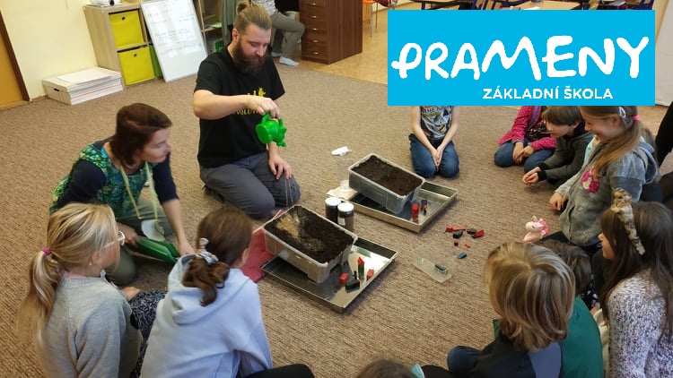
We established contact with local primary school to involve children and youth. We arranged workshops for the 60 pupils.
We spread awareness of the project through a number of published articles or media reports - press, Czech radio and television.
We made 4 awareness-raising spots summarizing addressed problems, the course and outcomes of the project.
How Citizens benefit
Rural agricultural areas in CZE are still dealing with impacts of the past: collectivisation and nationalisation tore the bond between people and the land around them. Residents now rather rarely own the land around their villages, and even if they do, they rarely work it themselves. Previously state owned agricultural cooperatives transformed into large agricultural businesses use the land without consideration of the specific local needs.
People living in rural settlements are witnessing the climate changes in nature, but they lack the expertise and concepts which would allow them to take part in the solutions and it leads into resignation and mistrust. There is lack of communication among stakeholders.
The climate change theme often seems too expert or distant. Project explained local examples of ongoing climate change to which residents were able to easily relate. We created local initiative, which gathered active citizens with similar motivations: individuals, who decided to take responsibility for their environment, for their vicinity. Volunteers who are willing continuously learn new things and cooperate in a team. Public meetings and debates took place. There was number of citizens with strong competencies to undertake similar projects in their areas. This led to new areas where we are currently working on feasibility studies.
The process of creating a feasibility study required that many people take part and contribute. The created studies becomed a starting point for a pragmatic and evidence-based debate among the stakeholders. It defined the main risks and problems in the landscape and clearly shows the benefits of the proposed solutions. Project is bringing a win-win strategy to help farmers tackle their problems (drought, erosion) and citizens to secure water resources and improve biodiversity.
Physical or other transformations
Innovative character
We bring a comprehensive and citizen-science based approach to climate-change adaptation. We have a complex tool for designing water retention and climate adaptation measures in open landscape. The tool is a step-by-step approach with map analysis, historical research, and projection in GIS programmes. We can train anyone to adopt this approach and initiate water retention projects in their vicinity.
So far it is the only method in the country that offers solutions for large-scale drainage facilities by using or closing them, as well as addressing erosion on agricultural land, revitalizing streams and returning wetlands and pools to their surroundings. Certification of the method is currently underway.
Our solution helps to lower the barrier between the citizens and the climate change. People feel overwhelmed by the changes they observe but don´t have the tool to become part of the solution. We turn this around by training them on the basic level to become “citizen science” pro´s. Our pilot project can be replicated to whole country and all around Eastern Europe which deals with similar legacy of mass agriculture and landscape management. We are currently focused on simplifying and speeding up of the process even more by introducing automation and using AI.
Our project uses the power of volunteer work and snow-ball effect. We can train hundreds of people, who then involve hundreds of coworkers in their vicinity. Our know-how is opens-source and once learned, cn be used over and over in new localities. We can train hundreds of people per yeas and we can further train consultants in other countries who will the train their own coordinators.
Learning transferred to other parties
Our know-how is accessible to anyone for free. We also provide a free step-by-step manual on how to achieve water retention and landscape restoration. The method offers a standardised approach to the creation of a unified map with newly proposed landscape remodelling measures anywhere in the world. We can train hundreds of people per year, who then involve further co-workers in their vicinity. We can also train consultants in other countries who will then train their local collaborators. Our ambition is to eventually create the entire Czech and EU Landscape Adaptation Plan.
The local coordinators have a uniform methodology that can be used for any catchment area. The individual feasibility studies can therefore build on each other in a sequential and coherent manner.
Our model has already been piloted in a number of localities. Its positive results have led several Czech municipalities to contracting our association for their own local study creation. The number of our volunteers is constantly growing.