Jõelähtme Digital Adventure Map
Developing the Cultural Life Environment of Jõelähtme Municipality Through a Digital Adventure Map
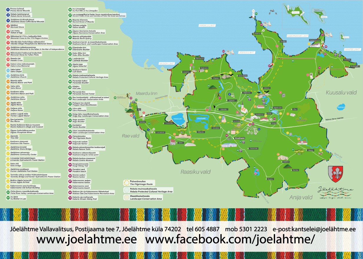
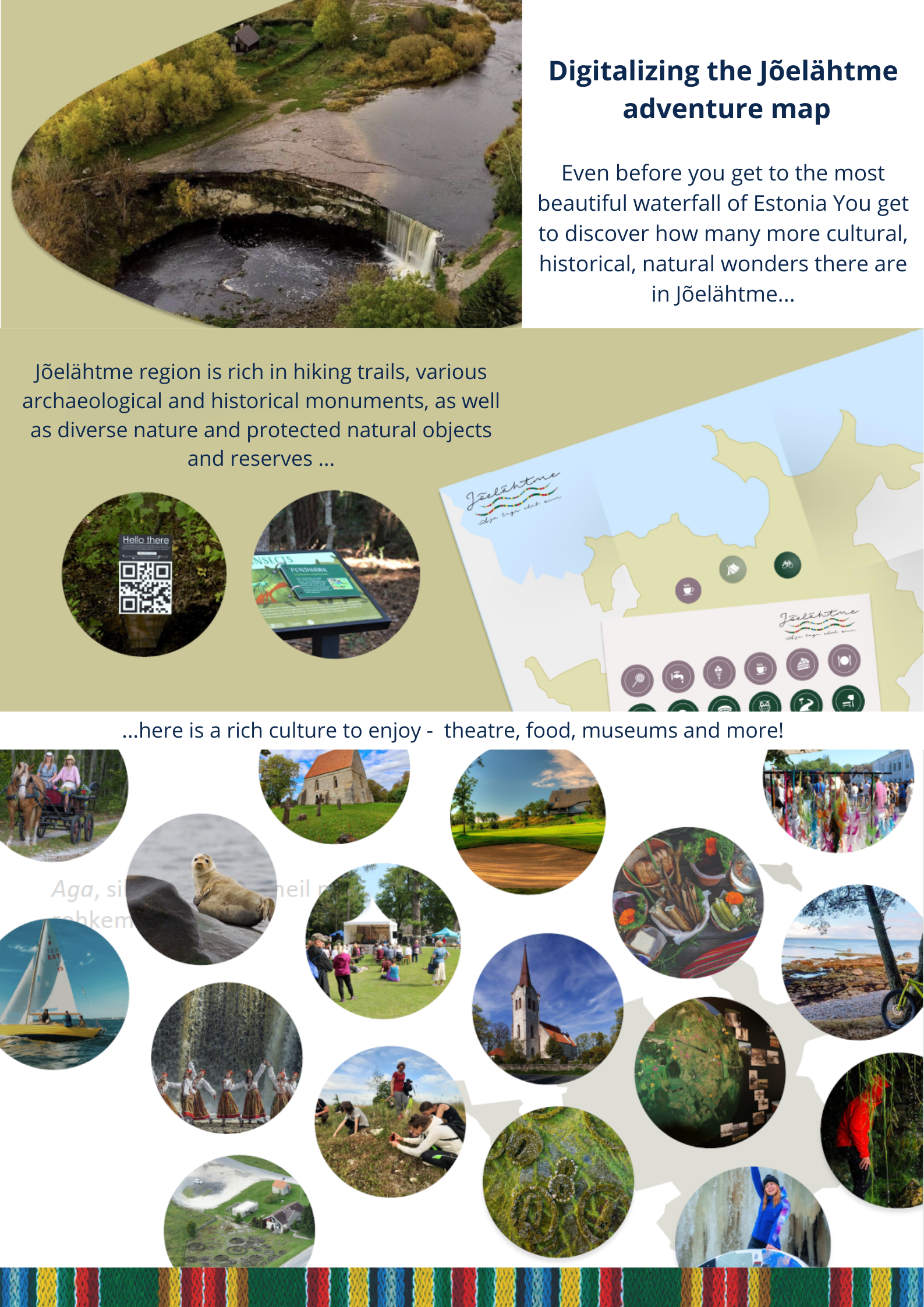
The adventure map of Jõelähtme Municipality was created in 2024 in collaboration with the municipal government, local certified guides, county councilor and a cultural historian. The map was designed to introduce the region's historical, natural, and cultural heritage sites and attractions. The objective is to transform the static, paper-based adventure map into a digital, interactive format to support the the planned Jägala-Joa information point-cafe and to help discover the area even further.
Estonia
Joa Recreation Area, Jägala-Joa village,Jõelähtme parish, Harju county, Estonia, 74204.
Prototype level
Yes
Yes
Yes
No
No
245: Jõelähtme vald (EE)
Jõelähtme municipality - with the population of 7665 and located strategically just 20 minutes from Estonia's capital, Tallinn, Jõelähtme provides the perfect balance between urban accessibility and rural tranquility. The municipality's motto, "The Story of Time Lives Here," reflects its rich cultural past, vibrant present, and promising future. The area is home to a vast array of archaeological relics and well-preserved cultural landscapes, making it an exciting destination for history enthusiasts and nature lovers alike.
To further enhance the region's attractiveness and support local entrepreneurship, the idea of digitizing the adventure map and adding interactive features was born.
PROJECT OBJECTIVES:
• Develop digital content for the Jägala Waterfall cafe-information point and transform the adventure map into an interactive map, offering updated and easily accessible information about the municipality's heritage.
• The adventure map is as a useful tool for local enterpeneurs, who can can add the adventure map to their website. There is an opportunity to link their products and/or services with the cultural and historical gems located on the adventure map to achieve greater visibility and interest.
The adventure map will be linked to the national VisitEstonia website, where the local enterpeneurs can add their accommodation and restaurants for even more visibility. So far in the Jõelähtme municipality such an uniting platform is missing.
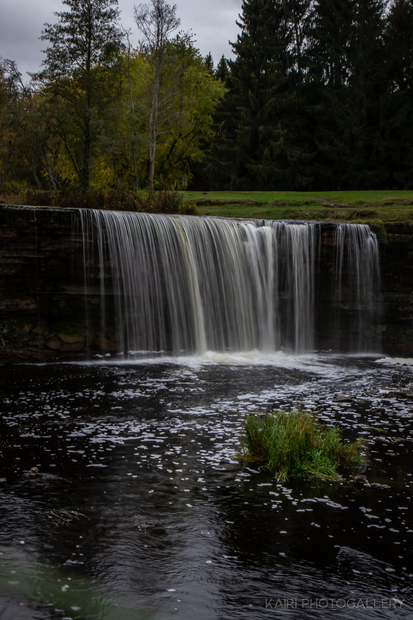
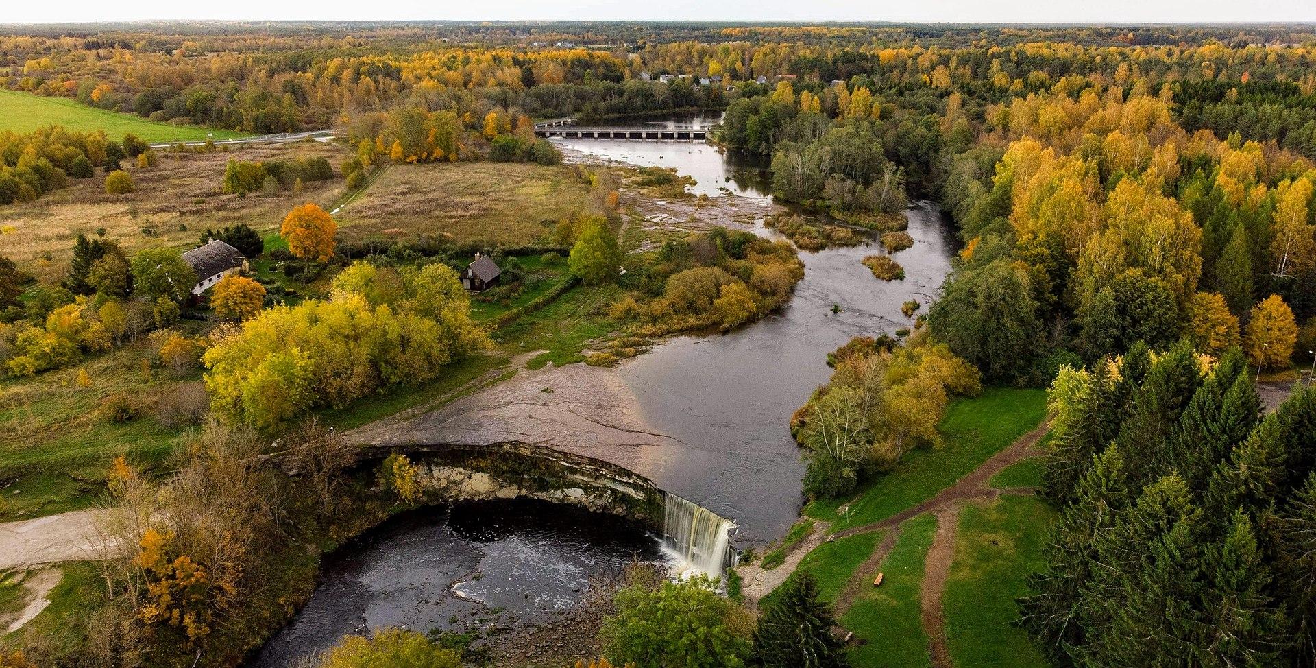
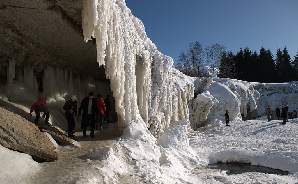
• Support the local tourism and service sectors by directing visitors from the heavily frequented Jägala Waterfall (which receives up to 100,000 visitors annually) to other parts of the municipality.
• Improve the overall attractiveness and accessibility of the region by promoting environmentally friendly transportation options, such as walking and cycling, to reduce reliance on cars and lower CO₂ emissions.
Enhance the living environment by promoting sustainable and eco-friendly movement options and improving leisure opportunities.
Preserve and respect the municipality's natural, cultural, and historical diversity and traditions.
The map can be used as a tool which can be used as a helpful tool for local enterpeneurs who can use the map on their websites and tie their
Strengthen community by involving local guides and cultural historians in the development of the digital map.
Encourage cross-regional tourism collaboration by allowing local tourism businesses to integrate their services into the adventure map, who can use the map on their websites and/or adding the information about accommodation or food services etc on the m
By making the adventure map interactive, the project aims to enhance the appeal of the municipality to both residents and visitors. This will highlight the region's unique historical, natural, and cultural heritage.
Improving the overall attractiveness and accessibility of the region by promoting environmentally friendly transportation options, such as walking and cycling, to reduce reliance on cars and lower CO₂ emissions.
Preserving and respecting the areas natural, cultural, and historical diversity and traditions.
Encouraging sustainable land use and environmental awareness: Promoting responsible tourism and reducing overcrowding in popular areas.
The adventure map is an aesthetically designed, artistic representation of local cultural values, enriched with high-quality images and relevant site information.
Jõelähtme municipality boasts a wealth of archaeological and historical sites, diverse natural landscapes and protected nature reserves. The area offers numerous recreational opportunities across all seasons, including fishing, hiking, and foraging. With its picturesque coastline, old villages, pristine forests, and even small mountains, the region is ideal for exploration.
By making the adventure map interactive, the project aims to enhance the appeal of the municipality to both residents and visitors. This will highlight the region's unique historical, natural, and cultural heritage.
By offering updated and easily accessible information about the areas heritage, the appeal of the local cultural heritage will rise.
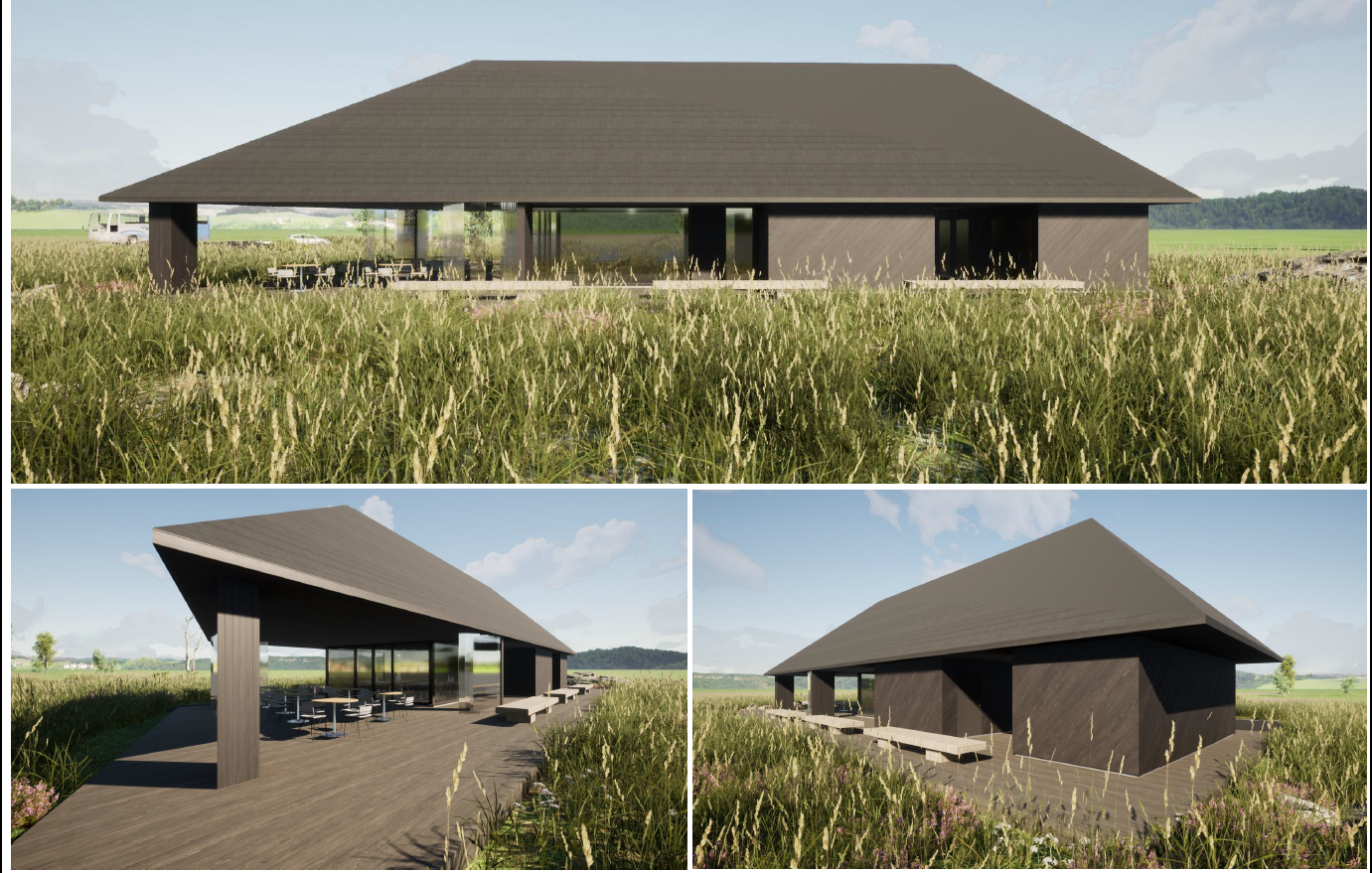
The municipal government team participated in a service design master class to offer visitors the most user-centered options possible - this resulted in the o the concept of Jägala-Joa cafe-information point – offering products and services of local entrepreneurs in the information point-café and also to use modern digital tools for easily accessible information on the local cultural and histrical life, improving the overall attractiveness and accessibility of the region.
The original adventure map of Jõelähtme Municipality was created in 2024 in collaboration with the municipal government, local certified guides, county councilor and a cultural historian. The map was designed to introduce the region's historical, natural, and cultural heritage sites and attractions.
The municipal government team participated in a service design master class to offer visitors the most user-centered options possible - this resulted in the o the concept of Jägala-Joa cafe-information point – offering products and services of local entrepreneurs in the information point-café and also to use modern digital tools for easily accessible information on the local cultural and histrical life.
Development of the digital map will again strengthen community cohesion by involving local guides and cultural historians once more to go over all the marked attractions and adding more value to the digital version.
Encouraginf cross-regional tourism collaboration by letting local tourism businesses to integrate their services into the adventure map. Enterpeneurs can use the map on their websites and/or adding the information about accommodation or food services etc on the map and getting better visibility.
Continue and strengthen the partnership with Estonian Business and Innovation Agency (SA Ettevõtluse ja Innovatsiooni Sihtasutus)/ VisitEstonia.ee and local businesses - there is an agreement set for the agency to come and introduce to local entrepreneurs the benefits of VisitEstonia and to intertwine VisitEstonia with the digital adventure map.
The digital adventure map will help:
• Enhancing community engagement and local identity: Enabling residents to contribute stories and historical insights, thereby fostering pride and involvement.
• Encouraging sustainable land use and environmental awareness: Promoting responsible tourism and reducing overcrowding in popular areas.
• Enhancing the living environment by promoting sustainable and eco-friendly movement options (by walking or cycling) and improving leisure opportunities.
• Boosting rural tourism and economic development: Directing visitors to hidden cultural and natural gems, supporting local businesses.
By making the adventure map interactive, the project aims to enhance the appeal of the Jõelähtme region not only to visitors, but also residents - the sense of pride about their home.
Regional level- The Jõelähtme municipal government team participated in a service design master class to offer visitors the most user-centered options possible. The goal was to use the tourism attraction - Jägala Waterfall with at least 100 000 visitors per year - and use it so the local (residents and enterpeneurs) would get the most benefits. The service desing masterclass helped to set the concept of the Jägala-Joa cafe-information point: – it´s ame is to offer products and services of local entrepreneurs and to give job oppurtunuties. Service deisgn masterclass had many homework tasks, which included interviewing and/ or visiting the local enterpeneurs, residents and even visitors of Jägala Waterfall - to get the real expectations of people involved (local level). Only the on set information point is not enough. The goal is to offer sustainable travelling and to send the visitors all around the beautiful area, using bycilces or hiking. So the idea of an adventure map came together, in 2024 the on paper adventure map came alive thanks to the co-operation with local guides and historians. Now to take the adventure map to the next level the municipality will continue and strenghten the co-operation with the local guides, historians, village elders and Harju Entrepreneurship and Development Center (Regional and National level) with round table and meetings to help the locals benefit from the soon to be finished Jägala joa information pont-cafe and adventure map and their possibilities.
Cultural heritage: Historians and certified guides provided knowledge about historical sites, ensuring the map accurately reflects the region’s heritage.
Digitatal technology: IT developers and service designers will collaborate to create an intuitive, engaging digital platform.
Enviroment: Specialists in sustainable tourism and environmental conservation guided decisions to minimize ecological impact and promote responsible travel.
Urban and rural planning: Municipal planners ensured the project aligned with infrastructure development.
Business: Local business owners can contribute by integrating their services into the map, enhancing their opportunities.
Tourism : professionals provided insights on visitor engagement and accessibility to improve the user experience.
Implementing digital innovation for rural development: Utilizing modern digital tools to attract audiences and improve service visibility for local businesses.
Enhancing community engagement, cultural and natural gems as well as local identity.
Comprehensive development of the visitor experience of attractions in Jõelähtme area, mapping and developing missing services ) in cooperation with communities, landowners and entrepreneurs.
Enhancing community engagement, cultural and natural gems as well as local identity.
Comprehensive development of the visitor experience of attractions in Jõelähtme area, mapping and developing missing services ) in cooperation with communities, landowners and entrepreneurs.
The project is built on a foundation of collaboration and community engagement. Key stakeholders, including the municipal government, local certified guides, county officials, cultural historians, and local businesses, have been actively involved in the initiative. Their contributions ensure that the digital adventure map reflects both the historical significance and contemporary needs of the region.
Workshops and roundtable meetings to collect insights from community members and tourism professionals, service design training, Collaboration with tourism and entrepreneurship organizations.
A major objective of the initiative is the transformation of the existing static, paper-based adventure map into a dynamic, interactive digital tool. This enhances accessibility and usability, making cultural and historical sites more discoverable for residents and visitors alike.Integration of local businesses’ services.
Sustainable Tourism and Environmental Considerations.
The project fosters strong public-private partnerships, recognizing the role of businesses and tourism organizations in economic and cultural development.
Strategic Alignment and Funding: The initiative aligns with the Strategic Development Plan for Jõelähtme Municipality (2023-2035), which focuses on heritage and nature tourism as a means of regional growth and sustainability. The project contributes to broader economic, cultural, and environmental goals by strengthening infrastructure and enhancing the tourism experience.
Collaborative approach: Engaging local stakeholders, including government entities, businesses, historians, and community members, can be successfully applied to other rural or urban tourism projects.
Digital transformation: Converting physical tourism materials into digital interactive platforms can enhance accessibility and engagement for other heritage and cultural tourism destinations.
Sustainable tourism practices: Encouraging eco-friendly transportation and responsible tourism can be integrated into other regions' tourism strategies to minimize environmental impact.
Public-private partnerships: The model of collaboration between local businesses, tourism boards, and government can be transferred to other sectors, fostering economic development and innovation.
Community-driven content: Allowing residents and experts to contribute knowledge and historical insights fosters a stronger connection to local heritage and enhances tourism experiences.
Adaptability to different contexts: The adventure map concept could be used in other heritage-rich areas, nature reserves, or even urban exploration initiatives by tailoring the digital tool to local needs.
By digitalizing the adventure map and linking it with the Jägala Joa information point, the project strengthens Jõelähtmes cultural, economic, and environmental landscape. It fosters local tourism, supports small businesses, promotes sustainable travel, and preserves regional heritage. This initiative will ensure that Jõelähtme continues to be an attractive, sustainable, and economically viable rural destination for generations to come.
Expanding digital accessibility: Enhancing the interactive map with additional language (english) and reality features for greater user experience.
Further engagement: Hosting additional community workshops and integrating more local businesses and cultural institutions.
Sustainability: eco-friendly visitor possibilities at key sites to further reduce the environmental impact (such as bike stands).
Partnering with others share best practices and further innovation.
The next steps include:
Securing additional funding for expanding digital infrastructure and further developing visitor-friendly, sustainable solutions.
Setting user feedback possibility to ensure continuous improvements.
Enhancing educational outreach by integrating the digital map into local school programs to promote cultural heritage awareness. The original adventure map (on paper) has been given to local schools (3) and youth centres (3) for them to use in history or orientating studies already.
Expanding sustainable tourism initiatives, such as guided eco-tours and hopefully digital storytelling features.

