Enhancing Circularity, Sustainability, and Innovation
Dashboard of Climate Justice
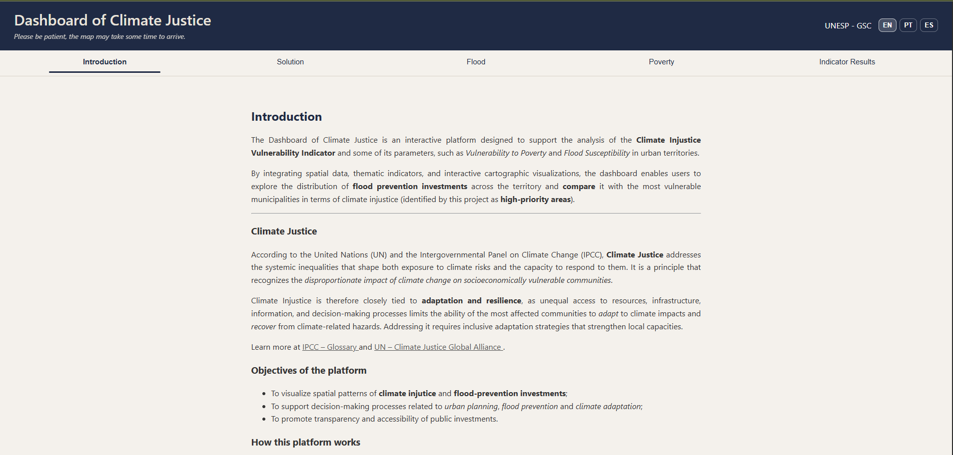
Climate Injustice and vulnerability dashboard for equitable flood risk and investment planning
A data-driven platform that maps flood risk and social vulnerability to guide fair and effective climate investments. By combining geospatial analysis, socioeconomic data, and community input, it identifies priority areas for action, helping governments reduce flood impacts while addressing inequality. Scalable, low-cost, and transparent, it supports smarter decisions for resilient and inclusive cities.
Brazil
Regional
The Sorocaba River Basin in São Paulo State, Brazil. encompassing 55 municipalities.
Mainly urban
It refers to other types of transformations (soft investment)
Prototype level
No
No
No
Organisation
Our concept is a data-driven decision-support framework designed to reduce climate injustice in flood-prone urban areas. It integrates socioeconomic, environmental, and infrastructure data into a Climate Injustice Vulnerability Index, which identifies and maps areas where flood risk and social vulnerability overlap. The system is supported by an interactive geospatial platform that enables policymakers to visualize vulnerabilities, compare them with current public investments, and prioritize more equitable and effective interventions.
The methodology has already been prototyped and tested across the Sorocaba River Basin, covering 55 municipalities. Achieved results include the successful development and application of the vulnerability indicator, integration of multiple datasets (e.g., income, land use, rainfall, infrastructure), and deployment of a functional visualization platform. Sensitivity analyses were conducted to validate indicator robustness, and a flood susceptibility model was implemented to compensate for limited historical flood data.
Expected results include a 20–30% reduction in flood-prone areas through better-targeted investments, a 25% decrease in infrastructure losses, and improved ecosystem conditions (e.g., increased vegetation and restored wetlands). The platform also enhances transparency, supports participatory governance, and strengthens institutional capacity. Designed with open-source tools, the framework is low-cost, scalable, and adaptable to different regions, enabling global replication while maintaining local relevance.
The methodology has already been prototyped and tested across the Sorocaba River Basin, covering 55 municipalities. Achieved results include the successful development and application of the vulnerability indicator, integration of multiple datasets (e.g., income, land use, rainfall, infrastructure), and deployment of a functional visualization platform. Sensitivity analyses were conducted to validate indicator robustness, and a flood susceptibility model was implemented to compensate for limited historical flood data.
Expected results include a 20–30% reduction in flood-prone areas through better-targeted investments, a 25% decrease in infrastructure losses, and improved ecosystem conditions (e.g., increased vegetation and restored wetlands). The platform also enhances transparency, supports participatory governance, and strengthens institutional capacity. Designed with open-source tools, the framework is low-cost, scalable, and adaptable to different regions, enabling global replication while maintaining local relevance.
The concept emerged from observing the disproportionate impact of flooding on vulnerable communities in rapidly urbanizing regions, particularly in the Sorocaba River Basin. The team identified that traditional flood management approaches often prioritize technical efficiency while neglecting social inequalities, resulting in uneven recovery and persistent climate injustice.
To address this gap, the team developed an interdisciplinary approach combining engineering, data science, and social equity principles. The first step involved defining the problem through literature review and analysis of local flood patterns and socioeconomic conditions. Next, relevant datasets were collected from public sources (e.g., climate projections, land use, demographic data), followed by the design of a composite vulnerability indicator.
The development process included parameter selection, weighting (validated through team and expert input), and sensitivity analysis to ensure robustness. Due to data limitations, a flood susceptibility model was created using terrain, slope, and land-use data. The indicator was then spatially applied across municipalities using GIS tools.
Parallel to this, an interactive web-based platform was developed using Python and open-source libraries, enabling visualization, comparison, and decision support. Community engagement was incorporated through planned consultations and participatory inputs for prioritization criteria.
The concept was iteratively tested at a regional scale, refining both the indicator and platform usability. This process demonstrated its feasibility, scalability, and potential to bridge the gap between scientific data and public policy, fostering more equitable and transparent climate adaptation strategies.
To address this gap, the team developed an interdisciplinary approach combining engineering, data science, and social equity principles. The first step involved defining the problem through literature review and analysis of local flood patterns and socioeconomic conditions. Next, relevant datasets were collected from public sources (e.g., climate projections, land use, demographic data), followed by the design of a composite vulnerability indicator.
The development process included parameter selection, weighting (validated through team and expert input), and sensitivity analysis to ensure robustness. Due to data limitations, a flood susceptibility model was created using terrain, slope, and land-use data. The indicator was then spatially applied across municipalities using GIS tools.
Parallel to this, an interactive web-based platform was developed using Python and open-source libraries, enabling visualization, comparison, and decision support. Community engagement was incorporated through planned consultations and participatory inputs for prioritization criteria.
The concept was iteratively tested at a regional scale, refining both the indicator and platform usability. This process demonstrated its feasibility, scalability, and potential to bridge the gap between scientific data and public policy, fostering more equitable and transparent climate adaptation strategies.
Climate justice
Flood risk management
Data-driven decision making
Social inclusion
Urban resilience
The concept addresses sustainability through an integrated environmental, social, and economic approach to flood risk and climate injustice. Environmentally, it reduces flood impacts by identifying priority areas for nature-based solutions, ecosystem restoration, and improved land-use planning, contributing to biodiversity enhancement and more resilient urban systems.
Socially, it targets the unequal exposure of vulnerable populations by combining flood risk with socioeconomic indicators, ensuring that adaptation measures prioritize those most affected. Economically, the framework optimizes public investments by directing resources where they generate the highest impact, reducing long-term infrastructure losses and recovery costs.
The use of open-source tools and globally available datasets ensures low implementation costs and long-term financial sustainability. Additionally, the model promotes circular and adaptive planning processes by continuously updating data and enabling iterative decision-making.
The concept is exemplary because it goes beyond risk mitigation: it systematically aligns environmental protection, social justice, and efficient resource allocation, creating a regenerative and scalable model for climate adaptation.
Socially, it targets the unequal exposure of vulnerable populations by combining flood risk with socioeconomic indicators, ensuring that adaptation measures prioritize those most affected. Economically, the framework optimizes public investments by directing resources where they generate the highest impact, reducing long-term infrastructure losses and recovery costs.
The use of open-source tools and globally available datasets ensures low implementation costs and long-term financial sustainability. Additionally, the model promotes circular and adaptive planning processes by continuously updating data and enabling iterative decision-making.
The concept is exemplary because it goes beyond risk mitigation: it systematically aligns environmental protection, social justice, and efficient resource allocation, creating a regenerative and scalable model for climate adaptation.
The concept contributes to aesthetics by enhancing the quality of urban environments through informed and equitable spatial planning. By identifying priority areas for intervention, it supports the creation of greener, safer, and more livable neighborhoods, integrating nature-based solutions such as green corridors, restored wetlands, and permeable urban spaces.
These interventions improve everyday life by reducing environmental stressors (e.g., flooding, heat, pollution) while promoting well-being and connection to nature. In the long term, the framework enables cities to evolve into more harmonious and resilient landscapes, where infrastructure and natural systems coexist.
The platform itself also contributes to “aesthetic intelligence” by making complex data accessible through intuitive visualizations, allowing stakeholders and communities to better understand their environment and engage with it meaningfully.
The project is exemplary in aesthetics because it links environmental performance with spatial quality and human experience, fostering a sense of place, belonging, and care through informed design and planning.
These interventions improve everyday life by reducing environmental stressors (e.g., flooding, heat, pollution) while promoting well-being and connection to nature. In the long term, the framework enables cities to evolve into more harmonious and resilient landscapes, where infrastructure and natural systems coexist.
The platform itself also contributes to “aesthetic intelligence” by making complex data accessible through intuitive visualizations, allowing stakeholders and communities to better understand their environment and engage with it meaningfully.
The project is exemplary in aesthetics because it links environmental performance with spatial quality and human experience, fostering a sense of place, belonging, and care through informed design and planning.
Inclusion is central to the concept, as it explicitly focuses on reducing climate injustice by prioritizing vulnerable populations in flood-prone areas. The methodology integrates socioeconomic indicators (e.g., income, population density, infrastructure access) to ensure that decision-making is equitable and targeted.
Accessibility is addressed through a user-friendly, open-access platform that enables governments, researchers, and communities to interact with the data. Affordability is ensured by the use of open-source technologies and low-cost implementation, making the solution viable for low- and middle-income regions.
The concept also promotes inclusive governance by incorporating participatory processes, where communities can contribute local knowledge and influence prioritization of interventions. This aligns with the NEB principle of fostering social justice and collective ownership.
It is exemplary because it operationalizes inclusion through measurable indicators and decision-making tools, rather than treating it as a secondary objective.
Accessibility is addressed through a user-friendly, open-access platform that enables governments, researchers, and communities to interact with the data. Affordability is ensured by the use of open-source technologies and low-cost implementation, making the solution viable for low- and middle-income regions.
The concept also promotes inclusive governance by incorporating participatory processes, where communities can contribute local knowledge and influence prioritization of interventions. This aligns with the NEB principle of fostering social justice and collective ownership.
It is exemplary because it operationalizes inclusion through measurable indicators and decision-making tools, rather than treating it as a secondary objective.
The concept incorporates participatory processes by involving stakeholders in multiple phases: data validation, prioritization of interventions, and policy design. Community engagement is planned through consultations, workshops, and integration of local knowledge into the platform.
This approach ensures that affected populations are not only beneficiaries but active contributors to decision-making, aligning with NEB’s emphasis on participation across design, implementation, and operation phases.
The impact of participation includes improved accuracy of data, stronger legitimacy of decisions, and increased public support for climate adaptation measures. It also fosters community ownership and long-term engagement with the project.
This approach ensures that affected populations are not only beneficiaries but active contributors to decision-making, aligning with NEB’s emphasis on participation across design, implementation, and operation phases.
The impact of participation includes improved accuracy of data, stronger legitimacy of decisions, and increased public support for climate adaptation measures. It also fosters community ownership and long-term engagement with the project.
The concept operates across multiple governance levels, from local communities to regional and national institutions. It is designed to be applied at different territorial scales (neighborhoods, municipalities, river basins), enabling vertical integration between local needs and policy frameworks.
Stakeholders include local governments, academic institutions, NGOs, and potentially international organizations (e.g., climate and water governance bodies).
The added value lies in connecting informal community knowledge with formal decision-making systems, while also enabling horizontal collaboration across municipalities and sectors. This multilevel structure enhances policy coherence, scalability, and long-term impact.
Stakeholders include local governments, academic institutions, NGOs, and potentially international organizations (e.g., climate and water governance bodies).
The added value lies in connecting informal community knowledge with formal decision-making systems, while also enabling horizontal collaboration across municipalities and sectors. This multilevel structure enhances policy coherence, scalability, and long-term impact.
The concept is inherently transdisciplinary, combining knowledge from environmental engineering, data science, urban planning, social sciences, and public policy. The development integrates geospatial analysis, climate modeling, and socioeconomic assessment into a unified framework.
This collaboration enables innovative solutions that would not emerge within a single discipline, particularly in addressing complex challenges like climate injustice and flood risk.
The use of digital tools (Python, GIS), combined with social and environmental analysis, exemplifies a holistic approach that bridges technical and human-centered perspectives.
This collaboration enables innovative solutions that would not emerge within a single discipline, particularly in addressing complex challenges like climate injustice and flood risk.
The use of digital tools (Python, GIS), combined with social and environmental analysis, exemplifies a holistic approach that bridges technical and human-centered perspectives.
The business model is structured as a hybrid approach that combines public funding, institutional partnerships, and service-based revenue streams to ensure long-term financial sustainability. In its initial stages, the concept relies on research grants, government funding, and international climate finance mechanisms to support development and implementation. Over time, revenue can be generated through subscription-based access to advanced analytics and decision-support features, as well as through consulting services provided to municipalities, regional governments, and organizations seeking customized applications of the platform. Additional income streams include tailored implementation projects, data integration services, and partnerships with NGOs and international agencies working in climate adaptation. The use of open-source technologies and academic collaboration significantly reduces operational costs, allowing the model to remain financially viable while ensuring accessibility, particularly for public-sector stakeholders and low-resource contexts.
The concept demonstrates strong scalability due to its modular, data-agnostic design, which allows it to be adapted to a wide range of geographic and institutional contexts. Its core components—including the vulnerability index methodology, integration of global datasets (such as climate, socioeconomic, and land-use data), and the geospatial visualization platform—can be replicated in different regions with minimal structural changes. The framework is designed to operate across multiple spatial scales, from neighborhoods to entire river basins, enabling flexibility in application. Additionally, the use of globally available datasets and open-source tools ensures that the concept can be implemented even in data-scarce or resource-constrained environments. The participatory governance model further enhances transferability by allowing local adaptation based on community input and institutional structures, making the concept suitable for diverse socio-political and environmental contexts worldwide.
Over the next 12 months, the focus will be on advancing the concept from a validated prototype to a fully operational and scalable solution. This includes refining the vulnerability index by incorporating additional datasets, improving parameter calibration, and integrating feedback from experts and stakeholders to enhance robustness and accuracy. The platform will undergo technical upgrades, including improvements to the user interface, automation of data processing, and potential integration of real-time or near-real-time data sources. The project will expand its pilot implementation beyond the Sorocaba River Basin to additional municipalities or regions, demonstrating adaptability and broader applicability. Parallel to this, strategic partnerships will be established with local governments, NGOs, academic institutions, and international organizations to support implementation and dissemination. Efforts will also focus on securing funding through grants and climate innovation programs, while increasing community engagement through workshops and participatory processes to incorporate local knowledge and strengthen stakeholder ownership. These steps aim to ensure practical deployment, institutional adoption, and long-term impact.