Arts, Culture, and Heritage as Drivers of Change
Jardim Lapenna wayfinding project
Jardim Lapenna wayfinding project
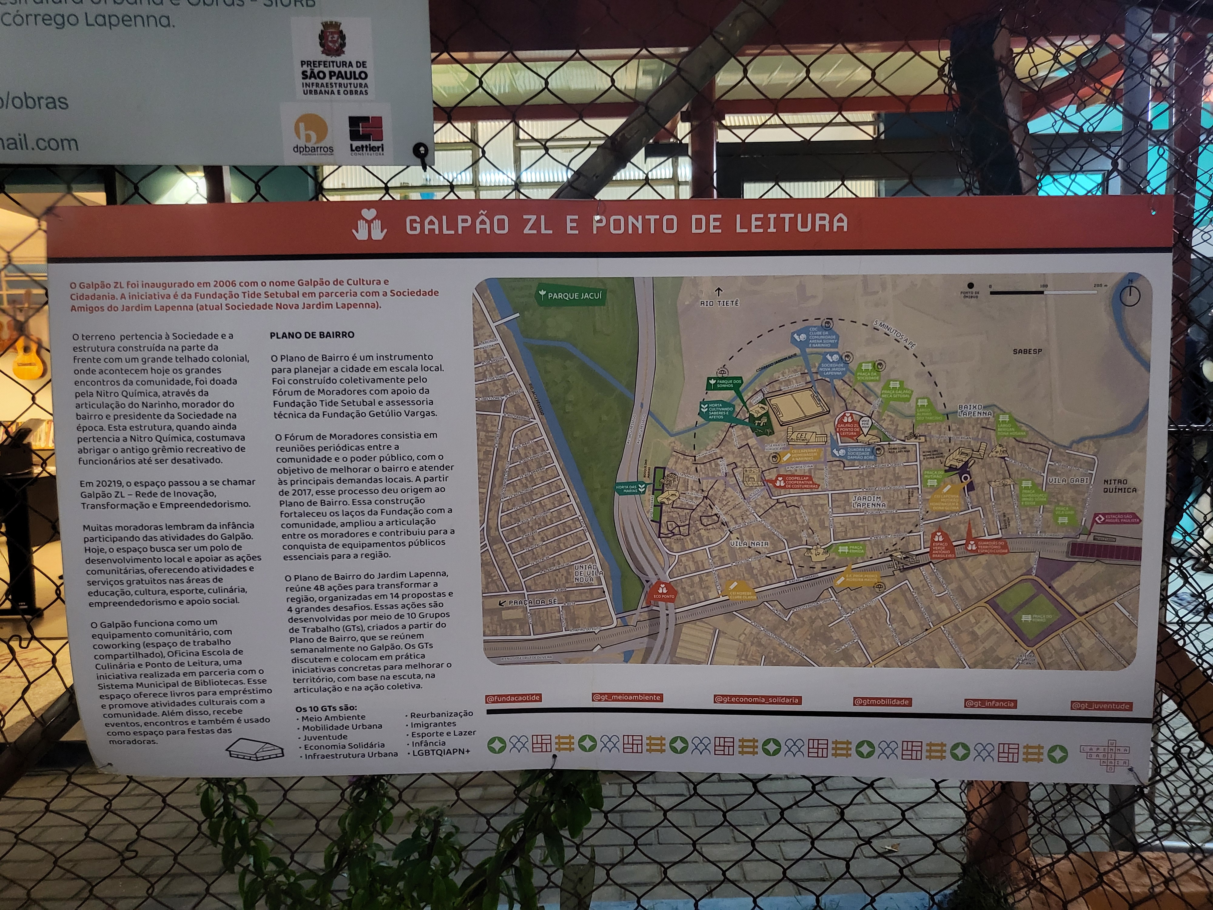
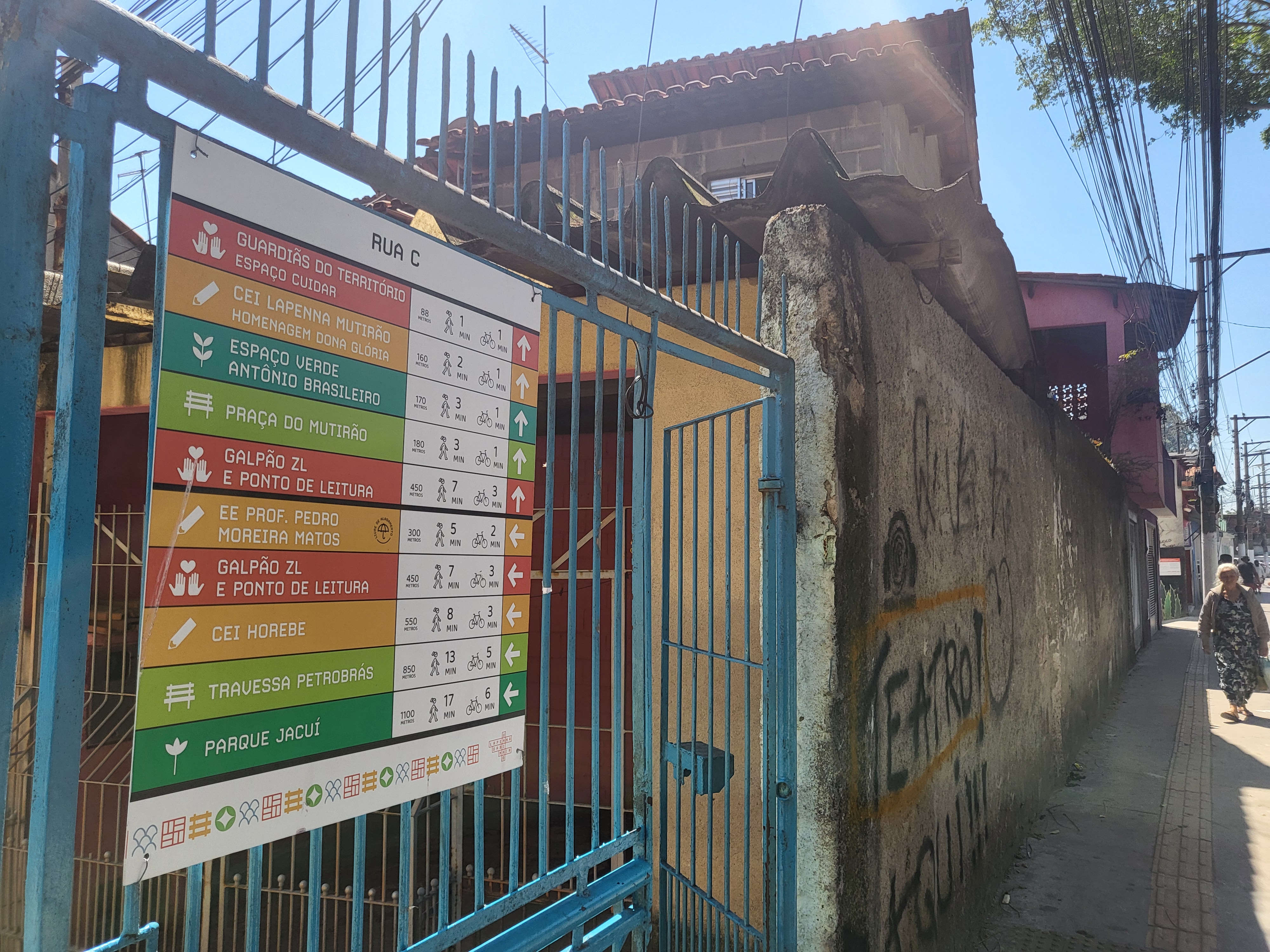
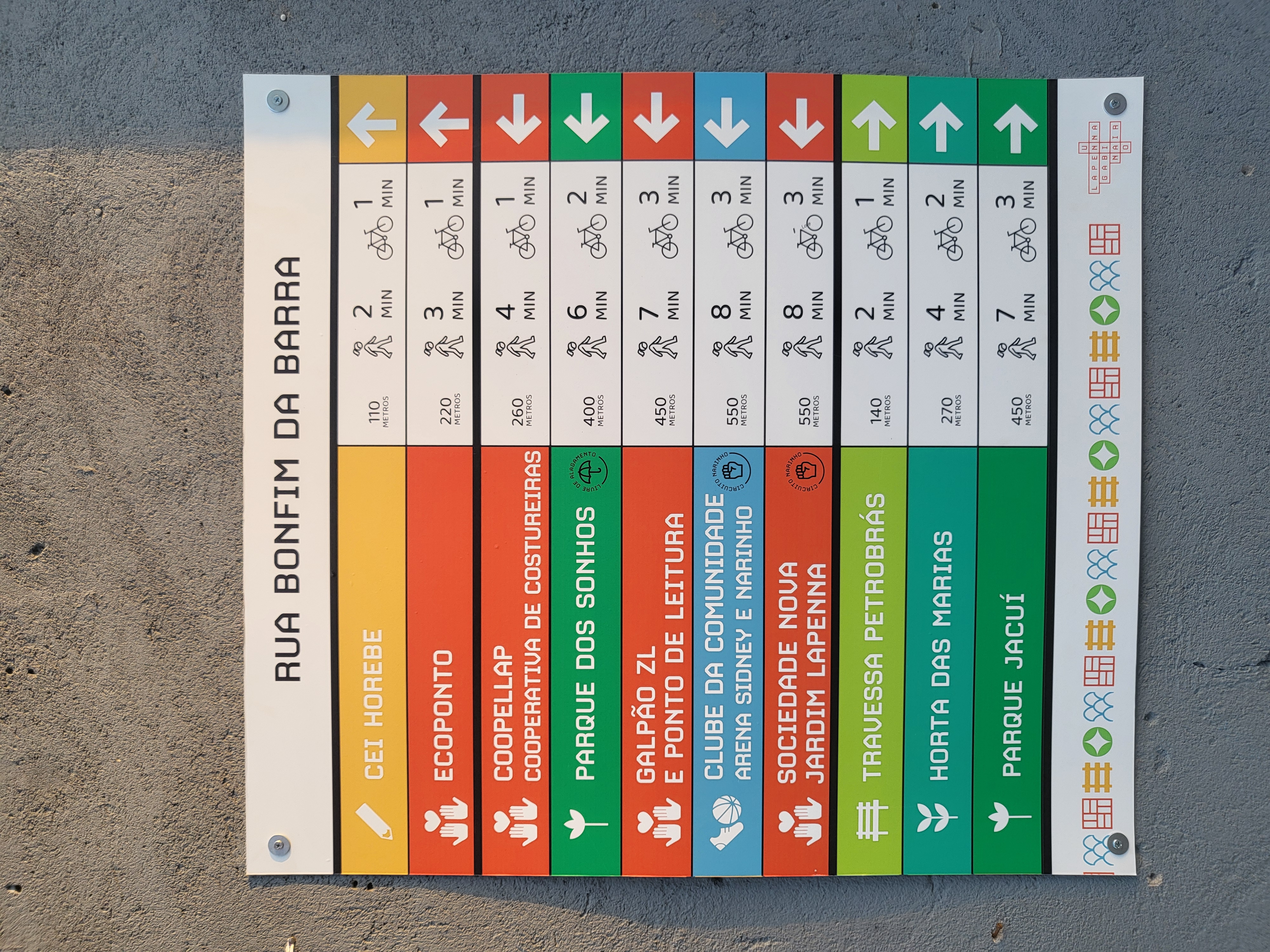
The Jardim Lapenna wayfinding project strengthens walkability and celebrates local identity with 42 signs showing maps, directions, and neighborhood stories. Part of a community-led Bairro Plan with Fundação Tide Setúbal and Galpão ZL, it integrates local knowledge into urban policy. Residents—especially women—co-created content, defined routes, and installed signs. Public spaces honor local leaders, enhancing belonging, safety, and daily walking.
Brazil
Local
São Paulo
Jardim Lapena neighborhood
Jardim Lapena neighborhood
Mainly urban
It involves other types of transformations (soft investment)
Yes
2025-09-28
No
No
No
Organisation
The Jardim Lapenna wayfinding project strengthens walkability while celebrating local identity, guiding people on foot and connecting public spaces through a system of signs with maps, directions, and information about the neighborhood. Developed as part of a community-led Bairro Plan, in partnership with Fundação Tide Setúbal and Galpão ZL, it integrates local knowledge and aspirations into urban policy, with a focus on active mobility and territorial strengthening.
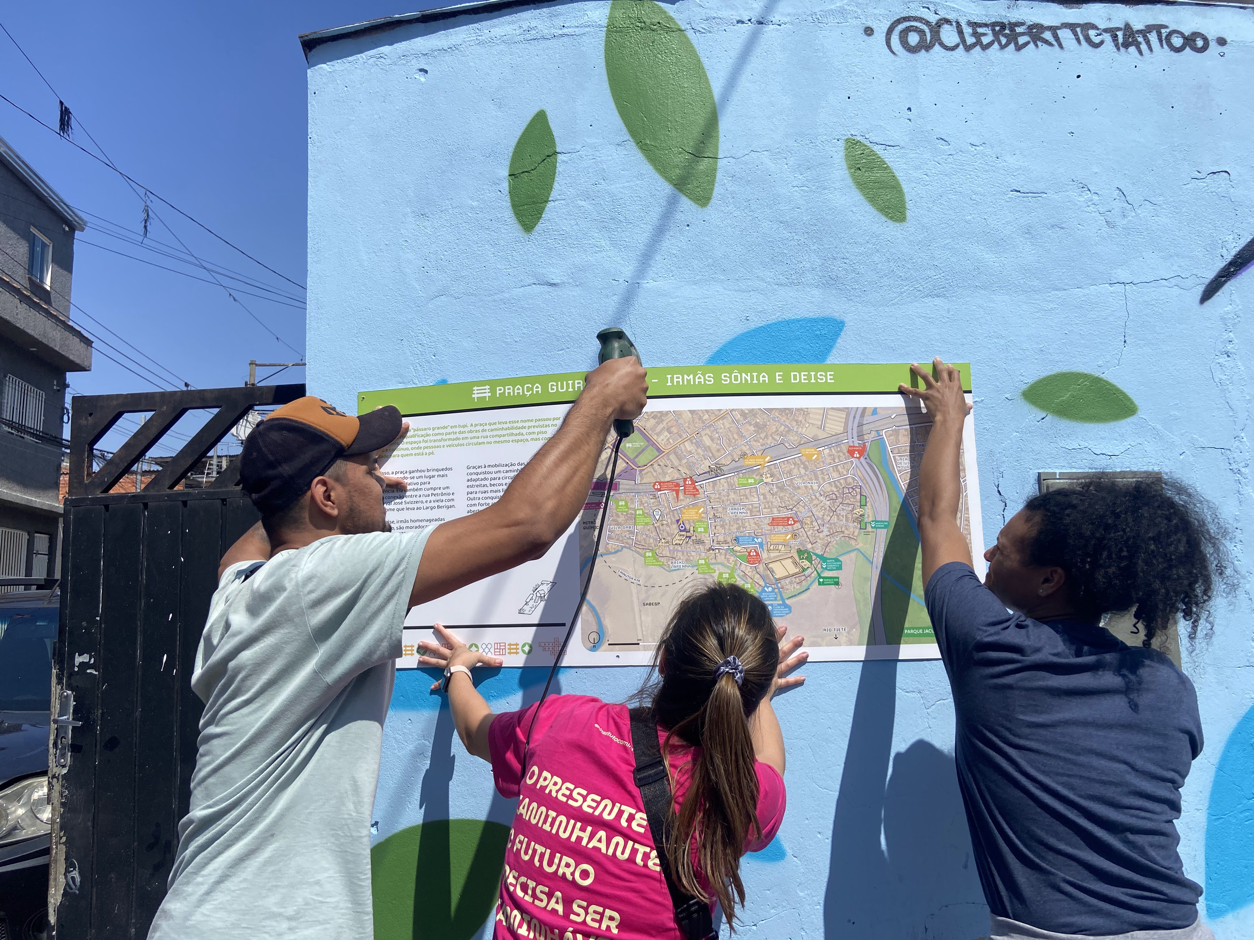
The project was implemented through a participatory approach, including workshops, collective mapping, and community-led installation. Residents, especially women, played a central role in defining routes, selecting locations, and co-creating content. Local stories were incorporated into the signage, and public spaces were named in honor of community leaders, reinforcing belonging and collective memory.
As a result, 42 signs were installed, including informational, directional, and location-based panels strategically placed to improve navigation. The system enhances citizen legibility, making the neighborhood easier to understand, safer, and more welcoming, while highlighting local assets such as schools, squares, and community spaces.
The project has strengthened social ties, increased the sense of safety, especially for women, and promoted walking as a daily practice and a fundamental urban right. It also fostered skills such as community organization, communication, and collective care.
Building on a pilot in Jardim Nakamura, the methodology is replicable and adaptable, using simple participatory tools and strong partnerships. It has been systematized and can inform public policies such as neighborhood plans and safe routes to school. In the long term, it contributes to more inclusive, sustainable, and people-centered urban environments.
The project was implemented through a participatory approach, including workshops, collective mapping, and community-led installation. Residents, especially women, played a central role in defining routes, selecting locations, and co-creating content. Local stories were incorporated into the signage, and public spaces were named in honor of community leaders, reinforcing belonging and collective memory.
As a result, 42 signs were installed, including informational, directional, and location-based panels strategically placed to improve navigation. The system enhances citizen legibility, making the neighborhood easier to understand, safer, and more welcoming, while highlighting local assets such as schools, squares, and community spaces.
The project has strengthened social ties, increased the sense of safety, especially for women, and promoted walking as a daily practice and a fundamental urban right. It also fostered skills such as community organization, communication, and collective care.
Building on a pilot in Jardim Nakamura, the methodology is replicable and adaptable, using simple participatory tools and strong partnerships. It has been systematized and can inform public policies such as neighborhood plans and safe routes to school. In the long term, it contributes to more inclusive, sustainable, and people-centered urban environments.
The project emerged from a broader community-led Bairro Plan process focused on strengthening the territory and improving everyday mobility. During early workshops and conversations with residents, especially women, a recurring issue became clear: although the neighborhood had many important spaces and services, people often struggled to navigate it, and much of its history and local knowledge remained invisible.
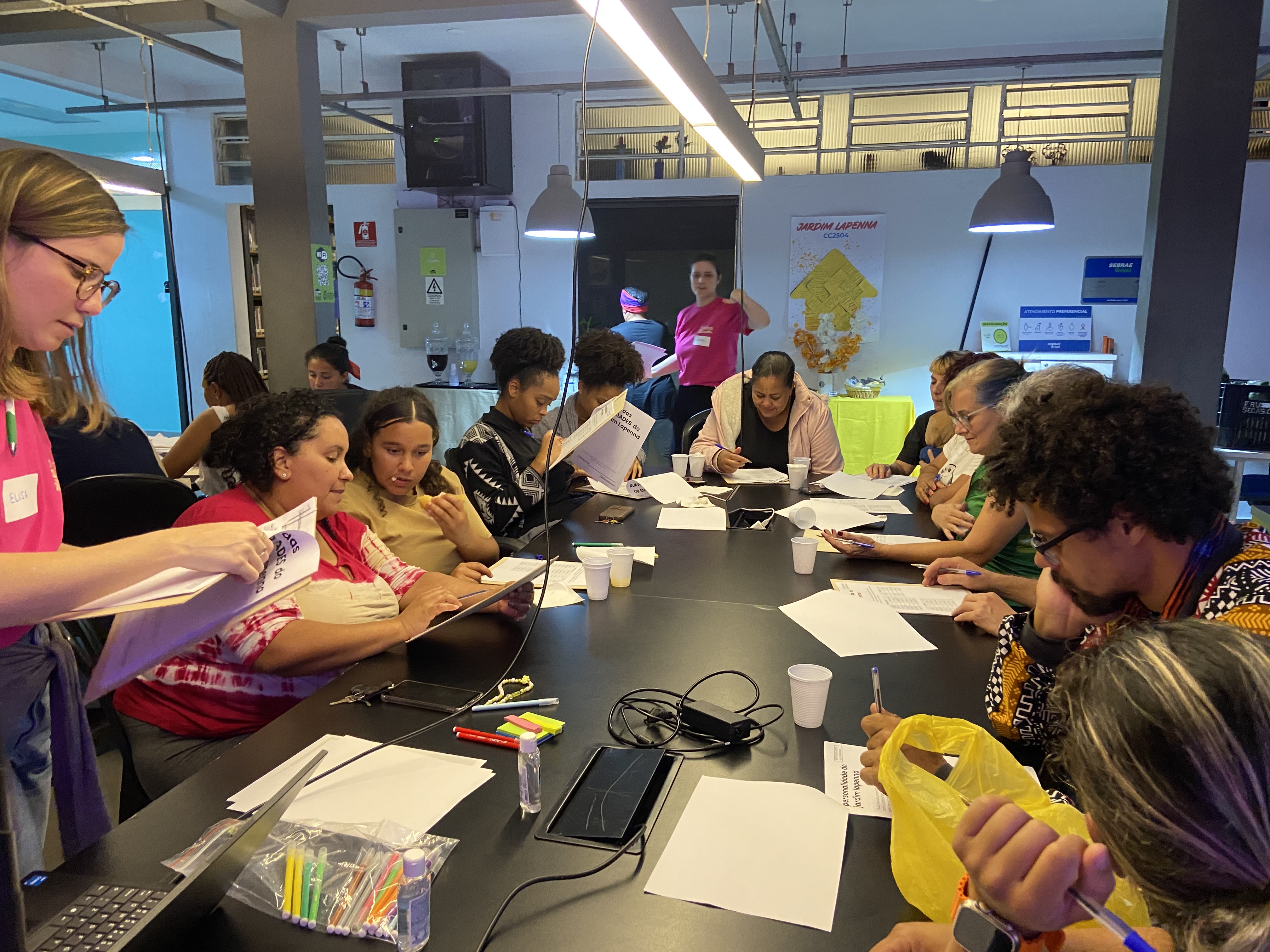
From this shared diagnosis, the idea of creating a community-based wayfinding system took shape. Rather than a top-down intervention, the project was designed to be built with residents at every stage. It began with participatory workshops and collective mapping activities, where residents identified key routes, daily destinations, and meaningful places in the neighborhood. These moments also helped surface everyday experiences of walking, including barriers and perceptions of safety.
In parallel, storytelling sessions and interviews were conducted to gather local histories and recognize community leaders. These narratives became central to the project, ensuring that the system would not only guide movement but also reflect local identity and memory.
The process was developed in partnership with local organizations, including Fundação Tide Setúbal and Galpão ZL, which provided institutional, logistical, and financial support. Together, these partners helped structure the process while maintaining a strong emphasis on community protagonism.
Based on collective inputs, residents co-defined the content, language, and placement of the signs. The implementation involved joint efforts, including community-led installation activities, reinforcing a sense of ownership, collaboration, and long-term care for the intervention.
From this shared diagnosis, the idea of creating a community-based wayfinding system took shape. Rather than a top-down intervention, the project was designed to be built with residents at every stage. It began with participatory workshops and collective mapping activities, where residents identified key routes, daily destinations, and meaningful places in the neighborhood. These moments also helped surface everyday experiences of walking, including barriers and perceptions of safety.
In parallel, storytelling sessions and interviews were conducted to gather local histories and recognize community leaders. These narratives became central to the project, ensuring that the system would not only guide movement but also reflect local identity and memory.
The process was developed in partnership with local organizations, including Fundação Tide Setúbal and Galpão ZL, which provided institutional, logistical, and financial support. Together, these partners helped structure the process while maintaining a strong emphasis on community protagonism.
Based on collective inputs, residents co-defined the content, language, and placement of the signs. The implementation involved joint efforts, including community-led installation activities, reinforcing a sense of ownership, collaboration, and long-term care for the intervention.
Walkability
Wayfinding
Community co-design
Social inclusion
Active mobility
The wayfinding project promotes sustainability by addressing environmental, social, and cultural challenges through the enhancement of walkability and active mobility. By creating a participatory system of signs that guides people on foot, the project encourages daily walking as a safe, accessible, and visible mode of transportation. This reduces reliance on private vehicles, contributing to lower traffic congestion, decreased air pollution, and reduced greenhouse gas emissions, while promoting healthier and more sustainable mobility patterns.
Socially, the project strengthens the sense of belonging and community cohesion by recognizing local histories, honoring community leaders, and involving residents—especially women and children—in every stage of the process. By increasing safety and legibility in public spaces, the project ensures that walking is not only possible but attractive, empowering residents to navigate and inhabit their neighborhood with confidence. These social benefits also support equity and inclusion, as walking is the main mode of transport for those who may not have access to cars.
Culturally, the project values local knowledge and identity, incorporating storytelling and community memory into the signage. This approach preserves and shares the neighborhood’s heritage while fostering pride and recognition of collective contributions.
The initiative is exemplary in terms of sustainability because it combines environmental impact with social and cultural benefits. It promotes low-carbon mobility, safer and more inclusive streets, and a stronger connection between residents and their territory. By using participatory, low-cost methods and replicable tools, the project can be adapted to other neighborhoods, creating long-term benefits in urban design, mobility, and community resilience. It shows how a people-centered, collaborative approach can transform public space into a sustainable, welcoming, vibrant urban environment.
Socially, the project strengthens the sense of belonging and community cohesion by recognizing local histories, honoring community leaders, and involving residents—especially women and children—in every stage of the process. By increasing safety and legibility in public spaces, the project ensures that walking is not only possible but attractive, empowering residents to navigate and inhabit their neighborhood with confidence. These social benefits also support equity and inclusion, as walking is the main mode of transport for those who may not have access to cars.
Culturally, the project values local knowledge and identity, incorporating storytelling and community memory into the signage. This approach preserves and shares the neighborhood’s heritage while fostering pride and recognition of collective contributions.
The initiative is exemplary in terms of sustainability because it combines environmental impact with social and cultural benefits. It promotes low-carbon mobility, safer and more inclusive streets, and a stronger connection between residents and their territory. By using participatory, low-cost methods and replicable tools, the project can be adapted to other neighborhoods, creating long-term benefits in urban design, mobility, and community resilience. It shows how a people-centered, collaborative approach can transform public space into a sustainable, welcoming, vibrant urban environment.
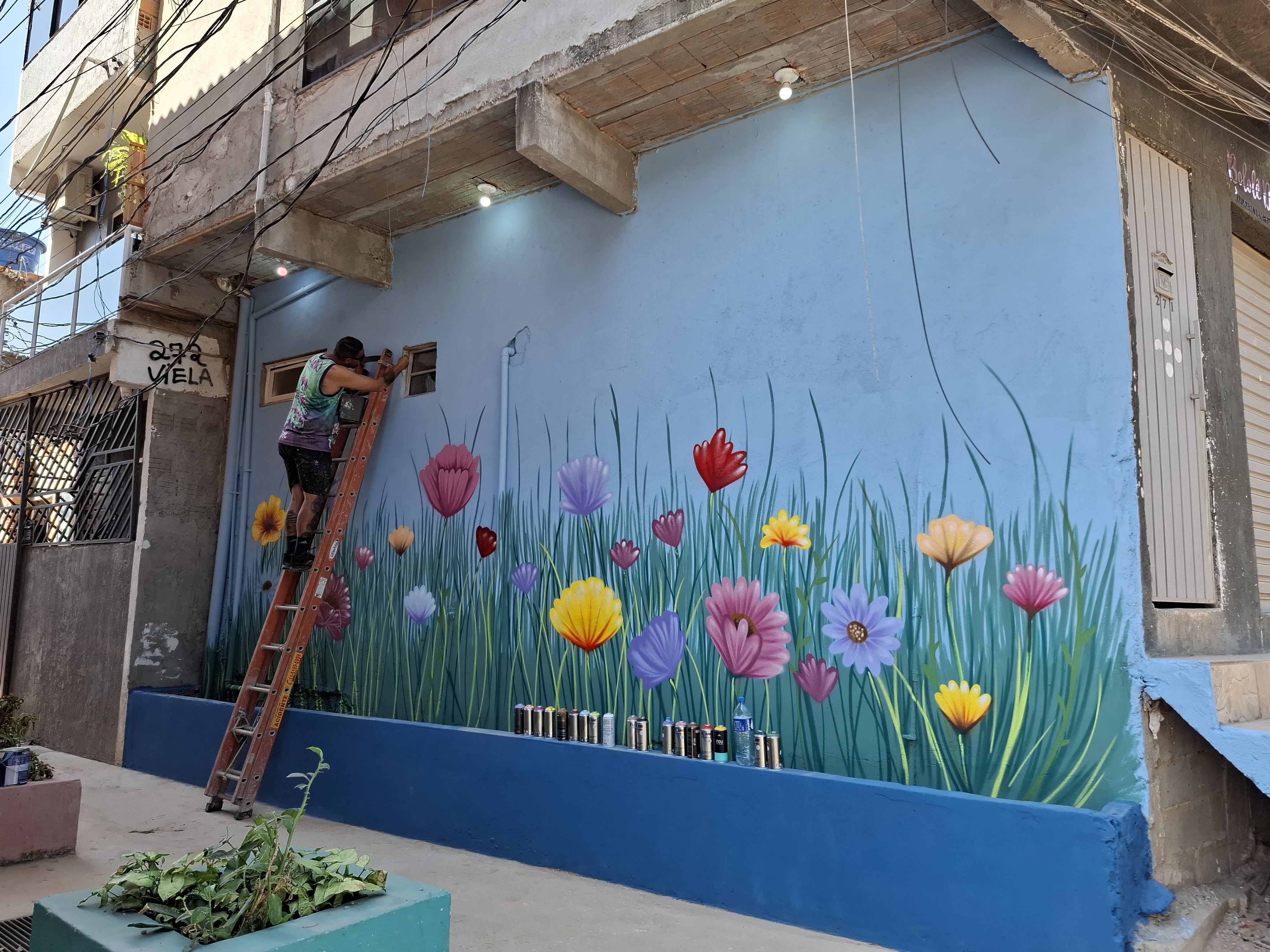
By making public spaces visually engaging and reflective of local identity, the project supports aesthetics while transforming the neighborhood into a more welcoming, legible, and meaningful space for residents. Beyond the 42 signs with maps, directions, and local stories, several public spaces received murals created by local artists, improving the visual quality and character of streets and squares. The signage system also honors important community members, highlighting local leaders whose contributions shaped the neighborhood and fostering pride, recognition, and a sense of belonging.
Residents participated actively in workshops and co-creation processes, helping define the design, content, and placement of both signs and murals. This ensures that aesthetic interventions reflect local narratives, tastes, and values, creating everyday encounters with beauty that are functional, culturally meaningful, and emotionally engaging. Walking through Jardim Lapenna becomes a richer experience where orientation, art, and community memory intersect.
The project is exemplary in aesthetics because it combines functionality, visual pleasure, storytelling, and community recognition to create streets and public spaces that are attractive, legible, and socially meaningful. By strengthening the connection between people and place, it encourages care for public spaces and provides long-term benefits for quality of life, community identity, and neighborhood pride.
Residents participated actively in workshops and co-creation processes, helping define the design, content, and placement of both signs and murals. This ensures that aesthetic interventions reflect local narratives, tastes, and values, creating everyday encounters with beauty that are functional, culturally meaningful, and emotionally engaging. Walking through Jardim Lapenna becomes a richer experience where orientation, art, and community memory intersect.
The project is exemplary in aesthetics because it combines functionality, visual pleasure, storytelling, and community recognition to create streets and public spaces that are attractive, legible, and socially meaningful. By strengthening the connection between people and place, it encourages care for public spaces and provides long-term benefits for quality of life, community identity, and neighborhood pride.
Focusing on making the neighborhood easier to navigate, the Jardim Lapenna wayfinding project strengthens inclusion for residents, especially those who walk daily, including women, children, and people without access to private vehicles. By providing clear, community-designed signs with maps, directions, and information about local services, public spaces, and cultural landmarks, the project ensures that essential destinations are reachable and visible to everyone, regardless of age, gender, or mobility level.
The project was implemented through a participatory process that actively involved residents in defining routes, selecting locations, and co-creating the content of the signs. Storytelling workshops and interviews ensured that local histories and community members were recognized, with plaques honoring important residents and reinforcing social inclusion and community recognition.
By valuing local knowledge and fostering co-creation, the project strengthens inclusive governance and shared decision-making. Residents develop skills in communication, organization, and collective care, participating in decisions that directly affect their daily lives and public spaces. The methodology promotes a “design for all” approach by addressing the needs of the most frequent pedestrians and ensuring that public infrastructure is legible, safe, and culturally meaningful.
The initiative is exemplary in inclusion because it integrates social, cultural, and spatial equity. It reduces barriers to movement, increases safety for vulnerable groups, amplifies marginalized voices, and strengthens a sense of belonging and ownership over the neighborhood. Through replicable participatory tools and a collaborative approach, the project offers a model for other communities seeking to combine accessibility, equity, and local empowerment in urban design.
The project was implemented through a participatory process that actively involved residents in defining routes, selecting locations, and co-creating the content of the signs. Storytelling workshops and interviews ensured that local histories and community members were recognized, with plaques honoring important residents and reinforcing social inclusion and community recognition.
By valuing local knowledge and fostering co-creation, the project strengthens inclusive governance and shared decision-making. Residents develop skills in communication, organization, and collective care, participating in decisions that directly affect their daily lives and public spaces. The methodology promotes a “design for all” approach by addressing the needs of the most frequent pedestrians and ensuring that public infrastructure is legible, safe, and culturally meaningful.
The initiative is exemplary in inclusion because it integrates social, cultural, and spatial equity. It reduces barriers to movement, increases safety for vulnerable groups, amplifies marginalized voices, and strengthens a sense of belonging and ownership over the neighborhood. Through replicable participatory tools and a collaborative approach, the project offers a model for other communities seeking to combine accessibility, equity, and local empowerment in urban design.
The process was built on a participatory approach, actively involving residents, community organizations, and local civil society partners at every stage. From the initial diagnosis, residents were engaged through workshops, collective mapping exercises, and interviews to identify key routes, destinations, and meaningful places in the neighborhood. These activities ensured that the project addressed real needs, particularly those of frequent pedestrians, such as women, children, and people without access to private vehicles.
Community members also co-created the content and design of the signage, including directions, maps, and stories about local landmarks and important residents. Storytelling sessions and participatory workshops helped surface local histories and narratives that were incorporated into the plaques, strengthening community identity and memory. In addition, murals created by local artists were integrated into public spaces as part of the participatory process, combining functional orientation with cultural expression.
Civil society organizations, including Fundação Tide Setúbal and Galpão ZL, provided logistical, technical, and financial support while maintaining close collaboration with residents. Regular meetings and feedback sessions ensured that the project reflected community priorities and incorporated diverse perspectives, fostering trust and co-ownership.
The impact of this participatory approach has been significant. Residents gained skills in communication, collective organization, and care for public space, while the process strengthened social cohesion, pride, and a sense of belonging. The project also reinforced inclusive decision-making, giving residents direct influence over interventions that affect their daily lives and environment. By centering local voices, knowledge, and agency, the Jardim Lapenna wayfinding project demonstrates how participatory urban design can create more equitable, responsive, and resilient neighborhoods.
Community members also co-created the content and design of the signage, including directions, maps, and stories about local landmarks and important residents. Storytelling sessions and participatory workshops helped surface local histories and narratives that were incorporated into the plaques, strengthening community identity and memory. In addition, murals created by local artists were integrated into public spaces as part of the participatory process, combining functional orientation with cultural expression.
Civil society organizations, including Fundação Tide Setúbal and Galpão ZL, provided logistical, technical, and financial support while maintaining close collaboration with residents. Regular meetings and feedback sessions ensured that the project reflected community priorities and incorporated diverse perspectives, fostering trust and co-ownership.
The impact of this participatory approach has been significant. Residents gained skills in communication, collective organization, and care for public space, while the process strengthened social cohesion, pride, and a sense of belonging. The project also reinforced inclusive decision-making, giving residents direct influence over interventions that affect their daily lives and environment. By centering local voices, knowledge, and agency, the Jardim Lapenna wayfinding project demonstrates how participatory urban design can create more equitable, responsive, and resilient neighborhoods.
Developed through a multilevel governance approach, the Jardim Lapenna wayfinding project engaged stakeholders at local, municipal, and institutional levels to align with urban policies, community needs, and sustainable practices. Residents were central partners, participating in workshops, collective mapping, and co-creation of signage content, shaping routes, destinations, and the recognition of local histories and leaders.
Local organizations, such as Galpão ZL, and civil society partners, including Fundação Tide Setúbal, provided logistical, technical, and financial support, facilitating workshops, production, and installation, and connecting the project to broader neighborhood initiatives.
Municipal authorities, including SPTuris (Tourism Agency), validated the signage, integrated it into public space management, and ensured compliance with regulations, in alignment with the municipal Bairro Plan guiding neighborhood development and active mobility policies.
While national or European stakeholders were not directly involved, the methodology reflects participatory governance and sustainability principles, offering a replicable model to inform walkability, community engagement, and public space design.
This multilevel approach combined grassroots participation with municipal and institutional support, enhancing social legitimacy, technical feasibility, and long-term impact, and providing a model for inclusive, participatory, and context-sensitive urban interventions.
Local organizations, such as Galpão ZL, and civil society partners, including Fundação Tide Setúbal, provided logistical, technical, and financial support, facilitating workshops, production, and installation, and connecting the project to broader neighborhood initiatives.
Municipal authorities, including SPTuris (Tourism Agency), validated the signage, integrated it into public space management, and ensured compliance with regulations, in alignment with the municipal Bairro Plan guiding neighborhood development and active mobility policies.
While national or European stakeholders were not directly involved, the methodology reflects participatory governance and sustainability principles, offering a replicable model to inform walkability, community engagement, and public space design.
This multilevel approach combined grassroots participation with municipal and institutional support, enhancing social legitimacy, technical feasibility, and long-term impact, and providing a model for inclusive, participatory, and context-sensitive urban interventions.
Adopting a transdisciplinary approach, the Jardim Lapenna neighborhood wayfinding project integrated knowledge from urban planning, design, social sciences, education, and the arts. Urban planning and mobility expertise guided the project, informing the strategic placement of signage to enhance navigation, connectivity, and active mobility. Design principles shaped the visual language of the signs and maps, ensuring clarity, accessibility, and aesthetic quality, while also highlighting local identity.
Social sciences contributed to understanding the community’s practices, needs, and narratives through participatory mapping, workshops, and interviews, ensuring that the project reflected lived experiences and local histories. Education and community engagement methods were applied to co-create content, foster collective learning, and strengthen residents’ capacities for organizing and caring for their territory. Arts and cultural knowledge were embedded through the creation of murals and the inclusion of significant local figures in the signage, enhancing both aesthetics and a sense of belonging.
This integration of disciplines allowed for a holistic approach where technical, social, and cultural dimensions were considered simultaneously, creating an inclusive and context-sensitive urban intervention. The project demonstrates how combining multiple fields of knowledge can produce innovative, sustainable, and participatory solutions for urban public spaces, fostering walkability, local identity, and community empowerment.
Social sciences contributed to understanding the community’s practices, needs, and narratives through participatory mapping, workshops, and interviews, ensuring that the project reflected lived experiences and local histories. Education and community engagement methods were applied to co-create content, foster collective learning, and strengthen residents’ capacities for organizing and caring for their territory. Arts and cultural knowledge were embedded through the creation of murals and the inclusion of significant local figures in the signage, enhancing both aesthetics and a sense of belonging.
This integration of disciplines allowed for a holistic approach where technical, social, and cultural dimensions were considered simultaneously, creating an inclusive and context-sensitive urban intervention. The project demonstrates how combining multiple fields of knowledge can produce innovative, sustainable, and participatory solutions for urban public spaces, fostering walkability, local identity, and community empowerment.
Built through partnerships between residents, civil society, and municipal authorities, the project is built on a collaborative and financially sustainable model with a total budget of approximately R$ 52,300 (~$9,950 USD). The budget covered coordination, research, workshop facilitation, design, production and installation of 30 signs, audiovisual documentation, artist commission, transportation, materials, and administrative costs. Funding came primarily from civil society organizations, including Fundação Tide Setúbal, which provided financial and logistical support, and local partners, such as Galpão ZL, who contributed technical expertise and in-kind resources, reducing costs while fostering community ownership.
Municipal authorities, including SPTuris (Tourism Agency), supported the project by validating signage installations, aligning them with public space management, and integrating the initiative with the municipal Bairro Plan. This collaboration ensures compliance with regulations, strengthens legitimacy, and opens opportunities for future public support, facilitating long-term sustainability.
The project’s methodology is highly replicable and transferable to other neighborhoods or urban contexts. It relies on participatory tools, low-cost and adaptable signage, and locally generated content. Workshops, mapping exercises, and co-creation of signage foster residents’ skills and social capital, enabling the community to sustain and adapt the project over time. The low-cost, modular design also allows integration with other public programs, crowdfunding, or donations.
By combining diverse funding sources, community engagement, and municipal collaboration, the project demonstrates a financially sustainable, scalable, and replicable model for improving walkability, strengthening local identity, and fostering inclusive urban development.
Municipal authorities, including SPTuris (Tourism Agency), supported the project by validating signage installations, aligning them with public space management, and integrating the initiative with the municipal Bairro Plan. This collaboration ensures compliance with regulations, strengthens legitimacy, and opens opportunities for future public support, facilitating long-term sustainability.
The project’s methodology is highly replicable and transferable to other neighborhoods or urban contexts. It relies on participatory tools, low-cost and adaptable signage, and locally generated content. Workshops, mapping exercises, and co-creation of signage foster residents’ skills and social capital, enabling the community to sustain and adapt the project over time. The low-cost, modular design also allows integration with other public programs, crowdfunding, or donations.
By combining diverse funding sources, community engagement, and municipal collaboration, the project demonstrates a financially sustainable, scalable, and replicable model for improving walkability, strengthening local identity, and fostering inclusive urban development.
The Jardim Lapenna neighborhood wayfinding project is highly scalable and transferable due to its participatory methodology, low-cost and adaptable tools, and community-driven approach. Key elements that can be replicated include:
1. Participatory methodology: Workshops, collective mapping, and co-creation of content ensure that interventions reflect local knowledge, needs, and priorities. This approach can be applied in other neighborhoods, cities, or contexts, enabling communities to take ownership of public space initiatives.
2. Wayfinding and signage system: The modular design of signs, maps, and informational panels is low-cost, easily produced, and adaptable to different urban layouts. The system can be scaled to other neighborhoods or tailored for schools, parks, or cultural areas to enhance legibility, navigation, and active mobility.
3. Integration of local stories and identity: Including local narratives, murals, and recognition of community leaders fosters belonging and strengthens social ties. This approach can be adapted to highlight local culture, history, and community assets in other contexts.
4. Community capacity-building: The project strengthens residents’ skills in organization, communication, and participatory design, which can be applied to future initiatives and sustained over time in new contexts.
5. Partnership model: Collaboration with civil society organizations, municipal authorities, and local institutions provides a replicable framework for resource coordination, technical support, and long-term sustainability.
The project has already been implemented as a pilot in Jardim Nakamura and adapted for Jardim Lapenna, demonstrating the methodology’s flexibility and replicability. Its combination of participatory design, low-cost materials, and municipal alignment makes it a model that can be transferred to other neighborhoods, cities, or countries, supporting inclusive, sustainable, and people-centered urban development.
1. Participatory methodology: Workshops, collective mapping, and co-creation of content ensure that interventions reflect local knowledge, needs, and priorities. This approach can be applied in other neighborhoods, cities, or contexts, enabling communities to take ownership of public space initiatives.
2. Wayfinding and signage system: The modular design of signs, maps, and informational panels is low-cost, easily produced, and adaptable to different urban layouts. The system can be scaled to other neighborhoods or tailored for schools, parks, or cultural areas to enhance legibility, navigation, and active mobility.
3. Integration of local stories and identity: Including local narratives, murals, and recognition of community leaders fosters belonging and strengthens social ties. This approach can be adapted to highlight local culture, history, and community assets in other contexts.
4. Community capacity-building: The project strengthens residents’ skills in organization, communication, and participatory design, which can be applied to future initiatives and sustained over time in new contexts.
5. Partnership model: Collaboration with civil society organizations, municipal authorities, and local institutions provides a replicable framework for resource coordination, technical support, and long-term sustainability.
The project has already been implemented as a pilot in Jardim Nakamura and adapted for Jardim Lapenna, demonstrating the methodology’s flexibility and replicability. Its combination of participatory design, low-cost materials, and municipal alignment makes it a model that can be transferred to other neighborhoods, cities, or countries, supporting inclusive, sustainable, and people-centered urban development.