Arts, Culture, and Heritage as Drivers of Change
Last Seen Landscapes
Last Seen Landscapes: Revealing disappearing urban environments through spatial and visual alignment
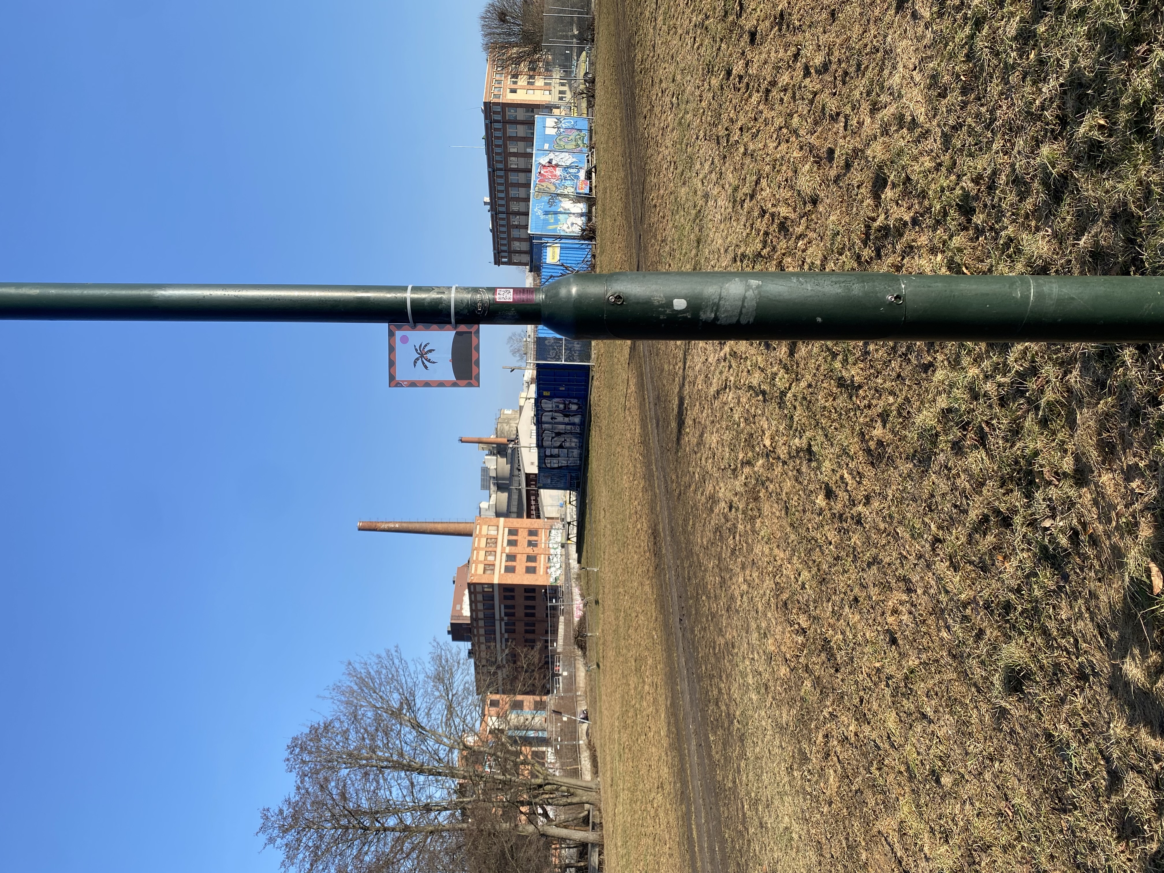
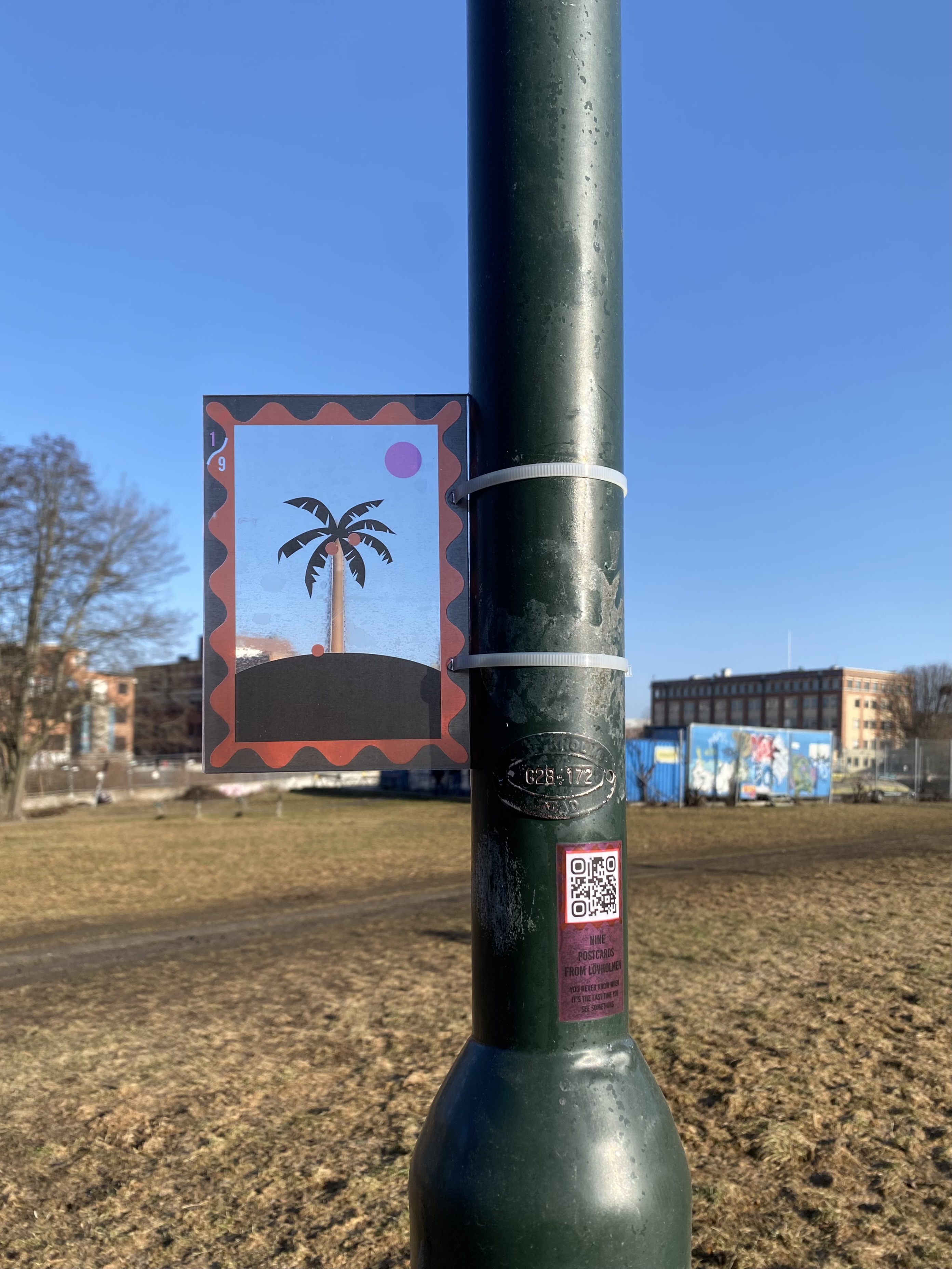
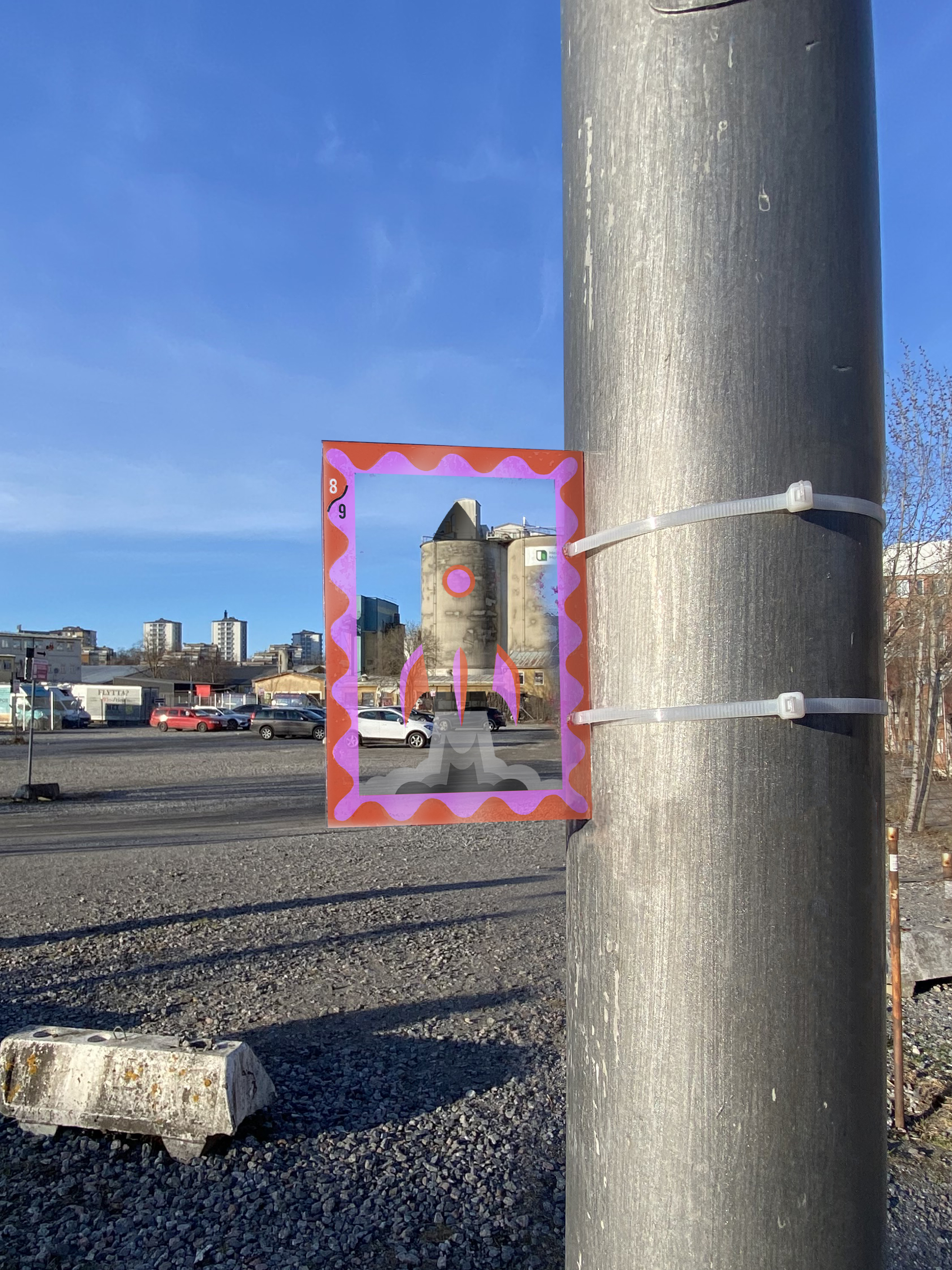
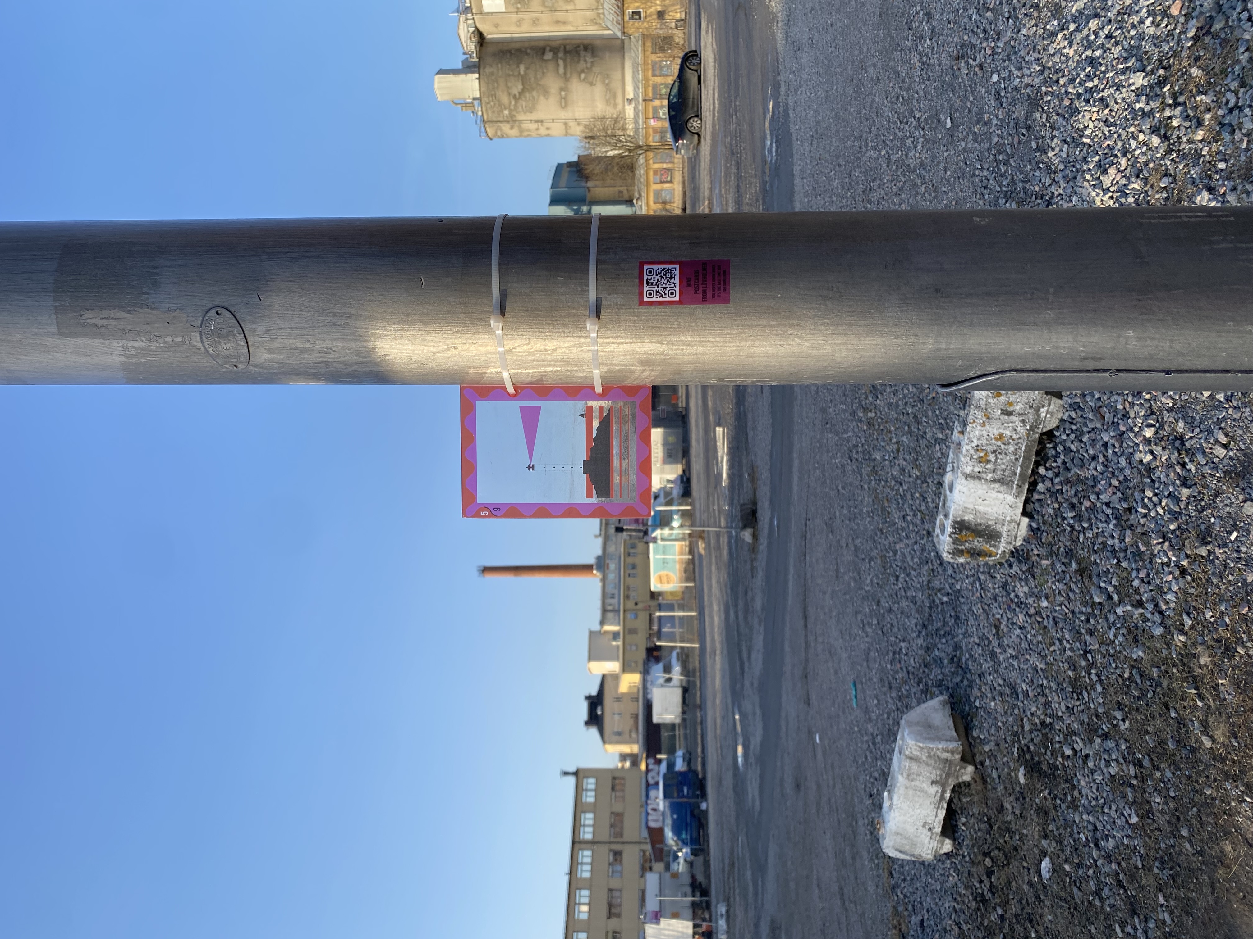
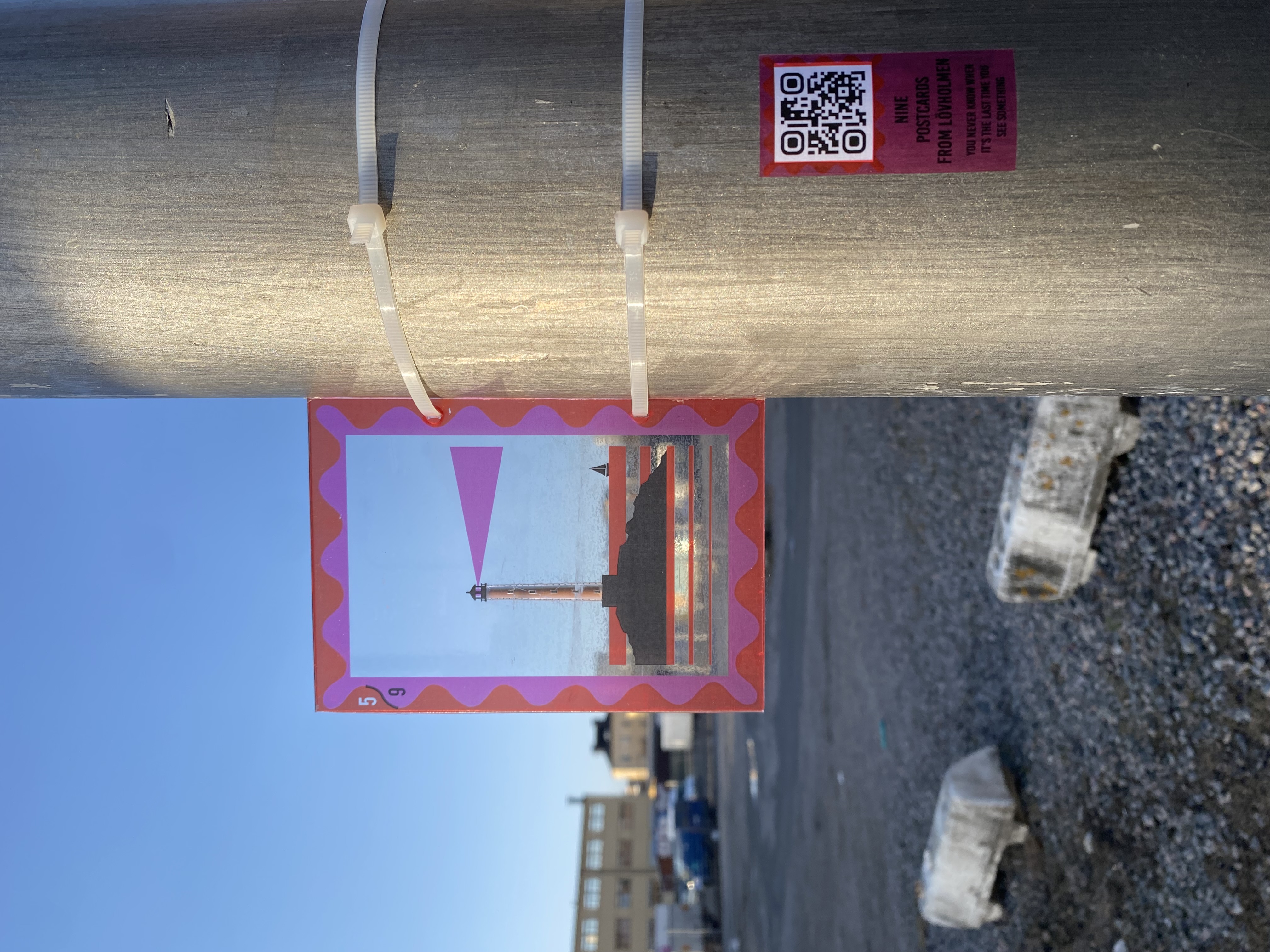
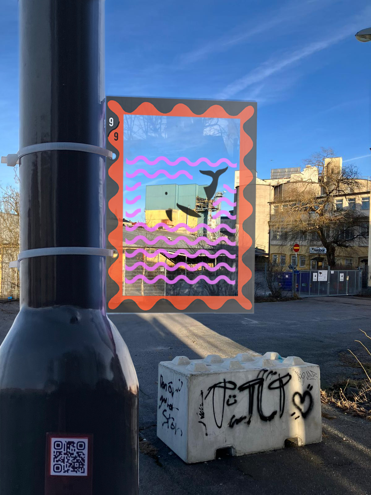
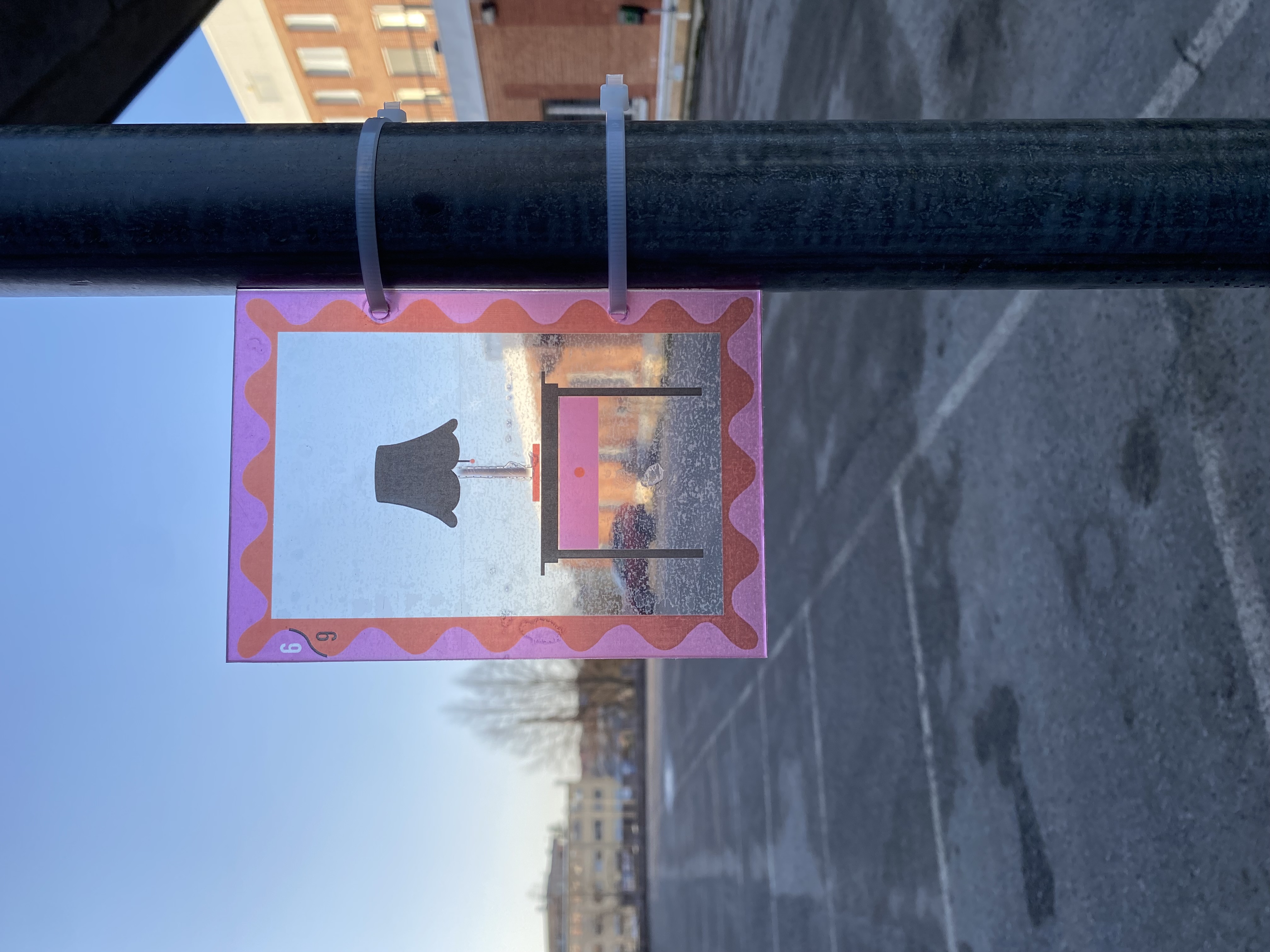
Last Seen Landscapes is a spatial intervention that raises awareness of upcoming urban changes bridging the gap between planning documents and embodied local experiences. Using transparent illustrated postcards placed at precise viewpoints, the project overlays playful reinterpretations onto the existing skyline, prompting careful looking and reflection, reminding us that we rarely know when we are seeing something for the last time.
Sweden
Local
Stockholm
Mainly urban
It refers to other types of transformations (soft investment)
Prototype level
No
No
No
Individual
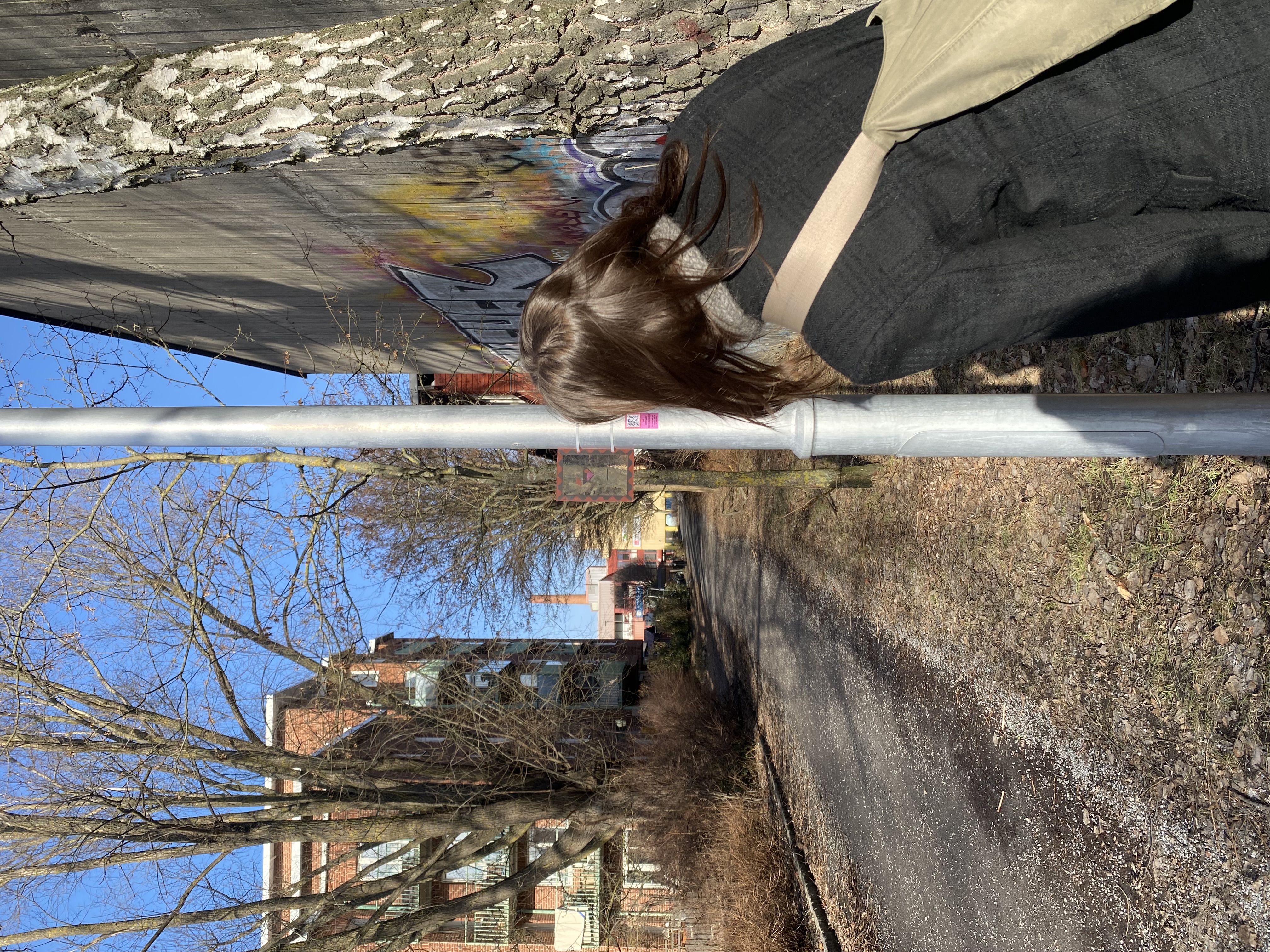
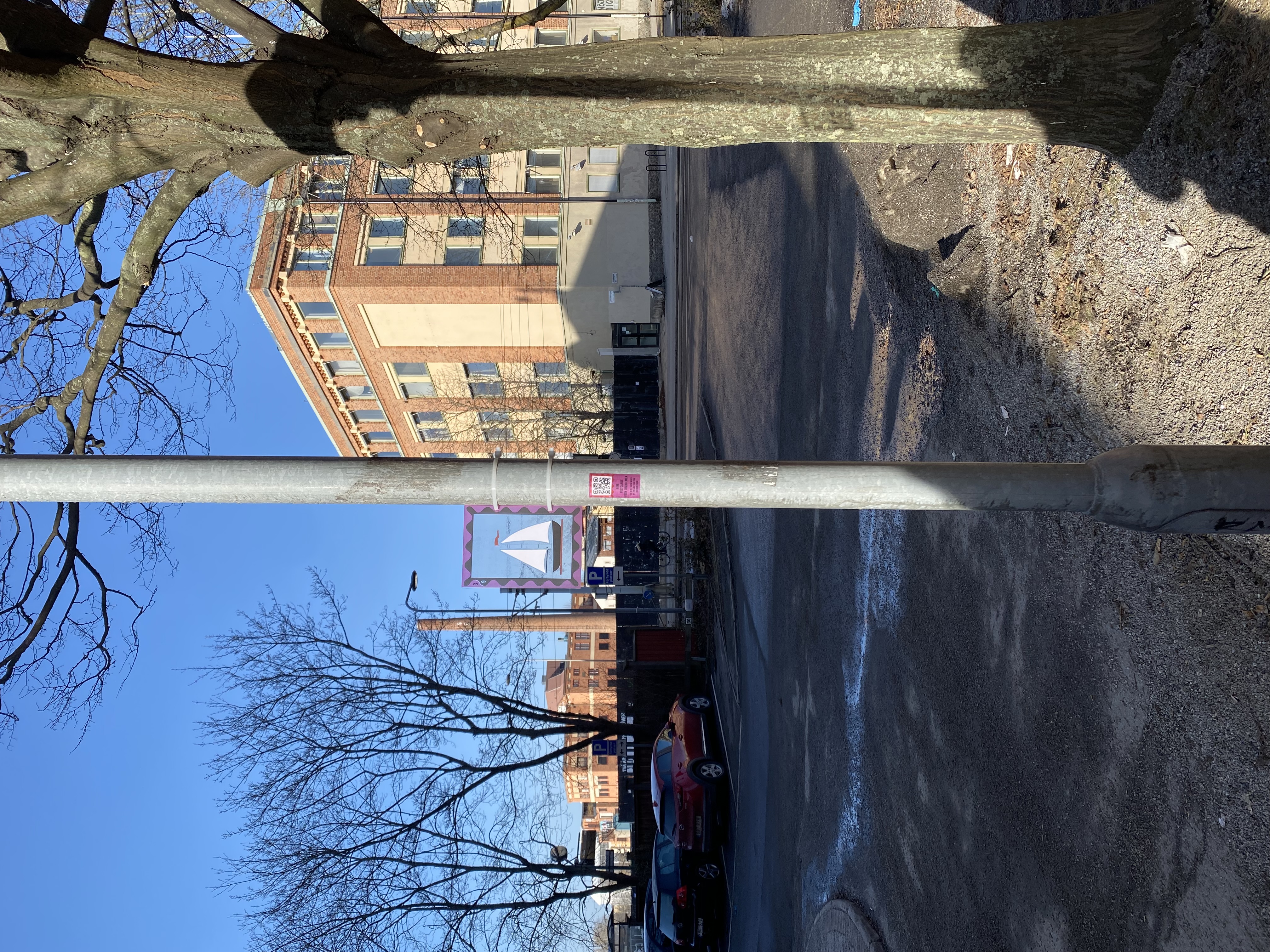
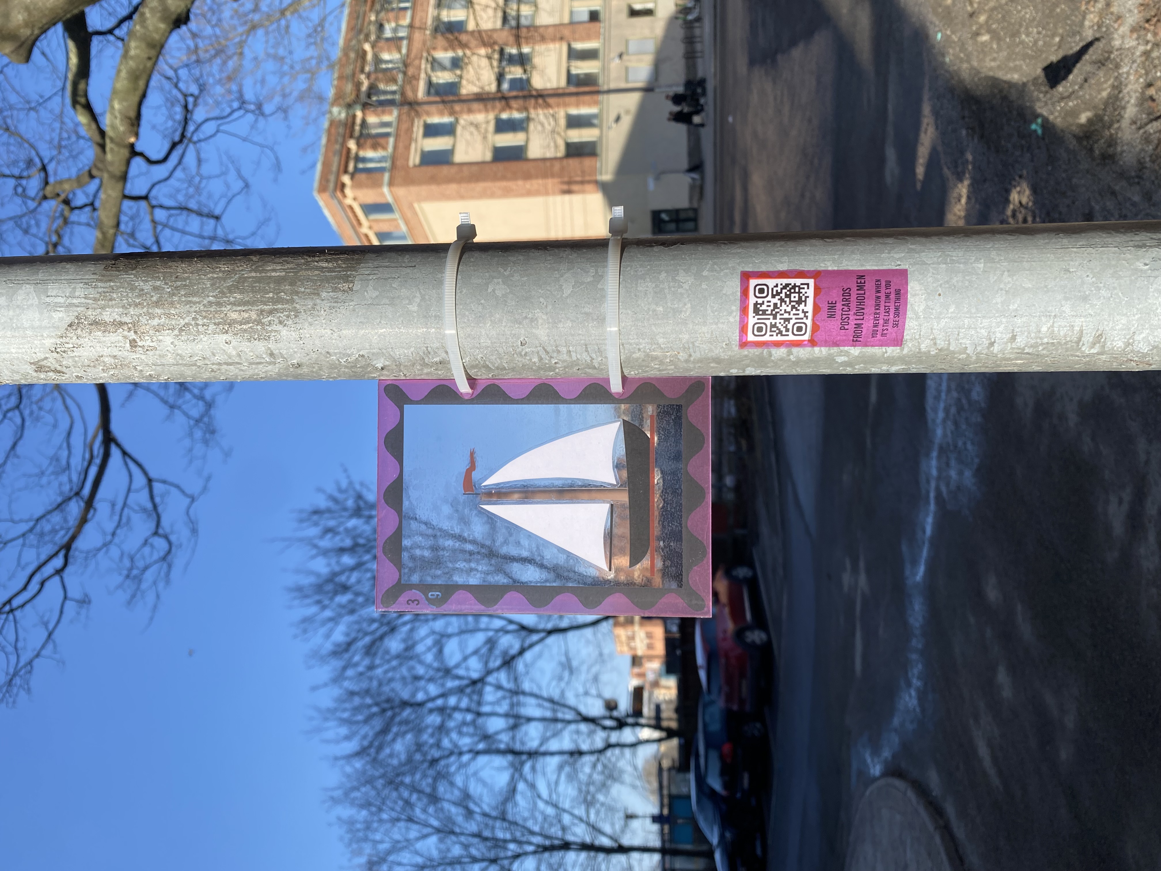
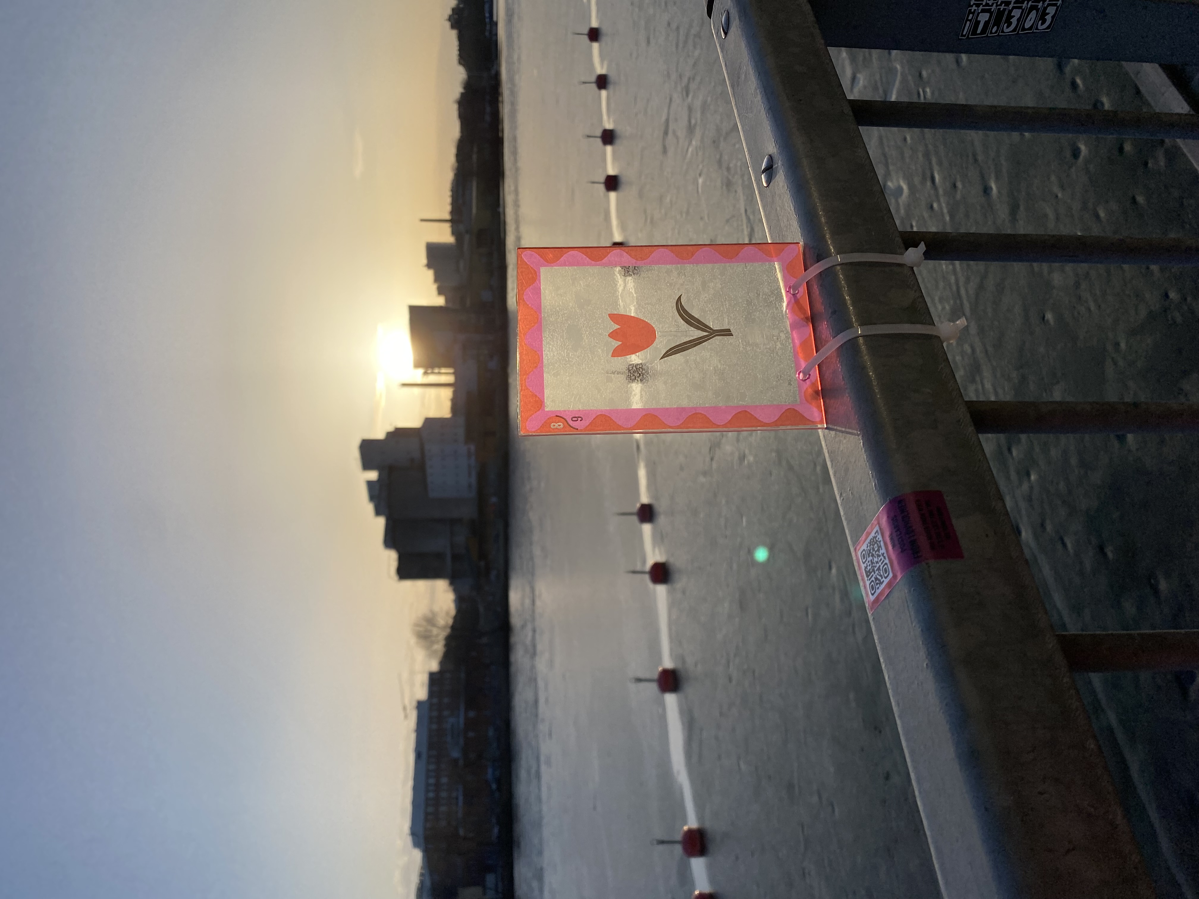
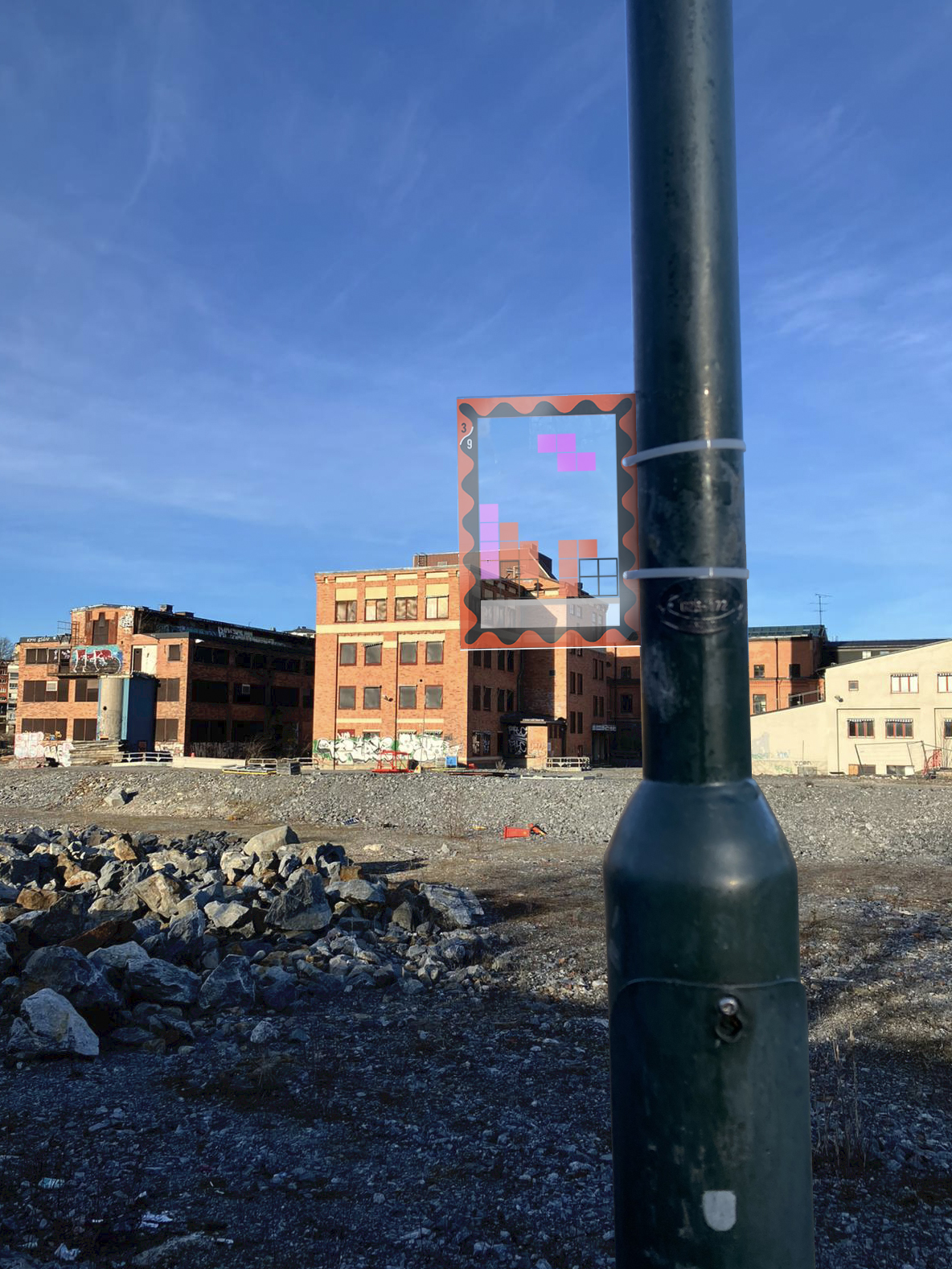
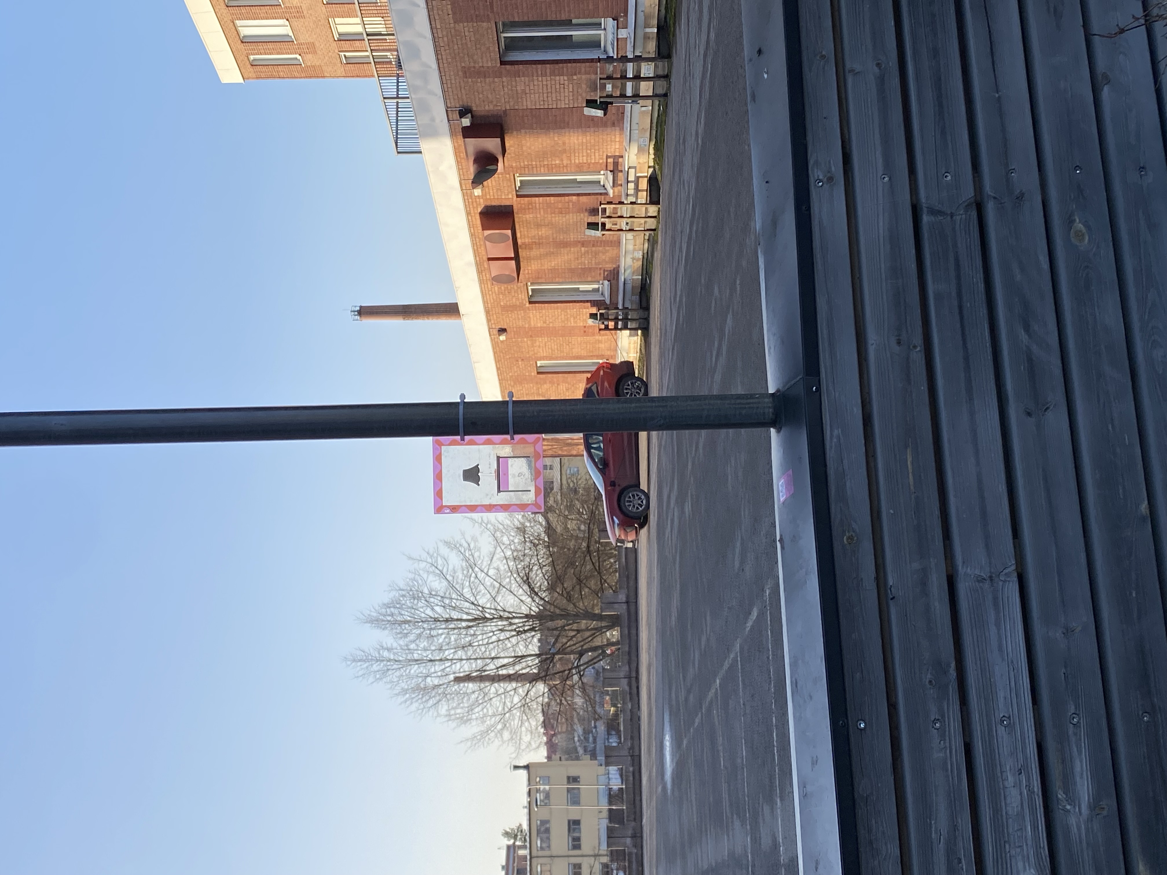
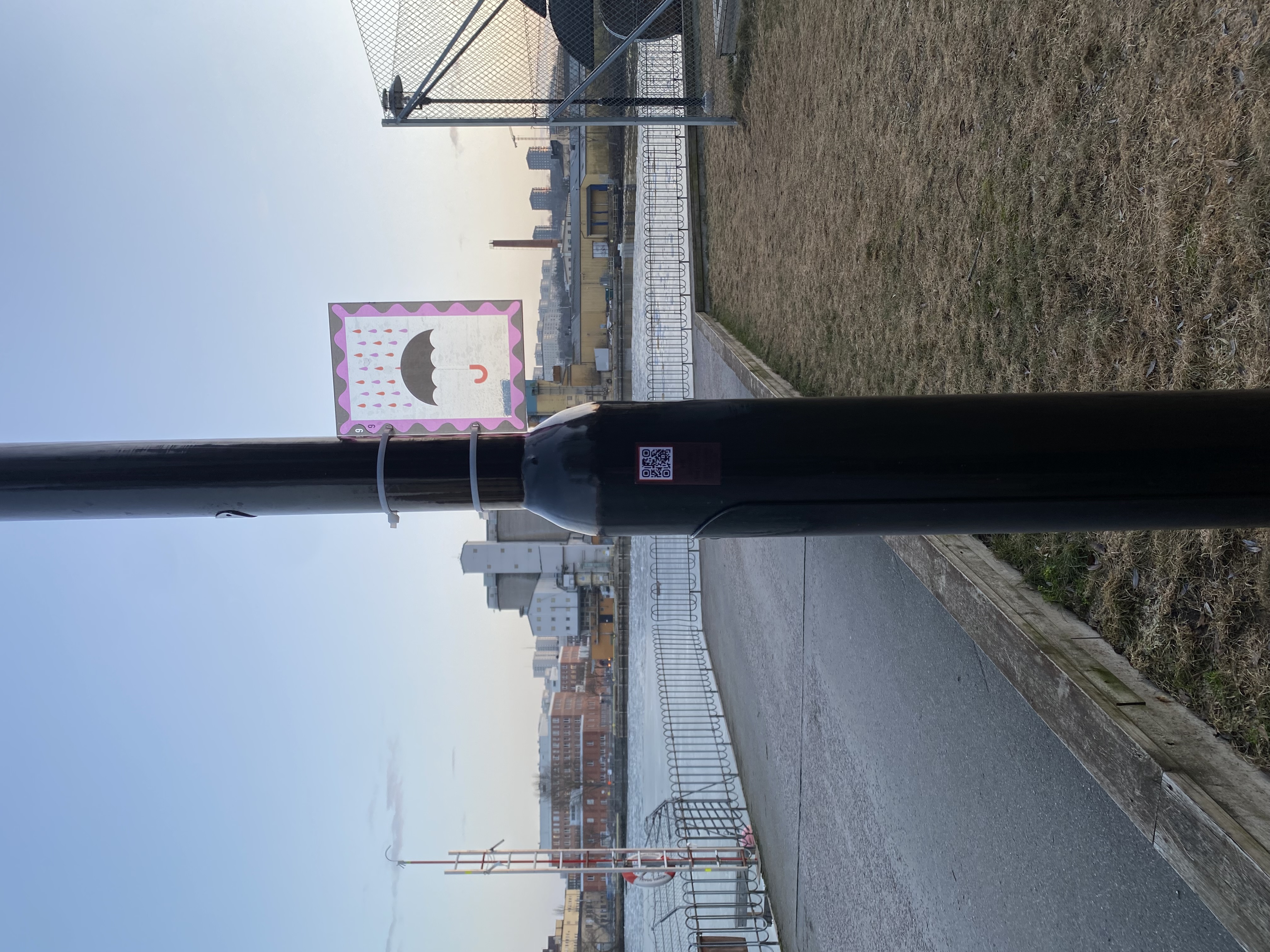
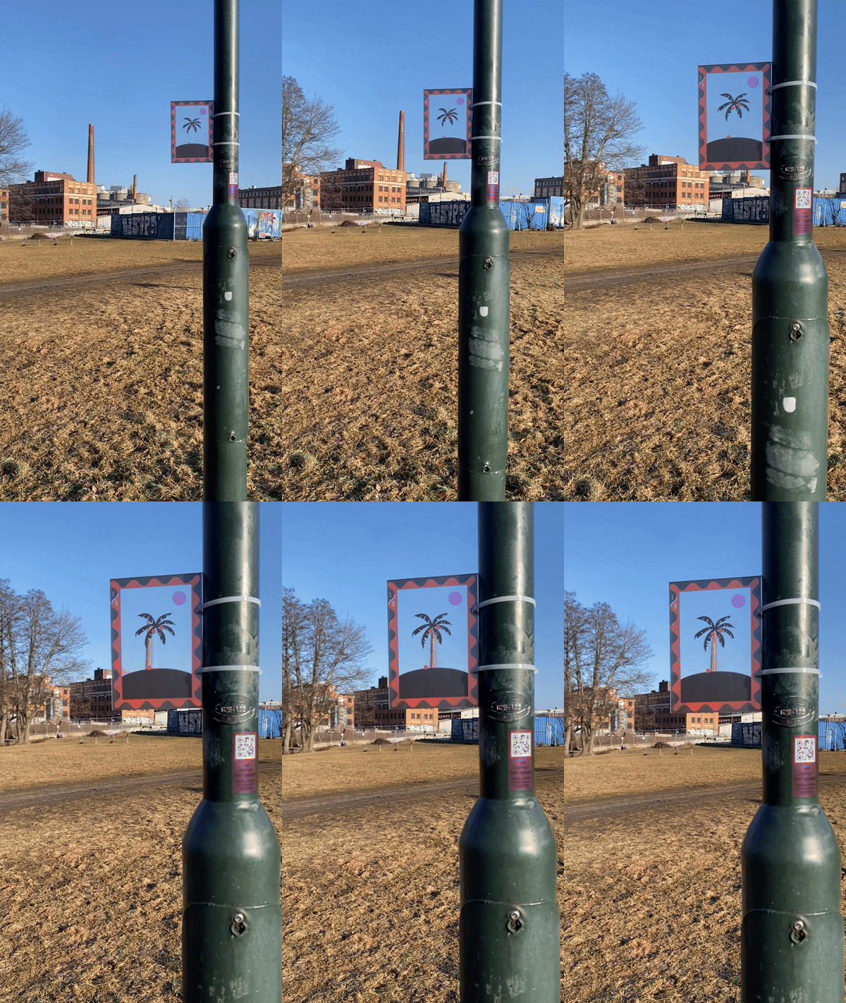
Last Seen Landscapes is an artistic and spatial intervention that reveals disappearing urban environments through alignment, archival imagery, artistic interpretation, and movement in space. Installed in public space, transparent plexiglass postcards frame elements of the existing skyline while overlaying them with playful reinterpretations of what is being lost.
The concept transforms ordinary viewpoints into sites of reflection. Meaning emerges only when visitors actively position themselves in relation to the installation, turning perception into a participatory act. The visual overlays may be created in collaboration with locally connected artists, allowing artistic voices rooted in the area to contribute to how change is represented and remembered.
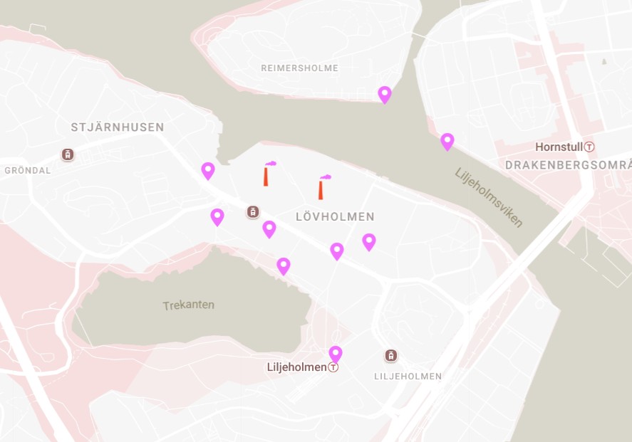
QR codes extend the experience into a digital layer, offering historical context, accessibility-adapted content, and linking the installations into a coherent walking route.
Expected results include increased awareness of gradual urban change, stronger emotional connection to place, and greater appreciation of a historical urban fabric in transition. The project operates at a human scale, using minimal material resources while producing strong experiential impact.
Although rooted in Lövholmen, the method is intentionally simple, low-cost, and replicable. It offers a transferable model for engaging communities with urban transformation across Europe, particularly in areas experiencing long periods of uncertainty or transition.
The concept transforms ordinary viewpoints into sites of reflection. Meaning emerges only when visitors actively position themselves in relation to the installation, turning perception into a participatory act. The visual overlays may be created in collaboration with locally connected artists, allowing artistic voices rooted in the area to contribute to how change is represented and remembered.
QR codes extend the experience into a digital layer, offering historical context, accessibility-adapted content, and linking the installations into a coherent walking route.
Expected results include increased awareness of gradual urban change, stronger emotional connection to place, and greater appreciation of a historical urban fabric in transition. The project operates at a human scale, using minimal material resources while producing strong experiential impact.
Although rooted in Lövholmen, the method is intentionally simple, low-cost, and replicable. It offers a transferable model for engaging communities with urban transformation across Europe, particularly in areas experiencing long periods of uncertainty or transition.
The idea for Last Seen Landscapes emerged from personal experiences of loss linked to urban change that happened quietly, without warning, and without time for reflection.
Lövholmen is a site shaped by multiple layers of transformation. Historically an industrial area, its factories and silos formed a distinctive presence along Stockholm’s waterfront skyline. As industrial activity declined, these large buildings were gradually occupied by artists, offering spacious ateliers and contributing to the emergence of an alternative art scene. Today, long-term planning documents outline its redevelopment into a residential neighbourhood. While these documents are formally open to the public, in practice they are difficult to access and interpret. Many are unaware of the scale and timing of the transformation and only encounter it once demolition or construction has already begun.
This condition resonates with a personal experience recalled by one of the co-authors. During her childhood, a local cinema played an important role in her everyday life. Years later, when she returned to the neighbourhood, the building was gone, replaced by a construction site. The shock came not only from the loss itself, but from the absence of a moment to acknowledge it.
A second experience reinforced this reflection at a broader scale. In Borlänge, the industrial building Maskinhallen — known as the lying Eiffel Tower — was demolished as part of a planned transformation. Although the process was formally documented, the scale of what would be lost only became apparent after the demolition. When the intended development was later withdrawn, the site remained empty, revealing how irreversible change can occur before its value is fully perceived.
Together, these experiences reveal a shared condition: urban environments often change without giving people the time or tools to recognise what is being lost. Last Seen Landscapes acts on this gap by making transformation perceptible in the present
Lövholmen is a site shaped by multiple layers of transformation. Historically an industrial area, its factories and silos formed a distinctive presence along Stockholm’s waterfront skyline. As industrial activity declined, these large buildings were gradually occupied by artists, offering spacious ateliers and contributing to the emergence of an alternative art scene. Today, long-term planning documents outline its redevelopment into a residential neighbourhood. While these documents are formally open to the public, in practice they are difficult to access and interpret. Many are unaware of the scale and timing of the transformation and only encounter it once demolition or construction has already begun.
This condition resonates with a personal experience recalled by one of the co-authors. During her childhood, a local cinema played an important role in her everyday life. Years later, when she returned to the neighbourhood, the building was gone, replaced by a construction site. The shock came not only from the loss itself, but from the absence of a moment to acknowledge it.
A second experience reinforced this reflection at a broader scale. In Borlänge, the industrial building Maskinhallen — known as the lying Eiffel Tower — was demolished as part of a planned transformation. Although the process was formally documented, the scale of what would be lost only became apparent after the demolition. When the intended development was later withdrawn, the site remained empty, revealing how irreversible change can occur before its value is fully perceived.
Together, these experiences reveal a shared condition: urban environments often change without giving people the time or tools to recognise what is being lost. Last Seen Landscapes acts on this gap by making transformation perceptible in the present
Participatory perception
Urban transformation
Collective memory
Public art
Urban archival
Last Seen Landscapes addresses sustainability primarily through cultural and social dimensions. By drawing attention to existing urban elements before their disappearance, the project promotes a more conscious and reflective relationship with the built environment.
Rather than advocating for demolition or preservation, it encourages informed awareness of transformation, supporting more thoughtful long-term decision-making. The installations are lightweight, low-impact, and designed to be mounted on existing infrastructure, minimising material use and environmental footprint.
The project also contributes to cultural sustainability by making visible the everyday layers of the built environment — from industrial structures to social and cultural spaces — that quietly shape people’s lives and collective memory. Its replicable and modular approach allows it to be adapted to different contexts without resource-intensive construction.
Rather than advocating for demolition or preservation, it encourages informed awareness of transformation, supporting more thoughtful long-term decision-making. The installations are lightweight, low-impact, and designed to be mounted on existing infrastructure, minimising material use and environmental footprint.
The project also contributes to cultural sustainability by making visible the everyday layers of the built environment — from industrial structures to social and cultural spaces — that quietly shape people’s lives and collective memory. Its replicable and modular approach allows it to be adapted to different contexts without resource-intensive construction.
The project creates moments of beauty through precise visual alignment, layering of time, and interaction with the existing skyline. Ordinary urban viewpoints are transformed into framed compositions where past and present coexist.
By inviting visitors to slow down, align themselves, and observe carefully, the project cultivates a sense of care and attentiveness towards place. The aesthetic experience is subtle and embedded in everyday movement, demonstrating how beauty can emerge from minimal interventions, thoughtful positioning, and engagement with context rather than monumental design.
By inviting visitors to slow down, align themselves, and observe carefully, the project cultivates a sense of care and attentiveness towards place. The aesthetic experience is subtle and embedded in everyday movement, demonstrating how beauty can emerge from minimal interventions, thoughtful positioning, and engagement with context rather than monumental design.
Last Seen Landscapes is designed as an open, free, and non-exclusive intervention in public space. It is accessible without tickets, prior knowledge, or cost, and can be encountered through everyday movement in the neighbourhood.
The project does not impose a single correct way of interaction. Visitors may stop briefly, follow the entire route, engage only physically, or explore additional information digitally. This openness supports diverse ways of engaging based on individual interest, ability, and time.
The concept acknowledges that its core visual experience may be less accessible to people with visual impairments. Complementary accessibility measures are therefore integrated through the digital layer, including audio descriptions, screen-reader compatible text, transcripts, and alternative text for images. Physical placement considers clear pedestrian flow and reachable heights, supporting design-for-all principles.
In terms of governance, the project promotes transparency in urban transformation by making change visible in situ, offering equal access to information beyond formal planning documents. It empowers people to understand, question, and reflect on changes affecting their everyday environment.
The project does not impose a single correct way of interaction. Visitors may stop briefly, follow the entire route, engage only physically, or explore additional information digitally. This openness supports diverse ways of engaging based on individual interest, ability, and time.
The concept acknowledges that its core visual experience may be less accessible to people with visual impairments. Complementary accessibility measures are therefore integrated through the digital layer, including audio descriptions, screen-reader compatible text, transcripts, and alternative text for images. Physical placement considers clear pedestrian flow and reachable heights, supporting design-for-all principles.
In terms of governance, the project promotes transparency in urban transformation by making change visible in situ, offering equal access to information beyond formal planning documents. It empowers people to understand, question, and reflect on changes affecting their everyday environment.
Participation is a central principle of Last Seen Landscapes, embedded both in the visitor experience and in the project’s development process.
Both authors have been professionally involved in the Lövholmen neighbourhood, and the project grew out of long‑term engagement with the area through conversations with residents, as well as sustained research and on‑site observation. Rather than being introduced as an external intervention, the project builds on existing relationships and local knowledge.
Participation is further strengthened through the involvement of locally connected artists. Lövholmen has historically hosted a strong community of artists, particularly during its post‑industrial phase when large industrial buildings were temporarily repurposed as ateliers. The project builds on this cultural layer by inviting a small number of artists with ties to the area to contribute illustrated motifs, photographic reinterpretations, or short texts linked to specific viewpoints. This ensures that representations of change emerge from within the local cultural context.
To test public engagement, nine prototypes were installed on site. Discreet QR codes placed next to the frames provided access to additional content and were scanned 447 times. These interactions offered a non‑intrusive way to understand how people encountered the installation.
Participation remains intentionally open‑ended. There is no prescribed route, duration, or interpretation. Engagement begins with bodily positioning and observation and may extend into reflection, movement through the neighbourhood, or deeper exploration of its layered histories.
Future iterations will expand participation through an optional digital archive allowing residents, visitors, and artists to contribute memories, images, or short texts linked to specific viewpoints. Temporary installations may also appear shortly before demolition events, creating quiet moments of collective acknowledgment rather than spectacle.
Both authors have been professionally involved in the Lövholmen neighbourhood, and the project grew out of long‑term engagement with the area through conversations with residents, as well as sustained research and on‑site observation. Rather than being introduced as an external intervention, the project builds on existing relationships and local knowledge.
Participation is further strengthened through the involvement of locally connected artists. Lövholmen has historically hosted a strong community of artists, particularly during its post‑industrial phase when large industrial buildings were temporarily repurposed as ateliers. The project builds on this cultural layer by inviting a small number of artists with ties to the area to contribute illustrated motifs, photographic reinterpretations, or short texts linked to specific viewpoints. This ensures that representations of change emerge from within the local cultural context.
To test public engagement, nine prototypes were installed on site. Discreet QR codes placed next to the frames provided access to additional content and were scanned 447 times. These interactions offered a non‑intrusive way to understand how people encountered the installation.
Participation remains intentionally open‑ended. There is no prescribed route, duration, or interpretation. Engagement begins with bodily positioning and observation and may extend into reflection, movement through the neighbourhood, or deeper exploration of its layered histories.
Future iterations will expand participation through an optional digital archive allowing residents, visitors, and artists to contribute memories, images, or short texts linked to specific viewpoints. Temporary installations may also appear shortly before demolition events, creating quiet moments of collective acknowledgment rather than spectacle.
The project operates primarily at the local level while engaging broader urban transformation processes. Potential stakeholders include cultural institutions, municipal planning departments, heritage archives, landowners, and developers active in transition areas.
By connecting lived experience with planning and heritage frameworks, the project offers a complementary cultural layer to formal redevelopment processes and supports more informed dialogue around change.
By connecting lived experience with planning and heritage frameworks, the project offers a complementary cultural layer to formal redevelopment processes and supports more informed dialogue around change.
The concept combines architecture, urban planning, visual arts, photography, heritage studies, and digital mapping. It bridges spatial design with archival research and participatory experience, demonstrating how multiple disciplines can intersect to address urban transformation holistically.
The project is designed as a low-cost, adaptable intervention. Funding may combine public cultural grants, municipal support, partnerships with landowners and developers, and commissions from cities undergoing transformation.
Over time, the concept could be sustained through curated installations, publications, guided routes, or adaptation as a cultural tool supporting redevelopment processes.
Over time, the concept could be sustained through curated installations, publications, guided routes, or adaptation as a cultural tool supporting redevelopment processes.
The methodology — viewpoint selection, transparent overlays, archival integration, and digital mapping — is highly transferable. It can be applied to other neighbourhoods and cities with minimal adaptation, relying on context-specific alignment and local archives.
This makes the project suitable for replication across Europe, particularly in post-industrial or transitioning urban areas.
This makes the project suitable for replication across Europe, particularly in post-industrial or transitioning urban areas.
In the year following the application, the project will focus on delivering a final installation in Lövholmen. This includes refining materials, selecting precise viewpoints, developing illustrated postcard motifs linked to the existing skyline, and finalising the digital map and audio content.
Building on the experience gained from nine previously installed prototypes and observed public interaction, a complete walking route will be installed and tested in public space. This phase will result in a fully realised installation and documented engagement, informing adjustments to placement, graphic clarity, and accessibility.
Subsequent phases will adapt the methodology to additional locations in Stockholm or Sweden that are undergoing transformation or experiencing development pauses. The long‑term ambition is to establish Last Seen Landscapes as a replicable participatory programme of small‑scale, low‑impact installations, with clear processes for permissions, partnerships, funding, and implementation.
Building on the experience gained from nine previously installed prototypes and observed public interaction, a complete walking route will be installed and tested in public space. This phase will result in a fully realised installation and documented engagement, informing adjustments to placement, graphic clarity, and accessibility.
Subsequent phases will adapt the methodology to additional locations in Stockholm or Sweden that are undergoing transformation or experiencing development pauses. The long‑term ambition is to establish Last Seen Landscapes as a replicable participatory programme of small‑scale, low‑impact installations, with clear processes for permissions, partnerships, funding, and implementation.