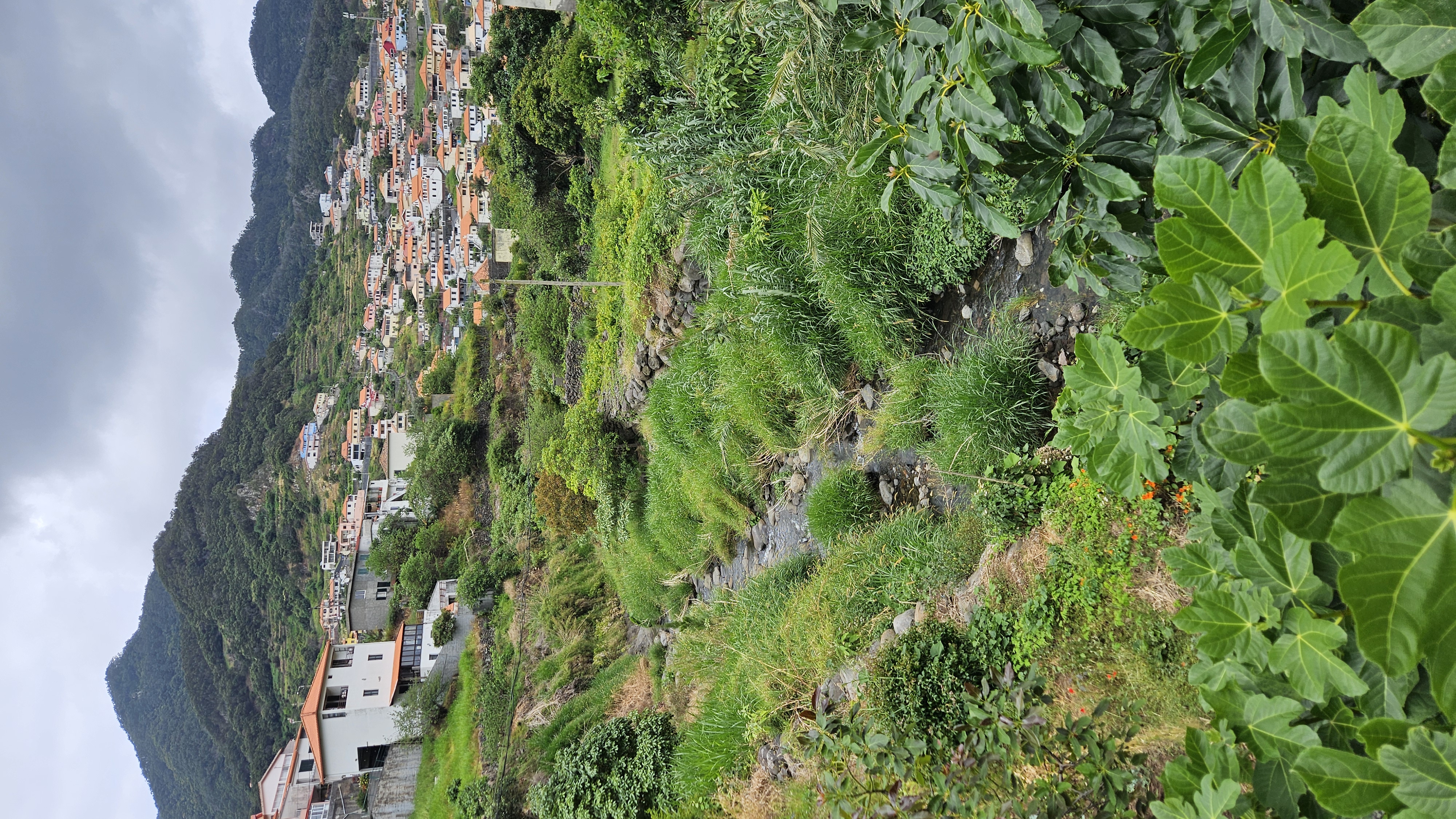
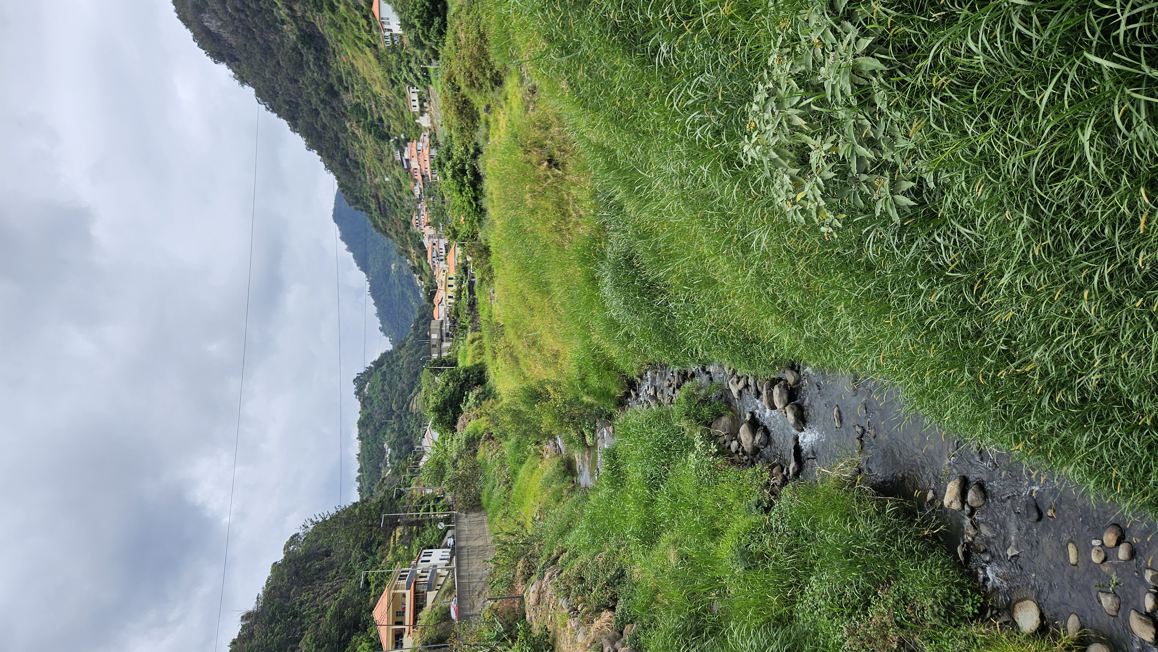
Machico Nature-Based Riverside Corridor
Machico River Corridor: A Pilot Project for Urban Climate Resilience and Nature-Based Solutions
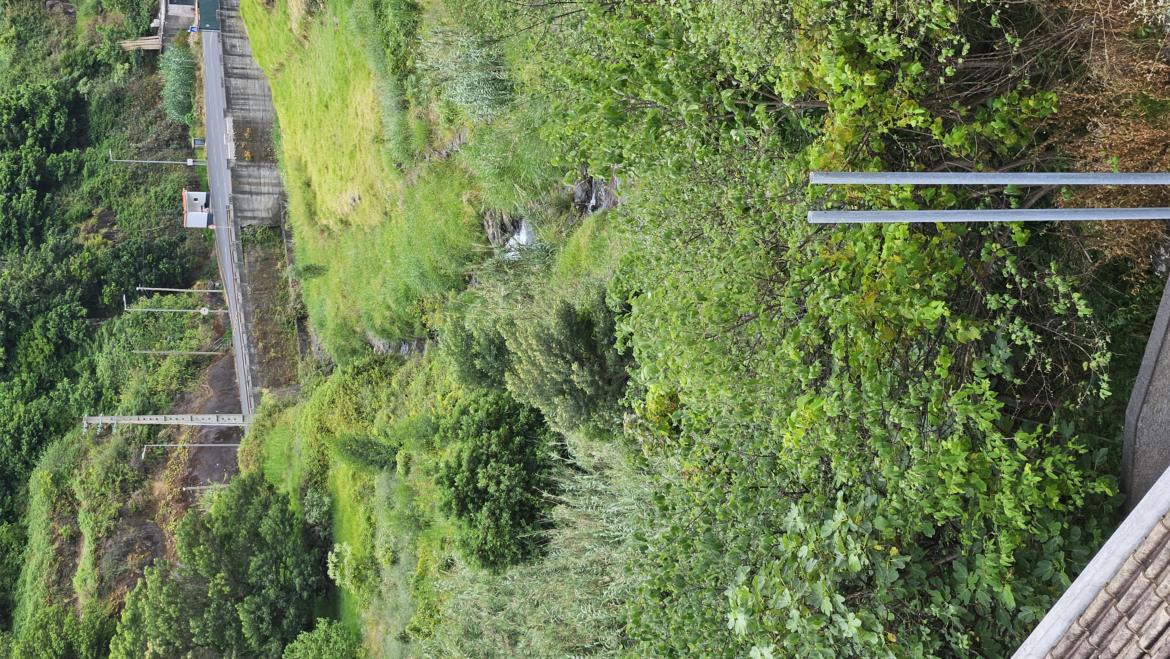
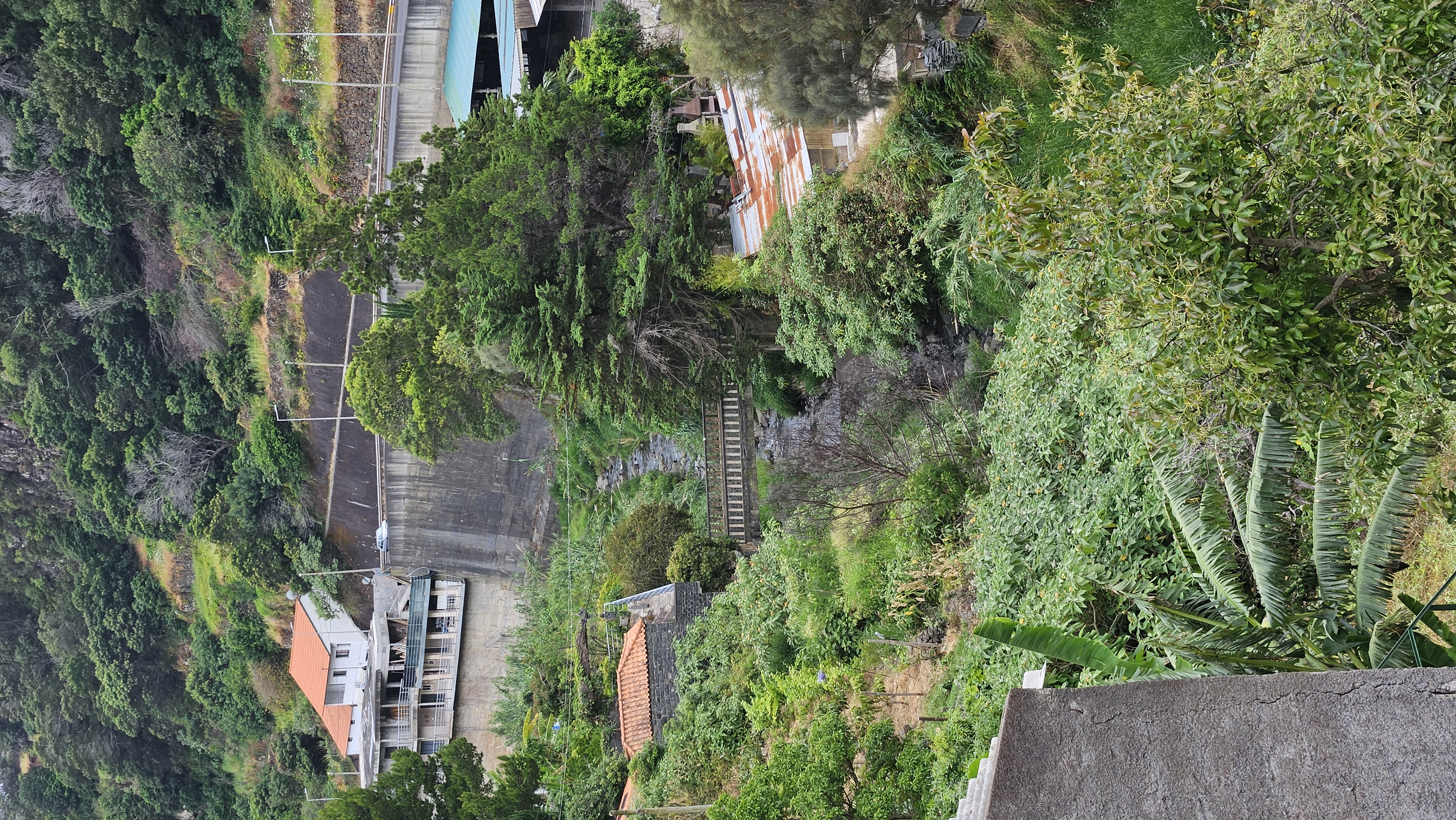
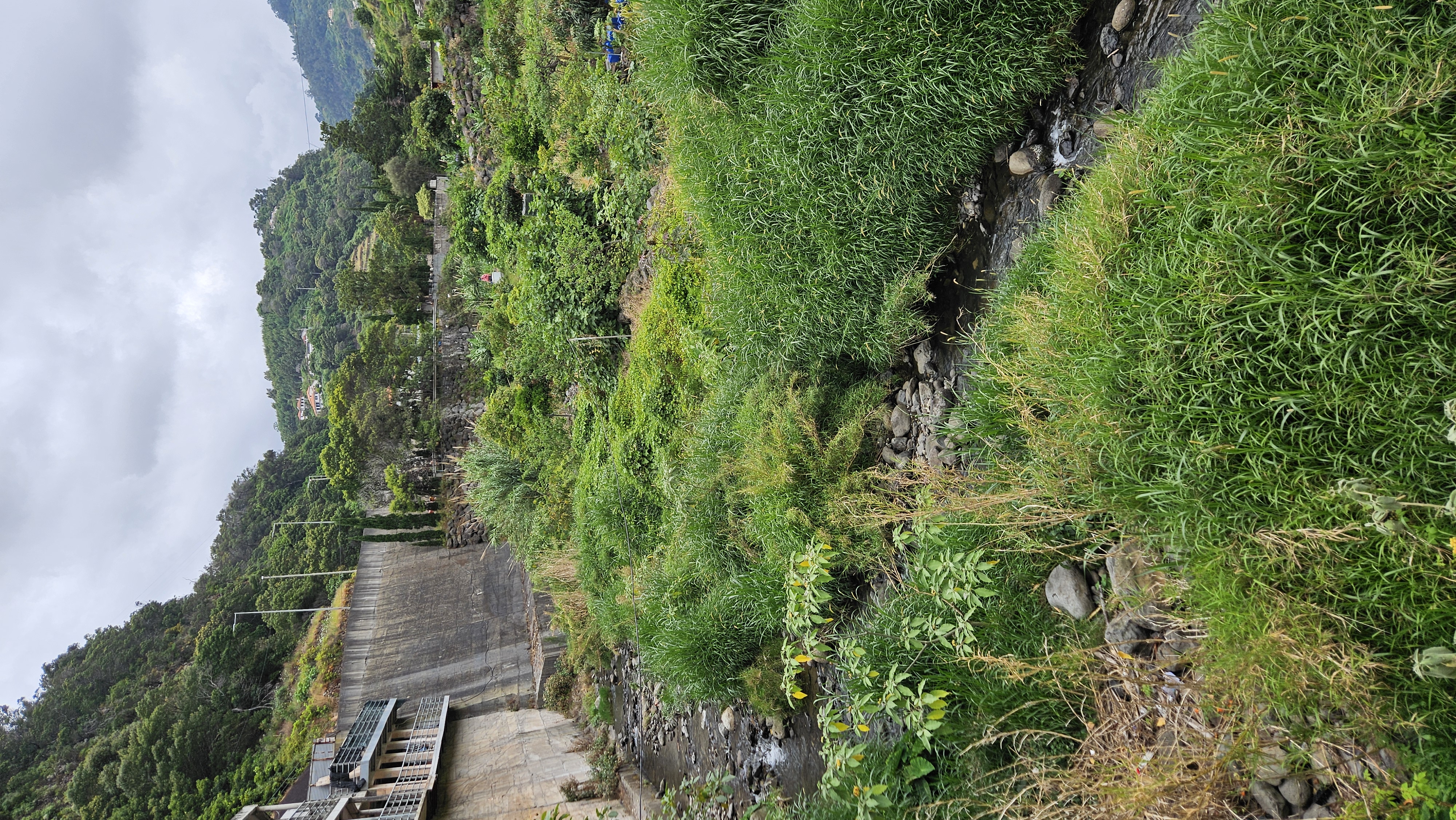
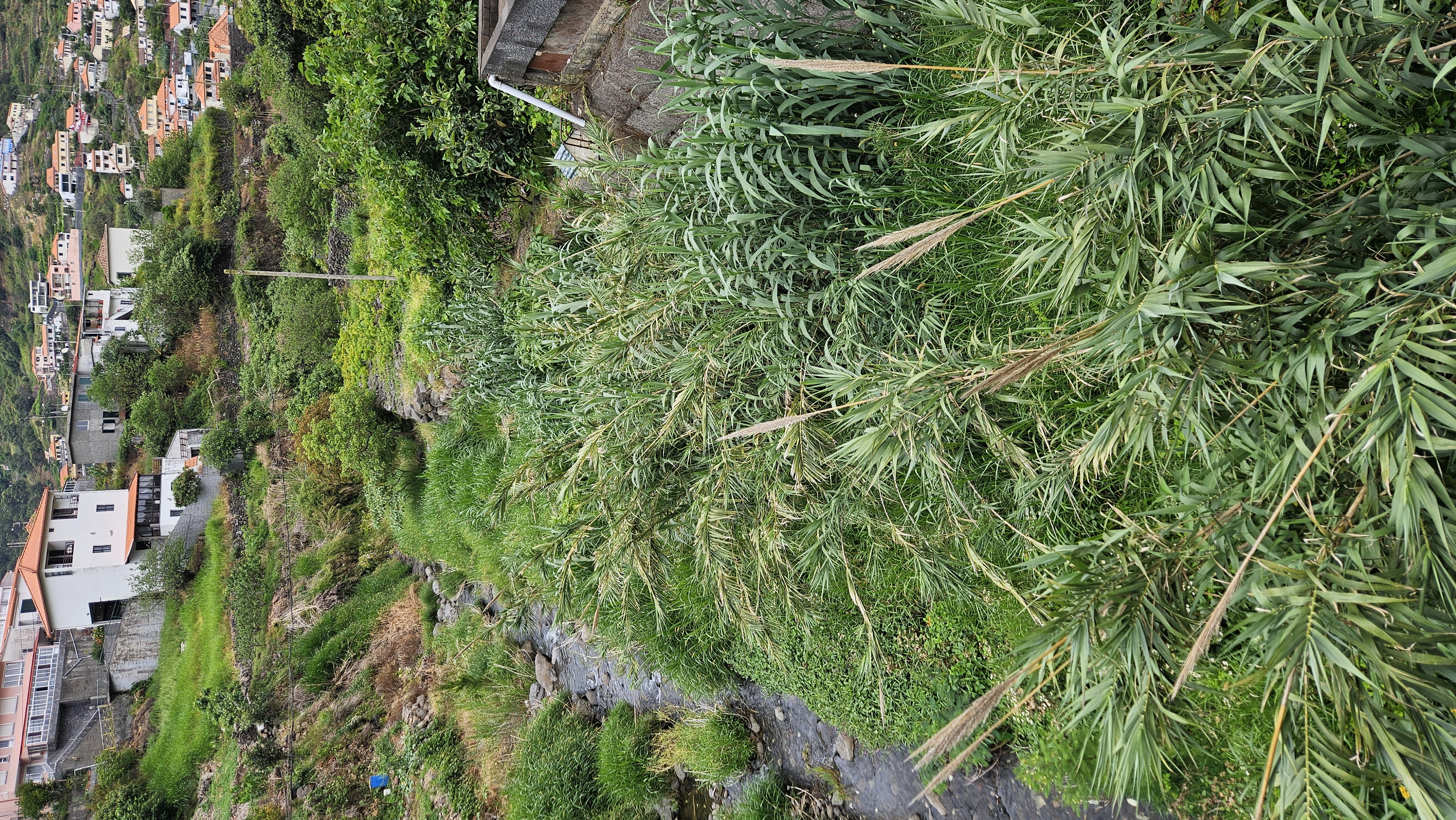
Machico is transforming 9 hectares of its riverside into a resilient, nature-driven urban park. By integrating Nature-Based Solutions (NBS) like rain gardens and bioswales, we are mitigating flood risks while restoring local Macaronesian biodiversity. This pilot project, already in its execution phase, combines sustainable water management with inclusive public spaces, fostering community engagement and environmental education to build a greener, more resilient future for all residents.
Portugal
{Empty}
Early initiative
Yes
Yes
Yes
No
No
310403: Machico (PT)
Overall Aim:
The Machico Nature-Based Riverside Corridor aims to transform a 9-hectare Significant Potential Flood Risk Area (ARPSI) into a resilient, multifunctional green-blue corridor. The initiative shifts the local urban paradigm from traditional "grey" hydraulic engineering (concrete channeling) to Nature-Based Solutions (NBS). This project serves as a climate adaptation pilot to restore the city’s ecological relationship with its riparian heritage while mitigating the historical impact of devastating flash floods.
Target Group(s):
Local Community: Specifically residents in high-risk zones, who gain increased safety and high-quality, barrier-free social spaces.
Educational Community: Students and researchers using the corridor as a "living laboratory" for biodiversity and sustainable water management study.
Local Economy & Visitors: Benefiting from a landmark aesthetic destination that promotes sustainable tourism and urban regeneration.
Specific Objective(s):
Hydraulic Resilience: Implementing bioswales, rain gardens, and detention basins to manage the water cycle circularly, reducing runoff and recharging aquifers.
Ecological Restoration: Rehabilitating the 9-hectare area using 100% autochthonous Macaronesian flora to restore native habitats.
Inclusive Co-creation: Establishing a legally mandated participatory framework to involve citizens in the functional design and zoning of the corridor.
Expected Outcomes:
A significant reduction in peak flood flows and improved sediment management as per PGRI-RAM strategic goals.
Creation of a continuous, accessible pedestrian and cycling network that fosters social inclusion.
A "Shovel-Ready" technical blueprint, backed by a secured budget of €43,889.00 and a 210-day execution timeline formally awarded on March 16, 2026.
The Machico Nature-Based Riverside Corridor aims to transform a 9-hectare Significant Potential Flood Risk Area (ARPSI) into a resilient, multifunctional green-blue corridor. The initiative shifts the local urban paradigm from traditional "grey" hydraulic engineering (concrete channeling) to Nature-Based Solutions (NBS). This project serves as a climate adaptation pilot to restore the city’s ecological relationship with its riparian heritage while mitigating the historical impact of devastating flash floods.
Target Group(s):
Local Community: Specifically residents in high-risk zones, who gain increased safety and high-quality, barrier-free social spaces.
Educational Community: Students and researchers using the corridor as a "living laboratory" for biodiversity and sustainable water management study.
Local Economy & Visitors: Benefiting from a landmark aesthetic destination that promotes sustainable tourism and urban regeneration.
Specific Objective(s):
Hydraulic Resilience: Implementing bioswales, rain gardens, and detention basins to manage the water cycle circularly, reducing runoff and recharging aquifers.
Ecological Restoration: Rehabilitating the 9-hectare area using 100% autochthonous Macaronesian flora to restore native habitats.
Inclusive Co-creation: Establishing a legally mandated participatory framework to involve citizens in the functional design and zoning of the corridor.
Expected Outcomes:
A significant reduction in peak flood flows and improved sediment management as per PGRI-RAM strategic goals.
Creation of a continuous, accessible pedestrian and cycling network that fosters social inclusion.
A "Shovel-Ready" technical blueprint, backed by a secured budget of €43,889.00 and a 210-day execution timeline formally awarded on March 16, 2026.
Nature-Based Solutions
Climate Resilience
Water Management
Urban Regeneration
Community Co-creation
Key Objectives:
The primary objective is to transform a Significant Potential Flood Risk Area (ARPSI) into a resilient, multifunctional riverside corridor. This initiative replaces traditional "grey" hydraulic engineering with Nature-Based Solutions (NBS) to manage the urban water cycle, directly responding to the vulnerabilities and historical flash floods documented in the PGRI-RAM (Flood Risk Management Plan of Madeira). A core environmental goal is the restoration of 9 hectares of riparian ecosystem using 100% autochthonous Macaronesian flora, ensuring low water consumption and biodiversity recovery.
How they are being met:
The project is administratively and financially secured, with the contract formally awarded on March 16, 2026, for a 210-day execution period. A dedicated budget of €43,889.00 (REC 301) has been committed to a transdisciplinary team to deliver blueprints focused on rain gardens, bioswales, and permeable pavements. The design incorporates scientific evidence from local studies regarding soil permeability and climate adaptation in Machico.
Exemplary Character:
The initiative is exemplary for its "Circular City" approach in an island context. It treats water as a resource for urban regeneration rather than a threat, mimicking natural hydrological cycles to recharge aquifers and mitigate flood peaks. By integrating a mandatory Monitoring and Maintenance Plan, Machico is setting a scalable benchmark for climate resilience in small Atlantic municipalities.
The primary objective is to transform a Significant Potential Flood Risk Area (ARPSI) into a resilient, multifunctional riverside corridor. This initiative replaces traditional "grey" hydraulic engineering with Nature-Based Solutions (NBS) to manage the urban water cycle, directly responding to the vulnerabilities and historical flash floods documented in the PGRI-RAM (Flood Risk Management Plan of Madeira). A core environmental goal is the restoration of 9 hectares of riparian ecosystem using 100% autochthonous Macaronesian flora, ensuring low water consumption and biodiversity recovery.
How they are being met:
The project is administratively and financially secured, with the contract formally awarded on March 16, 2026, for a 210-day execution period. A dedicated budget of €43,889.00 (REC 301) has been committed to a transdisciplinary team to deliver blueprints focused on rain gardens, bioswales, and permeable pavements. The design incorporates scientific evidence from local studies regarding soil permeability and climate adaptation in Machico.
Exemplary Character:
The initiative is exemplary for its "Circular City" approach in an island context. It treats water as a resource for urban regeneration rather than a threat, mimicking natural hydrological cycles to recharge aquifers and mitigate flood peaks. By integrating a mandatory Monitoring and Maintenance Plan, Machico is setting a scalable benchmark for climate resilience in small Atlantic municipalities.
Key Objectives:
The objective is to reconnect the urban fabric with its natural heritage through high-quality landscape design that promotes well-being and environmental stewardship. We aim to transform a neglected riverside into a vibrant social landmark that blends technical hydraulic safety with a high-quality sensory experience for residents and visitors.
How they are being met:
The project integrates NBS elements—such as bio-retention basins—seamlessly into a new pedestrian and cycling network. The design utilizes the unique colors and textures of endemic Macaronesian flora to preserve local landscape identity. Furthermore, the initiative includes a dedicated "Sinalética e Programa Educacional" (Educational Signage), turning the infrastructure into an outdoor museum where citizens can learn about riparian biodiversity and sustainable water management through interpretive trails.
Exemplary Character:
This project is exemplary for its "Educational Aesthetics." It proves that vital flood-mitigation infrastructure does not have to be invisible or purely functional; it can be a beautiful, culturally rich public asset. By prioritizing the quality of the user experience alongside technical safety, Machico creates a new standard for resilient urban parks where beauty serves as a bridge to environmental awareness.
The objective is to reconnect the urban fabric with its natural heritage through high-quality landscape design that promotes well-being and environmental stewardship. We aim to transform a neglected riverside into a vibrant social landmark that blends technical hydraulic safety with a high-quality sensory experience for residents and visitors.
How they are being met:
The project integrates NBS elements—such as bio-retention basins—seamlessly into a new pedestrian and cycling network. The design utilizes the unique colors and textures of endemic Macaronesian flora to preserve local landscape identity. Furthermore, the initiative includes a dedicated "Sinalética e Programa Educacional" (Educational Signage), turning the infrastructure into an outdoor museum where citizens can learn about riparian biodiversity and sustainable water management through interpretive trails.
Exemplary Character:
This project is exemplary for its "Educational Aesthetics." It proves that vital flood-mitigation infrastructure does not have to be invisible or purely functional; it can be a beautiful, culturally rich public asset. By prioritizing the quality of the user experience alongside technical safety, Machico creates a new standard for resilient urban parks where beauty serves as a bridge to environmental awareness.
Key Objectives:
Inclusion is the core governing principle of this initiative. Our objective is to ensure that the 9-hectare corridor is physically, socially, and economically accessible to all. This includes a commitment to "Design for All" principles and the implementation of an inclusive governance model that empowers the local community in the decision-making process.
How they are being met:
The commitment is proven by the mandatory Phase 1: Co-creation and Participation, established in the awarded contract. This stage involves stakeholder mapping and participatory mapping sessions where residents—especially those in flood-prone areas—directly influence the functional zoning of the park. The project ensures universal accessibility to the riverside, removing physical barriers and providing safe, affordable recreational spaces for all age groups, from students to the elderly.
Exemplary Character:
The initiative is exemplary for its "Inclusive Governing System." By making co-creation a contractual obligation rather than an option, the Municipality of Machico shifts from a "top-down" engineering model to a "bottom-up" societal model. This fosters a sense of ownership and long-term stewardship among citizens, ensuring the project’s social sustainability and democratic value as a shared public heritage.
Inclusion is the core governing principle of this initiative. Our objective is to ensure that the 9-hectare corridor is physically, socially, and economically accessible to all. This includes a commitment to "Design for All" principles and the implementation of an inclusive governance model that empowers the local community in the decision-making process.
How they are being met:
The commitment is proven by the mandatory Phase 1: Co-creation and Participation, established in the awarded contract. This stage involves stakeholder mapping and participatory mapping sessions where residents—especially those in flood-prone areas—directly influence the functional zoning of the park. The project ensures universal accessibility to the riverside, removing physical barriers and providing safe, affordable recreational spaces for all age groups, from students to the elderly.
Exemplary Character:
The initiative is exemplary for its "Inclusive Governing System." By making co-creation a contractual obligation rather than an option, the Municipality of Machico shifts from a "top-down" engineering model to a "bottom-up" societal model. This fosters a sense of ownership and long-term stewardship among citizens, ensuring the project’s social sustainability and democratic value as a shared public heritage.
Role and Level of Involvement:
Citizen involvement is the core governing principle of this initiative. As established in the Technical Specifications (S_04_CE) and the contract awarded on March 16, 2026, co-creation is a mandatory requirement of Phase 1: Diagnosis and Participation. The role of civil society is that of co-designers, acting through in-person participatory mapping sessions. In these sessions, residents—particularly those living in historically high-risk flood zones—identify local vulnerabilities and propose specific functions (recreation, education, protection) for the 9-hectare corridor.
Impact of Involvement:
This level of involvement transforms citizens from passive beneficiaries into active guardians of the project. The direct impact is an increased social acceptance of Nature-Based Solutions (NBS) and a guarantee that the final design responds to real safety and usability needs. By involving the community in the diagnosis phase, we reduce usage conflicts and foster a sense of ownership, which is essential for the long-term maintenance and resilience of the green infrastructure.
Citizen involvement is the core governing principle of this initiative. As established in the Technical Specifications (S_04_CE) and the contract awarded on March 16, 2026, co-creation is a mandatory requirement of Phase 1: Diagnosis and Participation. The role of civil society is that of co-designers, acting through in-person participatory mapping sessions. In these sessions, residents—particularly those living in historically high-risk flood zones—identify local vulnerabilities and propose specific functions (recreation, education, protection) for the 9-hectare corridor.
Impact of Involvement:
This level of involvement transforms citizens from passive beneficiaries into active guardians of the project. The direct impact is an increased social acceptance of Nature-Based Solutions (NBS) and a guarantee that the final design responds to real safety and usability needs. By involving the community in the diagnosis phase, we reduce usage conflicts and foster a sense of ownership, which is essential for the long-term maintenance and resilience of the green infrastructure.
Stakeholders and Roles:
The initiative operates within a vertical and horizontal multi-level governance structure:
Local Level: The Municipality of Machico ensures political and financial commitment, with a dedicated Project Manager (Raul Alves) overseeing execution and technical supervision.
Regional Level: Strategic alignment with the Regional Government of Madeira through the Flood Risk Management Plan (PGRI-RAM). The AMRAM (Association of Municipalities) acts as a platform for disseminating best practices.
European Level: The project follows NEB guidelines and aligns with EU climate resilience goals, serving as a pilot for Atlantic island territories.
Added Value:
The added value of this engagement is the integration of specialized technical knowledge with large-scale public policies. Multi-level coordination ensures that the Machico pilot project is not an isolated intervention, but a scalable and transferable model. Regional validation (via PGRI) grants technical authority to the solution, while the European framework ensures compliance with excellence standards in sustainability and inclusion.
The initiative operates within a vertical and horizontal multi-level governance structure:
Local Level: The Municipality of Machico ensures political and financial commitment, with a dedicated Project Manager (Raul Alves) overseeing execution and technical supervision.
Regional Level: Strategic alignment with the Regional Government of Madeira through the Flood Risk Management Plan (PGRI-RAM). The AMRAM (Association of Municipalities) acts as a platform for disseminating best practices.
European Level: The project follows NEB guidelines and aligns with EU climate resilience goals, serving as a pilot for Atlantic island territories.
Added Value:
The added value of this engagement is the integration of specialized technical knowledge with large-scale public policies. Multi-level coordination ensures that the Machico pilot project is not an isolated intervention, but a scalable and transferable model. Regional validation (via PGRI) grants technical authority to the solution, while the European framework ensures compliance with excellence standards in sustainability and inclusion.
Disciplines Involved:
The design and implementation reflect a deep collaboration between Hydraulic Engineering, Landscape Architecture, Ecology, Geology, and Social Sciences. This interaction is evident in the technical proposal, which merges flood modeling with riparian ecosystem restoration and public space design.
Interaction and Added Value:
Interaction occurs through an integrated design process: technical hydraulic safety requirements (Engineering) define the typology of detention basins, which are then shaped to support autochthonous Macaronesian flora (Ecology) and integrated into accessible pathways (Architecture). The added value is the transition beyond traditional "siloed" engineering. The result is not just a drainage channel, but a multifunctional blue-green infrastructure. This transdisciplinary process ensures the solution is technically robust for flood mitigation, ecologically regenerative, and aesthetically enriching for the city.
The design and implementation reflect a deep collaboration between Hydraulic Engineering, Landscape Architecture, Ecology, Geology, and Social Sciences. This interaction is evident in the technical proposal, which merges flood modeling with riparian ecosystem restoration and public space design.
Interaction and Added Value:
Interaction occurs through an integrated design process: technical hydraulic safety requirements (Engineering) define the typology of detention basins, which are then shaped to support autochthonous Macaronesian flora (Ecology) and integrated into accessible pathways (Architecture). The added value is the transition beyond traditional "siloed" engineering. The result is not just a drainage channel, but a multifunctional blue-green infrastructure. This transdisciplinary process ensures the solution is technically robust for flood mitigation, ecologically regenerative, and aesthetically enriching for the city.
Innovation vs. Mainstream Actions:
The mainstream approach to flood management in Macaronesian islands has historically relied on "hard engineering"—channeling rivers with high-walled concrete structures to accelerate water discharge. While temporarily effective, this "grey" infrastructure destroys riparian ecosystems, increases downstream peak flows, and lacks aesthetic or social value.
Our initiative breaks this paradigm by implementing Nature-Based Solutions (NBS) within a Significant Potential Flood Risk Area (ARPSI). Instead of fighting the water, we design for it. The innovation lies in the "Circular Water Management" approach: using bioswales, rain gardens, and detention basins to slow down, filter, and infiltrate runoff, recharging local aquifers while mitigating flood risks.
Furthermore, the project is innovative in its multifunctionality. It transforms a "hazard zone" into a high-quality urban park that restores endemic biodiversity and provides social spaces. By moving from a single-purpose utility (drainage) to a multi-benefit social-ecological asset, Machico is pioneering a resilient urban model that balances technical safety with the NEB values of beauty and sustainability.
The mainstream approach to flood management in Macaronesian islands has historically relied on "hard engineering"—channeling rivers with high-walled concrete structures to accelerate water discharge. While temporarily effective, this "grey" infrastructure destroys riparian ecosystems, increases downstream peak flows, and lacks aesthetic or social value.
Our initiative breaks this paradigm by implementing Nature-Based Solutions (NBS) within a Significant Potential Flood Risk Area (ARPSI). Instead of fighting the water, we design for it. The innovation lies in the "Circular Water Management" approach: using bioswales, rain gardens, and detention basins to slow down, filter, and infiltrate runoff, recharging local aquifers while mitigating flood risks.
Furthermore, the project is innovative in its multifunctionality. It transforms a "hazard zone" into a high-quality urban park that restores endemic biodiversity and provides social spaces. By moving from a single-purpose utility (drainage) to a multi-benefit social-ecological asset, Machico is pioneering a resilient urban model that balances technical safety with the NEB values of beauty and sustainability.
A Phased Transdisciplinary Framework:
The initiative follows a rigorous 210-day methodology, formally awarded on March 16, 2026, structured into three mandatory stages to ensure technical excellence and community alignment:
Phase 1: Diagnosis and Co-creation: Before any technical drawing begins, the methodology mandates a participatory stage. This involves stakeholder mapping and workshops where citizens and experts co-design the park's functions. This ensures the project is rooted in local knowledge and social needs.
Phase 2: Integrated Technical Design: A transdisciplinary team of hydraulic engineers, ecologists, and landscape architects translates the co-creation outcomes into blueprints. This stage uses advanced hydrological modeling to ensure the NBS elements (rain gardens, permeable pavements) meet the safety standards required by the Regional Flood Plan (PGRI-RAM).
Phase 3: Stewardship and Monitoring: Unlike mainstream projects that end at construction, our approach includes a long-term Monitoring and Maintenance Plan. This ensures the biological health of the 9-hectare riparian corridor and tracks its hydraulic performance during extreme weather events.
Administrative Readiness:
This methodology is backed by a secured budget of €43,889.00 (REC 301), demonstrating that the "Ready-to-Implement" status is a core part of our approach.
The initiative follows a rigorous 210-day methodology, formally awarded on March 16, 2026, structured into three mandatory stages to ensure technical excellence and community alignment:
Phase 1: Diagnosis and Co-creation: Before any technical drawing begins, the methodology mandates a participatory stage. This involves stakeholder mapping and workshops where citizens and experts co-design the park's functions. This ensures the project is rooted in local knowledge and social needs.
Phase 2: Integrated Technical Design: A transdisciplinary team of hydraulic engineers, ecologists, and landscape architects translates the co-creation outcomes into blueprints. This stage uses advanced hydrological modeling to ensure the NBS elements (rain gardens, permeable pavements) meet the safety standards required by the Regional Flood Plan (PGRI-RAM).
Phase 3: Stewardship and Monitoring: Unlike mainstream projects that end at construction, our approach includes a long-term Monitoring and Maintenance Plan. This ensures the biological health of the 9-hectare riparian corridor and tracks its hydraulic performance during extreme weather events.
Administrative Readiness:
This methodology is backed by a secured budget of €43,889.00 (REC 301), demonstrating that the "Ready-to-Implement" status is a core part of our approach.
The Machico Riverside Corridor has been designed as a scalable "blue-green" blueprint, specifically tailored for small municipalities and island territories facing high hydrological risks. The following elements are highly transferable:
1. Contractual Methodology for Co-creation
The most replicable element is our legal-administrative framework. By making Phase 1 (Co-creation) a mandatory contractual requirement in the public procurement process, we provide a model for other public authorities to move from "top-down" engineering to inclusive urbanism. This process ensures that Nature-Based Solutions (NBS) are not just technically sound but socially accepted and locally adapted.
2. Island-Specific NBS Toolkit
The technical approach—using bioswales, rain gardens, and detention basins specifically designed for steep-sloped Atlantic basins—is directly transferable to other Macaronesian islands (Azores, Canarias, Cape Verde) and Mediterranean coastal towns. The use of 100% autochthonous flora provides a biological "recipe" for ecological restoration that minimizes maintenance and irrigation costs in similar climates.
3. Multi-Hazard Integration
The initiative demonstrates how to align local urban projects with regional strategic plans, such as the Flood Risk Management Plan (PGRI-RAM). This "policy-to-project" alignment is a valuable learning for small municipalities that struggle to translate large-scale environmental directives into tangible local actions.
4. Digital and Educational Products
The planned Educational Signage and Monitoring Program can be replicated as a tool for "climate literacy." By turning flood-mitigation infrastructure into an outdoor museum, the project offers a product that improves the quality of experience for both residents and tourists, adding economic value beyond safety.
1. Contractual Methodology for Co-creation
The most replicable element is our legal-administrative framework. By making Phase 1 (Co-creation) a mandatory contractual requirement in the public procurement process, we provide a model for other public authorities to move from "top-down" engineering to inclusive urbanism. This process ensures that Nature-Based Solutions (NBS) are not just technically sound but socially accepted and locally adapted.
2. Island-Specific NBS Toolkit
The technical approach—using bioswales, rain gardens, and detention basins specifically designed for steep-sloped Atlantic basins—is directly transferable to other Macaronesian islands (Azores, Canarias, Cape Verde) and Mediterranean coastal towns. The use of 100% autochthonous flora provides a biological "recipe" for ecological restoration that minimizes maintenance and irrigation costs in similar climates.
3. Multi-Hazard Integration
The initiative demonstrates how to align local urban projects with regional strategic plans, such as the Flood Risk Management Plan (PGRI-RAM). This "policy-to-project" alignment is a valuable learning for small municipalities that struggle to translate large-scale environmental directives into tangible local actions.
4. Digital and Educational Products
The planned Educational Signage and Monitoring Program can be replicated as a tool for "climate literacy." By turning flood-mitigation infrastructure into an outdoor museum, the project offers a product that improves the quality of experience for both residents and tourists, adding economic value beyond safety.
The initiative is currently moving from the administrative award phase into active design. The NEB values have been incorporated as follows:
Sustainability: We have shifted from traditional concrete channeling to Nature-Based Solutions (NBS). Planned activities include the design of rain gardens and bioswales to manage the urban water cycle "circularly," alongside the ecological restoration of 9 hectares using 100% autochthonous Macaronesian flora.
Inclusion: A mandatory Co-creation Phase is contractually secured. This ensures that the design is not imposed but developed with the community, especially residents in high-risk areas, ensuring social affordability and accessibility.
Aesthetics: The project aims to create a "Living Museum." Planned interpretive trails and high-quality landscape design will turn hydraulic infrastructure into a sensory and educational experience, reconnecting the city with its natural heritage.
Key Implementation Steps (NEB Alignment)
The implementation follows a 210-day timeline anchored in NEB working principles:
Stage 1: Participatory Diagnosis (Transdisciplinary & Participatory): Collaborative mapping sessions with citizens and a transdisciplinary team (engineers, ecologists, architects) to define the functional zoning of the corridor.
Stage 2: Integrated Technical Design (Sustainability & Aesthetics): Development of the execution project, where hydrological modeling meets landscape architecture to ensure the corridor is both technically robust against flash floods and aesthetically enriching.
Stage 3: Monitoring & Stewardship (Long-term Value): Implementation of a maintenance plan that involves the community in the long-term monitoring of the riparian ecosystem's health.
The municipality has already demonstrated a "proven commitment" to these steps by securing a dedicated budget of €43,889.00 and formally awarding the contract on March 16, 2026.
Sustainability: We have shifted from traditional concrete channeling to Nature-Based Solutions (NBS). Planned activities include the design of rain gardens and bioswales to manage the urban water cycle "circularly," alongside the ecological restoration of 9 hectares using 100% autochthonous Macaronesian flora.
Inclusion: A mandatory Co-creation Phase is contractually secured. This ensures that the design is not imposed but developed with the community, especially residents in high-risk areas, ensuring social affordability and accessibility.
Aesthetics: The project aims to create a "Living Museum." Planned interpretive trails and high-quality landscape design will turn hydraulic infrastructure into a sensory and educational experience, reconnecting the city with its natural heritage.
Key Implementation Steps (NEB Alignment)
The implementation follows a 210-day timeline anchored in NEB working principles:
Stage 1: Participatory Diagnosis (Transdisciplinary & Participatory): Collaborative mapping sessions with citizens and a transdisciplinary team (engineers, ecologists, architects) to define the functional zoning of the corridor.
Stage 2: Integrated Technical Design (Sustainability & Aesthetics): Development of the execution project, where hydrological modeling meets landscape architecture to ensure the corridor is both technically robust against flash floods and aesthetically enriching.
Stage 3: Monitoring & Stewardship (Long-term Value): Implementation of a maintenance plan that involves the community in the long-term monitoring of the riparian ecosystem's health.
The municipality has already demonstrated a "proven commitment" to these steps by securing a dedicated budget of €43,889.00 and formally awarding the contract on March 16, 2026.