Othrys Geomythological Park
Othrys Geomythological Park & History Center: Reviving Heritage Through Sustainable Development
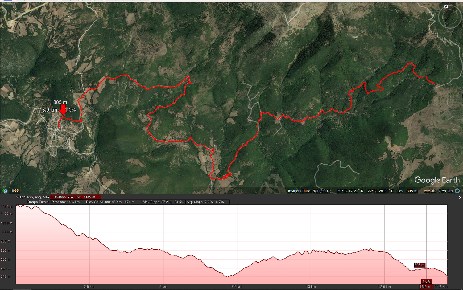
The Othrys Geomythological Park transforms a 1930s school into a vibrant knowledge hub, connecting 14.6km of mountain trails with local mythology and geology. This initiative revitalizes an underdeveloped region by blending heritage preservation with immersive learning. By providing accessible infrastructure, it creates a year-round destination that empowers the local community, protects the natural ecosystem, and sets a sustainable development model for the future of rural Greece.
Greece
Central Hub (History & Geomythology Center): Filiadona, Municipality of Domokos
Geographic Scope of the Park: Othrys Mountain Range
Geographic Scope of the Park: Othrys Mountain Range
Prototype level
Yes
Yes
Yes
No
No
27030101: Municipal Commune of Domokos (EL)
The Othrys Geomythological Park is a holistic regional development initiative designed to transform Mount Othrys into a premier destination for cultural and environmental tourism. By intertwining the region’s scientific geological significance with the epic narrative of the Titanomachy (the battle of the Titans), the project creates a unique "living laboratory" where myth meets earth science.
Strategic Objectives & Implementation:
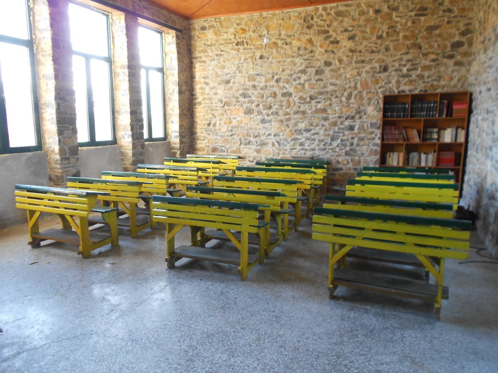
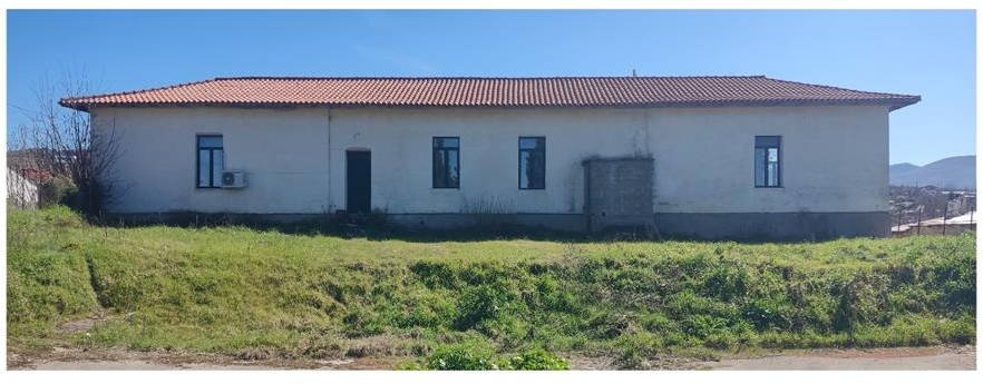
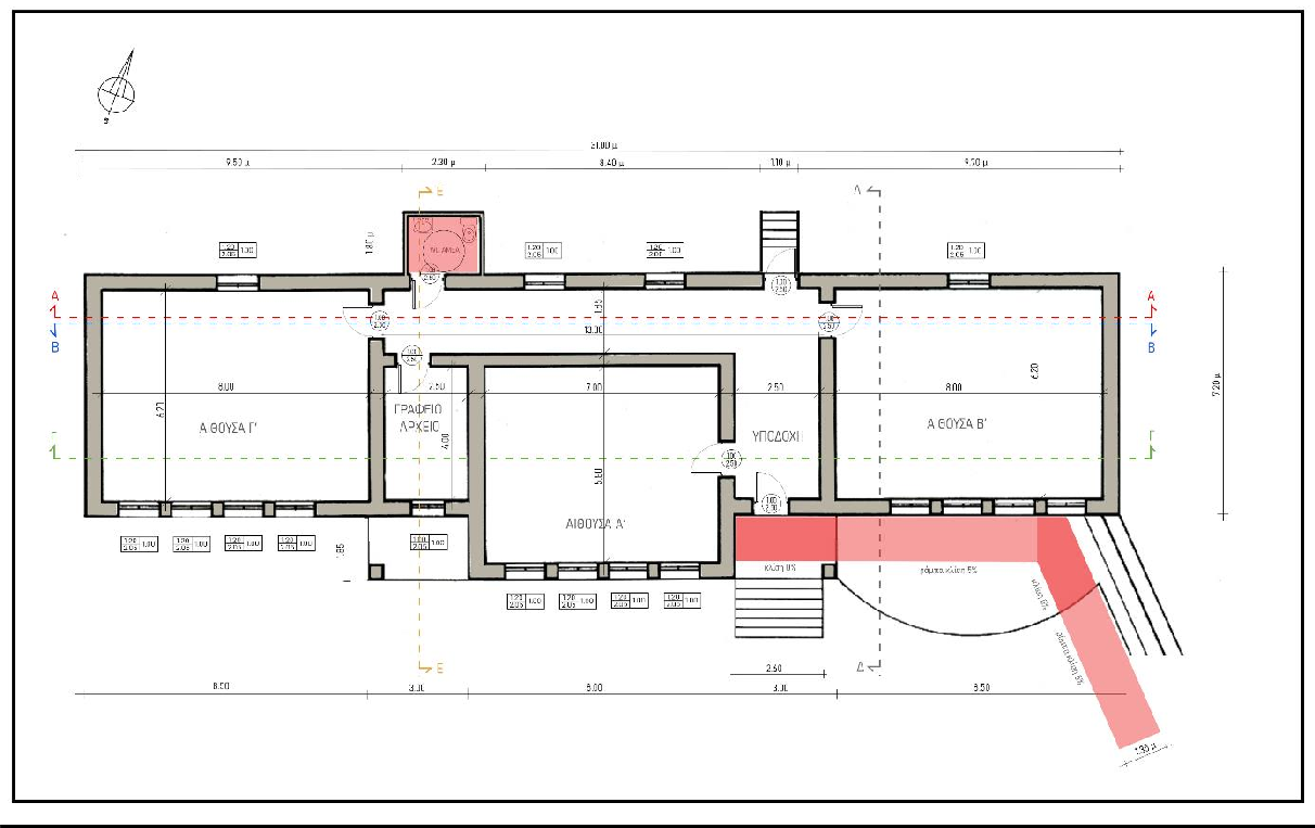
The initiative centers on the adaptive reuse of the historic 1930s schoolhouse in Filiadona, converting it into a state-of-the-art Reception and Information Center. This hub serves as the gateway to a 14.6km network of thematic trails. A core objective is "minimal intervention": we utilize existing ancestral paths and forest roads to protect riparian ecosystems and avoid the carbon footprint of new construction. Architecturally, the project balances the austerity of the interwar school with modern, sustainable design, using locally sourced materials to ensure a seamless aesthetic integration with the landscape.
Target Groups & Inclusion:
The project serves a broad spectrum of users, including the academic and school community (K-12 and university researchers), hikers, and eco-tourists. A primary focus is the empowerment of the local community of Domokos, involving them as co-creators and future stewards of the park. Adhering to "Design for All" principles, the Reception Center is fully accessible, ensuring that the legendary history of the "Mountain of the Titans" is available to visitors of all physical abilities.
Expected Outcomes:
The initiative is expected to revitalize the local economy by attracting "slow-tourism" and fostering new educational programs. Beyond economic growth, the project aims to preserve architectural memory, safeguard mountain biodiversity, and provide a replicable European model for how remote rural areas can leverage their deep history and natural wealth to build a sustainable, inclusive future.
Strategic Objectives & Implementation:
The initiative centers on the adaptive reuse of the historic 1930s schoolhouse in Filiadona, converting it into a state-of-the-art Reception and Information Center. This hub serves as the gateway to a 14.6km network of thematic trails. A core objective is "minimal intervention": we utilize existing ancestral paths and forest roads to protect riparian ecosystems and avoid the carbon footprint of new construction. Architecturally, the project balances the austerity of the interwar school with modern, sustainable design, using locally sourced materials to ensure a seamless aesthetic integration with the landscape.
Target Groups & Inclusion:
The project serves a broad spectrum of users, including the academic and school community (K-12 and university researchers), hikers, and eco-tourists. A primary focus is the empowerment of the local community of Domokos, involving them as co-creators and future stewards of the park. Adhering to "Design for All" principles, the Reception Center is fully accessible, ensuring that the legendary history of the "Mountain of the Titans" is available to visitors of all physical abilities.
Expected Outcomes:
The initiative is expected to revitalize the local economy by attracting "slow-tourism" and fostering new educational programs. Beyond economic growth, the project aims to preserve architectural memory, safeguard mountain biodiversity, and provide a replicable European model for how remote rural areas can leverage their deep history and natural wealth to build a sustainable, inclusive future.
Geomythology
Adaptive-Reuse
Inclusivity
Sustainability
Participatory
Our primary sustainability objective is to implement a circular development model that avoids the environmental costs of new construction. By opting for the adaptive reuse of the historic 1930s school in Filiadona, we preserve existing embodied energy and minimize waste. Furthermore, we prioritize the use of reclaimed and locally sourced natural materials for the restoration of the building and the development of the hiking infrastructure.
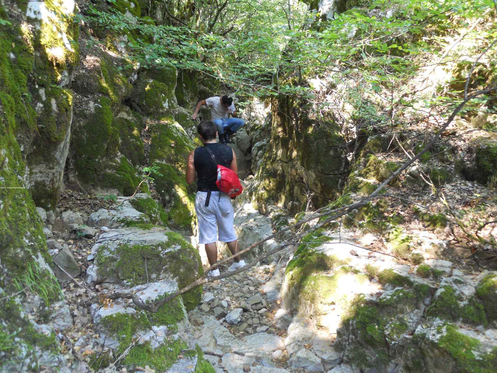
The project rejects the "demolish and rebuild" approach, upgrading the structural integrity of the existing school building. For the Geomythological Park, we utilize the pre-existing network of agricultural and forest roads, as well as traditional paths used by locals for generations. This strategy prevents habitat fragmentation and land clearing. The network includes riverside routes along small mountain streams, where interventions are strictly small-scale and eco-friendly. All auxiliary structures (seating, signage) are designed to be non-intrusive, using natural materials that harmonize with the ecosystem without altering the charm of the natural landscape.
This project is exemplary because it demonstrates how to create a high-value destination with minimal landscape intervention. By repurposing a dormant building and breathing new life into ancestral paths, we prove that rural development can thrive by honoring existing footprints. It provides a replicable, low-impact model for European mountain regions, showing that the most sustainable path forward often lies in the thoughtful restoration of what already exists.
The project rejects the "demolish and rebuild" approach, upgrading the structural integrity of the existing school building. For the Geomythological Park, we utilize the pre-existing network of agricultural and forest roads, as well as traditional paths used by locals for generations. This strategy prevents habitat fragmentation and land clearing. The network includes riverside routes along small mountain streams, where interventions are strictly small-scale and eco-friendly. All auxiliary structures (seating, signage) are designed to be non-intrusive, using natural materials that harmonize with the ecosystem without altering the charm of the natural landscape.
This project is exemplary because it demonstrates how to create a high-value destination with minimal landscape intervention. By repurposing a dormant building and breathing new life into ancestral paths, we prove that rural development can thrive by honoring existing footprints. It provides a replicable, low-impact model for European mountain regions, showing that the most sustainable path forward often lies in the thoughtful restoration of what already exists.
The initiative’s aesthetic goal is to create a "living narrative" that reflects the multilayered identity of Mount Othrys. Beyond its mythological significance as the stronghold of the Titans, the project aims to highlight the region’s unique geological heritage and its long human history. We aim to offer a multisensory experience where visitors move from the structured environment of the Reception and Information Center to an immersive landscape that functions as a natural museum of earth sciences and cultural memory.
The experience is designed as a journey through time and nature. The Reception and Information Center (the repurposed 1930s school) serves as the aesthetic anchor, blending historical architecture with modern interpretation. From there, the 14.6km trail network—utilizing existing agricultural and forest paths—invites visitors to explore diverse scenery: from riparian ecosystems and mountain streams to complex geological formations that tell the story of the Earth's creation. The aesthetic quality is maintained through "quiet interventions"—small-scale, eco-friendly structures that offer rest and information without overshadowing the landscape. By preserving the paths used by generations of locals, we ensure an authentic connection to the rural and pastoral heritage of the area.
The project is exemplary because it treats the natural landscape as a multifaceted cultural asset. It proves that high-quality design can harmonize diverse elements: the epic scale of the Titanomachy, the intricate beauty of geological phenomena, and the serenity of riverside environments. By connecting a historic building to this rich natural tapestry, we offer a "slow-tourism" experience that satisfies both the mind and the senses. This model serves as a benchmark for European rural development, showing how a single initiative can celebrate mythology, science, and history through a unified, sensitive aesthetic.
The experience is designed as a journey through time and nature. The Reception and Information Center (the repurposed 1930s school) serves as the aesthetic anchor, blending historical architecture with modern interpretation. From there, the 14.6km trail network—utilizing existing agricultural and forest paths—invites visitors to explore diverse scenery: from riparian ecosystems and mountain streams to complex geological formations that tell the story of the Earth's creation. The aesthetic quality is maintained through "quiet interventions"—small-scale, eco-friendly structures that offer rest and information without overshadowing the landscape. By preserving the paths used by generations of locals, we ensure an authentic connection to the rural and pastoral heritage of the area.
The project is exemplary because it treats the natural landscape as a multifaceted cultural asset. It proves that high-quality design can harmonize diverse elements: the epic scale of the Titanomachy, the intricate beauty of geological phenomena, and the serenity of riverside environments. By connecting a historic building to this rich natural tapestry, we offer a "slow-tourism" experience that satisfies both the mind and the senses. This model serves as a benchmark for European rural development, showing how a single initiative can celebrate mythology, science, and history through a unified, sensitive aesthetic.
The foundation of our inclusion strategy is to ensure that the Reception and Information Center—housed in the historic Filiadona school—acts as an open, welcoming, and accessible gateway for every visitor. Our primary objective is to bridge the gap between remote rural heritage and the wider public, providing a high-quality educational hub designed around "Design for All" principles. We aim to ensure that the mythic and geological wealth of Mount Othrys is an inclusive asset accessible to people of all physical abilities and backgrounds.The transformation of the school into a Reception and Information Center prioritizes universal access. The facility is being equipped with barrier-free entry points, ramps, and specialized facilities, ensuring that individuals with disabilities have full access to the geomythological exhibits. While the rugged terrain of the "Mountain of the Titans" presents natural challenges, we are identifying and marking specific trail segments that are suitable for different levels of mobility, ensuring that the experience of the landscape is shared as widely as possible. Furthermore, the initiative fosters an inclusive governing model by involving the Municipality of Domokos and local residents in the decision-making process. This ensures that the project remains a community-owned asset that reflects the local identity while serving as a platform for lifelong learning for students and researchers alike.The project is exemplary because it demonstrates how to turn a dormant rural building into a vibrant social and educational landmark. By establishing a fully accessible gateway in a mountainous region, we challenge the notion that remote heritage is inherently exclusive. This model of community-centered, inclusive design proves that cultural stewardship can empower local populations while breaking down the socio-physical barriers that often isolate mountainous areas, reinforcing the democratic and inclusive values of the New European Bauhaus.
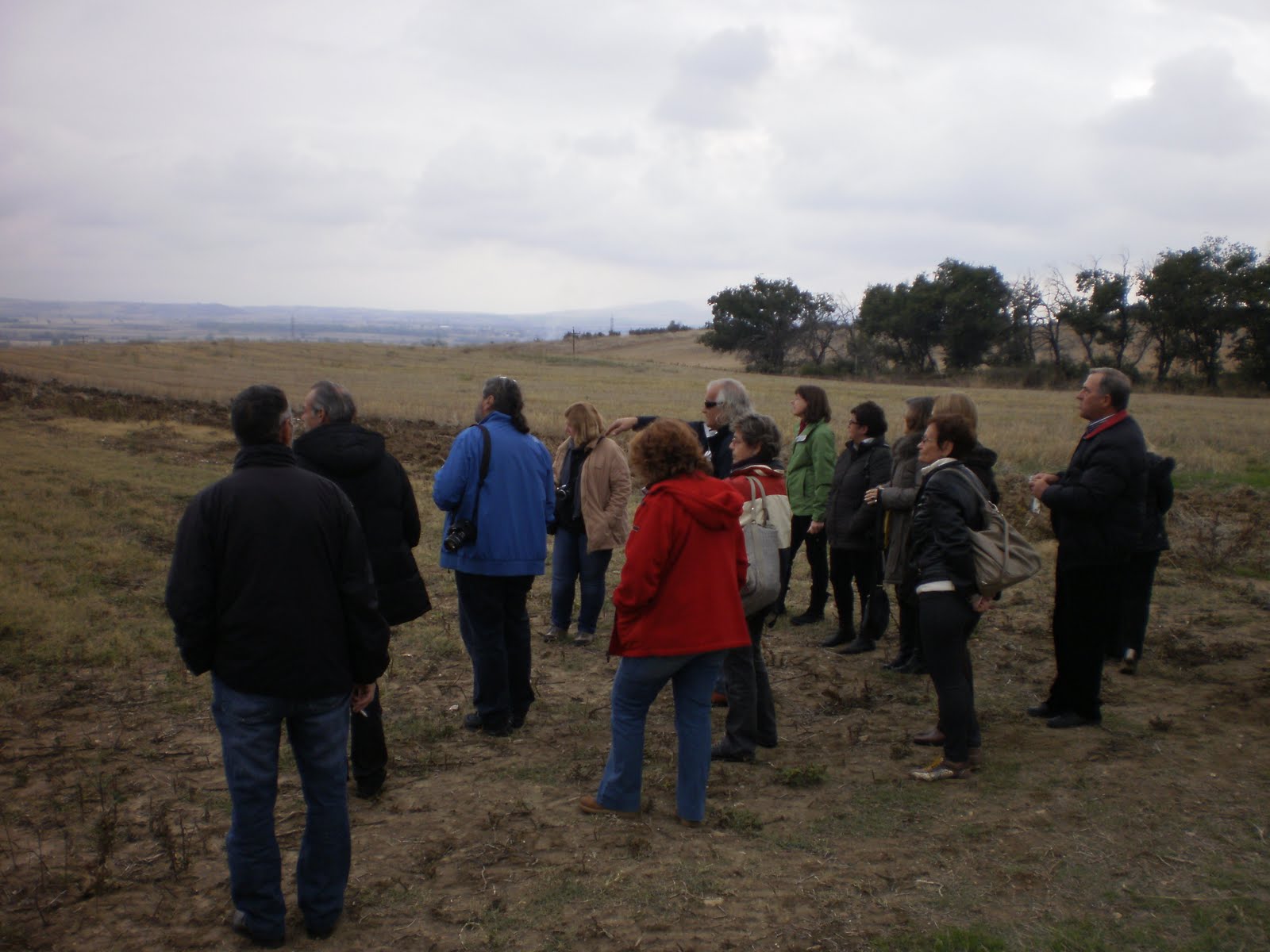
Civil society engagement constitutes the cornerstone of this initiative, transforming it from a purely technical infrastructure project into a living model of participatory governance that fully aligns with the values of the New European Bauhaus. This approach adopts Level 4 (Collaboration) on the participation scale, where the residents of Filiadona and Domokos act as co-creators and strategic partners. At the heart of this collaboration is the co-design of the 14.6km trail network with local "path-keepers"—shepherds, farmers, and elders—who guided the study team through the mountain's ancestral "invisible passages," ensuring that the scientific GIS mapping is rooted in authentic experiential knowledge. Simultaneously, the local community played a decisive role in the project’s cultural curation by collecting oral testimonies regarding the Titanomachy and the history of the 1930s primary school. This collective memory now forms the core content of the Reception Center’s three halls, transforming the building into a space that belongs organically to the community.
The impact of this deep involvement is structural, as it has fostered a powerful sense of local ownership, which serves as the best guarantee for the long-term protection and maintenance of both the trails and the building. The initiative has successfully reversed the narrative of social isolation and demographic decline by offering residents a new vision for the region based on the elevation of local heritage. Through active participation in decision-making—such as the strategic choice for the bioclimatic adaptive reuse of the school instead of new construction—citizens have been empowered to become ambassadors of change. The result is the creation of a socio-economic ecosystem where culture, education, and entrepreneurship interact, ensuring that the Geomythological Park is not a static intervention, but a sustainable and inclusive evolution of the local landscape.
The impact of this deep involvement is structural, as it has fostered a powerful sense of local ownership, which serves as the best guarantee for the long-term protection and maintenance of both the trails and the building. The initiative has successfully reversed the narrative of social isolation and demographic decline by offering residents a new vision for the region based on the elevation of local heritage. Through active participation in decision-making—such as the strategic choice for the bioclimatic adaptive reuse of the school instead of new construction—citizens have been empowered to become ambassadors of change. The result is the creation of a socio-economic ecosystem where culture, education, and entrepreneurship interact, ensuring that the Geomythological Park is not a static intervention, but a sustainable and inclusive evolution of the local landscape.
The initiative will function as a dynamic multi-level collaborative ecosystem, ensuring that local action aligns fully with European strategies for the green transition and social inclusion. At the local level, the Municipality of Domokos will serve as the institutional anchor, providing the legal framework for the bioclimatic adaptive reuse of the old school and the technical support for trail maintenance. Its involvement will be executive, ensuring the project is organically integrated into municipal development planning. At the regional level, collaboration with the Region of Central Greece and local tourism boards will aim to integrate the Geomythological Park into broader "green routes," increasing visibility and the area's attractiveness for sustainable investment.
At the national level, academic institutions and specialized scientists (geologists, architects, historians) will provide ongoing scientific validation, ensuring that the content within the Reception Center’s three halls meets national educational standards. Finally, at the European level, the initiative will connect with the New European Bauhaus network, functioning as a hub for exchanging best practices in rural revitalization.
The added value of this multi-level engagement will be the creation of economies of scale and the prevention of project isolation. This synergy will ensure that the initiative remains strategically aligned, scientifically sound, and economically viable. The result will be a project that preserves the "local soul" of Filiadona while incorporating the expertise and reach of a European landmark. This collaboration will transform the Park from a local trail into a replicable blueprint for showcasing geomythological heritage across Europe, proving that networking is the key to reversing rural abandonment.
At the national level, academic institutions and specialized scientists (geologists, architects, historians) will provide ongoing scientific validation, ensuring that the content within the Reception Center’s three halls meets national educational standards. Finally, at the European level, the initiative will connect with the New European Bauhaus network, functioning as a hub for exchanging best practices in rural revitalization.
The added value of this multi-level engagement will be the creation of economies of scale and the prevention of project isolation. This synergy will ensure that the initiative remains strategically aligned, scientifically sound, and economically viable. The result will be a project that preserves the "local soul" of Filiadona while incorporating the expertise and reach of a European landmark. This collaboration will transform the Park from a local trail into a replicable blueprint for showcasing geomythological heritage across Europe, proving that networking is the key to reversing rural abandonment.
The Othrys Geomythological Park initiative is being realized through a sophisticated transdisciplinary nexus, where Architecture, Earth Sciences (Geology), Humanities (Mythology and History), and Environmental Engineering converge to create a holistic landscape experience. Our methodology moves beyond traditional academic boundaries by establishing a "Living Lab" environment, where representatives from these diverse fields interact through integrated field workshops and co-design sessions. For instance, academic geologists and mythologists collaborate to "translate" the complex ophiolitic formations of Mount Othrys into the epic scenery of the Titanomachy. This synergy produces a unique educational product where scientific data is transformed into a sensory, myth-based journey for the visitor.Simultaneously, the architectural restoration of the 1930s primary school is a joint effort between heritage architects and environmental engineers. Their interaction focuses on bioclimatic adaptive reuse, prioritizing local materials and passive climate techniques to ensure that the three-hall Reception Center meets modern energy standards while preserving its historical identity. Digital designers further bridge these disciplines by developing QR-linked storytelling nodes along the 14.6km trail network, ensuring that scientific and mythological content is accessible and engaging for diverse audiences.
The strategic advantage of this interdisciplinary friction is the creation of a multifaceted educational and tourist landmark that is significantly greater than the sum of its individual parts. By merging scientific accuracy with artistic storytelling and sustainable design, the project caters equally to researchers, students, and hikers. The essential contribution of this "cross-fertilization" of knowledge lies in the fact that the Othrys Geomythological Park will function as a permanent center for rural innovation.
The strategic advantage of this interdisciplinary friction is the creation of a multifaceted educational and tourist landmark that is significantly greater than the sum of its individual parts. By merging scientific accuracy with artistic storytelling and sustainable design, the project caters equally to researchers, students, and hikers. The essential contribution of this "cross-fertilization" of knowledge lies in the fact that the Othrys Geomythological Park will function as a permanent center for rural innovation.
Geomythological Synthesis as an Educational Tool:
The primary innovation lies in the move away from traditional "passive" tourism toward "Interpretive Narrative Engineering." While mainstream practices usually separate natural sciences (Geology) from humanities (Mythology), our initiative uses the Titanomachy—the epic battle of the Titans—as a sophisticated framework to explain complex geological phenomena like tectonic plate movements and ophiolitic complexes. This transforms a hike into a "living classroom," making abstract scientific data emotionally resonant and accessible through the power of ancient storytelling.
Radical Adaptive Reuse vs. New Construction:
In contrast to mainstream rural development, which often relies on intrusive, modern "visitor centers" that can disrupt the landscape, our innovation is rooted in Bio-Climatic Heritage Preservation. By repurposing the 1930s schoolhouse using a "low-tech/high-performance" approach, we demonstrate how historic rural architecture can be upgraded to modern energy standards using local materials (lime, stone, wood) rather than industrial solutions. This serves as a technical pilot for the circular revitalization of dormant building stock across the Mediterranean.
Minimal Footprint Connectivity:
Unlike mainstream "adventure parks" that often scar the land with new infrastructure, our innovative methodology treats the existing forest roads as a pre-designed asset. By "curating" 14.6km of ancestral agricultural paths and riverside trails with digital storytelling and subtle, eco-friendly physical markers, we achieve high-value cultural branding with near-zero land disturbance. We prove that the "Mountain of the Titans" can become a world-class destination not through what we build, but through how we re-interpret and respect what is already there.
The primary innovation lies in the move away from traditional "passive" tourism toward "Interpretive Narrative Engineering." While mainstream practices usually separate natural sciences (Geology) from humanities (Mythology), our initiative uses the Titanomachy—the epic battle of the Titans—as a sophisticated framework to explain complex geological phenomena like tectonic plate movements and ophiolitic complexes. This transforms a hike into a "living classroom," making abstract scientific data emotionally resonant and accessible through the power of ancient storytelling.
Radical Adaptive Reuse vs. New Construction:
In contrast to mainstream rural development, which often relies on intrusive, modern "visitor centers" that can disrupt the landscape, our innovation is rooted in Bio-Climatic Heritage Preservation. By repurposing the 1930s schoolhouse using a "low-tech/high-performance" approach, we demonstrate how historic rural architecture can be upgraded to modern energy standards using local materials (lime, stone, wood) rather than industrial solutions. This serves as a technical pilot for the circular revitalization of dormant building stock across the Mediterranean.
Minimal Footprint Connectivity:
Unlike mainstream "adventure parks" that often scar the land with new infrastructure, our innovative methodology treats the existing forest roads as a pre-designed asset. By "curating" 14.6km of ancestral agricultural paths and riverside trails with digital storytelling and subtle, eco-friendly physical markers, we achieve high-value cultural branding with near-zero land disturbance. We prove that the "Mountain of the Titans" can become a world-class destination not through what we build, but through how we re-interpret and respect what is already there.
Our methodology is structured around a multi-layered integration strategy that bridges architectural restoration with territorial management. Instead of treating the building and the mountain as separate entities, we apply a unified approach.
Transdisciplinary Narrative Engineering: We utilize a "cross-mapping" technique where geological data (tectonics, ophiolite complexes) are superimposed onto the mythological cartography of the Titanomachy. This creates a dual-layer interpretive framework that dictates the placement of every information node and rest area along the 14.6km network, ensuring that the visitor’s physical journey follows a logical scientific and mythic sequence.
Adaptive Bio-Climatic Restoration: The transformation of the 1930s school follows a "Deep Heritage" protocol. Beyond mere aesthetics, we focus on the building’s thermal and structural performance using only local, traditional materials (stone, lime, wood). This methodology serves as a practical demonstration of how historic rural shells can reach modern energy standards without losing their cultural soul, acting as a technical pilot for the region.
Active Citizenship & Co-Design: We move beyond simple consultation to Co-Creation. We conduct field workshops with local "path-keepers" (shepherds and elders) to validate the trail network, ensuring it aligns with historical land-use patterns. This "Bottom-Up" governance ensures that the Park is integrated into the daily life of the community, fostering long-term social sustainability and local guardianship.
This approach is exemplary because it treats rural development as an interconnected ecosystem. By merging scientific rigor with local oral tradition and heritage architecture, we create a high-value "knowledge landscape" .
Transdisciplinary Narrative Engineering: We utilize a "cross-mapping" technique where geological data (tectonics, ophiolite complexes) are superimposed onto the mythological cartography of the Titanomachy. This creates a dual-layer interpretive framework that dictates the placement of every information node and rest area along the 14.6km network, ensuring that the visitor’s physical journey follows a logical scientific and mythic sequence.
Adaptive Bio-Climatic Restoration: The transformation of the 1930s school follows a "Deep Heritage" protocol. Beyond mere aesthetics, we focus on the building’s thermal and structural performance using only local, traditional materials (stone, lime, wood). This methodology serves as a practical demonstration of how historic rural shells can reach modern energy standards without losing their cultural soul, acting as a technical pilot for the region.
Active Citizenship & Co-Design: We move beyond simple consultation to Co-Creation. We conduct field workshops with local "path-keepers" (shepherds and elders) to validate the trail network, ensuring it aligns with historical land-use patterns. This "Bottom-Up" governance ensures that the Park is integrated into the daily life of the community, fostering long-term social sustainability and local guardianship.
This approach is exemplary because it treats rural development as an interconnected ecosystem. By merging scientific rigor with local oral tradition and heritage architecture, we create a high-value "knowledge landscape" .
The Othrys Geomythological Park has been designed as a model system (blueprint) whose methodology can be replicated in other regions with similar geographical and demographic characteristics. The key elements that allow for scaling and transferability include:
1. Participatory Co-design Methodology: The process of identifying "invisible passages" through local "path-keepers" (shepherds and farmers) represents a highly transferable practice for any mountainous community seeking to develop a trail network. This ensures project acceptance and long-term stewardship by the local society itself.
2. Interpretive Narrative Engineering Model: The technique of merging scientific data (Geology) with local mythology and tradition (The Titanomachy) can be applied to any site with unique geomorphological or historical features. This model transforms a simple path into an "immersive learning experience," offering a ready-to-use framework for specialized thematic tourism.
3. Bioclimatic Adaptive Reuse of Heritage Buildings: The restoration protocol of the 1930s schoolhouse—combining historical preservation with passive energy upgrade techniques—serves as a guide for revitalizing abandoned public buildings in the European countryside, turning them into multifunctional community hubs.
4. Digital Management & Smart Branding: The deployment of QR-linked on-site storytelling and the creation of a "Local Quality Label" for regional products are immediately transferable tools. These allow small communities to achieve international visibility and extroversion with low infrastructure costs.
The strategic advantage of this initiative is that it offers a comprehensive "Replicability Guide" for reversing rural abandonment. It proves that the convergence of New European Bauhaus values with local identity can create sustainable economic ecosystems anywhere in Europe.
1. Participatory Co-design Methodology: The process of identifying "invisible passages" through local "path-keepers" (shepherds and farmers) represents a highly transferable practice for any mountainous community seeking to develop a trail network. This ensures project acceptance and long-term stewardship by the local society itself.
2. Interpretive Narrative Engineering Model: The technique of merging scientific data (Geology) with local mythology and tradition (The Titanomachy) can be applied to any site with unique geomorphological or historical features. This model transforms a simple path into an "immersive learning experience," offering a ready-to-use framework for specialized thematic tourism.
3. Bioclimatic Adaptive Reuse of Heritage Buildings: The restoration protocol of the 1930s schoolhouse—combining historical preservation with passive energy upgrade techniques—serves as a guide for revitalizing abandoned public buildings in the European countryside, turning them into multifunctional community hubs.
4. Digital Management & Smart Branding: The deployment of QR-linked on-site storytelling and the creation of a "Local Quality Label" for regional products are immediately transferable tools. These allow small communities to achieve international visibility and extroversion with low infrastructure costs.
The strategic advantage of this initiative is that it offers a comprehensive "Replicability Guide" for reversing rural abandonment. It proves that the convergence of New European Bauhaus values with local identity can create sustainable economic ecosystems anywhere in Europe.
So far, the initiative has moved from conceptualization to a "Living Lab" model. The NEB values are already embedded in the preparatory phase: Sustainability through the decision for zero-new-build infrastructure; Aesthetics by selecting trails that showcase the dramatic geological "sculptures" of Othrys; and Inclusion by involving local elders and the Municipality in the initial mapping. We have shifted the focus from a "project for the community" to a "project by the community."
Restoration Phase (Sustainability & Aesthetics): The immediate next step is the bio-climatic upgrade of the 1930s school. Activities include using local stonemasons to restore the masonry and installing non-intrusive, energy-efficient lighting and heating. This step acts as a "demonstrator" of how heritage can meet the Green Deal.
Thematic Trail "Curating" (Aesthetics & Science): Instead of heavy construction, activities focus on "light-touch" signage and digital storytelling nodes. We will install low-impact, weather-resistant markers at the 14.6km trail's key "Titanomachy" viewpoints, providing QR-linked geological data.
Capacity Building (Inclusion & Participation): We have planned workshops to train local residents as "Geomythological Guides." This ensures that the economic benefits of the park stay within the village and that the narrative remains authentic.
Open-Source Toolkit Development (Transferability): A key step is documenting our "Low-Tech/High-Narrative" methodology into a digital toolkit. This will allow other remote Mediterranean communities to replicate the Othrys model.
The implementation follows a transdisciplinary approach, bringing together geologists, architects, and local storytellers. By maintaining a multi-level engagement (local, regional, and soon, European visitors), we ensure the initiative evolves from a local path into a sustainable, inclusive, and beautiful European cultural landmark.
Restoration Phase (Sustainability & Aesthetics): The immediate next step is the bio-climatic upgrade of the 1930s school. Activities include using local stonemasons to restore the masonry and installing non-intrusive, energy-efficient lighting and heating. This step acts as a "demonstrator" of how heritage can meet the Green Deal.
Thematic Trail "Curating" (Aesthetics & Science): Instead of heavy construction, activities focus on "light-touch" signage and digital storytelling nodes. We will install low-impact, weather-resistant markers at the 14.6km trail's key "Titanomachy" viewpoints, providing QR-linked geological data.
Capacity Building (Inclusion & Participation): We have planned workshops to train local residents as "Geomythological Guides." This ensures that the economic benefits of the park stay within the village and that the narrative remains authentic.
Open-Source Toolkit Development (Transferability): A key step is documenting our "Low-Tech/High-Narrative" methodology into a digital toolkit. This will allow other remote Mediterranean communities to replicate the Othrys model.
The implementation follows a transdisciplinary approach, bringing together geologists, architects, and local storytellers. By maintaining a multi-level engagement (local, regional, and soon, European visitors), we ensure the initiative evolves from a local path into a sustainable, inclusive, and beautiful European cultural landmark.