Enhancing Circularity, Sustainability, and Innovation
SOLAI
SOLAI - Drone Roof Measurement for Installations
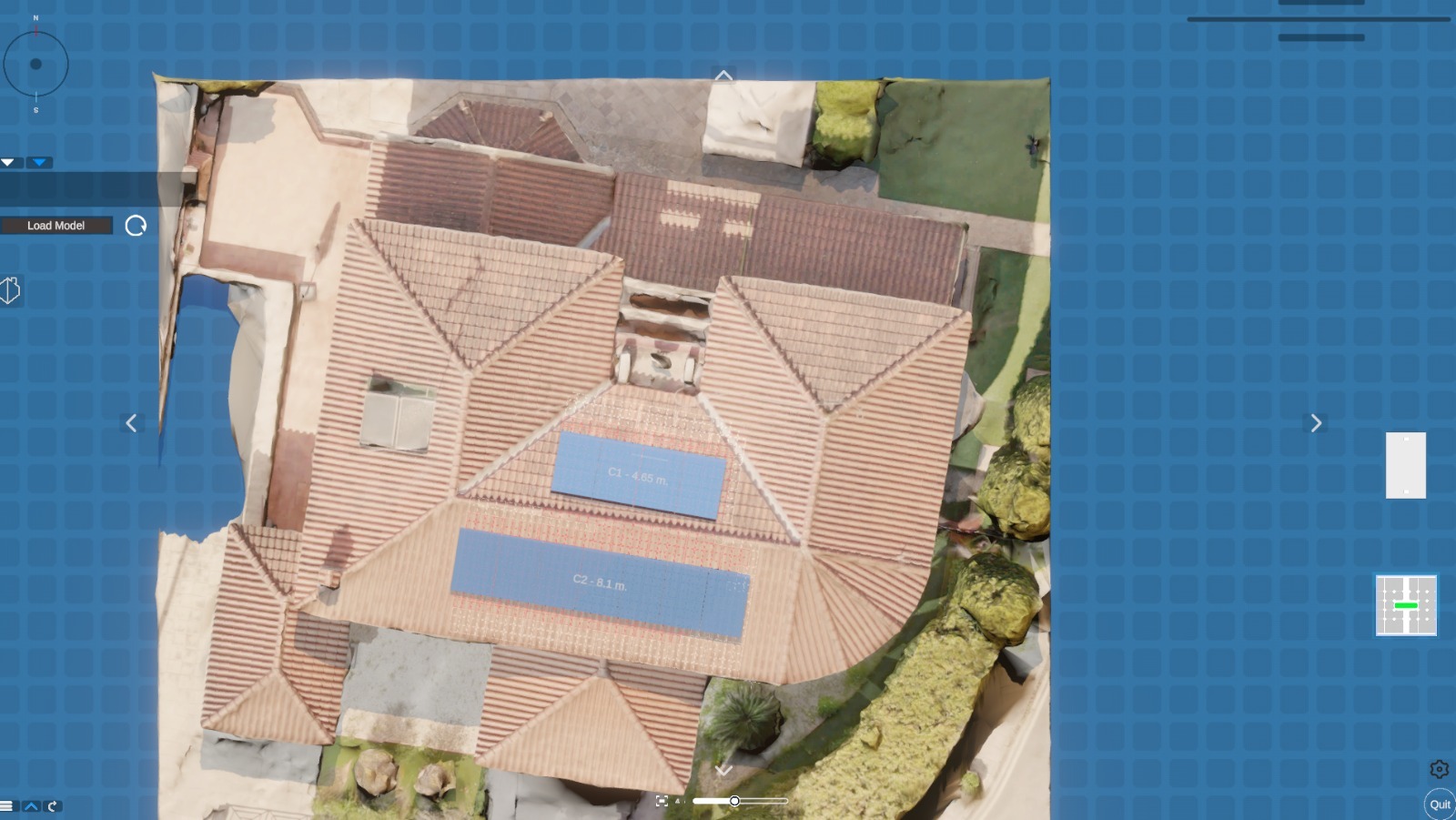
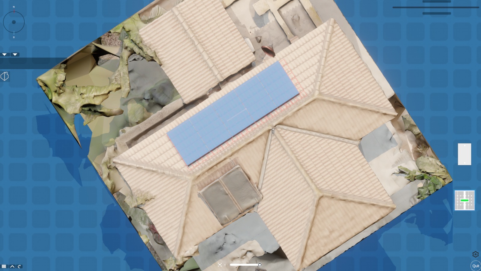
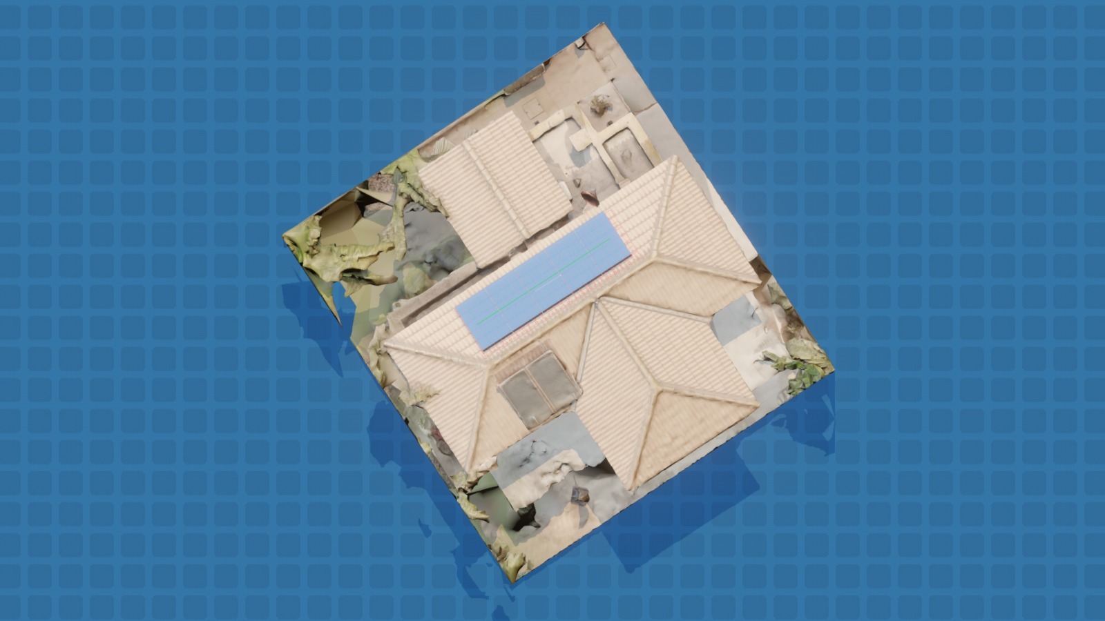
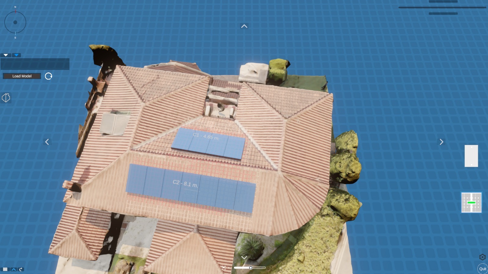
Measuring a rooftop means climbing it, until now. Our AI-powered drone scans rooftops in minutes, producing precise measurements for solar installations, surveys, and any rooftop project without a single person leaving the ground. Faster, safer, and more accurate than traditional methods, it eliminates the risk of falls, reduces costs, and enables perfectly optimised, symmetrical installations on any rooftop.
Cyprus
National
Mainly urban
It involves a physical transformation of the built environment (hard investment)
Prototype level
No
No
No
Organisation
Rooftop installations are among the most common projects in residential construction and among the most accident-prone. Manual measurement requires trained professionals to physically access rooftops, spending up to 40 minutes per site navigating safety protocols, setting up equipment, and taking measurements that are still vulnerable to human error. For installers working across dozens of sites weekly, this time and risk compounds significantly.
Our AI-powered drone roof mapping system replaces this process entirely. A single operator lifts off from street level, completes a precision scan of any rooftop in under seven minutes, and receives measurements of greater accuracy than any manual approach with zero physical risk to any person.
The primary beneficiaries are solar panel installers, rooftop surveyors, architects, and building contractors across Cyprus and Europe. But the impact extends further. Homeowners benefit from faster project delivery and lower costs, while communities gain rooftop installations that are optimally planned rather than approximated by hand.
The prototype is fully functional and has been validated across multiple real project sites. Third-party professionals from our installer network are actively testing the system on live jobs, feeding structured performance data back into ongoing development iterations.
A particularly significant application has emerged through early discussions with the Municipality of Nicosia, using the drone to survey and plan solar installations on protected historic buildings, structures where traditional access methods risk physical damage to irreplaceable facades and surfaces. This use case demonstrates the system's unique value in contexts where conventional surveying is not just inefficient, but genuinely harmful.
The concept is ready to move from validated prototype to commercial service within the year ahead.
Our AI-powered drone roof mapping system replaces this process entirely. A single operator lifts off from street level, completes a precision scan of any rooftop in under seven minutes, and receives measurements of greater accuracy than any manual approach with zero physical risk to any person.
The primary beneficiaries are solar panel installers, rooftop surveyors, architects, and building contractors across Cyprus and Europe. But the impact extends further. Homeowners benefit from faster project delivery and lower costs, while communities gain rooftop installations that are optimally planned rather than approximated by hand.
The prototype is fully functional and has been validated across multiple real project sites. Third-party professionals from our installer network are actively testing the system on live jobs, feeding structured performance data back into ongoing development iterations.
A particularly significant application has emerged through early discussions with the Municipality of Nicosia, using the drone to survey and plan solar installations on protected historic buildings, structures where traditional access methods risk physical damage to irreplaceable facades and surfaces. This use case demonstrates the system's unique value in contexts where conventional surveying is not just inefficient, but genuinely harmful.
The concept is ready to move from validated prototype to commercial service within the year ahead.
The idea did not come from a laboratory or a technology brief. It came from a problem our own installation teams lived with daily.
As a company with deep roots in residential solar installation, we observed the same friction point on every project. Before a single panel could be planned or priced, someone had to climb the roof. Safety harnesses, access equipment, two-person teams, lost hours. On complex or multi-pitch rooftops, measurements still came back with errors that required costly return visits. The inefficiency was accepted as simply the cost of doing business, until we asked whether it had to be.
The answer began with a question to our drone specialist: "Could a drone do this better?" The initial answer was yes but only with the right software. That conversation marked the start of a focused development process.
Phase one was problem definition. Our installation teams documented the specific data points needed for accurate rooftop surveys: pitch angles, surface dimensions, obstacle positions, orientation, providing the software engineers with a precise brief grounded in real-world installation requirements rather than theoretical specifications.
Phase two was software development. Engineers built and iteratively refined the scanning and measurement algorithms, running test flights against manually measured benchmarks to validate accuracy at each stage. Aerospace legal experts were consulted in parallel to map the regulatory framework for drone operation over residential rooftops across different jurisdictions.
Phase three was field testing. The prototype was taken to real project sites, operated alongside our installer network, and subjected to structured performance evaluation. Results consistently outperformed manual benchmarks on both speed and measurement precision.
The development process was deliberately kept close to the field, driven by practitioners, validated by practitioners, and refined through their ongoing feedback.
As a company with deep roots in residential solar installation, we observed the same friction point on every project. Before a single panel could be planned or priced, someone had to climb the roof. Safety harnesses, access equipment, two-person teams, lost hours. On complex or multi-pitch rooftops, measurements still came back with errors that required costly return visits. The inefficiency was accepted as simply the cost of doing business, until we asked whether it had to be.
The answer began with a question to our drone specialist: "Could a drone do this better?" The initial answer was yes but only with the right software. That conversation marked the start of a focused development process.
Phase one was problem definition. Our installation teams documented the specific data points needed for accurate rooftop surveys: pitch angles, surface dimensions, obstacle positions, orientation, providing the software engineers with a precise brief grounded in real-world installation requirements rather than theoretical specifications.
Phase two was software development. Engineers built and iteratively refined the scanning and measurement algorithms, running test flights against manually measured benchmarks to validate accuracy at each stage. Aerospace legal experts were consulted in parallel to map the regulatory framework for drone operation over residential rooftops across different jurisdictions.
Phase three was field testing. The prototype was taken to real project sites, operated alongside our installer network, and subjected to structured performance evaluation. Results consistently outperformed manual benchmarks on both speed and measurement precision.
The development process was deliberately kept close to the field, driven by practitioners, validated by practitioners, and refined through their ongoing feedback.
Rooftop precision mapping
Construction safety innovation
AI-powered surveying
Heritage-sensitive installation
Inclusive green infrastructure
The sustainability case for drone roof mapping operates at two levels: the direct environmental contribution of optimised installations, and the broader systemic impact of making sustainable infrastructure projects faster, cheaper, and more accessible.
At the installation level, the drone's precision directly improves the environmental performance of every rooftop project it serves. When solar panel systems are planned using accurate, high-resolution scan data rather than manual approximations, they can be positioned for maximum sun exposure, optimal airflow, and interference-free operation. Poorly planned installations, a common result of measurement error, under-perform throughout their entire lifespan, wasting the embodied carbon of both the panels and the installation process itself. Precision planning, enabled by the drone, closes this gap before the first panel is ever mounted.
At the process level, replacing manual rooftop surveys with a seven-minute drone flight eliminates a significant source of project-related carbon expenditure: the additional site visits, vehicle journeys, and wasted labour hours generated by measurement errors and repeat access requirements. Across thousands of installations annually, this reduction compounds meaningfully.
The Nicosia Municipality application adds a further sustainability dimension: enabling solar energy to reach protected historic buildings that have previously been excluded from the green transition due to access constraints. These buildings represent some of the densest and most energy-intensive urban environments in Cyprus. Unlocking their rooftops for solar planning without physical contact or risk of damage extends the reach of renewable energy into urban fabric that would otherwise remain dependent on grid electricity.
What makes this concept exemplary is that it improves sustainability outcomes by improving the quality of decisions made before any technology is installed.
At the installation level, the drone's precision directly improves the environmental performance of every rooftop project it serves. When solar panel systems are planned using accurate, high-resolution scan data rather than manual approximations, they can be positioned for maximum sun exposure, optimal airflow, and interference-free operation. Poorly planned installations, a common result of measurement error, under-perform throughout their entire lifespan, wasting the embodied carbon of both the panels and the installation process itself. Precision planning, enabled by the drone, closes this gap before the first panel is ever mounted.
At the process level, replacing manual rooftop surveys with a seven-minute drone flight eliminates a significant source of project-related carbon expenditure: the additional site visits, vehicle journeys, and wasted labour hours generated by measurement errors and repeat access requirements. Across thousands of installations annually, this reduction compounds meaningfully.
The Nicosia Municipality application adds a further sustainability dimension: enabling solar energy to reach protected historic buildings that have previously been excluded from the green transition due to access constraints. These buildings represent some of the densest and most energy-intensive urban environments in Cyprus. Unlocking their rooftops for solar planning without physical contact or risk of damage extends the reach of renewable energy into urban fabric that would otherwise remain dependent on grid electricity.
What makes this concept exemplary is that it improves sustainability outcomes by improving the quality of decisions made before any technology is installed.
The aesthetic contribution of drone roof mapping is perhaps the most underappreciated aspect of the concept, yet it is one of its most consequential.
Every rooftop installation is a visible feature of the built environment. Solar panels, water deposits, satellite dishes, and ventilation systems are seen from street level, from neighbouring buildings, and from public spaces every day. When these installations are planned using imprecise manual measurements, the result is often asymmetrical, misaligned, or spatially inefficient layouts that detract from the visual quality of both the individual building and the street it belongs to.
Drone mapping changes the starting conditions of every installation. With millimetre-accurate scan data, installers can plan layouts that are geometrically precise, symmetrically balanced, and spatially optimised for the specific rooftop in question. The difference between a haphazardly arranged panel array and one that has been precisely planned to fill a rooftop in clean, ordered rows is immediately visible and permanent.
Beyond individual rooftops, there is a neighbourhood-level aesthetic impact. Manual surveying requires visible crews, safety equipment, and access structures on rooftops, sometimes on multiple occasions if measurements need verification. This presence turns residential streets temporarily into building sites. Drone surveying eliminates this entirely: a single operator, a single flight, no scaffolding, no disruption, no visual intrusion into the neighbourhood during the planning phase.
For historic and heritage buildings, where the Municipality of Nicosia has expressed direct interest, the aesthetic stakes are highest. The drone's ability to survey without physical contact preserves not only the structural integrity of protected facades, but also the uninterrupted visual character of historic streetscapes that define the cultural identity of entire communities.
Every rooftop installation is a visible feature of the built environment. Solar panels, water deposits, satellite dishes, and ventilation systems are seen from street level, from neighbouring buildings, and from public spaces every day. When these installations are planned using imprecise manual measurements, the result is often asymmetrical, misaligned, or spatially inefficient layouts that detract from the visual quality of both the individual building and the street it belongs to.
Drone mapping changes the starting conditions of every installation. With millimetre-accurate scan data, installers can plan layouts that are geometrically precise, symmetrically balanced, and spatially optimised for the specific rooftop in question. The difference between a haphazardly arranged panel array and one that has been precisely planned to fill a rooftop in clean, ordered rows is immediately visible and permanent.
Beyond individual rooftops, there is a neighbourhood-level aesthetic impact. Manual surveying requires visible crews, safety equipment, and access structures on rooftops, sometimes on multiple occasions if measurements need verification. This presence turns residential streets temporarily into building sites. Drone surveying eliminates this entirely: a single operator, a single flight, no scaffolding, no disruption, no visual intrusion into the neighbourhood during the planning phase.
For historic and heritage buildings, where the Municipality of Nicosia has expressed direct interest, the aesthetic stakes are highest. The drone's ability to survey without physical contact preserves not only the structural integrity of protected facades, but also the uninterrupted visual character of historic streetscapes that define the cultural identity of entire communities.
Access to professional-grade surveying technology has historically been shaped by scale. Large construction firms and commercial developers can absorb the cost of specialist equipment and trained surveying teams as a standard line item. For smaller contractors, independent installers, and community-led projects, the same capability has been either unaffordable or logistically inaccessible.
This inequity has a direct knock-on effect for homeowners and communities: smaller installers either pass survey costs onto customers, invest less time in accurate planning, or rely on approximations that compromise the quality of the final installation. The households most likely to be served by small, local installers, often in less affluent or more rural communities, absorb the consequences of this resource gap.
Our drone service addresses this structural imbalance by providing professional-grade rooftop survey capability at a price point set at no more than 60% of existing surveying service costs. This is not a marginal discount. It is a fundamental repricing of access to precision. A small solar installer operating independently, a community housing association planning a shared rooftop system, or a local contractor working on a tight residential budget can all access the same quality of survey data as a large commercial operator.
The pricing model is also structured to accommodate different client profiles: a pay-per-survey service model removes the need for any capital investment from the installer, while a software licensing option provides higher-volume operators with a cost-efficient route to integrating the capability into their own operations.
Inclusion here is not only economic, it is technical. By democratising access to precision measurement, the drone levels the quality floor for rooftop installations across all scales, geographies, and installer profiles.
This inequity has a direct knock-on effect for homeowners and communities: smaller installers either pass survey costs onto customers, invest less time in accurate planning, or rely on approximations that compromise the quality of the final installation. The households most likely to be served by small, local installers, often in less affluent or more rural communities, absorb the consequences of this resource gap.
Our drone service addresses this structural imbalance by providing professional-grade rooftop survey capability at a price point set at no more than 60% of existing surveying service costs. This is not a marginal discount. It is a fundamental repricing of access to precision. A small solar installer operating independently, a community housing association planning a shared rooftop system, or a local contractor working on a tight residential budget can all access the same quality of survey data as a large commercial operator.
The pricing model is also structured to accommodate different client profiles: a pay-per-survey service model removes the need for any capital investment from the installer, while a software licensing option provides higher-volume operators with a cost-efficient route to integrating the capability into their own operations.
Inclusion here is not only economic, it is technical. By democratising access to precision measurement, the drone levels the quality floor for rooftop installations across all scales, geographies, and installer profiles.
The development of this concept has been shaped at every stage by the professionals who will use it and the communities who will benefit from it.
The founding insight came from within our own installation teams: practitioners who articulated the daily friction of manual rooftop surveying from direct experience. Their input did not just identify the problem; it defined the functional requirements. Installation teams documented the specific measurement data points needed for accurate solar planning, giving software engineers a brief rooted in real operational needs rather than assumed specifications. This practitioner-led briefing was the single most important input into the technical development process.
As the prototype evolved, it was taken directly into the field with third-party installers from our professional network. These were not passive observers. They operated the system on live project sites, compared its outputs against their own manual measurements, and provided structured feedback that drove iterative refinements to both the hardware configuration and the software algorithms. Their involvement transformed the prototype from a technically functional tool into one calibrated to actual professional workflows.
At the community level, the engagement with the Municipality of Nicosia represents a different but equally important form of participation. City planners and heritage officers contributed their knowledge of the specific challenges posed by historic building surveying: constraints, sensitivities, and requirements that no amount of technical development could have anticipated without direct dialogue. Their involvement has opened an entirely new application context for the concept and confirmed its relevance to urban sustainability planning at a civic level.
The concept is stronger, more precise, and more broadly applicable because of the people who helped shape it.
The founding insight came from within our own installation teams: practitioners who articulated the daily friction of manual rooftop surveying from direct experience. Their input did not just identify the problem; it defined the functional requirements. Installation teams documented the specific measurement data points needed for accurate solar planning, giving software engineers a brief rooted in real operational needs rather than assumed specifications. This practitioner-led briefing was the single most important input into the technical development process.
As the prototype evolved, it was taken directly into the field with third-party installers from our professional network. These were not passive observers. They operated the system on live project sites, compared its outputs against their own manual measurements, and provided structured feedback that drove iterative refinements to both the hardware configuration and the software algorithms. Their involvement transformed the prototype from a technically functional tool into one calibrated to actual professional workflows.
At the community level, the engagement with the Municipality of Nicosia represents a different but equally important form of participation. City planners and heritage officers contributed their knowledge of the specific challenges posed by historic building surveying: constraints, sensitivities, and requirements that no amount of technical development could have anticipated without direct dialogue. Their involvement has opened an entirely new application context for the concept and confirmed its relevance to urban sustainability planning at a civic level.
The concept is stronger, more precise, and more broadly applicable because of the people who helped shape it.
The drone roof mapping concept has engaged stakeholders across local, national, and European levels, each contributing a distinct and non-substitutable form of value to the project's development and future trajectory.
At the local level, the Municipality of Nicosia has been a key engagement partner. City officials and heritage planners have participated in discussions about applying the drone to survey protected historic buildings for solar installation planning, a challenge that sits at the intersection of urban sustainability, cultural heritage protection, and renewable energy policy. This municipal engagement has provided the project with a concrete, high-profile institutional use case, and positions the technology within the context of Cyprus's urban transformation agenda.
At the professional and sectoral level, a network of independent solar installers and rooftop contractors across Cyprus has been involved in field testing. These professionals operate at the frontline of the residential built environment, and their active participation in validation and feedback processes ensures the concept is grounded in the realities of everyday construction practice, not just theoretical performance.
At the European level, the regulatory landscape for commercial drone operations has been navigated through consultation with aerospace legal specialists familiar with EU drone operation frameworks. This engagement ensures the concept is developed in full compliance with EU airspace regulations, positioning it for straightforward deployment across member states without requiring country-by-country legal reinvention.
Together, these three levels of engagement create a project that is locally anchored, professionally validated, and scalable across Europe, combining civic legitimacy, practitioner credibility, and regulatory readiness into a concept that is genuinely prepared for real-world implementation.
At the local level, the Municipality of Nicosia has been a key engagement partner. City officials and heritage planners have participated in discussions about applying the drone to survey protected historic buildings for solar installation planning, a challenge that sits at the intersection of urban sustainability, cultural heritage protection, and renewable energy policy. This municipal engagement has provided the project with a concrete, high-profile institutional use case, and positions the technology within the context of Cyprus's urban transformation agenda.
At the professional and sectoral level, a network of independent solar installers and rooftop contractors across Cyprus has been involved in field testing. These professionals operate at the frontline of the residential built environment, and their active participation in validation and feedback processes ensures the concept is grounded in the realities of everyday construction practice, not just theoretical performance.
At the European level, the regulatory landscape for commercial drone operations has been navigated through consultation with aerospace legal specialists familiar with EU drone operation frameworks. This engagement ensures the concept is developed in full compliance with EU airspace regulations, positioning it for straightforward deployment across member states without requiring country-by-country legal reinvention.
Together, these three levels of engagement create a project that is locally anchored, professionally validated, and scalable across Europe, combining civic legitimacy, practitioner credibility, and regulatory readiness into a concept that is genuinely prepared for real-world implementation.
The drone roof mapping concept emerged from the intersection of fields that rarely share a design table and its defining qualities are the direct result of that intersection.
Drone technology and aerospace expertise provided the physical platform. The drone specialist contributed not only technical knowledge of flight systems, but operational constraints: wind tolerance, battery cycles, and flight path planning.
Software engineering translated physical capability into analytical value. Engineers developed the AI-powered algorithms that convert raw aerial data into precise, actionable measurements through close, iterative dialogue with installation teams who defined what useful measurement data actually means in practice.
Aerospace legal expertise introduced the regulatory dimension. Specialists mapped the EU and national frameworks governing commercial drone operations over residential rooftops, ensuring every design decision was compliance-ready across jurisdictions from the outset, not retrofitted after the fact.
Installation professionals and rooftop contractors contributed domain knowledge that no technical discipline alone could provide: the specific data points needed for accurate solar planning, the common failure modes of manual measurement, and the workflow constraints of a working installation team on a live project site.
Urban planning and heritage conservation entered through the Municipality of Nicosia engagement, introducing entirely new requirements around non-contact surveying of protected structures, requirements that pushed the software team to refine precision tolerances beyond what standard installation use cases demanded.
The result is a concept whose technical, legal, professional, and civic dimensions are genuinely integrated, each discipline having shaped the others in ways that produced a stronger, more broadly applicable outcome than any single field could have delivered alone.
Drone technology and aerospace expertise provided the physical platform. The drone specialist contributed not only technical knowledge of flight systems, but operational constraints: wind tolerance, battery cycles, and flight path planning.
Software engineering translated physical capability into analytical value. Engineers developed the AI-powered algorithms that convert raw aerial data into precise, actionable measurements through close, iterative dialogue with installation teams who defined what useful measurement data actually means in practice.
Aerospace legal expertise introduced the regulatory dimension. Specialists mapped the EU and national frameworks governing commercial drone operations over residential rooftops, ensuring every design decision was compliance-ready across jurisdictions from the outset, not retrofitted after the fact.
Installation professionals and rooftop contractors contributed domain knowledge that no technical discipline alone could provide: the specific data points needed for accurate solar planning, the common failure modes of manual measurement, and the workflow constraints of a working installation team on a live project site.
Urban planning and heritage conservation entered through the Municipality of Nicosia engagement, introducing entirely new requirements around non-contact surveying of protected structures, requirements that pushed the software team to refine precision tolerances beyond what standard installation use cases demanded.
The result is a concept whose technical, legal, professional, and civic dimensions are genuinely integrated, each discipline having shaped the others in ways that produced a stronger, more broadly applicable outcome than any single field could have delivered alone.
The drone roof mapping concept is currently self-funded through Eletoyia Group Ltd, with development costs absorbed as a strategic innovation investment. No external grants or public funding have been received to date, reflecting confidence in the concept's commercial viability and the company's commitment to seeing it through to market.
The envisioned revenue model operates across two complementary channels, designed to serve different client profiles and maximise market penetration.
The primary channel is a professional service offering to client such as solar installers, surveyors, architects, and contractors. They will commission a drone survey on a per-project basis, paying a service fee set at no more than 60% of the cost of equivalent traditional surveying services. This model requires no capital investment from the client, making it immediately accessible to small and independent operators who represent the majority of the residential installation market.
The secondary channel is a software licensing model targeting drone operators who already work within construction, surveying, or installation businesses. Rather than purchasing a service, these clients license the scanning and measurement software to deploy on their own drone hardware, generating recurring subscription revenue for the company while enabling partners to internalise the capability and offer it as part of their own service proposition.
As volume grows, both channels create compounding revenue streams: the service model scales with the number of installations in target markets, while the licensing model generates passive recurring income with low marginal cost. Together, they position the concept for financial sustainability without dependence on public funding, while preserving flexibility to adapt the model to market preferences as the concept matures commercially.
The envisioned revenue model operates across two complementary channels, designed to serve different client profiles and maximise market penetration.
The primary channel is a professional service offering to client such as solar installers, surveyors, architects, and contractors. They will commission a drone survey on a per-project basis, paying a service fee set at no more than 60% of the cost of equivalent traditional surveying services. This model requires no capital investment from the client, making it immediately accessible to small and independent operators who represent the majority of the residential installation market.
The secondary channel is a software licensing model targeting drone operators who already work within construction, surveying, or installation businesses. Rather than purchasing a service, these clients license the scanning and measurement software to deploy on their own drone hardware, generating recurring subscription revenue for the company while enabling partners to internalise the capability and offer it as part of their own service proposition.
As volume grows, both channels create compounding revenue streams: the service model scales with the number of installations in target markets, while the licensing model generates passive recurring income with low marginal cost. Together, they position the concept for financial sustainability without dependence on public funding, while preserving flexibility to adapt the model to market preferences as the concept matures commercially.
The drone roof mapping concept is among the most inherently transferable innovations in this application, because the problem it solves is not unique to Cyprus. Every country with a residential rooftop installation market faces the same inefficiency: manual measurement, physical risk, human error, and the costs they generate.
The core technology, the AI-powered scanning software and the measurement methodology, requires no physical adaptation to operate in different geographies. A rooftop in Athens, Milan, or Amsterdam presents the same geometric challenge as one in Nicosia. The software processes it identically.
The expansion strategy is designed to leverage existing relationships rather than build from scratch in each new market. Our solar installer network provides a natural and trusted channel for market entry: installers who have tested and validated the system in Cyprus become advocates and early adopters in their own regional networks as the concept scales to Greece and beyond. This installer-led expansion model significantly reduces the cost and time of market entry while ensuring the technology is introduced through practitioners who already understand its value.
Beyond the solar sector, the concept's applicability to any rooftop installation such as water systems, HVAC, telecommunications, and heritage conservation surveying. Each new market entered can be expanded horizontally across multiple industries. The historic buildings application pioneered with the Municipality of Nicosia, for example, can be replicated in any European city with a protected heritage stock, a category that encompasses virtually every major urban centre on the continent.
Replication requires a drone operator, the licensed software, and basic training. No specialised infrastructure, no large local team, and no regulatory reinvention. The EU drone operation framework provides a common compliance baseline across all member states.
The core technology, the AI-powered scanning software and the measurement methodology, requires no physical adaptation to operate in different geographies. A rooftop in Athens, Milan, or Amsterdam presents the same geometric challenge as one in Nicosia. The software processes it identically.
The expansion strategy is designed to leverage existing relationships rather than build from scratch in each new market. Our solar installer network provides a natural and trusted channel for market entry: installers who have tested and validated the system in Cyprus become advocates and early adopters in their own regional networks as the concept scales to Greece and beyond. This installer-led expansion model significantly reduces the cost and time of market entry while ensuring the technology is introduced through practitioners who already understand its value.
Beyond the solar sector, the concept's applicability to any rooftop installation such as water systems, HVAC, telecommunications, and heritage conservation surveying. Each new market entered can be expanded horizontally across multiple industries. The historic buildings application pioneered with the Municipality of Nicosia, for example, can be replicated in any European city with a protected heritage stock, a category that encompasses virtually every major urban centre on the continent.
Replication requires a drone operator, the licensed software, and basic training. No specialised infrastructure, no large local team, and no regulatory reinvention. The EU drone operation framework provides a common compliance baseline across all member states.
The concept is already moving forward. Development and implementation steps are already underway, with a clear roadmap for the twelve months following this application.
In the immediate term, the focus is on completing the current field testing programme with our installer network. Structured feedback from third-party professionals is being used to finalise the software's measurement algorithms and user interface ahead of commercial release. This phase is expected to conclude within Q2 2026.
In parallel, formal discussions with the Municipality of Nicosia are being progressed toward a pilot agreement for the drone's use in surveying protected historic buildings for solar installation planning. This pilot would represent the concept's first institutionally supported deployment, providing a high-visibility, publicly documented use case that demonstrates the system's value in one of the most demanding and sensitive contexts it will encounter.
Commercial service launch is targeted for Q3 2026, initially serving the existing solar installer network in Cyprus. This controlled launch allows for real-world performance monitoring, client feedback integration, and service model refinement before broader rollout.
By Q4 2026, the first international expansion steps are planned: presenting the concept to installer networks in Greece, initiating discussions with local surveying and construction associations, and exploring software licensing partnerships with drone operators already active in the Greek market.
Throughout this period, the team will actively pursue partnerships with European bodies and innovation networks aligned with the EU's clean energy and built environment agenda: building the multilevel institutional relationships that will support the concept's long-term scaling across member states.
The prototype works. The market is ready. The roadmap is defined. This concept aims at becoming standard practice across European rooftops.
In the immediate term, the focus is on completing the current field testing programme with our installer network. Structured feedback from third-party professionals is being used to finalise the software's measurement algorithms and user interface ahead of commercial release. This phase is expected to conclude within Q2 2026.
In parallel, formal discussions with the Municipality of Nicosia are being progressed toward a pilot agreement for the drone's use in surveying protected historic buildings for solar installation planning. This pilot would represent the concept's first institutionally supported deployment, providing a high-visibility, publicly documented use case that demonstrates the system's value in one of the most demanding and sensitive contexts it will encounter.
Commercial service launch is targeted for Q3 2026, initially serving the existing solar installer network in Cyprus. This controlled launch allows for real-world performance monitoring, client feedback integration, and service model refinement before broader rollout.
By Q4 2026, the first international expansion steps are planned: presenting the concept to installer networks in Greece, initiating discussions with local surveying and construction associations, and exploring software licensing partnerships with drone operators already active in the Greek market.
Throughout this period, the team will actively pursue partnerships with European bodies and innovation networks aligned with the EU's clean energy and built environment agenda: building the multilevel institutional relationships that will support the concept's long-term scaling across member states.
The prototype works. The market is ready. The roadmap is defined. This concept aims at becoming standard practice across European rooftops.