Strengthening Local Democracy and Inclusion
Tracce
Tracce: ICTs in Support of Monza’s PEBA - Plan for Eliminating Architectural Barriers
TRACCE is a participatory and data-driven project supporting Monza’s PEBA, the city plan for
eliminating architectural barriers. By combining citizen engagement, digital mapping and an accessibility-first navigation webapp based on users' needs, it helps identify barriers affecting everyday urban mobility for
people with disabilities or reduced mobility, older adults, and caregivers, while enabling
more accessible route planning and more inclusive, walkable and welcoming public spaces.
eliminating architectural barriers. By combining citizen engagement, digital mapping and an accessibility-first navigation webapp based on users' needs, it helps identify barriers affecting everyday urban mobility for
people with disabilities or reduced mobility, older adults, and caregivers, while enabling
more accessible route planning and more inclusive, walkable and welcoming public spaces.
Italy
Local
City level - the project is implemented in Monza, Italy. It addresses accessibility across the city’s pedestrian infrastructure, supporting the development of the Municipal PEBA (Plan for the Elimination of Architectural Barriers).
Mainly urban
It involves other types of transformations (soft investment)
Yes
2026-01-31
No
No
No
Organisation
TRACCE is a participatory and data-driven project developed to support Monza’s PEBA, the Municipal Plan for the Elimination of Architectural Barriers. It addresses urban accessibility not only as a technical issue, but as a matter of inclusion, autonomy and local democracy. Its objective was to create an evidence-based framework to understand how people with reduced mobility experience the city’s pedestrian environment and to turn this knowledge into practical tools for public decision-making.
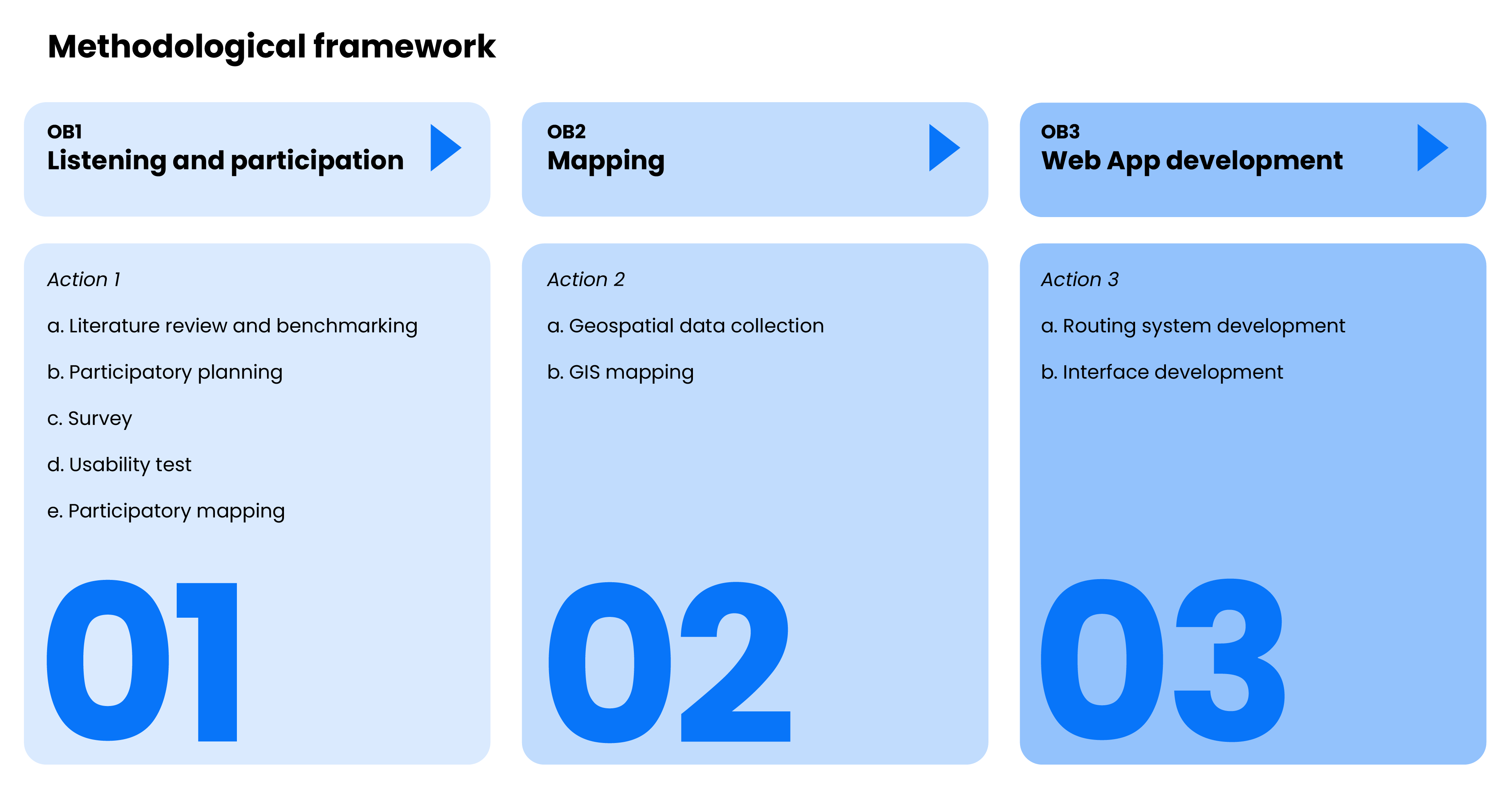
Its methodology combines three integrated components:
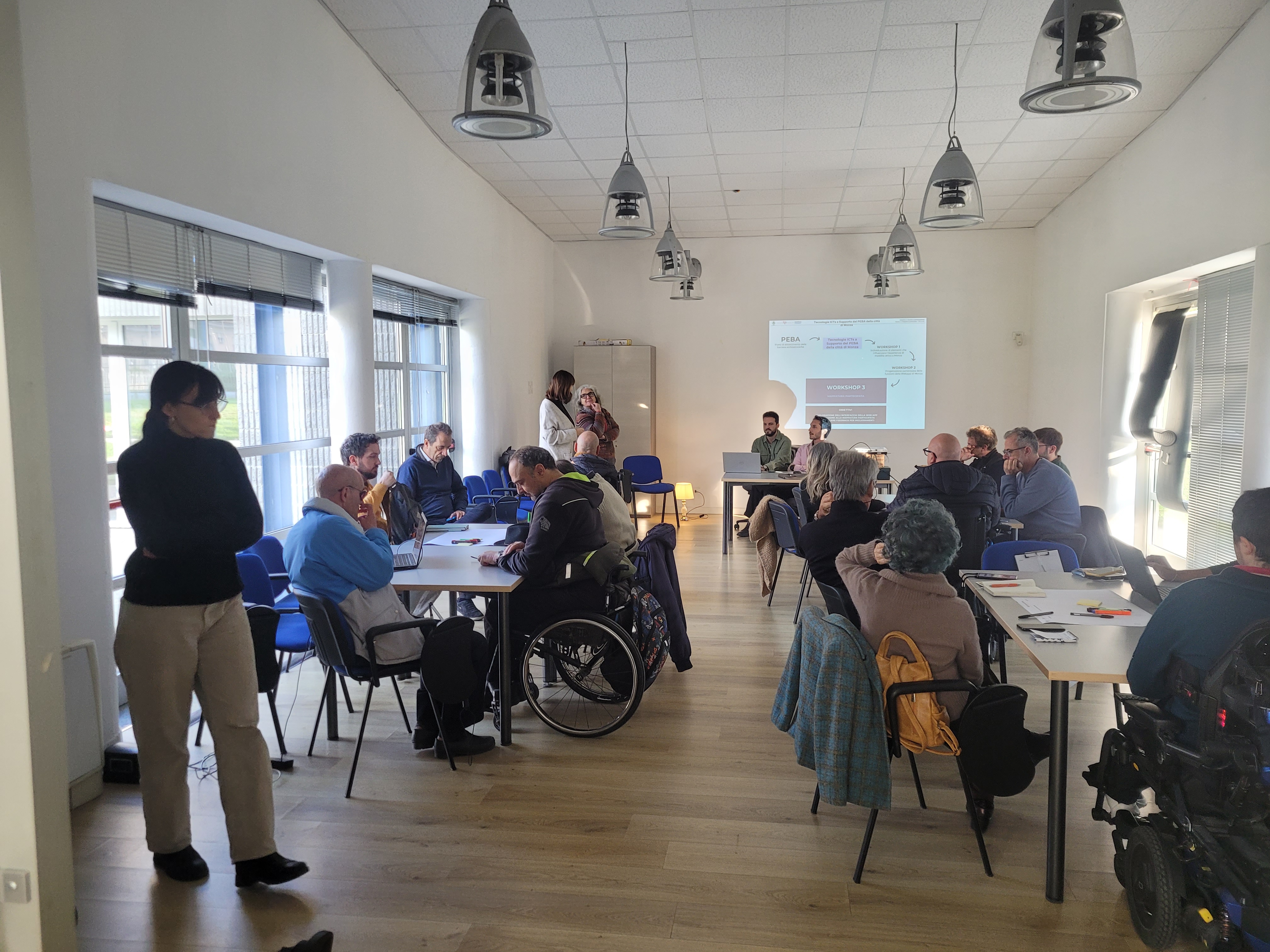
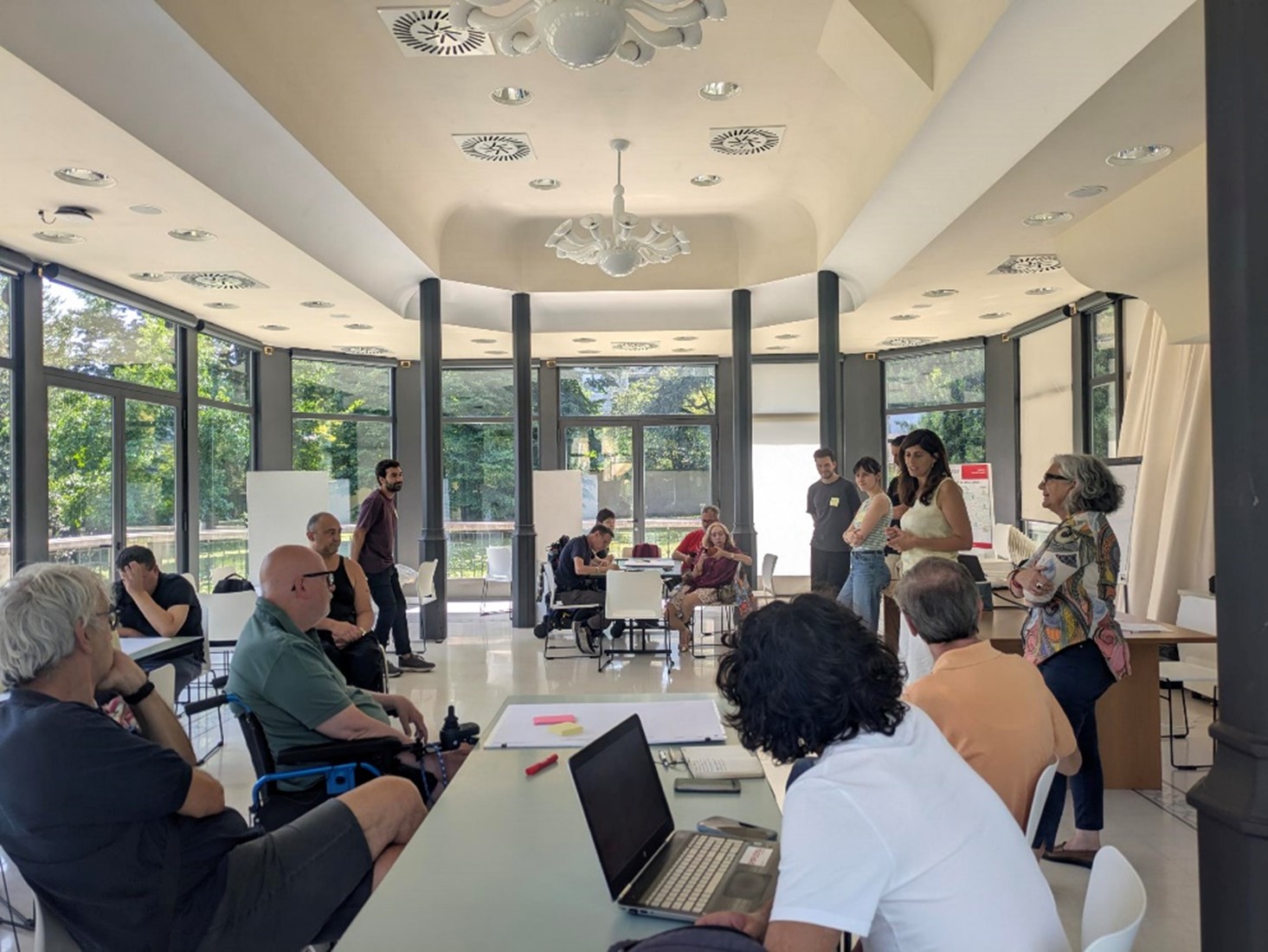
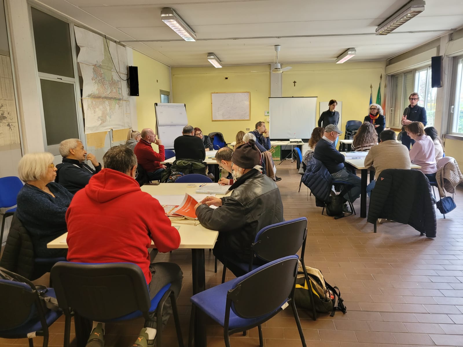
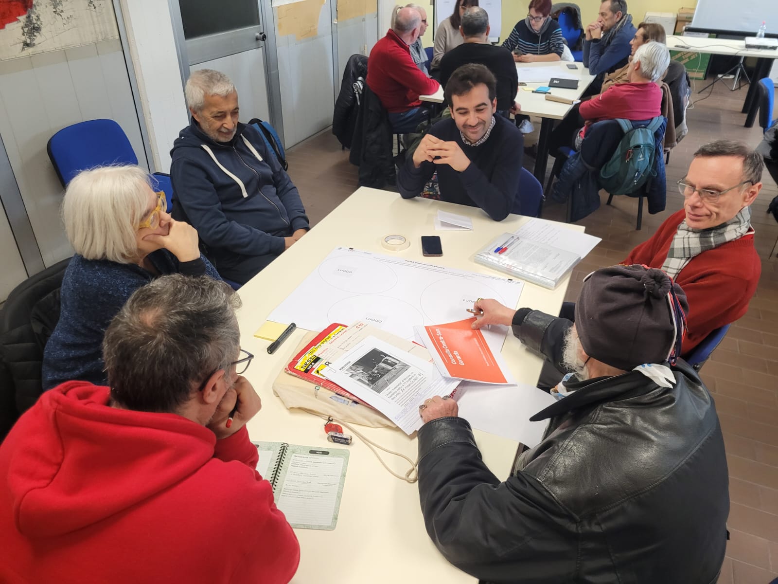
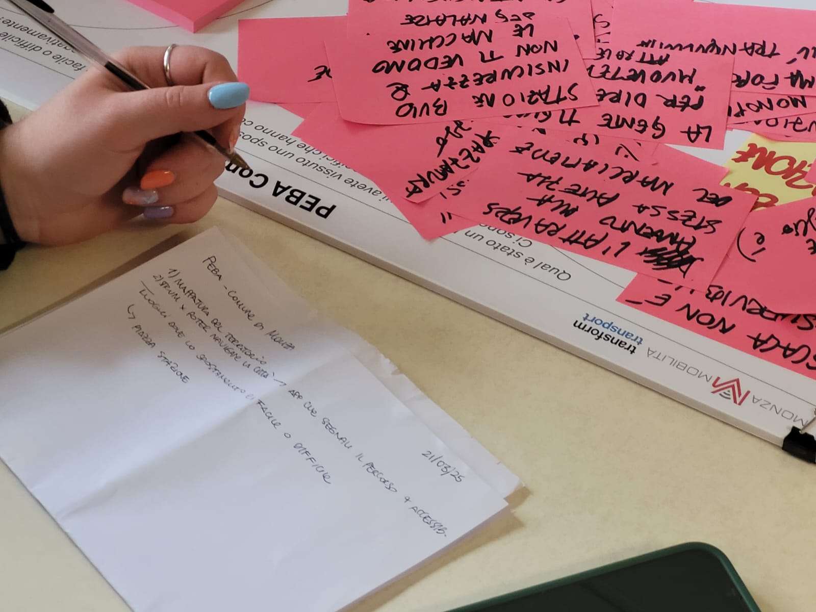
1. Listening and participation: TRACCE involved citizens, local associations, people with reduced mobility, caregivers and advisory councils through a structured engagement process, including three workshops held between March and November 2025 and a public questionnaire that collected 220 responses, generating first-hand evidence on barriers, facilitators and lived experiences of urban mobility.
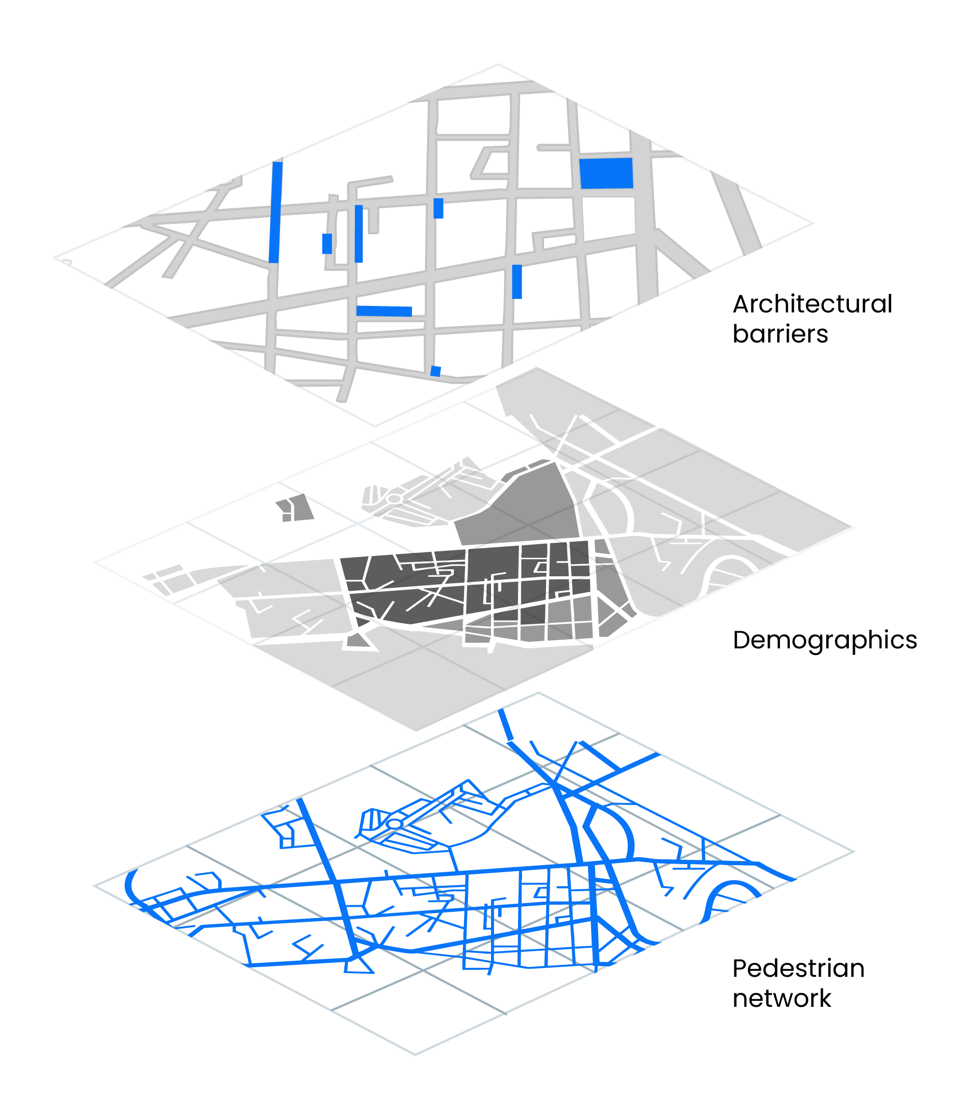
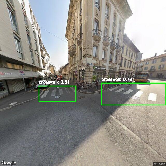
2. Mapping: between April and November 2025, the project combined open geolocated datasets, municipal and Monza Mobilità archives, field surveys and spatial analysis to build a multilevel map of Monza’s pedestrian network, including analyses of sidewalks, ramps, width, crossings, lighting and safety conditions, using AI-based image segmentation on Google Street View imagery.
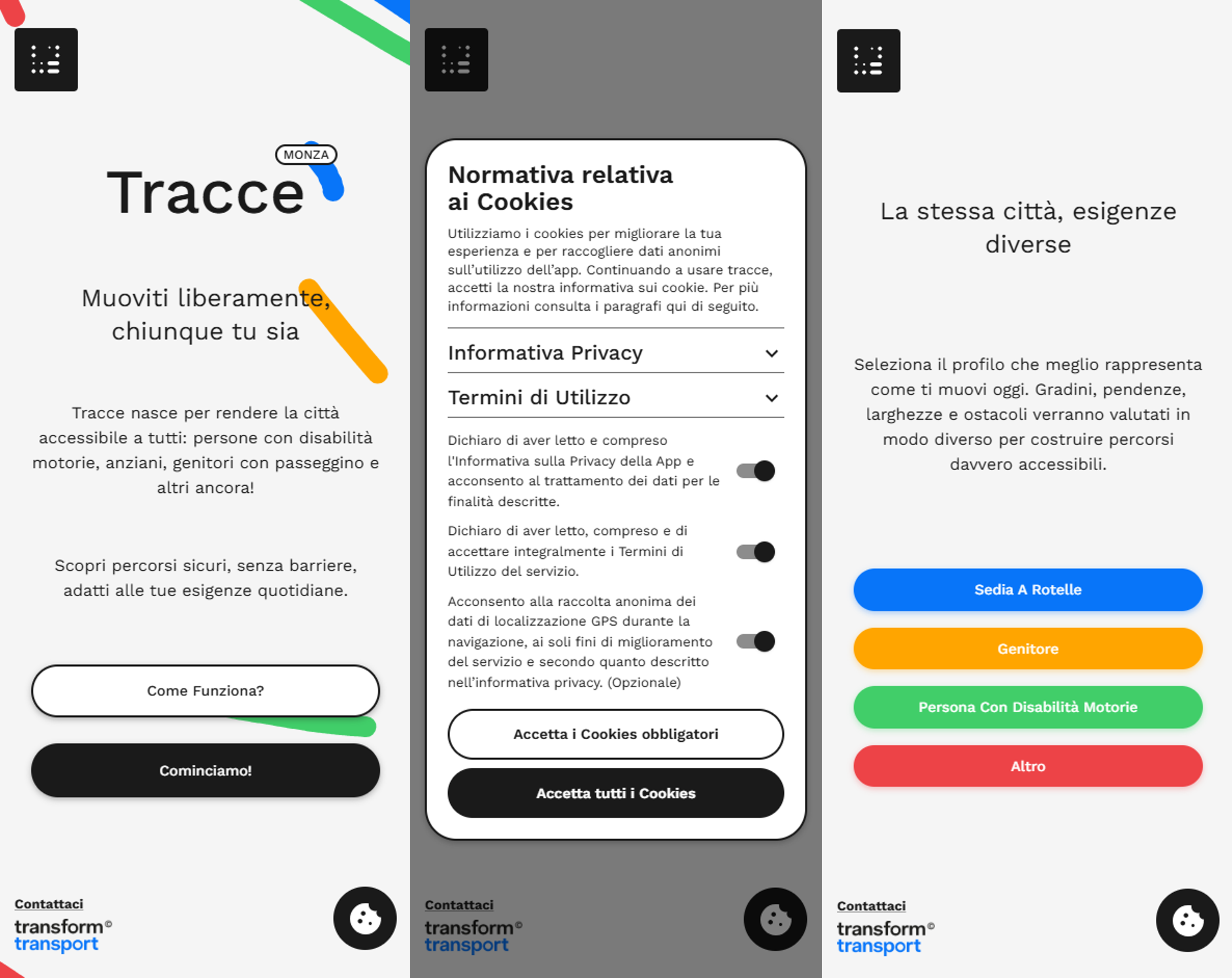
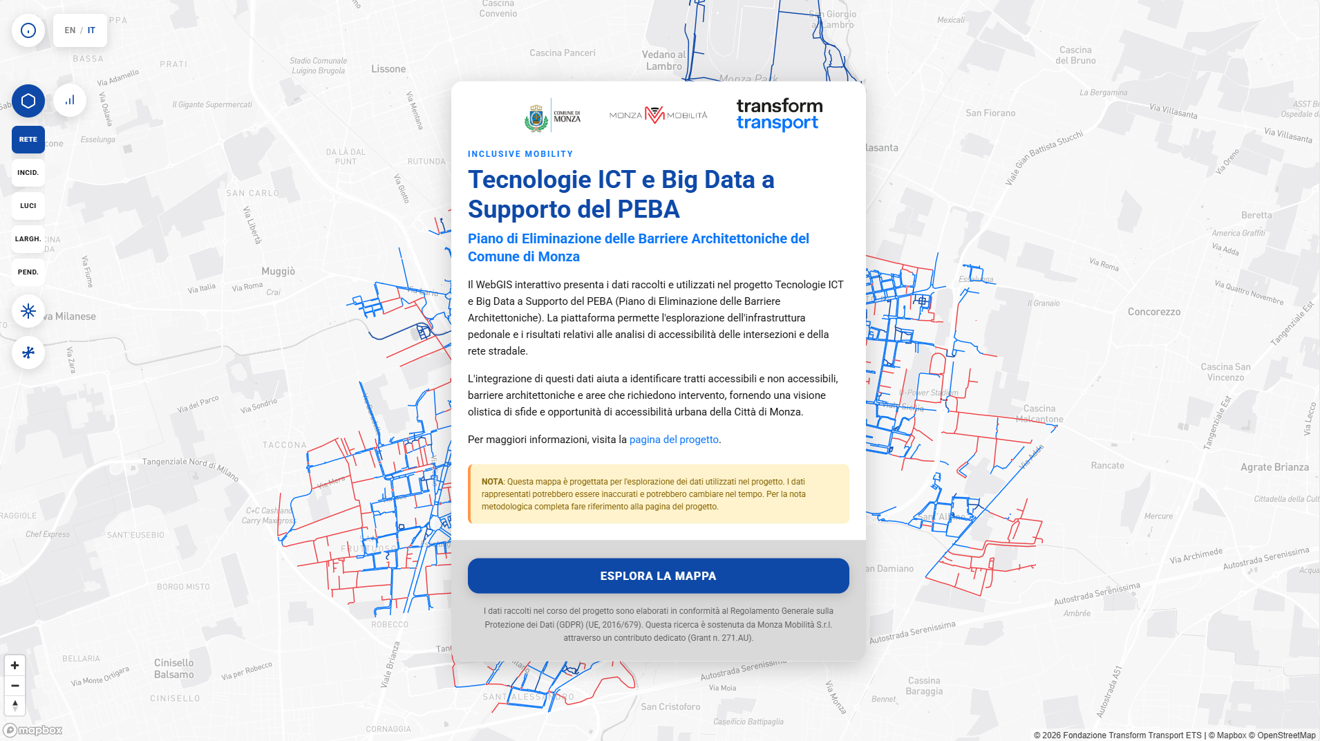
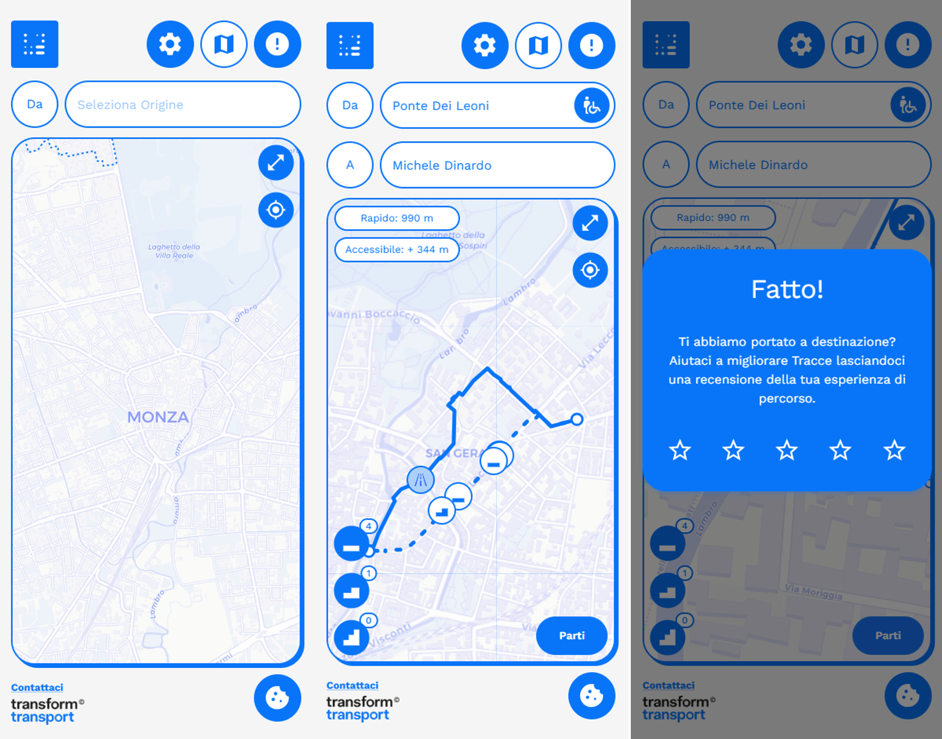
3. Digital tool development: the project produced two complementary outputs: a WebGIS platform for the Municipality, supporting barrier identification and intervention prioritisation, and the Tracce webapp for everyday users, which suggests routes based on accessibility needs allowing users to geolocate reporting of critical issues.
TRACCE has already delivered a structured accessibility knowledge base and practical tools now available to the Municipality. In the long term, it will help guide PEBA implementation, prioritise interventions and public funding, and strengthen citizens’ role in shaping a more inclusive, walkable and welcoming city.
Its methodology combines three integrated components:
1. Listening and participation: TRACCE involved citizens, local associations, people with reduced mobility, caregivers and advisory councils through a structured engagement process, including three workshops held between March and November 2025 and a public questionnaire that collected 220 responses, generating first-hand evidence on barriers, facilitators and lived experiences of urban mobility.
2. Mapping: between April and November 2025, the project combined open geolocated datasets, municipal and Monza Mobilità archives, field surveys and spatial analysis to build a multilevel map of Monza’s pedestrian network, including analyses of sidewalks, ramps, width, crossings, lighting and safety conditions, using AI-based image segmentation on Google Street View imagery.
3. Digital tool development: the project produced two complementary outputs: a WebGIS platform for the Municipality, supporting barrier identification and intervention prioritisation, and the Tracce webapp for everyday users, which suggests routes based on accessibility needs allowing users to geolocate reporting of critical issues.
TRACCE has already delivered a structured accessibility knowledge base and practical tools now available to the Municipality. In the long term, it will help guide PEBA implementation, prioritise interventions and public funding, and strengthen citizens’ role in shaping a more inclusive, walkable and welcoming city.
TRACCE emerged from a simple but urgent question: how can a city plan accessibility measures more fairly and effectively if it does not fully understand how people with reduced mobility actually experience everyday urban space? In Monza, the development of the PEBA created the opportunity to move beyond a purely technical approach and to build a bottom-up process grounded in lived experience, local knowledge and digital evidence to understand how the city is actually used, perceived and navigated by people with different mobility needs.
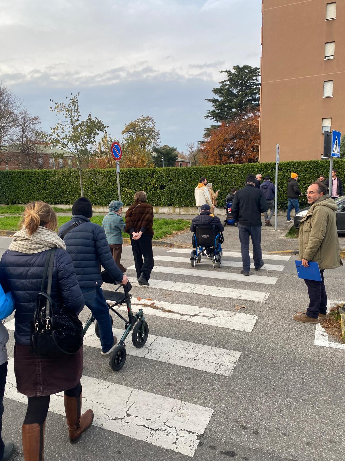
The project was implemented as a field-based and participatory process rather than a purely desk-based study. On the ground, it combined moments of collective discussion with direct observation of the pedestrian network. Workshops involved citizens, local associations, advisory councils, caregivers and people with reduced mobility, creating a space where lived experiences, everyday difficulties and local priorities could emerge clearly. A walkshop was also carried out with participants who moved through the city together, observing and documenting real conditions along pedestrian routes. This made it possible to identify barriers, discomfort, safety concerns and usability issues that are often invisible in conventional planning processes, while also highlighting what makes an urban route more accessible and dignified.
These insights were then translated into structured evidence through spatial analysis, mapping and digital tools, allowing everyday experience to inform municipal planning in a concrete way. In this sense, TRACCE came about as a response to a practical governance challenge, but it was implemented as a collaborative process linking citizens’ voices, field experience, desk research and public decision-making.
TRACCE translates citizens’ experiences into tools supporting both public decision-making and everyday urban navigation, contributing to more targeted public investments and a more inclusive urban future.
The project was implemented as a field-based and participatory process rather than a purely desk-based study. On the ground, it combined moments of collective discussion with direct observation of the pedestrian network. Workshops involved citizens, local associations, advisory councils, caregivers and people with reduced mobility, creating a space where lived experiences, everyday difficulties and local priorities could emerge clearly. A walkshop was also carried out with participants who moved through the city together, observing and documenting real conditions along pedestrian routes. This made it possible to identify barriers, discomfort, safety concerns and usability issues that are often invisible in conventional planning processes, while also highlighting what makes an urban route more accessible and dignified.
These insights were then translated into structured evidence through spatial analysis, mapping and digital tools, allowing everyday experience to inform municipal planning in a concrete way. In this sense, TRACCE came about as a response to a practical governance challenge, but it was implemented as a collaborative process linking citizens’ voices, field experience, desk research and public decision-making.
TRACCE translates citizens’ experiences into tools supporting both public decision-making and everyday urban navigation, contributing to more targeted public investments and a more inclusive urban future.
Urban accessibility & walkability
Social inclusion
Participatory governance
Digital innovation
Local democracy
TRACCE approaches sustainability by linking accessibility, public investment and long-term urban transformation. Its strongest contribution lies in making accessibility planning more durable, strategic and just. Instead of treating barriers as isolated problems to be addressed case by case, the project builds a structured basis for continuous action, helping the Municipality move from fragmented responses to a more coherent and lasting accessibility strategy.
By documenting how people with reduced mobility experience the pedestrian environment, TRACCE helps reduce unequal access to public space, services and everyday opportunities at social and economic level. At the same time, it gives the Municipality a clear basis for deciding where interventions are most needed, how to prioritise them, and how to direct public funding effectively. In this sense, the project supports a more responsible use of resources and strengthens the long-term public value of accessibility, linking sustainability to social and economic concerns and not only to environmental ones, leveraging on economy, cost-effectiveness and financial sustainability of related actions.
TRACCE also contributes to environmental sustainability in an indirect, concrete way. The NEB Compass places sustainable and smart mobility within the policy context of sustainability and stresses the importance of preserving and prolonging usability, upgrading systems over time, and supporting broader behavioural change. By improving the knowledge base for pedestrian accessibility and enabling more informed investment in walkable routes and public space, TRACCE supports a model of everyday mobility that is less dependent on exclusionary mobility patterns and more oriented towards proximity, walking and shared urban space.
Its value also lies in the cultural shift it promotes. The highest ambition is not only technical improvement, but transformation: a change in behaviours, mindsets and ways of organising society.
By documenting how people with reduced mobility experience the pedestrian environment, TRACCE helps reduce unequal access to public space, services and everyday opportunities at social and economic level. At the same time, it gives the Municipality a clear basis for deciding where interventions are most needed, how to prioritise them, and how to direct public funding effectively. In this sense, the project supports a more responsible use of resources and strengthens the long-term public value of accessibility, linking sustainability to social and economic concerns and not only to environmental ones, leveraging on economy, cost-effectiveness and financial sustainability of related actions.
TRACCE also contributes to environmental sustainability in an indirect, concrete way. The NEB Compass places sustainable and smart mobility within the policy context of sustainability and stresses the importance of preserving and prolonging usability, upgrading systems over time, and supporting broader behavioural change. By improving the knowledge base for pedestrian accessibility and enabling more informed investment in walkable routes and public space, TRACCE supports a model of everyday mobility that is less dependent on exclusionary mobility patterns and more oriented towards proximity, walking and shared urban space.
Its value also lies in the cultural shift it promotes. The highest ambition is not only technical improvement, but transformation: a change in behaviours, mindsets and ways of organising society.
TRACCE contributes to aesthetics by changing how accessibility is understood and experienced in everyday urban life. In this project, making life more beautiful does not mean adding a visual layer to the city, but making the city more legible, comfortable, dignified and welcoming for the people who move through it every day. For a person with reduced mobility, beauty begins when public space can be used with less stress, less uncertainty and greater autonomy. In this sense, TRACCE connects aesthetics to quality of urban mobility experience.
The project contributes to everyday quality of life by making barriers visible and by translating lived experience into practical change. Through participatory activities, accessibility was observed not as an abstract technical condition but as a real, embodied experience shaped by surfaces, crossings, continuity, safety, effort and orientation. This helped reveal what makes an urban route feel not only functional, but also usable, reassuring, readable, and respectful.
TRACCE also contributes to a sense of belonging and care for place. It created space for citizens, associations, caregivers and people with reduced mobility to actively describe the city from their own perspective and to influence how it is read and prioritised. In doing so, it strengthens the relationship between people and place: not as passive users of the city, but as legitimate interpreters of it, linking beauty with meaningful collective experiences, belonging and mutual care; this is one of the project’s strongest contributions.
In the longer term, TRACCE makes beauty structural. Its WebGIS and webapp are not just digital outputs: they are tools that help the Municipality and citizens co-produce a more inclusive public realm over time. Because the project now informs PEBA implementation, it can shape where interventions happen, how resources are prioritised, and how urban space gradually becomes more accessible and more hospitable to everybody.
The project contributes to everyday quality of life by making barriers visible and by translating lived experience into practical change. Through participatory activities, accessibility was observed not as an abstract technical condition but as a real, embodied experience shaped by surfaces, crossings, continuity, safety, effort and orientation. This helped reveal what makes an urban route feel not only functional, but also usable, reassuring, readable, and respectful.
TRACCE also contributes to a sense of belonging and care for place. It created space for citizens, associations, caregivers and people with reduced mobility to actively describe the city from their own perspective and to influence how it is read and prioritised. In doing so, it strengthens the relationship between people and place: not as passive users of the city, but as legitimate interpreters of it, linking beauty with meaningful collective experiences, belonging and mutual care; this is one of the project’s strongest contributions.
In the longer term, TRACCE makes beauty structural. Its WebGIS and webapp are not just digital outputs: they are tools that help the Municipality and citizens co-produce a more inclusive public realm over time. Because the project now informs PEBA implementation, it can shape where interventions happen, how resources are prioritised, and how urban space gradually becomes more accessible and more hospitable to everybody.
TRACCE addresses inclusion by recognising accessibility as a condition for equal participation in urban life. The project focuses on the everyday mobility of people with reduced mobility for any reason, and treats accessibility not as a specialised issue, but as a public concern that affects dignity, autonomy and the right to use the city.
Its first contribution is to make exclusion visible. Through workshops, public questionnaires and spatial analysis, TRACCE captures barriers that often remain overlooked in conventional planning: unsafe crossings, missing ramps, uneven surfaces, fixed and mobile obstacles, route discontinuity and uncertainty. By documenting how these conditions affect real journeys, the project turns lived experience into actionable evidence. Its second contribution is inclusive governance. TRACCE was built through a participatory process involving citizens, local associations, advisory councils, caregivers and people directly affected by mobility barriers. This means that priorities were not defined only by technical experts, but also by those who experience exclusion first-hand. In this way, the project strengthens local democracy and creates a clearer link between citizen knowledge and municipal decision-making. The project also reflects design for all principles. Its tools are designed to improve the public realm for a wide range of users, not for a narrow category alone. The Tracce webapp proposes routes based on accessibility needs rather than only speed and allows geolocated reporting of critical issues. The WebGIS helps the Municipality identify barriers, compare conditions and prioritise interventions.
What makes TRACCE particularly strong is that it combines inclusion in process, inclusion in tools and inclusion in long-term governance. It gives citizens a stronger voice, provides the Municipality with a fairer basis for action, and helps ensure that future PEBA implementation responds to the needs of those most often excluded.
Its first contribution is to make exclusion visible. Through workshops, public questionnaires and spatial analysis, TRACCE captures barriers that often remain overlooked in conventional planning: unsafe crossings, missing ramps, uneven surfaces, fixed and mobile obstacles, route discontinuity and uncertainty. By documenting how these conditions affect real journeys, the project turns lived experience into actionable evidence. Its second contribution is inclusive governance. TRACCE was built through a participatory process involving citizens, local associations, advisory councils, caregivers and people directly affected by mobility barriers. This means that priorities were not defined only by technical experts, but also by those who experience exclusion first-hand. In this way, the project strengthens local democracy and creates a clearer link between citizen knowledge and municipal decision-making. The project also reflects design for all principles. Its tools are designed to improve the public realm for a wide range of users, not for a narrow category alone. The Tracce webapp proposes routes based on accessibility needs rather than only speed and allows geolocated reporting of critical issues. The WebGIS helps the Municipality identify barriers, compare conditions and prioritise interventions.
What makes TRACCE particularly strong is that it combines inclusion in process, inclusion in tools and inclusion in long-term governance. It gives citizens a stronger voice, provides the Municipality with a fairer basis for action, and helps ensure that future PEBA implementation responds to the needs of those most often excluded.
Participation was a core principle of TRACCE from the outset. The project was designed not only for people affected by mobility barriers, but with them. Citizens, local associations, caregivers, people with reduced mobility and representatives of advisory councils were involved throughout the process to ensure that accessibility priorities reflected lived experience rather than being defined only through technical criteria.
Their involvement began with three workshops and a public questionnaire that collected 220 responses. These activities made it possible to identify recurring barriers, priority routes, daily difficulties and local needs. The project also included a walkshop with the target group, which was especially valuable because it brought the discussion into the public realm itself: participants moved through the city together, observing, testing and discussing real pedestrian conditions on site.
Their role went beyond consultation. Participants helped validate the process and reveal issues that are often invisible in standard planning processes, contributed to framing priorities, and grounded the project in real journeys rather than abstract assumptions. Their perspective directly informed the interpretation of accessibility conditions and the development of the tools.
Participation also continues beyond the initial project phase. The Tracce app includes a dedicated function through which users can submit geolocated reports on barriers, obstacles and critical issues they encounter in the city. This means that citizens’ knowledge can keep feeding the project over time: their reports can enrich the evidence base, inform the WebGIS, and provide the Municipality with updated information to support future decisions and PEBA implementation.
The impact of this involvement has been substantial. It made the project more accurate, grounded and legitimate, while also creating a stronger link between citizens’ everyday experience and municipal action.
Their involvement began with three workshops and a public questionnaire that collected 220 responses. These activities made it possible to identify recurring barriers, priority routes, daily difficulties and local needs. The project also included a walkshop with the target group, which was especially valuable because it brought the discussion into the public realm itself: participants moved through the city together, observing, testing and discussing real pedestrian conditions on site.
Their role went beyond consultation. Participants helped validate the process and reveal issues that are often invisible in standard planning processes, contributed to framing priorities, and grounded the project in real journeys rather than abstract assumptions. Their perspective directly informed the interpretation of accessibility conditions and the development of the tools.
Participation also continues beyond the initial project phase. The Tracce app includes a dedicated function through which users can submit geolocated reports on barriers, obstacles and critical issues they encounter in the city. This means that citizens’ knowledge can keep feeding the project over time: their reports can enrich the evidence base, inform the WebGIS, and provide the Municipality with updated information to support future decisions and PEBA implementation.
The impact of this involvement has been substantial. It made the project more accurate, grounded and legitimate, while also creating a stronger link between citizens’ everyday experience and municipal action.
TRACCE was primarily developed and implemented at the local level, but through a multi-actor governance structure that brought together different types of stakeholders with complementary roles. The core institutional framework involved the Municipality of Monza, Monza Mobilità and Transform Transport, working together to connect public planning needs, operational knowledge and methodological development.
The Municipality of Monza was the key public authority and the main actor responsible for the broader PEBA process. Its role was essential in ensuring that the project addressed a real planning need and that its outputs could inform future public decisions. Monza Mobilità, as the local public mobility company, played a crucial operational role by supporting the process and helping connect the project to the city’s mobility governance structure. Transform Transport developed and implemented the methodology, combining user experience research, spatial analysis and psychology, participatory activities and digital tool development.
Alongside these institutional actors, civil society stakeholders were actively involved through workshops,and participatory actions. Local associations, advisory councils, caregivers and people with reduced mobility contributed first-hand knowledge that helped shape priorities and ground the project in lived experience. Their involvement added a level of accountability and relevance that purely technical planning processes often lack.
Although the project was not structured as a formal regional or national governance initiative, its added value lies in the way it links local implementation with wider policy principles that are also central at national and European level, including urban accessibility, inclusion, participation, design for all. In this sense, TRACCE shows how local governance can become stronger when public institutions, service providers, civil society and applied research work together around a shared evidence base.
The Municipality of Monza was the key public authority and the main actor responsible for the broader PEBA process. Its role was essential in ensuring that the project addressed a real planning need and that its outputs could inform future public decisions. Monza Mobilità, as the local public mobility company, played a crucial operational role by supporting the process and helping connect the project to the city’s mobility governance structure. Transform Transport developed and implemented the methodology, combining user experience research, spatial analysis and psychology, participatory activities and digital tool development.
Alongside these institutional actors, civil society stakeholders were actively involved through workshops,and participatory actions. Local associations, advisory councils, caregivers and people with reduced mobility contributed first-hand knowledge that helped shape priorities and ground the project in lived experience. Their involvement added a level of accountability and relevance that purely technical planning processes often lack.
Although the project was not structured as a formal regional or national governance initiative, its added value lies in the way it links local implementation with wider policy principles that are also central at national and European level, including urban accessibility, inclusion, participation, design for all. In this sense, TRACCE shows how local governance can become stronger when public institutions, service providers, civil society and applied research work together around a shared evidence base.
TRACCE was developed through a transdisciplinary methodology that combined urban and accessibility planning, mobility studies, GIS and spatial analysis, digital technologies, user experience research and participatory methods within a single operational framework. This was essential to approach accessibility not simply as a physical property of infrastructure but as a precise system of spatial analysis informing digital development, participatory evidence improving interpretation, and planning needs shaping the structure of the tools.
Specifically, the project was first grounded in urban and accessibility planning, as it was designed to support the development of Monza’s PEBA and to inform decisions on barrier removal and pedestrian accessibility priorities. This planning perspective was combined with mobility studies, particularly around walkability and route usability, in order to understand where barriers exist and how they affect everyday urban movement. A second core dimension was GIS and spatial analysis. The project integrated open geolocated datasets, municipal archives, data and field observations to build a multilevel representation of the pedestrian city network. Sidewalk continuity, width, ramps, crossings, lighting, obstacles and safety conditions were analysed spatially and organised into a framework that could support both interpretation and prioritisation. This analytical layer was connected to digital technologies through the development of two tools with different but complementary functions: a WebGIS platform for municipal decision support and a web app for users, focused on accessible route planning. The project also explored AI-based image segmentation on Google Street View imagery to support further detection of specific accessibility-related elements. At the same time, the methodology drew on user experience research and participatory knowledge to interpret how the built environment is actually navigated by people with reduced mobility.
Specifically, the project was first grounded in urban and accessibility planning, as it was designed to support the development of Monza’s PEBA and to inform decisions on barrier removal and pedestrian accessibility priorities. This planning perspective was combined with mobility studies, particularly around walkability and route usability, in order to understand where barriers exist and how they affect everyday urban movement. A second core dimension was GIS and spatial analysis. The project integrated open geolocated datasets, municipal archives, data and field observations to build a multilevel representation of the pedestrian city network. Sidewalk continuity, width, ramps, crossings, lighting, obstacles and safety conditions were analysed spatially and organised into a framework that could support both interpretation and prioritisation. This analytical layer was connected to digital technologies through the development of two tools with different but complementary functions: a WebGIS platform for municipal decision support and a web app for users, focused on accessible route planning. The project also explored AI-based image segmentation on Google Street View imagery to support further detection of specific accessibility-related elements. At the same time, the methodology drew on user experience research and participatory knowledge to interpret how the built environment is actually navigated by people with reduced mobility.
TRACCE is based on a public-service business model. It was developed in response to a concrete municipal need within Monza’s PEBA process and funded by Monza Mobilità. Its financial sustainability does not depend on commercial revenues, but on its capacity to remain useful within an ongoing public function: accessibility planning, prioritisation of interventions and allocation of resources.
This model is sustainable because it supports better public spending over time. By improving the evidence base for accessibility planning, TRACCE helps the Municipality identify where interventions are most needed and where funding can generate the greatest public value. In this sense, its business logic is linked to long-term institutional use and to the efficiency gains it can generate in future planning and investment decisions. It also creates value by reducing fragmentation between data, field evidence and decision-making, making accessibility planning more operational and better targeted.
A second element is adaptability. In the Italian context, TRACCE stands out for combining participatory accessibility planning, spatial analysis and digital tools for both public authorities and everyday users within a single methodology. Its future applicability in other cities is possible, but context-dependent: it relies above all on the availability, quality and interoperability of urban and georeferenced data. Where these conditions are in place, the methodology can be adapted and commissioned as a service for other local authorities; where they are not, additional work on data collection and system integration would be needed.
The project is therefore sustained by a combination of public funding, long-term institutional utility, efficiency in future public investment, and the possibility of adapt the methodology and offer it as a service to other municipalities, provided the data conditions are in place, rather than by short-term market-based revenue.
This model is sustainable because it supports better public spending over time. By improving the evidence base for accessibility planning, TRACCE helps the Municipality identify where interventions are most needed and where funding can generate the greatest public value. In this sense, its business logic is linked to long-term institutional use and to the efficiency gains it can generate in future planning and investment decisions. It also creates value by reducing fragmentation between data, field evidence and decision-making, making accessibility planning more operational and better targeted.
A second element is adaptability. In the Italian context, TRACCE stands out for combining participatory accessibility planning, spatial analysis and digital tools for both public authorities and everyday users within a single methodology. Its future applicability in other cities is possible, but context-dependent: it relies above all on the availability, quality and interoperability of urban and georeferenced data. Where these conditions are in place, the methodology can be adapted and commissioned as a service for other local authorities; where they are not, additional work on data collection and system integration would be needed.
The project is therefore sustained by a combination of public funding, long-term institutional utility, efficiency in future public investment, and the possibility of adapt the methodology and offer it as a service to other municipalities, provided the data conditions are in place, rather than by short-term market-based revenue.
TRACCE has strong transferability potential because it is not limited to a single local output, but is based on a methodology that can be adapted to other contexts. Its most replicable element is the integrated approach itself: combining participatory accessibility assessment, spatial analysis and digital tools to support both public decision-making and everyday users.
Several components can be transferred. First, the methodological framework: the combination of workshops, walkshop activities, questionnaires, field observation and spatial analysis can be adapted to other municipalities that need to understand accessibility not only through technical standards, but through lived experience. Second, the digital architecture can be reused in modular ways: a WebGIS for institutional decision support, and a user-oriented app for accessible route planning and geolocated reporting. Third, the project offers transferable process innovation, because it connects participation, data and planning within a single workflow rather than treating them as separate phases.
The approach could be replicated in other cities developing or updating a PEBA, but also in broader contexts where pedestrian accessibility, inclusive mobility or public space usability are central concerns. Potential beneficiaries therefore include local authorities, mobility agencies, accessibility offices and communities of users who are underrepresented in planning processes.
Its scalability is not based on simple duplication. Some elements can be transferred, while others require adaptation to local conditions. The most important enabling factor is the availability, quality and interoperability of urban and georeferenced data. Local governance capacity, institutional commitment and the possibility of engaging relevant user groups are also crucial. Where these conditions are in place, TRACCE can be scaled as a model, a planning support methodology, or a digital ecosystem for accessibility governance.
Several components can be transferred. First, the methodological framework: the combination of workshops, walkshop activities, questionnaires, field observation and spatial analysis can be adapted to other municipalities that need to understand accessibility not only through technical standards, but through lived experience. Second, the digital architecture can be reused in modular ways: a WebGIS for institutional decision support, and a user-oriented app for accessible route planning and geolocated reporting. Third, the project offers transferable process innovation, because it connects participation, data and planning within a single workflow rather than treating them as separate phases.
The approach could be replicated in other cities developing or updating a PEBA, but also in broader contexts where pedestrian accessibility, inclusive mobility or public space usability are central concerns. Potential beneficiaries therefore include local authorities, mobility agencies, accessibility offices and communities of users who are underrepresented in planning processes.
Its scalability is not based on simple duplication. Some elements can be transferred, while others require adaptation to local conditions. The most important enabling factor is the availability, quality and interoperability of urban and georeferenced data. Local governance capacity, institutional commitment and the possibility of engaging relevant user groups are also crucial. Where these conditions are in place, TRACCE can be scaled as a model, a planning support methodology, or a digital ecosystem for accessibility governance.
- https://transformtransport.org/research/inclusive-mobility/icts-in-support-of-monzas-peba-plan-for-eliminating-architectural-barriers/
- https://app.transformtransport.org/monza/pebaGIS.html?_gl=1*bb55mp*_ga*MTY4MjcxODY4LjE3NTEzNjAwNDI.*_ga_QLF35HKRZE*czE3NzMzMTA4MDQkbzk0JGcxJHQxNzczMzExMTkxJGo2MCRsMCRoMA..*_ga_G1J3PHQ0MD*czE3NzMzMTA4MDQkbzIyJGcxJHQxNzczMzExMTkxJGo2MCRsMCRoMA..
- https://tracce.app/