Enhancing Circularity, Sustainability, and Innovation
Fonte do Mouro Square
Renovation and renaturation of Fonte do Mouro square and Picota street
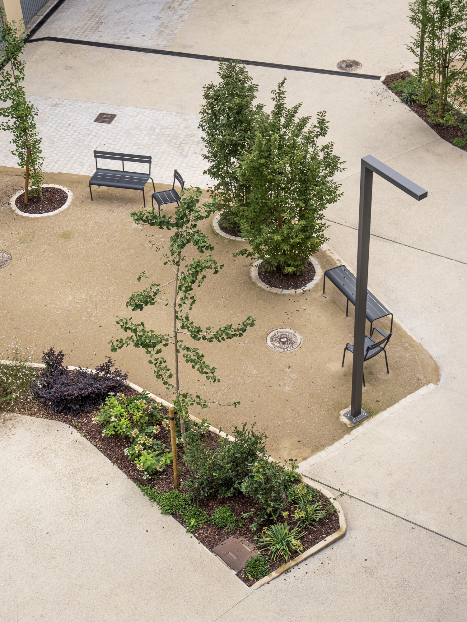
The project transforms an asphalt-dominated landscape shaped by traffic into a new public realm structured around water, vegetation and community life. Through Sustainable Urban Drainage Systems (SUDS), urban biodiversity and new pedestrian spaces, the intervention restores the site’s historic relationship with water. What was once a vehicle-oriented space becomes an urban ecosystem and a gathering place for residents and Camino de Santiago pilgrims.
Spain
Local
Redondela
Mainly urban
It involves a physical transformation of the built environment (hard investment)
Yes
2023-06-14
No
No
Yes
Individual
The project transforms an urban space formerly dominated by asphalt and traffic into a renewed public structured by water, vegetation, and community life. It reclaims water as the site’s collective memory and reinterprets it as ecological infrastructure for the contemporary city.
Located in the northern part of Redondela, A Picota neighborhood had lost much of its urban identity during the rapid urban growth of the 1960s. This process replaced former runoff landscape and its historic fountain —once anchored by a large watering trough and water-related gathering spaces— with a vehicle-dominated street and a square turned into an asphalt roundabout. The intervention recovers this place as an accessible, inclusive and environmentally resilient public space.
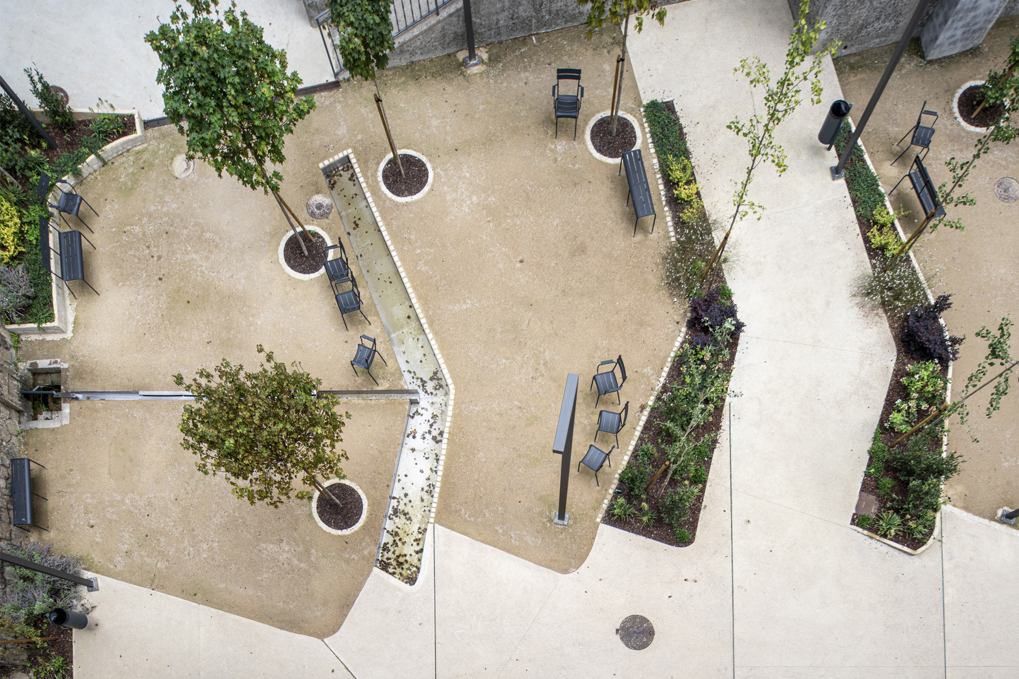
The completed project has already enabled the recovery of a high-quality public space, returning more than 2,900 m² to pedestrian use and creating a safer and more liveable urban environment. Water once again assumes a structuring role within the design. Through a network of planted swales, micro-topographies and permeable pavements, the project integrates biodiversity into the city and manages rainwater through Sustainable Urban Drainage Systems. These strategies infiltration, retention, and controlled release of rainwater, reducing surface runoff and contributing to flood mitigation.
The intervention reinforces the democratic character of public space in a neighbourhood historically marginalized from the town center. The new square traffic-calmed street encourage everyday social interaction, support local commerce and restore a shared civic setting that had disappeared.
The growth of vegetation and the expansion of tree canopies will consolidate a small urban ecosystem. It will mitigate the urban heat island effect, improve microclimatic comfort, and strengthen the neighborhood’s environmental resilience. Gradually, A Picota emerges as a living urban landscape where nature, water, and community converge again.
Located in the northern part of Redondela, A Picota neighborhood had lost much of its urban identity during the rapid urban growth of the 1960s. This process replaced former runoff landscape and its historic fountain —once anchored by a large watering trough and water-related gathering spaces— with a vehicle-dominated street and a square turned into an asphalt roundabout. The intervention recovers this place as an accessible, inclusive and environmentally resilient public space.
The completed project has already enabled the recovery of a high-quality public space, returning more than 2,900 m² to pedestrian use and creating a safer and more liveable urban environment. Water once again assumes a structuring role within the design. Through a network of planted swales, micro-topographies and permeable pavements, the project integrates biodiversity into the city and manages rainwater through Sustainable Urban Drainage Systems. These strategies infiltration, retention, and controlled release of rainwater, reducing surface runoff and contributing to flood mitigation.
The intervention reinforces the democratic character of public space in a neighbourhood historically marginalized from the town center. The new square traffic-calmed street encourage everyday social interaction, support local commerce and restore a shared civic setting that had disappeared.
The growth of vegetation and the expansion of tree canopies will consolidate a small urban ecosystem. It will mitigate the urban heat island effect, improve microclimatic comfort, and strengthen the neighborhood’s environmental resilience. Gradually, A Picota emerges as a living urban landscape where nature, water, and community converge again.
The project emerges from the history of a place deeply rooted in water. The A Picota neighborhood lies over a former runoff system that descended toward the Vigo estuary. For centuries, the Fonte do Mouro and its watering trough functioned as a meeting point between landscape, water and everyday life.
The rapid urban growth of the 1960s radically transformed this environment. The former water landscape was covered by asphalt. The fountain was a residual element and the street became a traffic-dominated road. Over time, the neighborhood lost much of its identity and its social spaces.
Decades later, various public initiatives began to promote the recovery of urban space in this area. The transformation of A Picota was made possible through the convergence of public policies at different scales —regional, provincial and municipal— aimed at improving the quality of the public realm.
The Xunta de Galicia promoted urban and landscape improvement strategies linked to the Camino de Santiago, which passes through this neighborhood. The Provincial Council of Pontevedra, through its Rede Ágora programme based on the principles of the 2030 Agenda, launched a grant scheme to recover degraded urban areas. Within this framework, the municipality of Redondela promoted the neighborhood’s transformation together with its residents.
The intervention was conceived as an opportunity to recover the site’s hydraulic memory and transform it into an ecological infrastructure for the contemporary city. Water, which had been channelled and hidden for decades, returns to the public space. Through the design of paving, planted bands, and sustainable drainage systems, the project restores the natural logic of the place and turns it into the element structuring the new urban landscape.
Recovering water meant reclaiming the landscape, but also rebuilding the collective life of the neighborhood.
The rapid urban growth of the 1960s radically transformed this environment. The former water landscape was covered by asphalt. The fountain was a residual element and the street became a traffic-dominated road. Over time, the neighborhood lost much of its identity and its social spaces.
Decades later, various public initiatives began to promote the recovery of urban space in this area. The transformation of A Picota was made possible through the convergence of public policies at different scales —regional, provincial and municipal— aimed at improving the quality of the public realm.
The Xunta de Galicia promoted urban and landscape improvement strategies linked to the Camino de Santiago, which passes through this neighborhood. The Provincial Council of Pontevedra, through its Rede Ágora programme based on the principles of the 2030 Agenda, launched a grant scheme to recover degraded urban areas. Within this framework, the municipality of Redondela promoted the neighborhood’s transformation together with its residents.
The intervention was conceived as an opportunity to recover the site’s hydraulic memory and transform it into an ecological infrastructure for the contemporary city. Water, which had been channelled and hidden for decades, returns to the public space. Through the design of paving, planted bands, and sustainable drainage systems, the project restores the natural logic of the place and turns it into the element structuring the new urban landscape.
Recovering water meant reclaiming the landscape, but also rebuilding the collective life of the neighborhood.
Nature-based solutions
Sustainable Urban Drainage Systems (SUDS)
Public space regeneration
Urban biodiversity
Climate Resilience
The project restores the site’s original hydrological logic, reinterpreting the former runoff landscape through Sustainable Urban Drainage Systems (SUDS) that integrate water, vegetation, and public space.
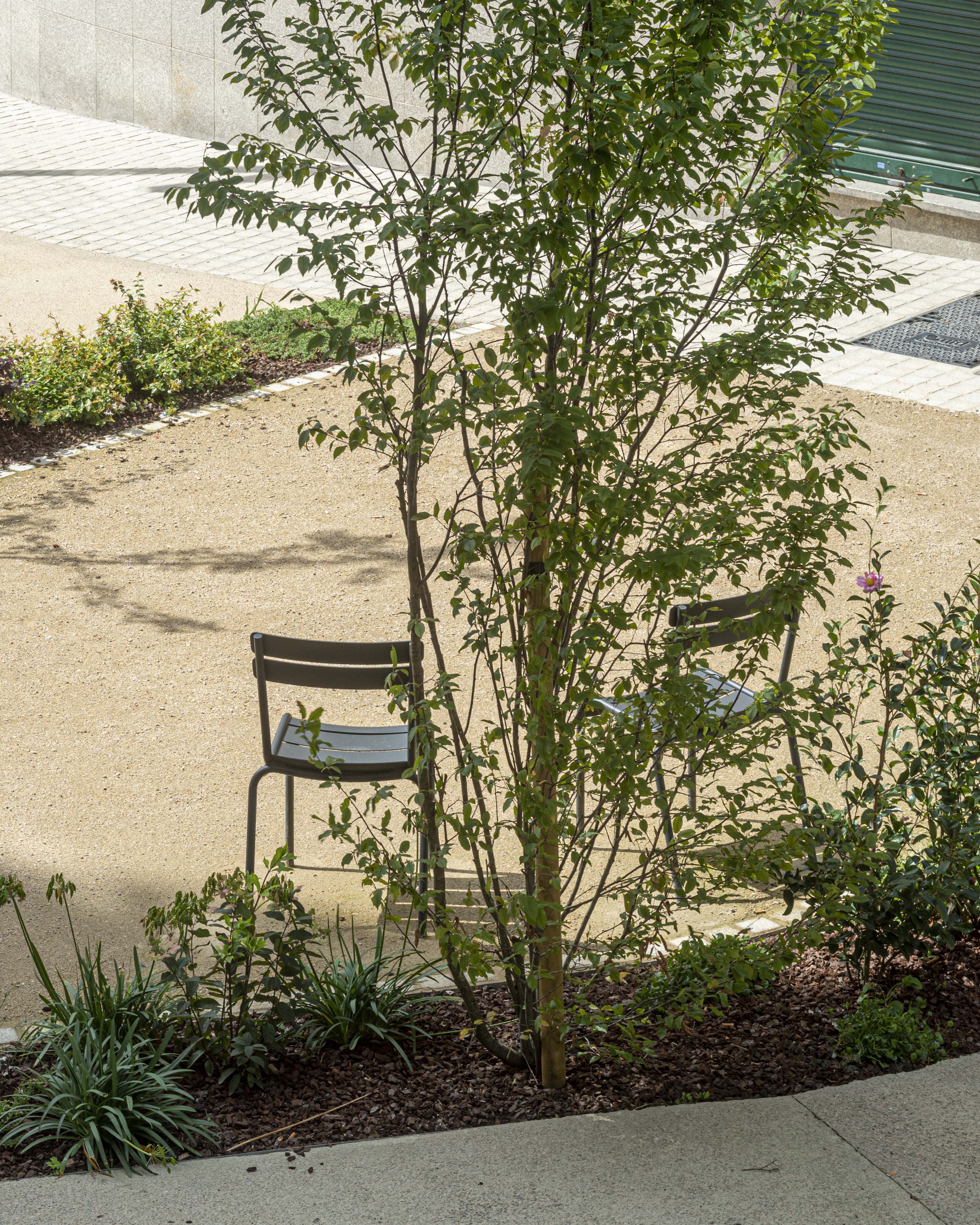
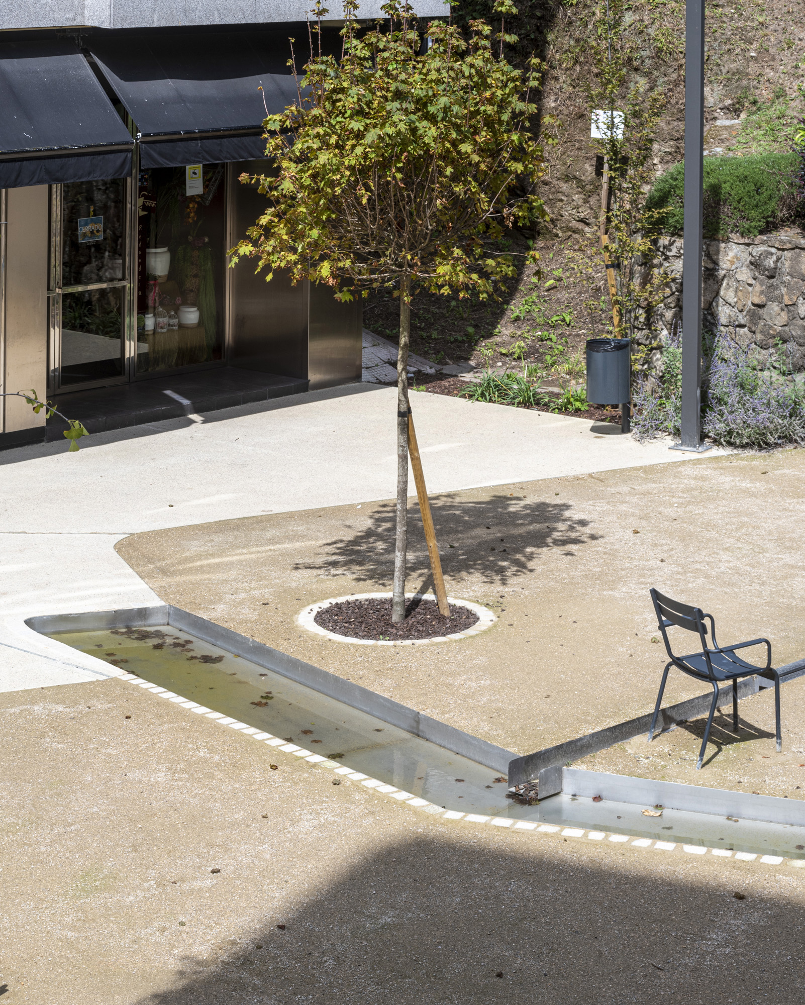
Rainwater management becomes part of the design of the public space. Through permeable pavements, vegetated strips and subtle micro-topographies, the project incorporates SUDS that enable the infiltration, retention, and controlled regulation of rainwater. Each infiltration planter functions as a small ecological unit that collects rainwater, naturally filters it and contributes to groundwater recharge.
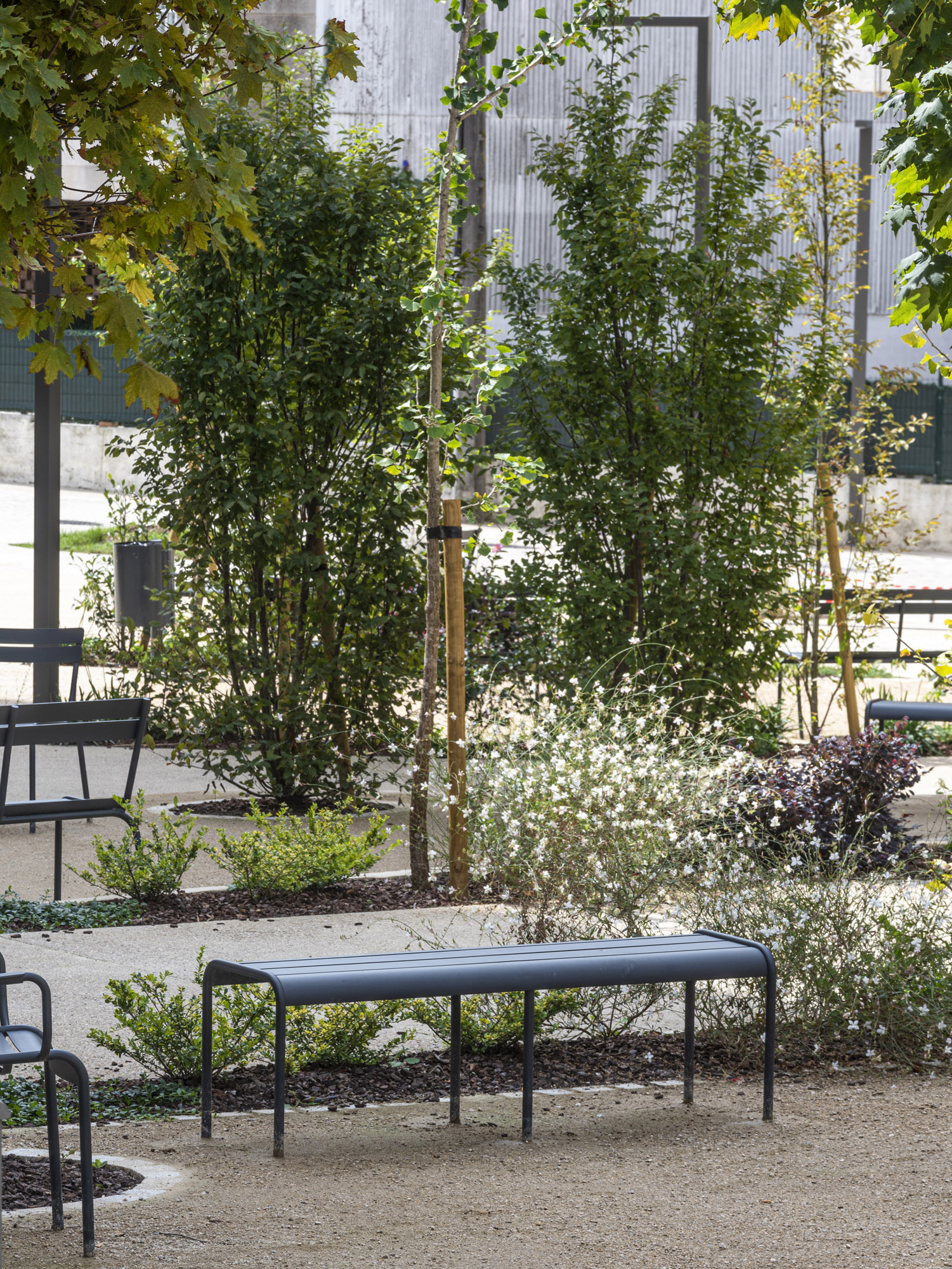
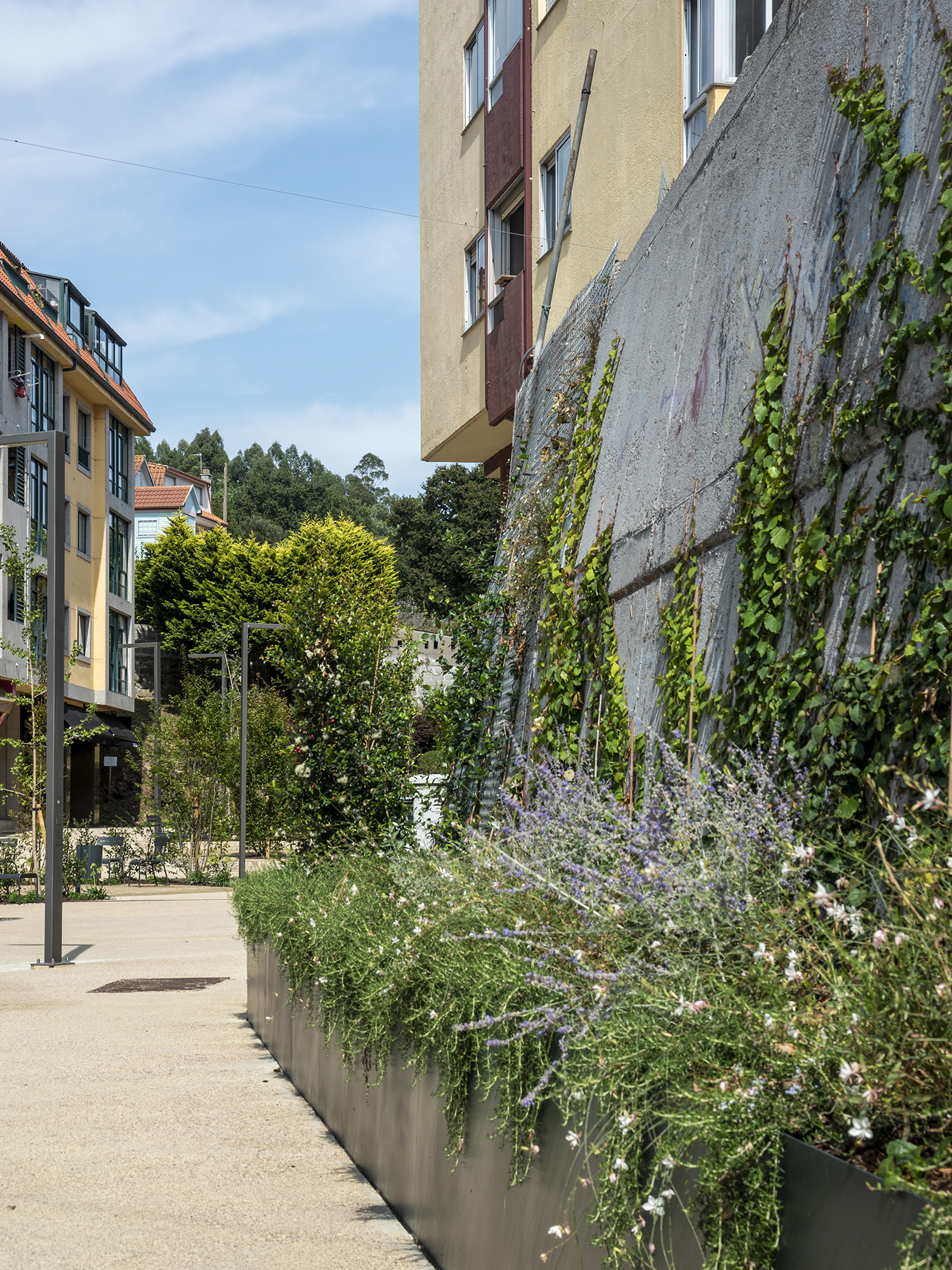
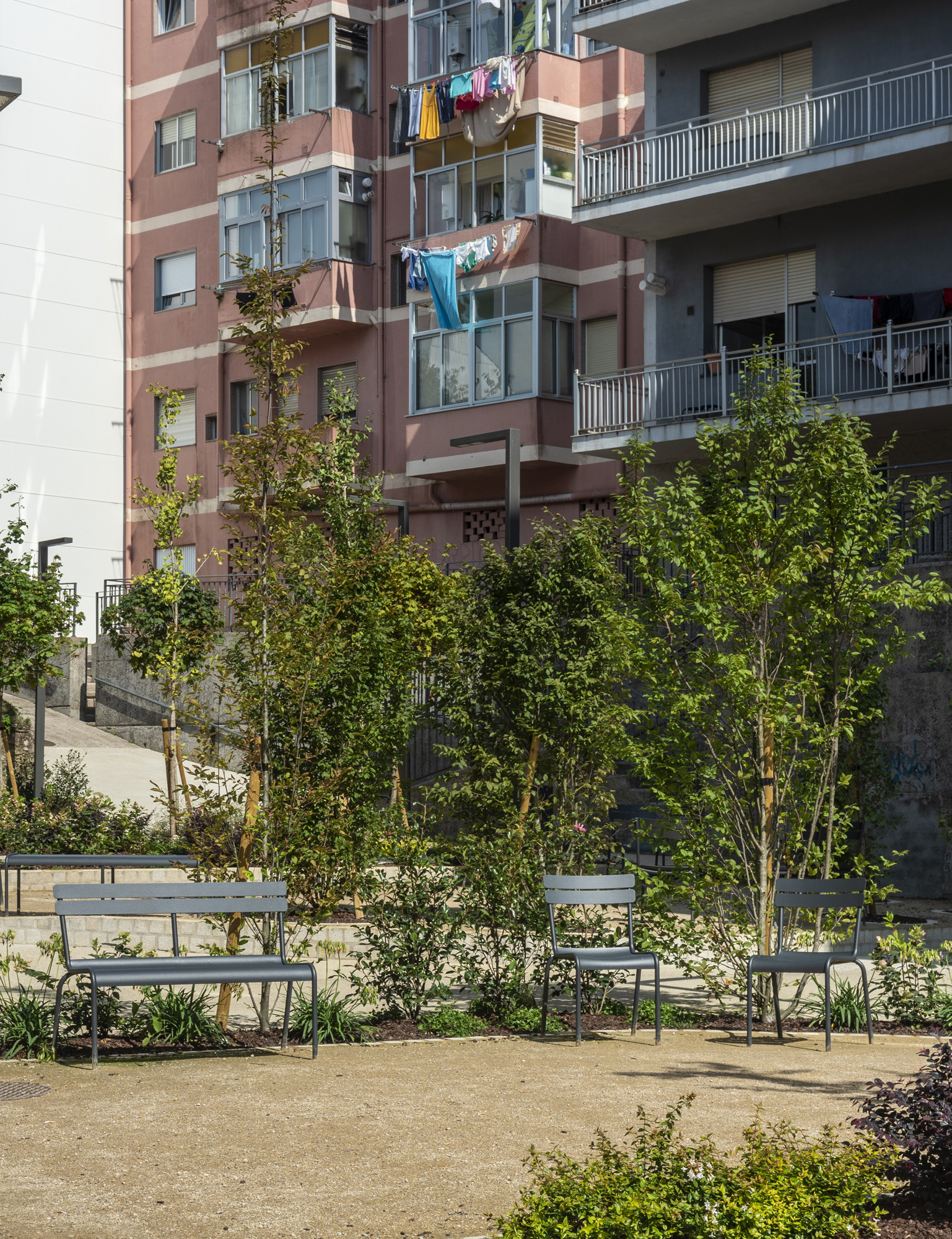
Vegetation is conceived as an ecological infrastructure capable of enhacing the environmental performance of urban space. The combination of deciduous and evergreen trees, together with varied canopy typologies, generates a diverse vegetative structure responsive to differing urban conditions. This diversity allows the vegetation system to adapt to multiple orientations, scales and spatial configurations across the square.
The introduction of trees, shrubs and herbaceous species creates habitats for biodiversity and improves the environmental quality. In the medium and long term, the growth of vegetation and tree canopies will reduce the urban heat island effect and improve the thermal comfort of the public space.
The project thus transforms an asphalt surface into a small urban ecosystem capable of regulating water, temperature and biodiversity. A Picota demonstrates how public space design can become an effective tool for climate adaptation and sustainable water management in contemporary cities.
Rainwater management becomes part of the design of the public space. Through permeable pavements, vegetated strips and subtle micro-topographies, the project incorporates SUDS that enable the infiltration, retention, and controlled regulation of rainwater. Each infiltration planter functions as a small ecological unit that collects rainwater, naturally filters it and contributes to groundwater recharge.
Vegetation is conceived as an ecological infrastructure capable of enhacing the environmental performance of urban space. The combination of deciduous and evergreen trees, together with varied canopy typologies, generates a diverse vegetative structure responsive to differing urban conditions. This diversity allows the vegetation system to adapt to multiple orientations, scales and spatial configurations across the square.
The introduction of trees, shrubs and herbaceous species creates habitats for biodiversity and improves the environmental quality. In the medium and long term, the growth of vegetation and tree canopies will reduce the urban heat island effect and improve the thermal comfort of the public space.
The project thus transforms an asphalt surface into a small urban ecosystem capable of regulating water, temperature and biodiversity. A Picota demonstrates how public space design can become an effective tool for climate adaptation and sustainable water management in contemporary cities.
The project understands aesthetics as a way to reconnect people with the landscape and the site memory. Water thus returns as part of the everyday experience of public space.
For decades the site had been reduced to an asphalt surface dominated by traffic. The intervention transforms this setting into an urban landscape where water, vegetation and topography once again shape the spatial experience.
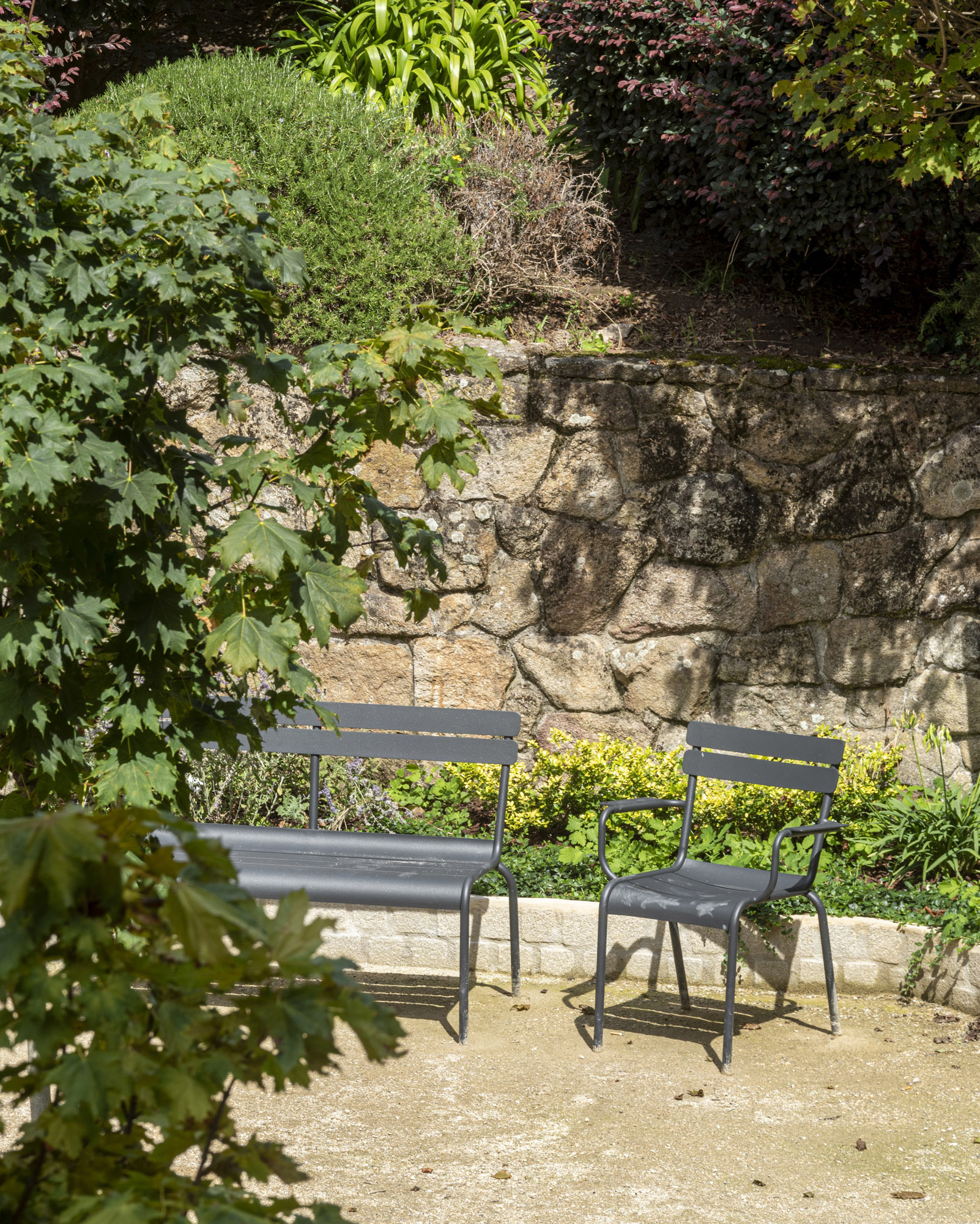
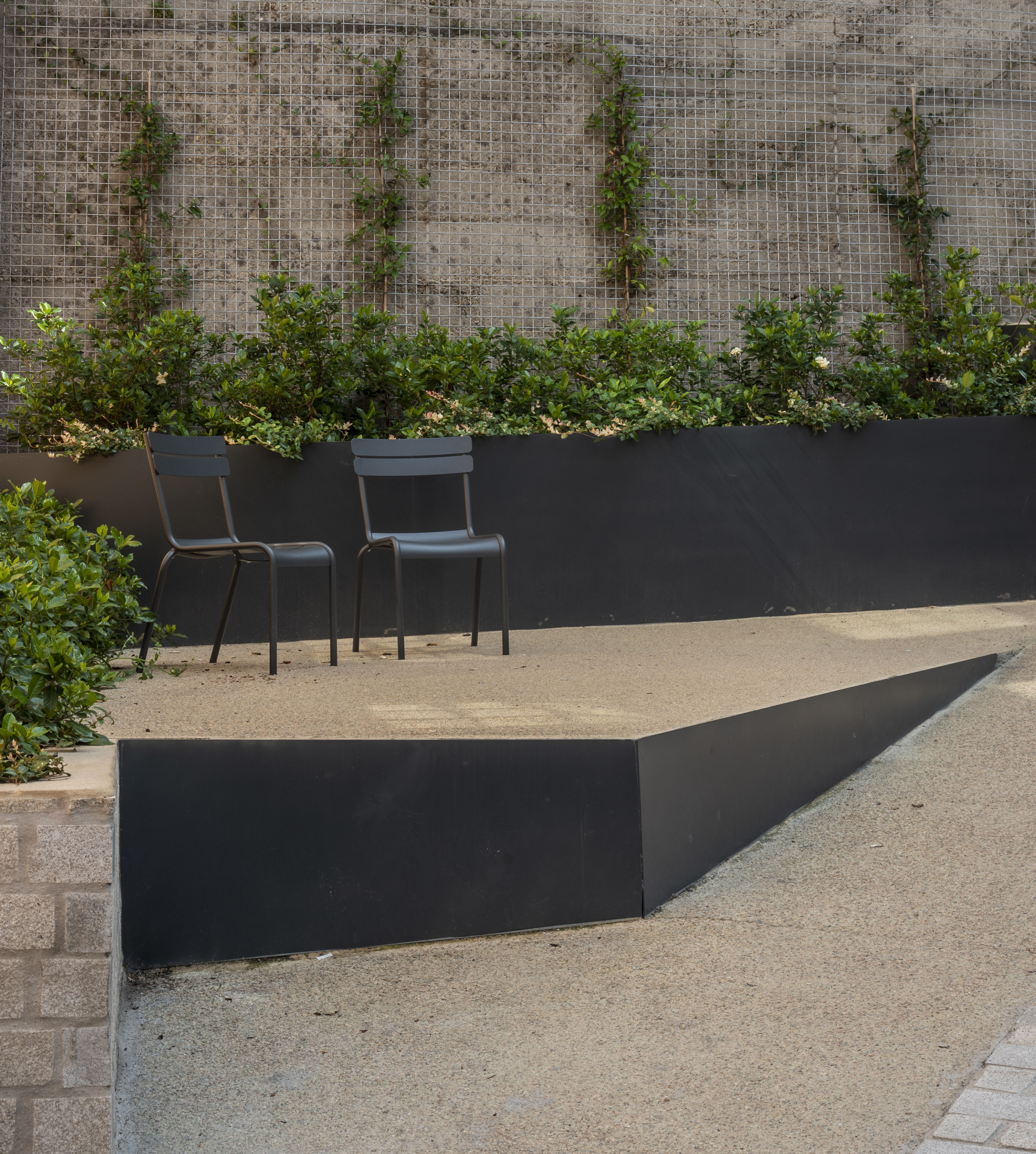
The project’s materiality is defined through a carefully calibrated palette. A chromatic study was carried out for recycled aggregate concrete in order to achieve beige and earthy tones capable of engaging with the existing urban landscape. These materials are combined with stone pavers sourced from local quarries. The combination of concrete, soil tones and stone softens the atmosphere of a place previously marked by the hardness of asphalt and traffic.
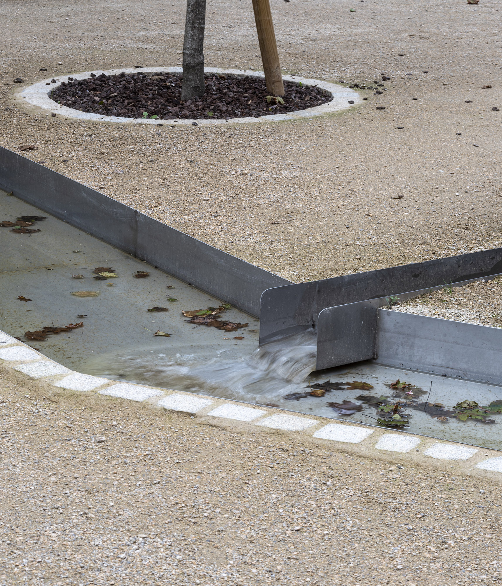
Water also regains a sensory presence within the public space. The historic fountain re-emerges in the square through a small basin that allows water to become visible and audible once again. This gesture introduces new sounds and forms of life into the space: birds find a place to drink, children approach the water, and the murmur of flowing water replaces the dominant noise of traffic.
Vegetation reinforces this natural atmosphere. Over time, the growth of trees and plants will consolidate a greener, more liveable urban landscape.
The remaining urban elements—such as lighting fixtures and street furniture—are discreetly integrated into the ensemble. Their colours and finishes follow the chromatic palette used along the Camino de Santiago, which passes through the neighborhood. These elements do not seek formal protagonism but rather support the landscape and reinforce the identity of the place.
For decades the site had been reduced to an asphalt surface dominated by traffic. The intervention transforms this setting into an urban landscape where water, vegetation and topography once again shape the spatial experience.
The project’s materiality is defined through a carefully calibrated palette. A chromatic study was carried out for recycled aggregate concrete in order to achieve beige and earthy tones capable of engaging with the existing urban landscape. These materials are combined with stone pavers sourced from local quarries. The combination of concrete, soil tones and stone softens the atmosphere of a place previously marked by the hardness of asphalt and traffic.
Water also regains a sensory presence within the public space. The historic fountain re-emerges in the square through a small basin that allows water to become visible and audible once again. This gesture introduces new sounds and forms of life into the space: birds find a place to drink, children approach the water, and the murmur of flowing water replaces the dominant noise of traffic.
Vegetation reinforces this natural atmosphere. Over time, the growth of trees and plants will consolidate a greener, more liveable urban landscape.
The remaining urban elements—such as lighting fixtures and street furniture—are discreetly integrated into the ensemble. Their colours and finishes follow the chromatic palette used along the Camino de Santiago, which passes through the neighborhood. These elements do not seek formal protagonism but rather support the landscape and reinforce the identity of the place.
The project conceives public space as an open and accessible social infrastructure for all. The reintroduction of water into the square fosters new ways of engaging with public space, creating a gathering place for neighbours, children and visitors.
Before the intervention, the area was dominated by vehicular traffic and presented significant barriers to pedestrian use. 84% of the surface was covered by asphalt, reflecting a car-centered urban model.
The transformation has allowed the recovery of 2,940 m² of public space, of which 1,686 m² have become fully pedestrian areas, while 1,254 m² have been reorganised as shared space, prioritising people. This transformation returns urban space to residents and promotes safer, more accessible and more liveable mobility.
The new square and traffic-calmed street offer a comfortable environment for people of all ages, encouraging everyday encounters among neighbors, children, elderly residents, and visitors.
The intervention also helps reintegrate a neighborhood historically marginalised from the dynamics of the town center. By improving the quality of public space, the project strengthens the community’s sense of belonging and restores a place for social interaction.
The project also has a broader territorial dimension. Rúa Picota forms part of the Camino de Santiago route. The transformation allows pilgrims and residents to share a more welcoming urban landscape, generating new opportunities for social interaction and local economic activity.
Before the intervention, the area was dominated by vehicular traffic and presented significant barriers to pedestrian use. 84% of the surface was covered by asphalt, reflecting a car-centered urban model.
The transformation has allowed the recovery of 2,940 m² of public space, of which 1,686 m² have become fully pedestrian areas, while 1,254 m² have been reorganised as shared space, prioritising people. This transformation returns urban space to residents and promotes safer, more accessible and more liveable mobility.
The new square and traffic-calmed street offer a comfortable environment for people of all ages, encouraging everyday encounters among neighbors, children, elderly residents, and visitors.
The intervention also helps reintegrate a neighborhood historically marginalised from the dynamics of the town center. By improving the quality of public space, the project strengthens the community’s sense of belonging and restores a place for social interaction.
The project also has a broader territorial dimension. Rúa Picota forms part of the Camino de Santiago route. The transformation allows pilgrims and residents to share a more welcoming urban landscape, generating new opportunities for social interaction and local economic activity.
The project responds to everyday issues identified in the A Picota neighborhood, where public space had gradually been taken over by road traffic and had lost its role as a place for community interaction.
One of the main concerns pointed out by residents was the accumulation of water at the lowest point of the site, where the former roundabout frequently flooded during intense rainfall events.
The project addresses this issue through an integrated water management strategy. Along the street and square, Sustainable Urban Drainage Systems (SUDS) collect, slow down and infiltrate rainwater progressively, reducing surface runoff. These vegetated strips and drainage planters capture water from higher points and guide it towards infiltration areas at the lowest point of the site, preventing the flooding that previously affected the space.
Beyond solving the local flooding issue, this strategy also helps relieve pressure on the municipal stormwater network. By infiltrating part of the rainwater into the ground, pressure on the sewer system during heavy rainfall events is reduced, preventing the activation of overflow structures at the wastewater treatment plant and thereby contributing to the mitigation of pollution episodes in the Vigo estuary.
At the same time, the transformation of the former traffic space into an accessible green square allows the place to be recovered as a social node for the neighborhood, encouraging everyday encounters between neighbours, supporting local commerce and enabling shared use by residents, visitors and Camino de Santiago pilgrims.
In this way, the project responds in an integrated manner to technical, social, and environmental demands, demonstrating how public space design can transform an urban problem into an opportunity to enhance the neighborhood’s quality of life.
One of the main concerns pointed out by residents was the accumulation of water at the lowest point of the site, where the former roundabout frequently flooded during intense rainfall events.
The project addresses this issue through an integrated water management strategy. Along the street and square, Sustainable Urban Drainage Systems (SUDS) collect, slow down and infiltrate rainwater progressively, reducing surface runoff. These vegetated strips and drainage planters capture water from higher points and guide it towards infiltration areas at the lowest point of the site, preventing the flooding that previously affected the space.
Beyond solving the local flooding issue, this strategy also helps relieve pressure on the municipal stormwater network. By infiltrating part of the rainwater into the ground, pressure on the sewer system during heavy rainfall events is reduced, preventing the activation of overflow structures at the wastewater treatment plant and thereby contributing to the mitigation of pollution episodes in the Vigo estuary.
At the same time, the transformation of the former traffic space into an accessible green square allows the place to be recovered as a social node for the neighborhood, encouraging everyday encounters between neighbours, supporting local commerce and enabling shared use by residents, visitors and Camino de Santiago pilgrims.
In this way, the project responds in an integrated manner to technical, social, and environmental demands, demonstrating how public space design can transform an urban problem into an opportunity to enhance the neighborhood’s quality of life.
The realization of the project has been made possible through collaboration among different tiers of public administration.
At the regional level, the intervention is linked to strategies promoted by the Xunta de Galicia to improve the urban and landscape quality of environments connected to the Camino de Santiago.
At the provincial level, the project was selected within the Rede Ágora programme promoted by the Provincial Council of Pontevedra, which supports the regeneration of public spaces based on the principles of 2030 Agenda.
Finally, the municipality of Redondela promoted and implemented the intervention as a concrete improvement within the urban fabric of the A Picota neighbourhood.
The coordination between regional, provincial, and municipal administrations has enabled a shared vision for high-quality public space to materialize in a concrete intervention that enhances everyday life in the neighborhood.
At the regional level, the intervention is linked to strategies promoted by the Xunta de Galicia to improve the urban and landscape quality of environments connected to the Camino de Santiago.
At the provincial level, the project was selected within the Rede Ágora programme promoted by the Provincial Council of Pontevedra, which supports the regeneration of public spaces based on the principles of 2030 Agenda.
Finally, the municipality of Redondela promoted and implemented the intervention as a concrete improvement within the urban fabric of the A Picota neighbourhood.
The coordination between regional, provincial, and municipal administrations has enabled a shared vision for high-quality public space to materialize in a concrete intervention that enhances everyday life in the neighborhood.
The project is developed through a transdisciplinary approach that combines multiple fields of expertise to address the site’s urban, environmental, and social challenges in an integrated manner.
During the design phase, professionals from various disciplines were involved within the project team, including architects, urban designers, and landscape architects, together with an agricultural engineer and a technical architect. This collaboration allowed the integration of public space design, vegetation systems, water management and construction feasibility into a coherent proposal.
The transdisciplinary approach continued during the construction phase. The execution supervision was undertaken by a municipal technician from the municipality of Redondela, in coordination with the project team and the technical staff of the construction company.
Throughout the process, continuous dialogue between the different disciplines involved —design, engineering, landscape and construction— allowed the proposed solutions to be adapted to the real conditions of the site.
This collaborative framework made it possible to deliver a public space that integrates water infrastructure, urban biodiversity, and social life within a single, cohesive intervention.
During the design phase, professionals from various disciplines were involved within the project team, including architects, urban designers, and landscape architects, together with an agricultural engineer and a technical architect. This collaboration allowed the integration of public space design, vegetation systems, water management and construction feasibility into a coherent proposal.
The transdisciplinary approach continued during the construction phase. The execution supervision was undertaken by a municipal technician from the municipality of Redondela, in coordination with the project team and the technical staff of the construction company.
Throughout the process, continuous dialogue between the different disciplines involved —design, engineering, landscape and construction— allowed the proposed solutions to be adapted to the real conditions of the site.
This collaborative framework made it possible to deliver a public space that integrates water infrastructure, urban biodiversity, and social life within a single, cohesive intervention.
The project was financed through coordinated public investment across multiple tiers of government. The intervention was delivered through collaboration between the Municipality of Redondela, the Provincial Council of Pontevedra—via the Rede Ágora public space enhancement programme—and regional strategies promoted by the Xunta de Galicia in connection with the Camino de Santiago.
The project’s economic sustainability is grounded in a low-maintenance public realm model. The use of climate-adapted planting, permeable paving systems, and Sustainable Urban Drainage Systems (SuDS) reduces long-term operational and maintenance costs while enhancing environmental performance and resilience.
The regeneration of public space also strengthens local commerce and neighborhood activity, generating indirect social and economic benefits and reinforcing the area’s urban vitality.
The project’s economic sustainability is grounded in a low-maintenance public realm model. The use of climate-adapted planting, permeable paving systems, and Sustainable Urban Drainage Systems (SuDS) reduces long-term operational and maintenance costs while enhancing environmental performance and resilience.
The regeneration of public space also strengthens local commerce and neighborhood activity, generating indirect social and economic benefits and reinforcing the area’s urban vitality.
The project is conceived as a replicable urban model grounded in simple, adaptable design strategies. The integration of Sustainable Urban Drainage Systems (SuDS), planted swales, subtle micro-topographies, and permeable paving enables effective stormwater management, enhanced microclimatic comfort, and the creation of new social spaces within the public realm.
These strategies do not depend on complex technological systems but rather on nature-based solutions that can be readily adapted to diverse urban contexts.
The implementation of the intervention in a small town demonstrates that such approaches are both feasible and effective in small municipalities. At the same time, the system is inherently scalable and can be extended to more complex urban fabrics, becoming a valuable tool for climate adaptation and ecological urbanism in larger cities.
The project thus represents a transferable best-practice case, illustrating how integrated water management, urban biodiversity, and public space design can converge within a coherent and resilient urban strategy.
These strategies do not depend on complex technological systems but rather on nature-based solutions that can be readily adapted to diverse urban contexts.
The implementation of the intervention in a small town demonstrates that such approaches are both feasible and effective in small municipalities. At the same time, the system is inherently scalable and can be extended to more complex urban fabrics, becoming a valuable tool for climate adaptation and ecological urbanism in larger cities.
The project thus represents a transferable best-practice case, illustrating how integrated water management, urban biodiversity, and public space design can converge within a coherent and resilient urban strategy.