Enhancing Circularity, Sustainability, and Innovation
Where Does the Sand Go?
Adaptation strategies for the future of the coasts
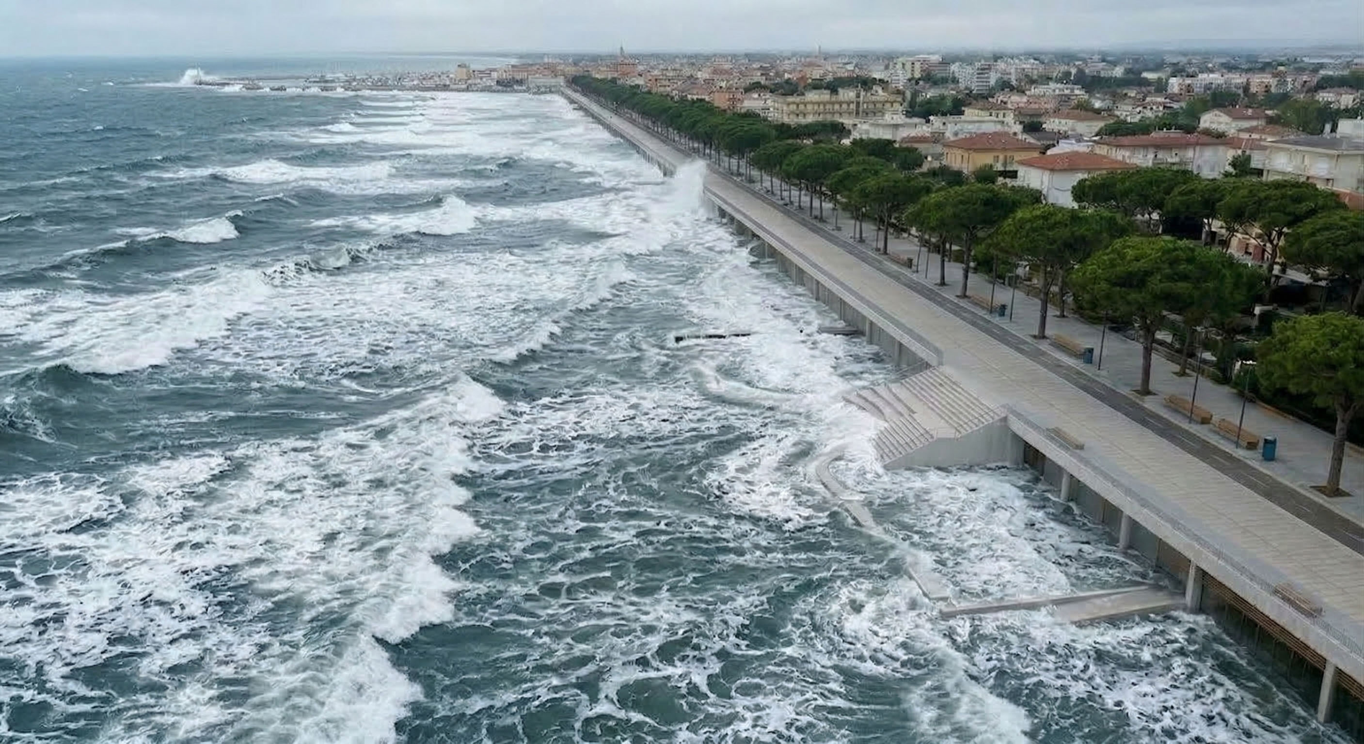
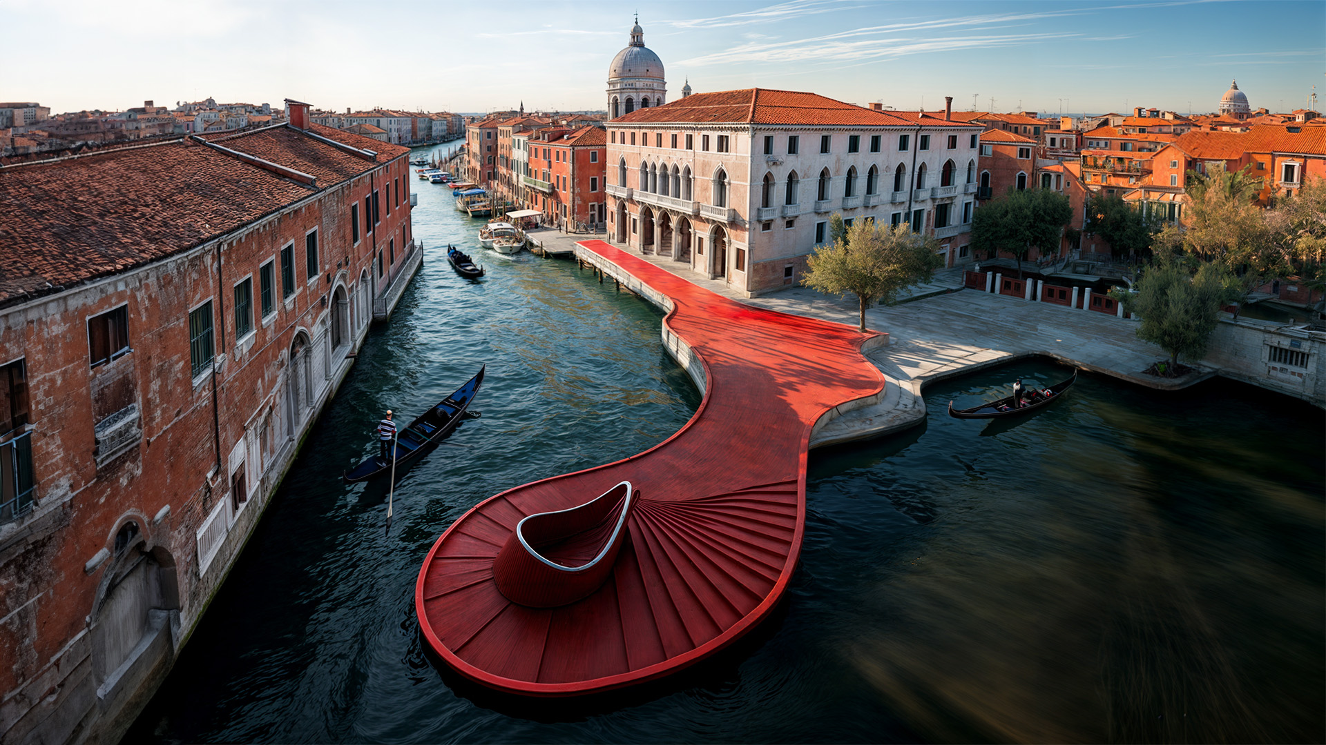
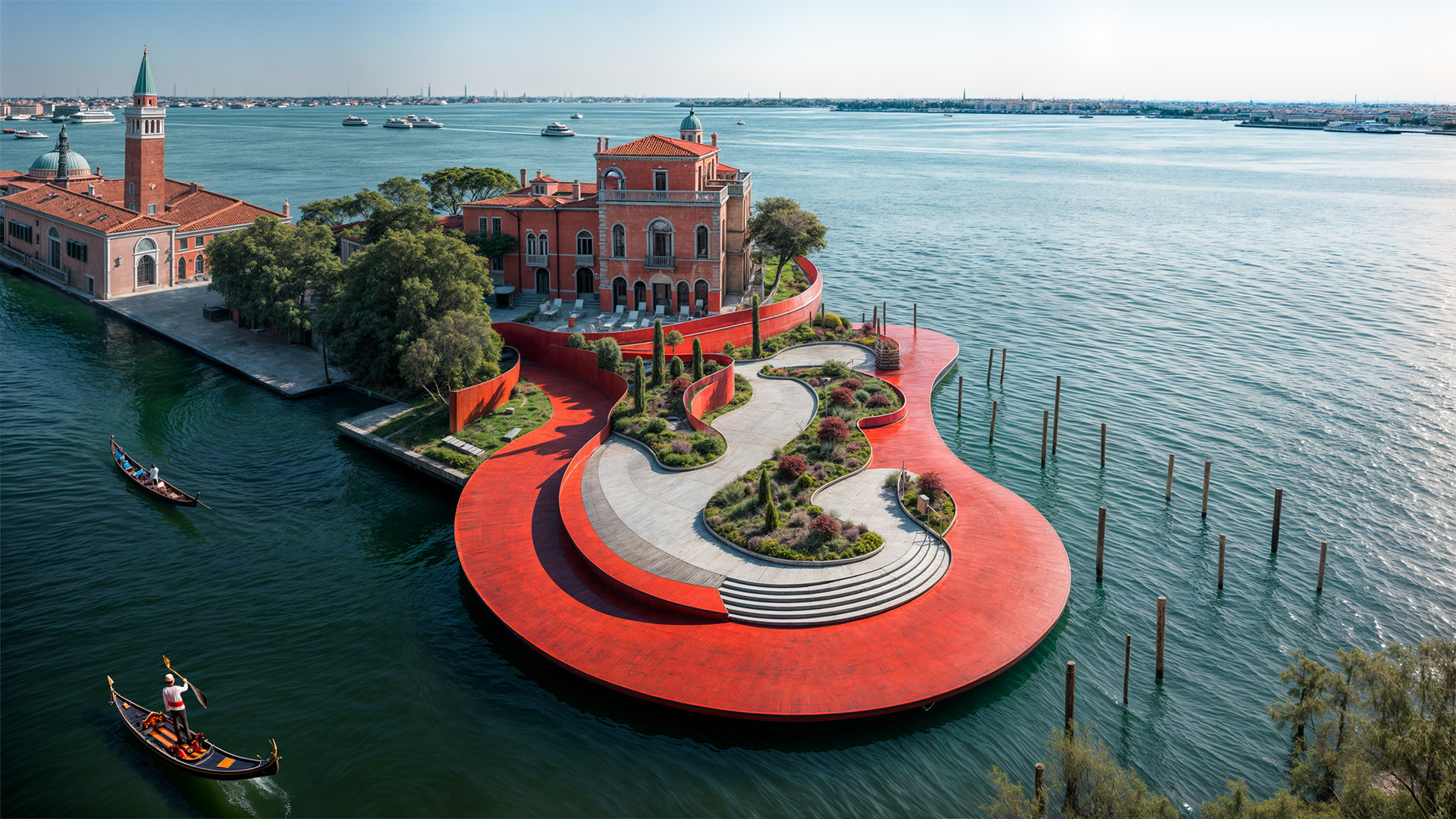
As sea levels are projected to rise by up to 1 meter by 2100, Where Does the Sand Go? reimagines coastlines and waterfront cities as living public landscapes. Curated by Filippo Mercuri through Gaud•e Project, it uses AI-generated visions to turn scientific research into shared futures. Through Piers, Levels and Bays, the project transforms erosion, seasonality and sea-level rise into spatial, ecological and civic opportunities.
Italy
National
It addresses urban-rural linkages
It involves a physical transformation of the built environment (hard investment)
Early concept
No
No
Yes
Individual
Where Does the Sand Go? reframes coastal adaptation as a public, spatial and ecological project rather than a purely defensive one. Developed by Filippo Mercuri through Gaud•e—an AI-imagery platform that rethinks urban, cultural, environmental and atmospheric events as drivers of transformation—the concept addresses a growing European challenge: how to redesign coastlines facing erosion, sea-level rise, seasonality and increasing pressure on waterfronts.
Its purpose is to turn the coastline from a fixed edge into a resilient civic landscape where protection, accessibility, ecological regeneration and public life work together. It is intended for coastal communities, residents, visitors, public institutions, designers, researchers and decision-makers working on adaptation, tourism and public space.
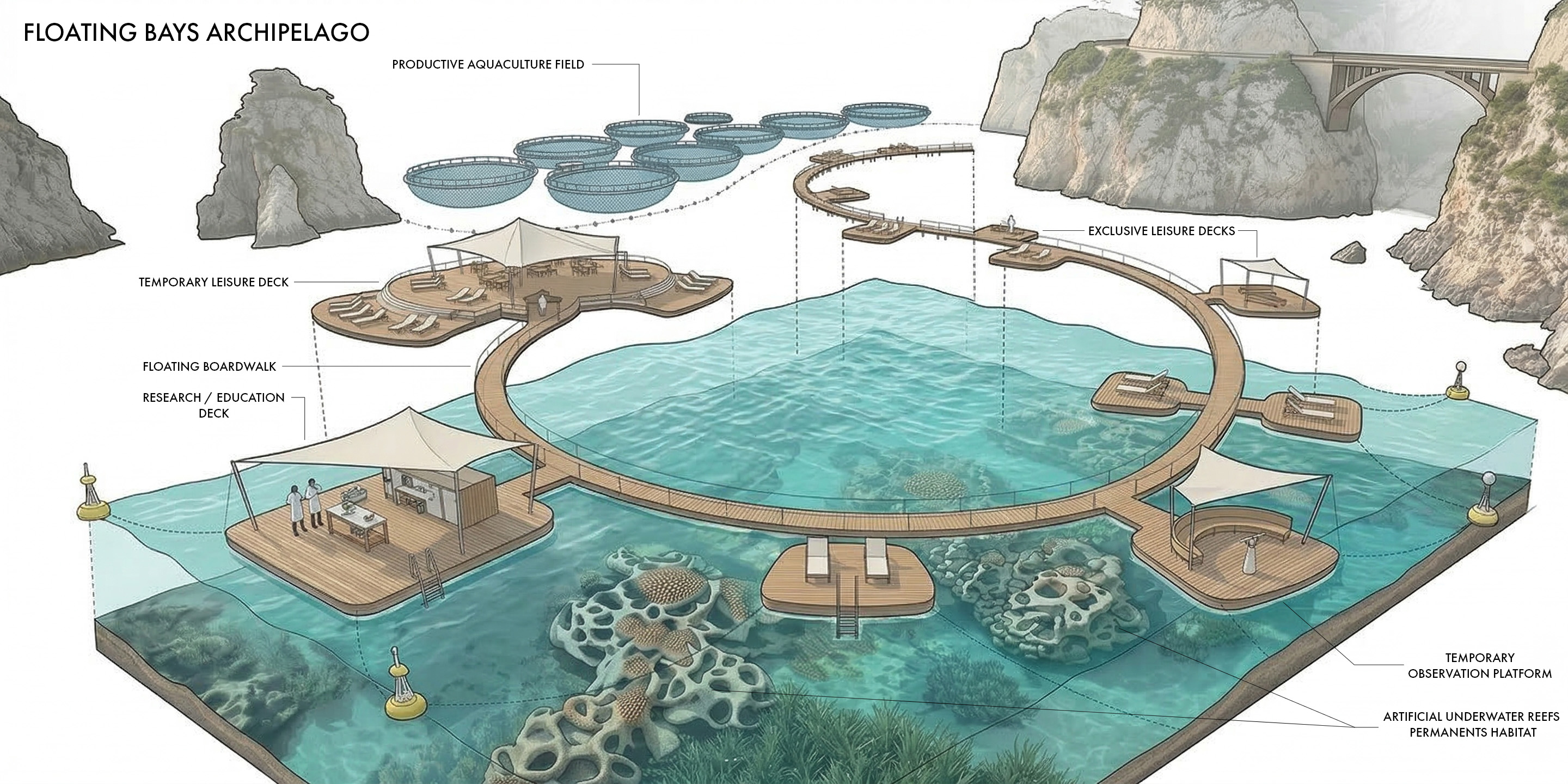
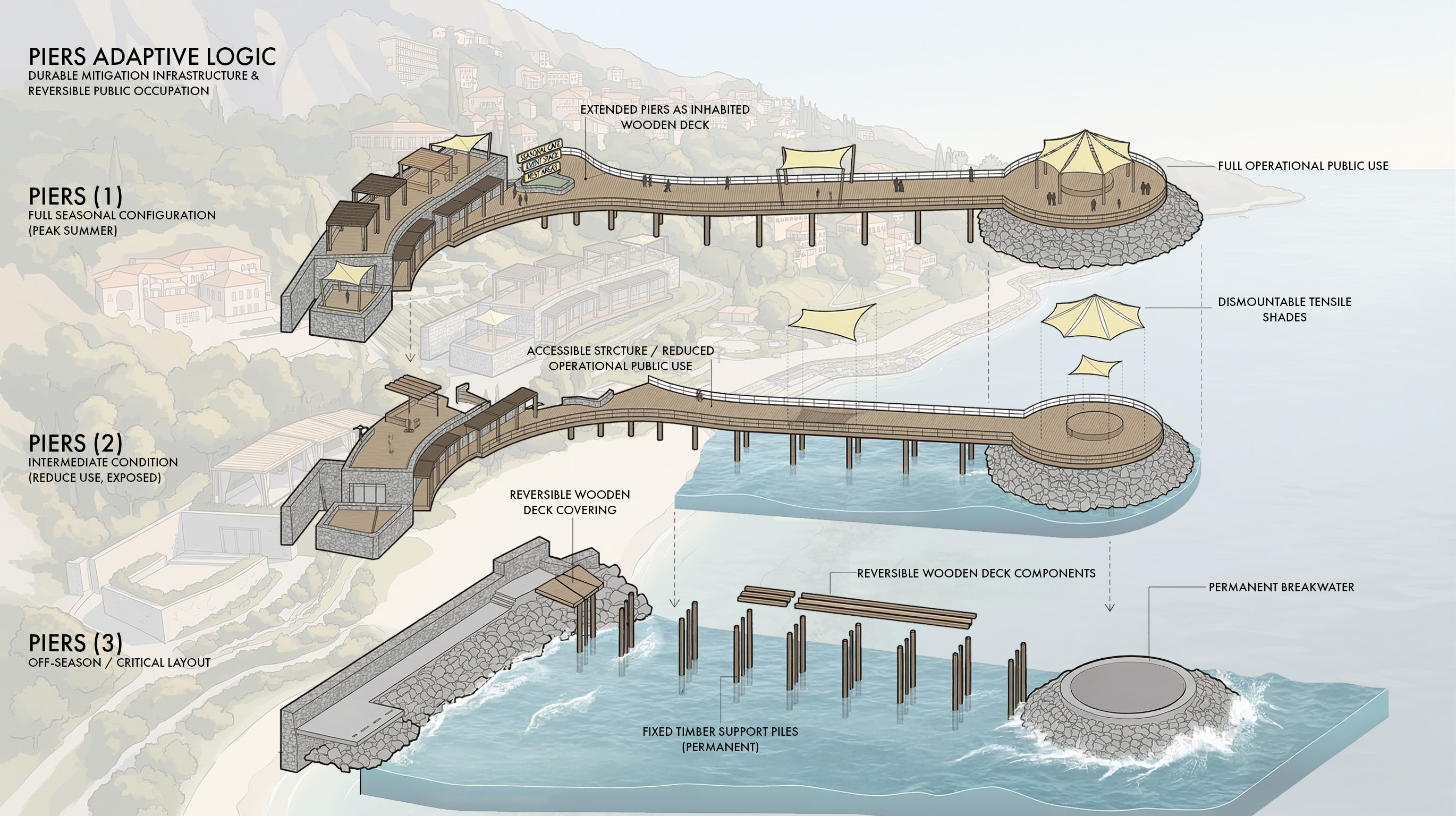
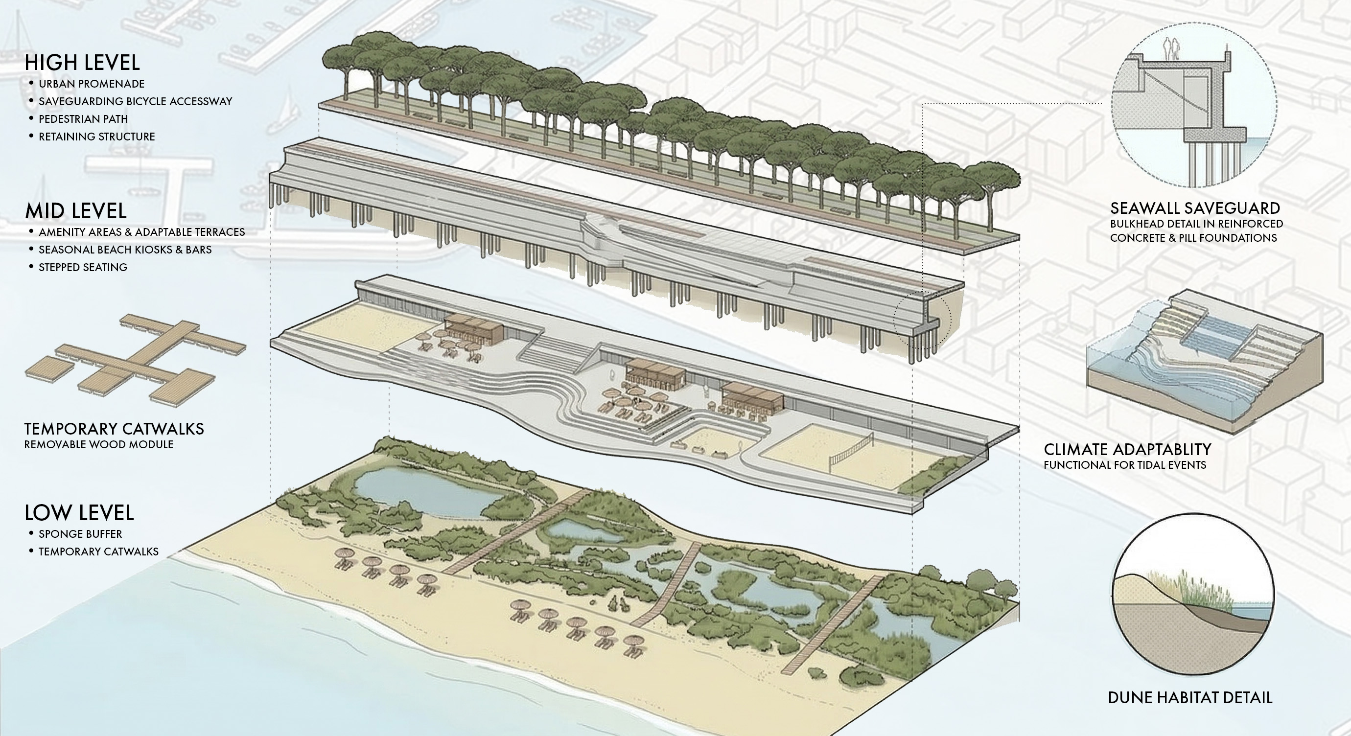
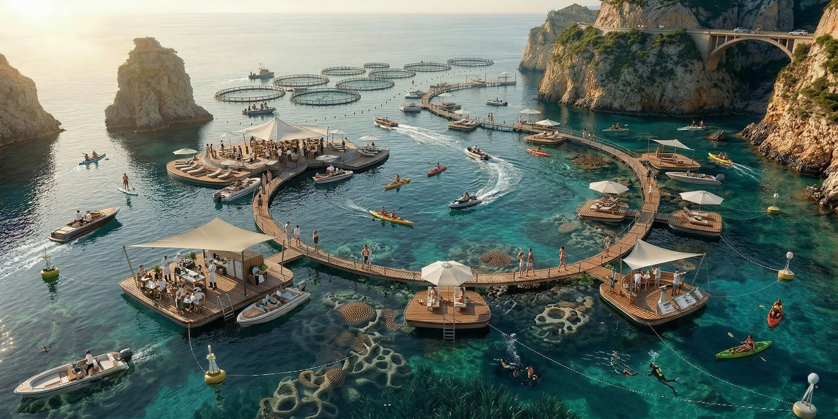
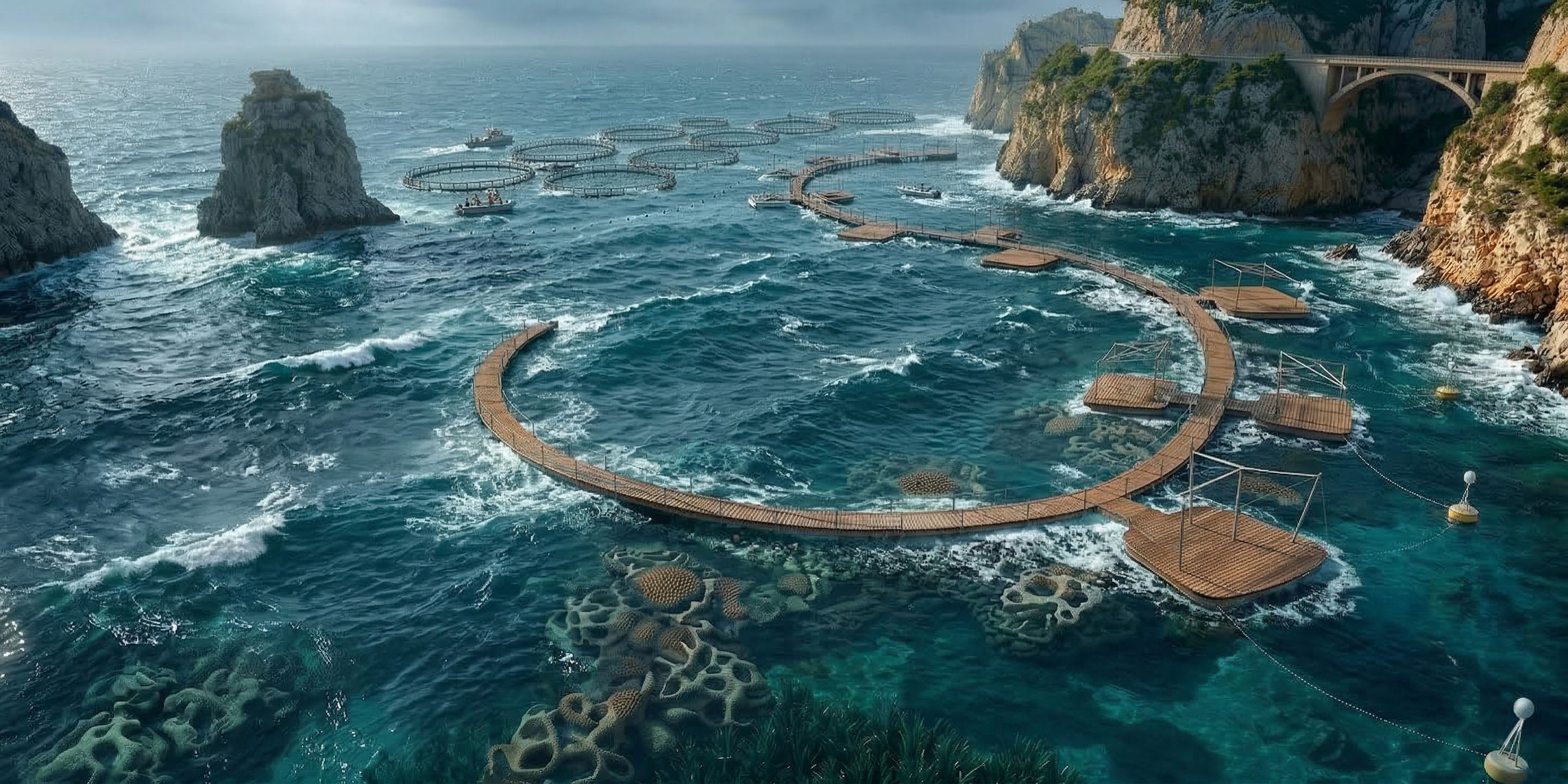
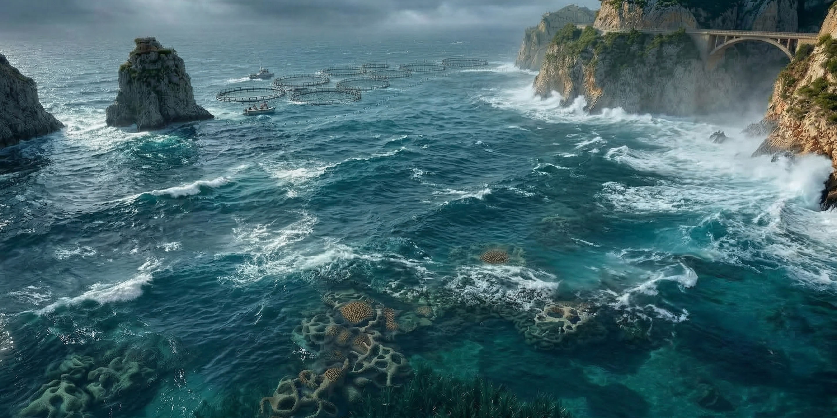
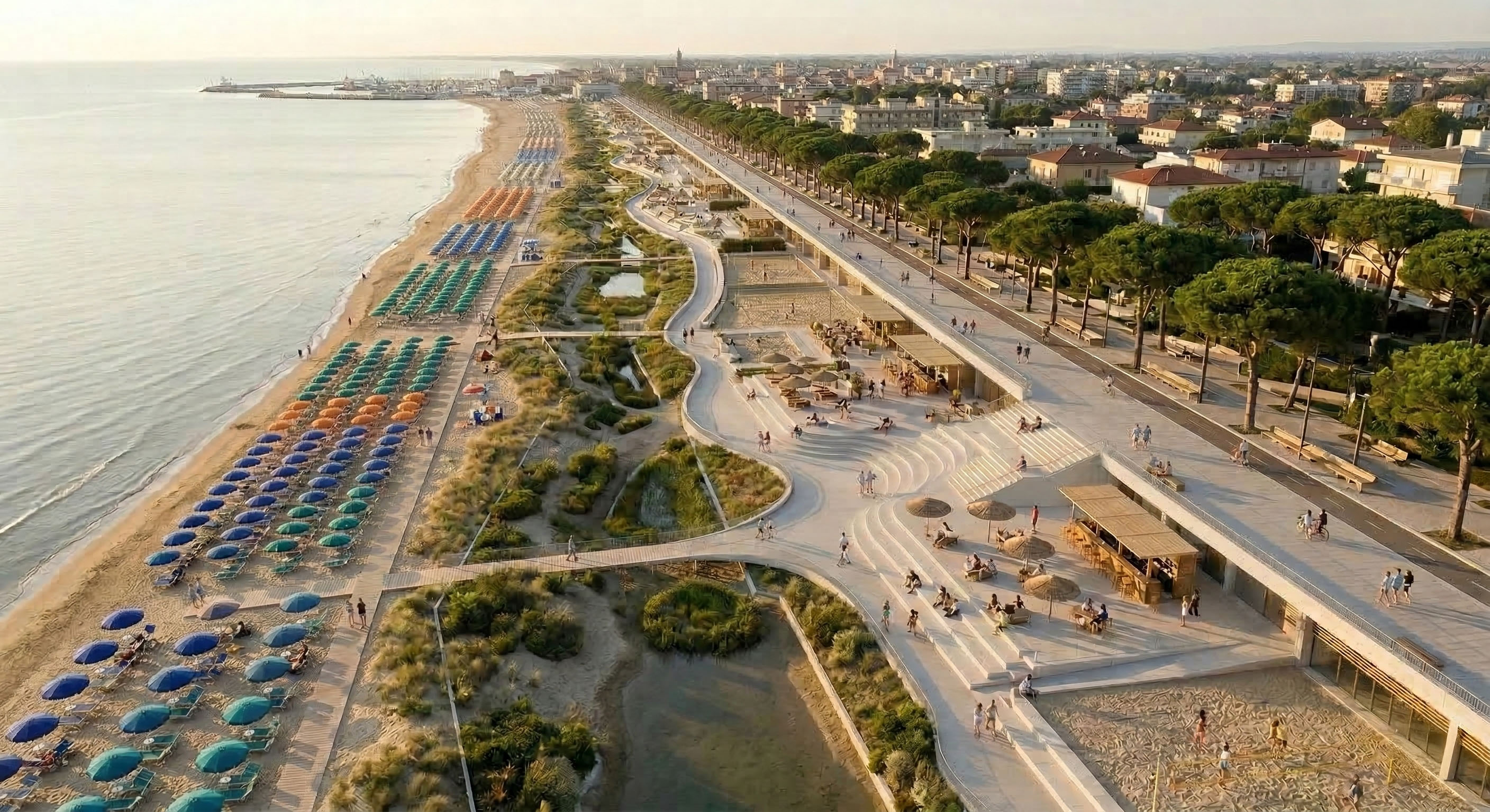
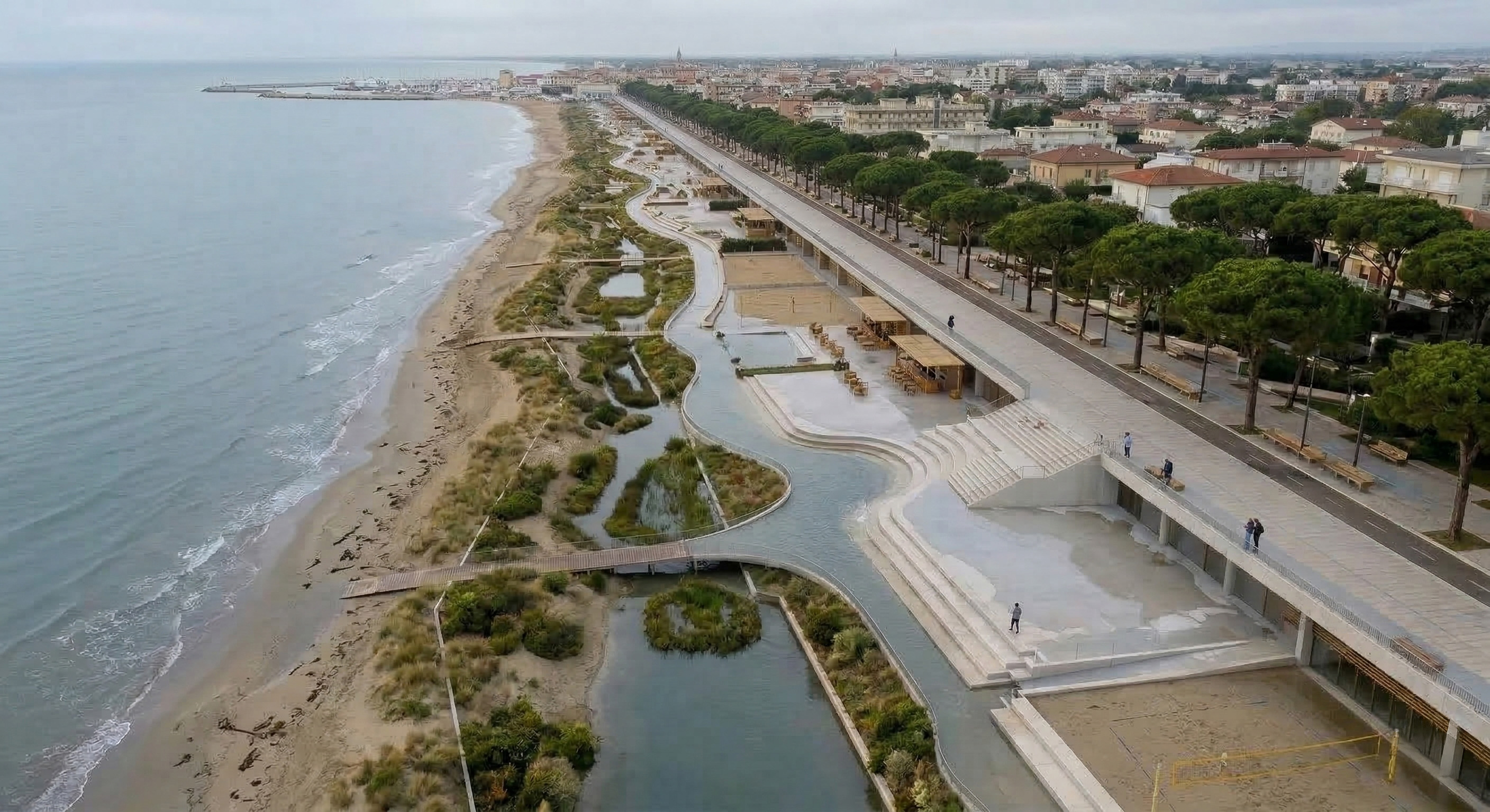
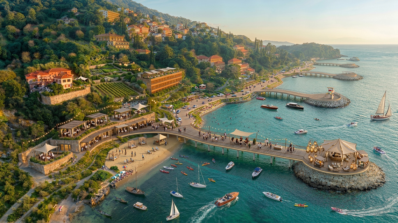
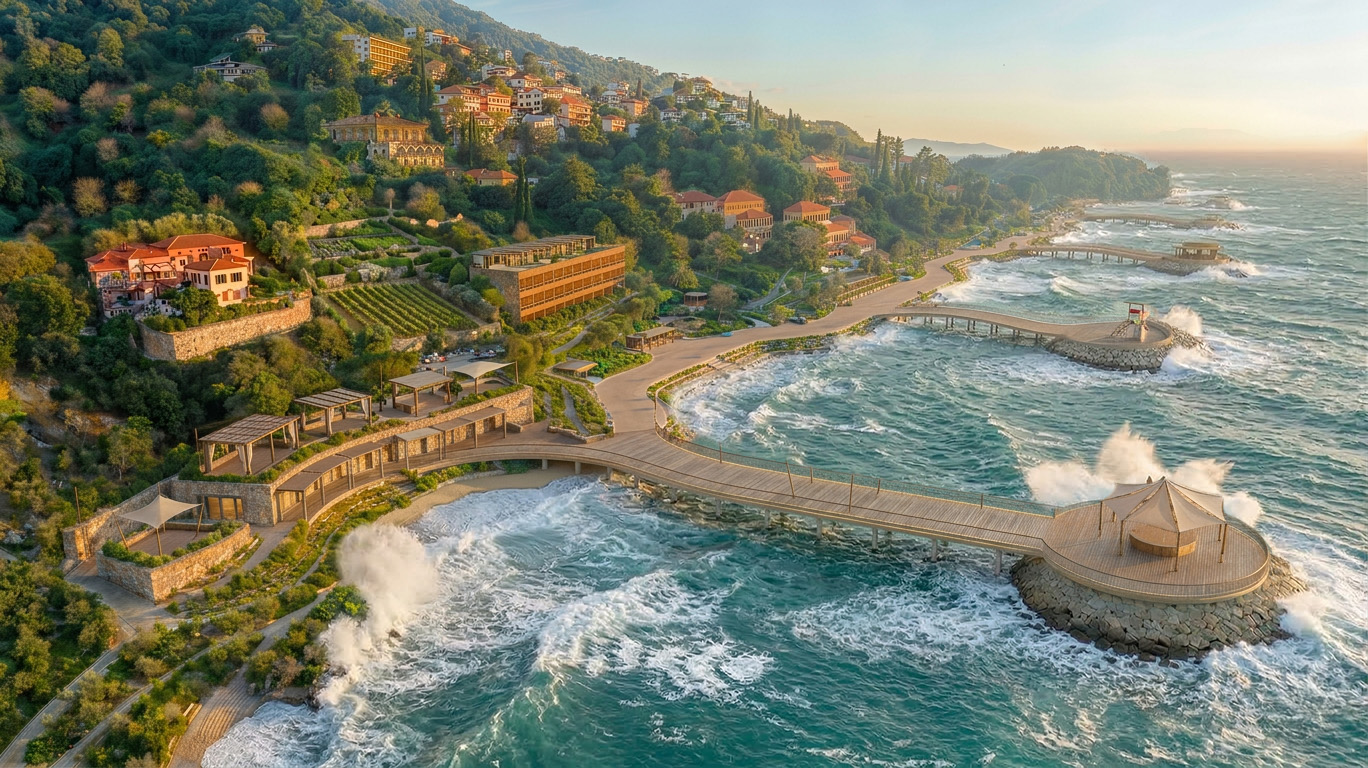
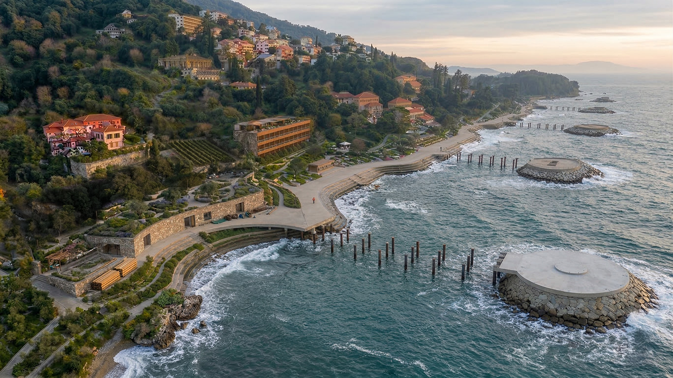
The concept is structured through three integrated actions. Piers / Activate extends public access and collective use over the water through reversible infrastructures. Levels / Retain & Manage organizes the coast through adaptive topographies that absorb and manage water, erosion and seasonal change. Bays / Regenerate restores marine ecologies through artificial reefs, floating habitats and new shared water commons.
So far, the project has produced a coherent body of AI-generated imagery, diagrams and spatial scenarios that make future coastal transformations visible, discussable and transferable. It has already helped build a shared conversation between architecture, ESG strategy, coastal expertise and climate-risk research.
Its expected result is not a single fixed masterplan, but a replicable framework for future briefs, public debate and pilot interventions. Its transformative potential lies in showing that resilient coastlines can be protective, beautiful, publicly accessible and economically activatable at the same time.
Its purpose is to turn the coastline from a fixed edge into a resilient civic landscape where protection, accessibility, ecological regeneration and public life work together. It is intended for coastal communities, residents, visitors, public institutions, designers, researchers and decision-makers working on adaptation, tourism and public space.
The concept is structured through three integrated actions. Piers / Activate extends public access and collective use over the water through reversible infrastructures. Levels / Retain & Manage organizes the coast through adaptive topographies that absorb and manage water, erosion and seasonal change. Bays / Regenerate restores marine ecologies through artificial reefs, floating habitats and new shared water commons.
So far, the project has produced a coherent body of AI-generated imagery, diagrams and spatial scenarios that make future coastal transformations visible, discussable and transferable. It has already helped build a shared conversation between architecture, ESG strategy, coastal expertise and climate-risk research.
Its expected result is not a single fixed masterplan, but a replicable framework for future briefs, public debate and pilot interventions. Its transformative potential lies in showing that resilient coastlines can be protective, beautiful, publicly accessible and economically activatable at the same time.
The concept began within Gaud•e, Filippo Mercuri’s AI-based project exploring how major events can reshape space. In the Venice Biennale of Architecture context, Italian Pavillion “Terrae Aquae”, that reflection shifted toward the coast: the shoreline was no longer understood as a border to defend, but as a moving threshold to redesign. From this came the central question of the project: where does the sand go when the coastline moves?
The work was developed through an iterative exchange between Gaud•e, Lombardini22, L22 ESG, WaterFrontLab and Fondazione RETURN. Filippo Mercuri directed the spatial and visual vision through Gaud•e, while environmental knowledge, ESG strategy, territorial reasoning and climate-risk research continuously tested and refined the proposal. The process was collaborative but always anchored by a clear spatial narrative.
Its development followed four main phases: research on erosion, sea-level rise and coastal dynamics; translation of these issues into prompts, diagrams and AI-generated scenarios; spatial definition through the three adaptive families—Piers, Levels and Bays; and repeated iteration to connect resilience with everyday public life, including the Venice Biennale “Red Carpet” as an urban and symbolic reference.
The main tools were AI image generation, prompting, diagrammatic thinking, scenario building and interdisciplinary dialogue. Rather than producing a final object, the process built a design method: a shared vocabulary for discussing adaptation through water, public space and landscape.
If continued, the next step would be to turn this method into site-based proof-of-concept studies and participatory testing with local authorities, communities, researchers and coastal stakeholders.
The work was developed through an iterative exchange between Gaud•e, Lombardini22, L22 ESG, WaterFrontLab and Fondazione RETURN. Filippo Mercuri directed the spatial and visual vision through Gaud•e, while environmental knowledge, ESG strategy, territorial reasoning and climate-risk research continuously tested and refined the proposal. The process was collaborative but always anchored by a clear spatial narrative.
Its development followed four main phases: research on erosion, sea-level rise and coastal dynamics; translation of these issues into prompts, diagrams and AI-generated scenarios; spatial definition through the three adaptive families—Piers, Levels and Bays; and repeated iteration to connect resilience with everyday public life, including the Venice Biennale “Red Carpet” as an urban and symbolic reference.
The main tools were AI image generation, prompting, diagrammatic thinking, scenario building and interdisciplinary dialogue. Rather than producing a final object, the process built a design method: a shared vocabulary for discussing adaptation through water, public space and landscape.
If continued, the next step would be to turn this method into site-based proof-of-concept studies and participatory testing with local authorities, communities, researchers and coastal stakeholders.
Coastal adaptation
AI-generated scenarios
Nature-based solutions
Modular reversibility
Stakeholders dialogue
Where Does the Sand Go? proposes a different idea of coastal sustainability: not separating land from water through permanent barriers, but redesigning the shoreline as a system that can absorb change, reduce pressure and remain publicly usable over time. Its main objective is to respond to erosion, sea-level rise, seasonality and extreme events through lighter, reversible and water-sensitive strategies that reduce environmental impact while preserving access and quality of life.
This is implemented through three complementary actions. Piers / Activate extend public life across the water’s edge through elevated, reversible structures. Levels / Retain & Manage organise the coast through adaptive topographies, vegetated sponge zones and differentiated heights that retain, filter and manage water. Bays / Regenerate restore marine ecologies through artificial reefs, floating habitats and new biodiversity-supporting commons. Together, these strategies replace rigid defence with a more adaptive and regenerative coastal logic.
The concept has already produced a coherent body of images, diagrams and scenarios that made this approach visible and discussable across design, ESG and coastal research contexts. It has shown that coastal adaptation can be framed not only as technical protection, but as an integrated response combining ecology, public use and spatial quality.
Its exemplary character lies in proving that sustainability on the coast can be durable because it is flexible. Rather than resisting change blindly, the concept works with changing conditions and proposes a model that is lighter, repairable, seasonally adjustable and more compatible with long-term environmental transformation.
This is implemented through three complementary actions. Piers / Activate extend public life across the water’s edge through elevated, reversible structures. Levels / Retain & Manage organise the coast through adaptive topographies, vegetated sponge zones and differentiated heights that retain, filter and manage water. Bays / Regenerate restore marine ecologies through artificial reefs, floating habitats and new biodiversity-supporting commons. Together, these strategies replace rigid defence with a more adaptive and regenerative coastal logic.
The concept has already produced a coherent body of images, diagrams and scenarios that made this approach visible and discussable across design, ESG and coastal research contexts. It has shown that coastal adaptation can be framed not only as technical protection, but as an integrated response combining ecology, public use and spatial quality.
Its exemplary character lies in proving that sustainability on the coast can be durable because it is flexible. Rather than resisting change blindly, the concept works with changing conditions and proposes a model that is lighter, repairable, seasonally adjustable and more compatible with long-term environmental transformation.
Where Does the Sand Go? contributes to aesthetics by turning coastal adaptation into a meaningful public experience rather than a hidden technical response. Instead of treating the waterfront as a line of defence, the concept imagines it as a changing landscape where water, light, matter and collective life shape everyday beauty. This reflects the NEB idea that beauty can improve well-being and create belonging through shared experience.
The concept was born from Gaud•e’s work in the Venice Biennale context, where the glamour of the Film Festival was reinterpreted through the fragile condition of Venice’s waterfront. From this origin, the project developed a language of adaptive coastal spaces that combines design, cultural imagination and environmental awareness. The three strategies—Piers / Activate, Levels / Retain & Manage, Bays / Regenerate—are not only technical responses, but spatial atmospheres: places to walk, gather, observe, rest and reconnect with the sea.
Its aesthetic quality lies in creating a richer sensory relationship with the coast through reflection, wind, shade, sound, changing tides and seasonal transformation. It imagines light, reversible structures that do not erase the character of the place but intensify it. In this way, adaptation becomes emotionally legible and physically enjoyable, supporting comfort, curiosity and care.
The concept also strengthens cultural identity. It starts from Venice, but speaks more broadly to European coastal heritage, where ports, promenades, beaches and waterfront rituals are part of everyday life. By merging AI-driven visual research with architectural thinking, it creates forward-looking images of belonging.
Its exemplary character lies in showing that climate adaptation can be desirable, poetic and shared. Rather than separating people from water, it creates new forms of coexistence rooted in place, open to change and able to generate long-term attachment and care.
The concept was born from Gaud•e’s work in the Venice Biennale context, where the glamour of the Film Festival was reinterpreted through the fragile condition of Venice’s waterfront. From this origin, the project developed a language of adaptive coastal spaces that combines design, cultural imagination and environmental awareness. The three strategies—Piers / Activate, Levels / Retain & Manage, Bays / Regenerate—are not only technical responses, but spatial atmospheres: places to walk, gather, observe, rest and reconnect with the sea.
Its aesthetic quality lies in creating a richer sensory relationship with the coast through reflection, wind, shade, sound, changing tides and seasonal transformation. It imagines light, reversible structures that do not erase the character of the place but intensify it. In this way, adaptation becomes emotionally legible and physically enjoyable, supporting comfort, curiosity and care.
The concept also strengthens cultural identity. It starts from Venice, but speaks more broadly to European coastal heritage, where ports, promenades, beaches and waterfront rituals are part of everyday life. By merging AI-driven visual research with architectural thinking, it creates forward-looking images of belonging.
Its exemplary character lies in showing that climate adaptation can be desirable, poetic and shared. Rather than separating people from water, it creates new forms of coexistence rooted in place, open to change and able to generate long-term attachment and care.
Where Does the Sand Go? treats the coast as a shared public common, not as a privileged edge reserved for tourism, private use or hard infrastructure. Its inclusion objective is clear: to keep access to water open, legible and affordable, while avoiding adaptation models that exclude people through permanent barriers or costly, rigid solutions.
The concept addresses inclusion both spatially and economically. Spatially, it proposes publicly accessible piers, terraces, floating platforms and waterfront landscapes that support different forms of use, from everyday walking and bathing to research, education and collective activities. Economically, it relies on lighter, modular and reversible systems that can be implemented in phases, reducing the risk of exclusionary large-scale solutions and allowing broader public benefit.
Inclusion also shaped the way the concept was developed. Through Gaud•e, AI-generated images became shared tools for discussion rather than closed design outputs. WaterFrontLab, Lombardini22 / L22 ESG and Fondazione RETURN helped open the concept to different professional and institutional perspectives, creating a common ground between technical and non-technical actors.
The results achieved so far are conceptual but tangible: the project has already created a shared visual language that helps multiple actors understand and debate coastal change together. Its exemplary character lies in showing that inclusion on the coast is not only about access ramps or services, but about creating coastal spaces that remain publicly accessible, economically viable and collectively usable even under changing climate conditions.
The concept addresses inclusion both spatially and economically. Spatially, it proposes publicly accessible piers, terraces, floating platforms and waterfront landscapes that support different forms of use, from everyday walking and bathing to research, education and collective activities. Economically, it relies on lighter, modular and reversible systems that can be implemented in phases, reducing the risk of exclusionary large-scale solutions and allowing broader public benefit.
Inclusion also shaped the way the concept was developed. Through Gaud•e, AI-generated images became shared tools for discussion rather than closed design outputs. WaterFrontLab, Lombardini22 / L22 ESG and Fondazione RETURN helped open the concept to different professional and institutional perspectives, creating a common ground between technical and non-technical actors.
The results achieved so far are conceptual but tangible: the project has already created a shared visual language that helps multiple actors understand and debate coastal change together. Its exemplary character lies in showing that inclusion on the coast is not only about access ramps or services, but about creating coastal spaces that remain publicly accessible, economically viable and collectively usable even under changing climate conditions.
Where Does the Sand Go? was developed through participation understood as co-development: not presenting a finished answer, but building the concept through dialogue, testing and shared interpretation. The project is intended to benefit coastal communities, residents, visitors, public institutions, designers and all those affected by erosion, sea-level rise and the changing use of waterfronts.
Participation took place through consultation and iterative exchange. The first visual scenarios produced by Gaud•e were used to open discussion. They helped different actors see the same problem and react to the same spatial hypotheses. Through WaterFrontLab, the concept entered a wider conversation among professionals, companies and institutions, while Fondazione RETURN contributed climate-risk and coastal research, and Lombardini22 / L22 ESG connected the work to sustainability strategy and implementation thinking.
These actors had real influence on decisions. Their input helped move the concept from an initial intuition centred on urban piers in Venice toward a broader and more robust framework structured around Piers, Levels and Bays. Participation therefore improved the concept in concrete ways: it strengthened its environmental depth, increased its territorial realism and made it more transferable
At this stage, the project reflects the NEB ambition to co-develop. Its next step is to extend this participatory logic to local authorities, coastal communities and site-specific stakeholders through pilot testing and adaptation in real waterfront contexts.
Participation took place through consultation and iterative exchange. The first visual scenarios produced by Gaud•e were used to open discussion. They helped different actors see the same problem and react to the same spatial hypotheses. Through WaterFrontLab, the concept entered a wider conversation among professionals, companies and institutions, while Fondazione RETURN contributed climate-risk and coastal research, and Lombardini22 / L22 ESG connected the work to sustainability strategy and implementation thinking.
These actors had real influence on decisions. Their input helped move the concept from an initial intuition centred on urban piers in Venice toward a broader and more robust framework structured around Piers, Levels and Bays. Participation therefore improved the concept in concrete ways: it strengthened its environmental depth, increased its territorial realism and made it more transferable
At this stage, the project reflects the NEB ambition to co-develop. Its next step is to extend this participatory logic to local authorities, coastal communities and site-specific stakeholders through pilot testing and adaptation in real waterfront contexts.
The concept is designed to engage actors across multiple levels, because coastal adaptation cannot be addressed by a single stakeholder alone. At the local level, the concept is relevant to municipalities, waterfront authorities, cultural institutions, local communities, tourism operators and port-related actors directly affected by erosion, sea-level rise and the changing use of coastal space. For them, it offers a way to combine public space, water resilience and local identity through light, reversible and publicly accessible strategies.
At the regional and national level, the concept can involve universities, research centres, environmental agencies, ministries and design or infrastructure actors working on climate adaptation, risk management and coastal planning. This logic was already present in the dialogue between Gaud•e, Lombardini22 / L22 ESG, WaterFrontLab and Fondazione RETURN, which connected design vision, sustainability strategy and coastal-risk research. This kind of engagement adds technical expertise, policy relevance and implementation thinking.
At the European level, the concept is relevant to networks and institutions working on waterfront regeneration, climate adaptation, tourism transition and New European Bauhaus priorities. Its added value lies in offering a transferable vocabulary—Piers, Levels and Bays—that can help different coastal contexts imagine alternatives to rigid defensive infrastructure.
Multi-level engagement strengthens the concept in different ways: local actors provide territorial knowledge and legitimacy; regional and national actors bring coordination, planning capacity and research; European frameworks support exchange, visibility and scalability. Together, they make the concept more robust and better able to move from vision to implementation.
At the regional and national level, the concept can involve universities, research centres, environmental agencies, ministries and design or infrastructure actors working on climate adaptation, risk management and coastal planning. This logic was already present in the dialogue between Gaud•e, Lombardini22 / L22 ESG, WaterFrontLab and Fondazione RETURN, which connected design vision, sustainability strategy and coastal-risk research. This kind of engagement adds technical expertise, policy relevance and implementation thinking.
At the European level, the concept is relevant to networks and institutions working on waterfront regeneration, climate adaptation, tourism transition and New European Bauhaus priorities. Its added value lies in offering a transferable vocabulary—Piers, Levels and Bays—that can help different coastal contexts imagine alternatives to rigid defensive infrastructure.
Multi-level engagement strengthens the concept in different ways: local actors provide territorial knowledge and legitimacy; regional and national actors bring coordination, planning capacity and research; European frameworks support exchange, visibility and scalability. Together, they make the concept more robust and better able to move from vision to implementation.
Where Does the Sand Go? is transdisciplinary by design. It emerged through the interaction of architecture, spatial design, AI-based visual research, environmental and coastal studies, climate-risk research, ESG strategy and cultural production. Rather than treating these fields separately, the concept used them to build a shared framework for rethinking the coastline as a public, adaptive and regenerative space.
The process was led by Filippo Mercuri through Gaud•e, where AI image generation and scenario building were used as design tools to open discussion and make future transformations visible. These visual explorations were then confronted with other forms of expertise: Lombardini22 / L22 ESG contributed sustainability strategy and implementation thinking; Fondazione RETURN brought climate-risk awareness and research perspectives; WaterFrontLab supported dialogue across actors interested in coastal transformation. Exchanges with experts on shoreline change and sea-level rise further grounded the concept in coastal dynamics and the environmental effects of climate change.
Collaboration was organised through an iterative process of visual production, consultation and reframing. Gaud•e did not simply illustrate a finished solution; it helped create a common image around which technical, environmental and strategic perspectives could interact. Through this process, the initial intuition of urban piers evolved into a broader framework of Piers, Levels and Bays, combining public-space activation, water management and ecological regeneration.
The added value of this transdisciplinary process was its ability to bridge imagination and implementation. AI made complex futures legible; research added credibility; sustainability strategy connected the concept to real-world adaptation challenges. As a result, the project became more than a visual proposition: it became a transferable design vocabulary for resilient European waterfronts.
The process was led by Filippo Mercuri through Gaud•e, where AI image generation and scenario building were used as design tools to open discussion and make future transformations visible. These visual explorations were then confronted with other forms of expertise: Lombardini22 / L22 ESG contributed sustainability strategy and implementation thinking; Fondazione RETURN brought climate-risk awareness and research perspectives; WaterFrontLab supported dialogue across actors interested in coastal transformation. Exchanges with experts on shoreline change and sea-level rise further grounded the concept in coastal dynamics and the environmental effects of climate change.
Collaboration was organised through an iterative process of visual production, consultation and reframing. Gaud•e did not simply illustrate a finished solution; it helped create a common image around which technical, environmental and strategic perspectives could interact. Through this process, the initial intuition of urban piers evolved into a broader framework of Piers, Levels and Bays, combining public-space activation, water management and ecological regeneration.
The added value of this transdisciplinary process was its ability to bridge imagination and implementation. AI made complex futures legible; research added credibility; sustainability strategy connected the concept to real-world adaptation challenges. As a result, the project became more than a visual proposition: it became a transferable design vocabulary for resilient European waterfronts.
Where Does the Sand Go? is financially grounded in a simple principle: permanent coastal safety is co-financed as public infrastructure, while lighter reversible layers generate value through concession-based uses. It updates an existing coastal model by linking protection, ecological regeneration and public/economic activation in one system.
At present, the concept generates revenues for Gaud•e and project partners through research, design development, consultancy, visual strategy and commissioned concept work, although it does not yet produce recurring revenues from built sites.
In the future, municipalities and public authorities could generate revenues through seasonal concession fees and leases linked to hospitality, bathing, marine activities, research and aquaculture, helping recover part of the initial public investment. Private operators could generate revenues through tourism, hospitality, events, bathing platforms, educational programs, marine research services and aquaculture-related production.
Main costs include engineering works, permitting, ecological restoration, modular fit-out, operations and maintenance. These are shared between public actors for the permanent coastal armature and private actors for the temporary, revenue-generating components. The same model can also upgrade existing waterfronts through engineering consolidation plus reversible modular additions.
Its disruptive potential lies in turning coastal protection from a public cost into a shared platform for safety, economic activity and ecological regeneration. In Venice, this is especially relevant because long-term works on public lagoon edges require public investment, while lighter reversible layers can be sustained by concession-based cultural, hospitality and research uses.
At present, the concept generates revenues for Gaud•e and project partners through research, design development, consultancy, visual strategy and commissioned concept work, although it does not yet produce recurring revenues from built sites.
In the future, municipalities and public authorities could generate revenues through seasonal concession fees and leases linked to hospitality, bathing, marine activities, research and aquaculture, helping recover part of the initial public investment. Private operators could generate revenues through tourism, hospitality, events, bathing platforms, educational programs, marine research services and aquaculture-related production.
Main costs include engineering works, permitting, ecological restoration, modular fit-out, operations and maintenance. These are shared between public actors for the permanent coastal armature and private actors for the temporary, revenue-generating components. The same model can also upgrade existing waterfronts through engineering consolidation plus reversible modular additions.
Its disruptive potential lies in turning coastal protection from a public cost into a shared platform for safety, economic activity and ecological regeneration. In Venice, this is especially relevant because long-term works on public lagoon edges require public investment, while lighter reversible layers can be sustained by concession-based cultural, hospitality and research uses.
Where Does the Sand Go? is transferable because it is both a method and a kit of parts. It is not a site-specific object, but a replicable design vocabulary and technical framework for coastal adaptation that can be adjusted to different geographies, users and governance models.
Its value as a model lies first in methodology. AI-generated imagery, prompts, diagrams and scenario-building make complex coastal futures visible and discussable across institutions, researchers, companies and communities. This helps turn climate adaptation into a shared language that is easier to debate, test and scale.
Its second transferable dimension is technical. The concept works as a modular system combining permanent engineered bases with lighter, reversible and easy-to-assemble components. In Levels, retaining layers, vegetated sponge zones, differentiated heights and walkways create adaptive public space. In Bays, underwater artificial reefs support regeneration while floating modules host leisure, research and aquaculture. In Piers, fixed breakwaters or engineered bases support lighter modular decks, ramps, shading and service elements that can be mounted, replaced or seasonally removed.
Replication benefits from collaboration between designers, coastal engineers, climate-risk researchers, local institutions and implementation partners. Yet the construction logic remains simple: dry assembly, repeatable dimensions, interchangeable parts, local easy-to-source materials and systems that can be installed, repaired, extended or dismantled with relative ease.
What must change from place to place is not the logic, but its calibration: wave conditions, erosion patterns, governance, concession models, ecological priorities and local economic uses.
Its value as a model lies first in methodology. AI-generated imagery, prompts, diagrams and scenario-building make complex coastal futures visible and discussable across institutions, researchers, companies and communities. This helps turn climate adaptation into a shared language that is easier to debate, test and scale.
Its second transferable dimension is technical. The concept works as a modular system combining permanent engineered bases with lighter, reversible and easy-to-assemble components. In Levels, retaining layers, vegetated sponge zones, differentiated heights and walkways create adaptive public space. In Bays, underwater artificial reefs support regeneration while floating modules host leisure, research and aquaculture. In Piers, fixed breakwaters or engineered bases support lighter modular decks, ramps, shading and service elements that can be mounted, replaced or seasonally removed.
Replication benefits from collaboration between designers, coastal engineers, climate-risk researchers, local institutions and implementation partners. Yet the construction logic remains simple: dry assembly, repeatable dimensions, interchangeable parts, local easy-to-source materials and systems that can be installed, repaired, extended or dismantled with relative ease.
What must change from place to place is not the logic, but its calibration: wave conditions, erosion patterns, governance, concession models, ecological priorities and local economic uses.
The next phase is to turn Where Does the Sand Go? from a conceptual vision into a site-based proof of concept. In the year following the application, the priority is to make the system technically clearer, institutionally legible and ready for partnerships.
The first step will be to refine the three actions—Piers / Activate, Levels / Retain & Manage, Bays / Regenerate—into a clearer technical and spatial methodology, defining modular components, construction logic, maintenance principles and the relationship between permanent public armatures and lighter reversible layers.
The second step will be to consolidate the concept through dialogue with municipalities, coastal authorities, researchers, marine engineers, concessionaires and local operators. This phase will identify pilot contexts, assess environmental conditions, governance constraints, concession models and possible public-private structures.
The third step will be to develop one or more site-specific proof-of-concept scenarios. Here, the concept will evolve from general imagery into applied studies: fixed quays, engineered reefs, retaining landscapes, modular piers, floating platforms and aquaculture-related components will be tested against real environmental and economic conditions. Existing waterfronts could also be upgraded through engineering consolidation combined with reversible modular additions.
At the same time, the project will be promoted through exhibitions, talks, publications and strategic presentations, using Gaud•e’s visual language to build visibility and attract partners.
A parallel objective is to structure the implementation ecosystem: funding pathways, commissioning opportunities, concession models and the supply chain needed for replication. The intended result for the following year is a proof of concept that is technically clearer, economically grounded and ready to be tested through partnerships.
The first step will be to refine the three actions—Piers / Activate, Levels / Retain & Manage, Bays / Regenerate—into a clearer technical and spatial methodology, defining modular components, construction logic, maintenance principles and the relationship between permanent public armatures and lighter reversible layers.
The second step will be to consolidate the concept through dialogue with municipalities, coastal authorities, researchers, marine engineers, concessionaires and local operators. This phase will identify pilot contexts, assess environmental conditions, governance constraints, concession models and possible public-private structures.
The third step will be to develop one or more site-specific proof-of-concept scenarios. Here, the concept will evolve from general imagery into applied studies: fixed quays, engineered reefs, retaining landscapes, modular piers, floating platforms and aquaculture-related components will be tested against real environmental and economic conditions. Existing waterfronts could also be upgraded through engineering consolidation combined with reversible modular additions.
At the same time, the project will be promoted through exhibitions, talks, publications and strategic presentations, using Gaud•e’s visual language to build visibility and attract partners.
A parallel objective is to structure the implementation ecosystem: funding pathways, commissioning opportunities, concession models and the supply chain needed for replication. The intended result for the following year is a proof of concept that is technically clearer, economically grounded and ready to be tested through partnerships.